
Late in the day on May 27th, 2016, I arrived at the Mexico border just south of Campo, CA. Just over four months later, I was standing at the Canada border on October 3, 2016. The adventure did not begin with touching the monument at the southern border, nor did it end with touching the monument at the northern border.
The first day was full of adventure with travelling via airplane from Florida to San Diego, rushing around San Diego via rail and bus to buy stove canisters and find a quick place to eat lunch and still not miss the bus to Campo. But when the bus broke down after passing a fatal traffic accident, the adventure stepped up a notch as we were forced to hitchhike on a now deserted road ten miles from Mexico as the sun was fading. We was myself and two other hikers with me on the bus. We did end up making it to the southern terminus monument just before sundown, so our pictures include a beautiful sunset.
The last day was full of adventure and emotion, as I was the sole hiker in a group of nine that did not go into Canada. I had to turn around after our two hour celebration and hike another thirty miles south to the nearest road to make it into Seattle. Those days after the border were the most emotional days of the trip.
This is the journal of this epic trip and was written each evening after a full day of adventure. I spent about an hour every evening composing the journal entries on my phone and would upload them at the next location that had internet access, sometimes taking a week to ten days to be in a location with cellular service. I wrote it for keeping friends and family back home informed of my whereabouts and what I was experiencing. But I also wrote it for me as a journal that I can go back and read again in the weeks and years to come, so that I can relive this trip of a lifetime.
The 2016 PCT Trip by the Numbers
- Miles of official trail: 2,650 (with many detours and alternates)
- States Traversed: 3 – California, Oregon, and Washington
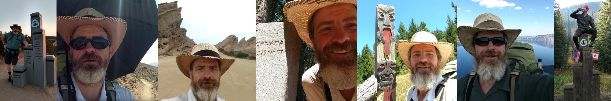
- Number of photos taken: 2,134
- Steps logged: 5.7 Million (missing 10 days of data)
- Duration of the hike: 127 days
- Number of days off-trail: 9 (for a wedding)
- Number of zeros: 3 (days on trail with zero miles hiked)
- Weight lost on the trip: 39 lbs
- Most miles in a single day: 34
- Average miles per day: 21.6
- Typical miles per day: 25-30
- Weight of my pack: typically 34 lbs after a resupply
- Heaviest resupply: 8.5 days of food from Kennedy Meadows
- Cougar sightings: 1
- Bear sightings: 0
- Rattlesnake sightings: 10+
- Wildfire sightings: 3
- Equipment failures: 1 (trekking poles)
- Pairs of shoes: 4
Even though the PCT traverses only three states, California is so large and so diverse, that it feels like three states. At nearly 1700 miles long, it dwarfs the monster of the Appalachian Trail, Virginia, which is a mere 500 miles of trail. Most people spend three or four months hiking California alone.
This record of my hike was organized after the hike had ended to group the trail into five major regions, and then smaller sections in each region. All of the region and section info was written after the hike, but the daily accounts are largely unedited posts from the daily blogs. I was using a WordPress app on my phone, that was updated through the hike with some improvements, but added some bugs. I found out after making some posts that one of the updates caused pictures to be destroyed if you included more than one picture and tried to edit the page. I also found out that some incorrect spellings were “stored” by the app and one update removed the inline spell correct, causing more and more spelling mistakes to make their way into the blog as the hike progressed. So the major edit is to add more pictures to the daily posts, and fix some spelling mistakes. I also went in to each post one year after the fact to give an updated perspective on some of the posts. Those updates will appear inline in italics or at the bottom on the daily blog posts.
Since I am publishing this live during editing, only the links with “Blog:” at the beginning of the link have been fully updated and edited. All other links are the original unedited posts.
One thing that makes this hike stand out from others, is that Karen and I originally started this summer of adventure as a thru-hike of the Appalachian Trail. Sixteen days into our hike, we discovered that what we thought was a week of blisters was really a serious case of Achilles tendonitis that would end our hike right then and there. Below is a link to the blog post of that transition from AT to PCT.
Blog: Reinvented Journey – The Pacific Crest Trail
I have also included the original schedule of the hike
The Pacific Crest Trail
The southern section of California is a dry, arid desert ecology of yucca and sage. The trail pops up above 6000 ft in a few places and is full of grasses and ponderosa pine. But it is mostly desert. Hot, dry desert. Water is scarce, but official and unofficial water caches make the task of staying hydrated easier. The Vasquez Rocks were the crown jewel of this section for me.
The central section of California is the high Sierras. This is the highest, and snowiest section of the trail. Much of this section also coincides with the John Muir Trail through Yosemite and Kings Canyon National Parks. Water is so abundant in much of this section, that the water report doesn’t even bother to log and report water conditions for over 200 miles of the trail. Muir pass was the crown jewel of this section for me.
The northern section of California returns to desert again, but it is high forest desert. There are mixes of large pines, but many of the forests are burned out. The terrain is higher, but also rockier and introduces volcanoes into the mix with Mt Shasta. The vegetation is taller than southern California, but it is still quite dry, but not quite as hot. Mt Shasta was the crown jewel of this section for me.
Oregon is hard to tell apart from northern California. It is still high desert and dry, but the volcanic aspect is much more prevalent. The 50 miles north of Mt Hood are more heavily forested and littered with waterfalls. This is the beginning of volcano country. Crater Lake is the jewel of Oregon, and possibly the jewel of the entire trail.
Washington starts off like a slightly more vegetated northern Oregon, but it has high rocky sections much like the Sierras. It is the most heavily forested state and reminded me very much of the Appalachian Trail in New Hampshire. The Goat Rock wilderness was the crown jewel of Washington for me.
I hope you enjoy this account of my hike along the Pacific Crest Trail in 2016.
Recent Comments