Month: January 2023

Day 29 Etoniah Creek State Forest

This was a surprise of a day. The State Forest was very interesting. I was not expecting a trail on a bluff way above a river. I was also not expecting so much road walking.

Bye Bye, Palatka

I was in no rush to get out early this morning. The internet was just too good and I had many posts to upload. The pictures were uploading faster than anywhere on the trail so far.

Breakfast was scrambled eggs, sausage links, and yogurt. It’s better than dry granola. It was too early for regular coffee, so I had a cup of decaf.

To my amazement, I was able to schedule an Uber ride out of Palatka back to the trailhead. I sure could have used it last night.

What Uber said would take 7 minutes to pick me up ended up being nearly 30 minutes as the driver was driving all over the town probably with other fares.

I knew I had time to run across the street to the gas station to grab a sandwich for the road. Sometimes delays can have perks too.

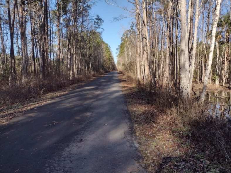
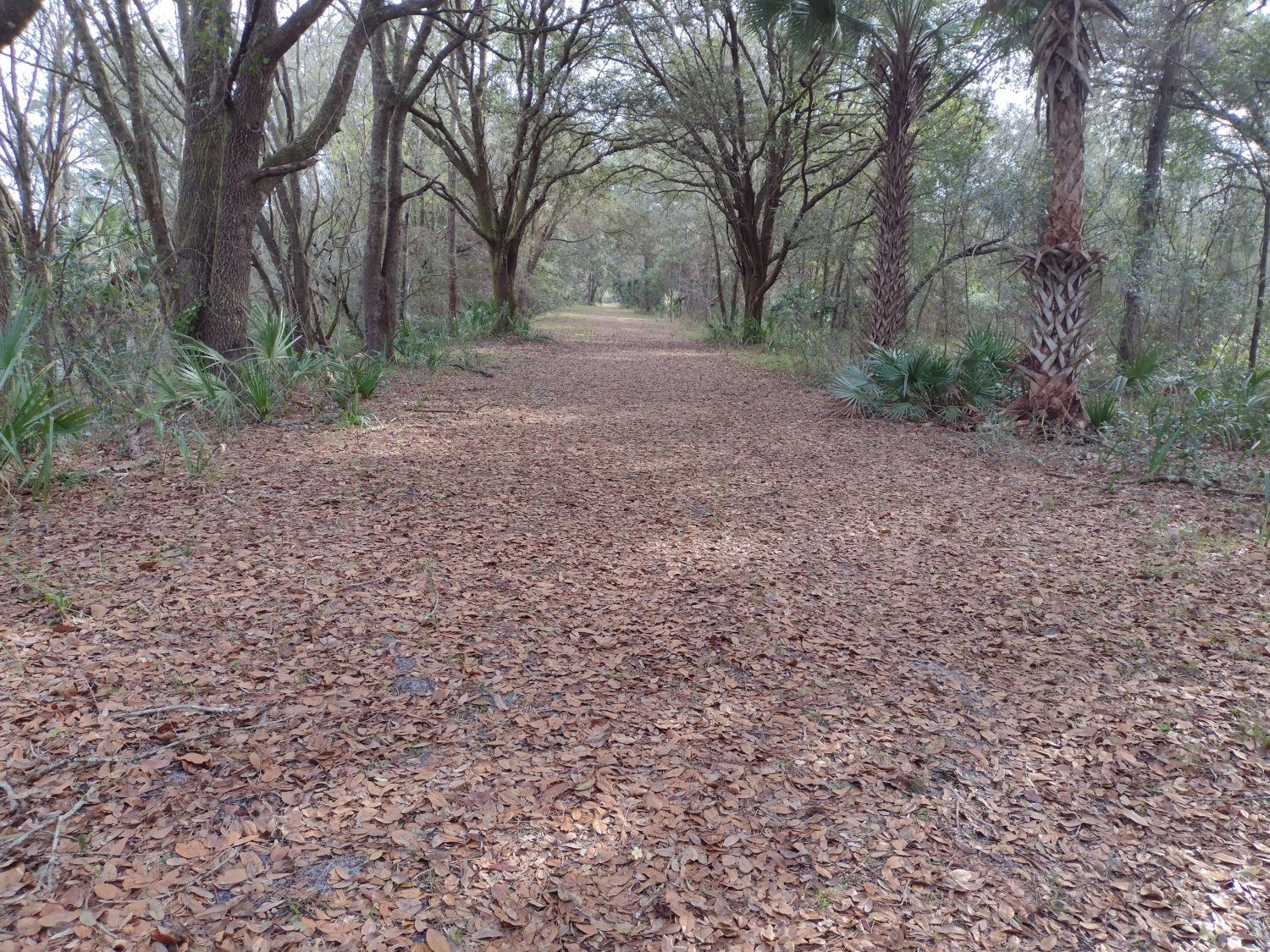
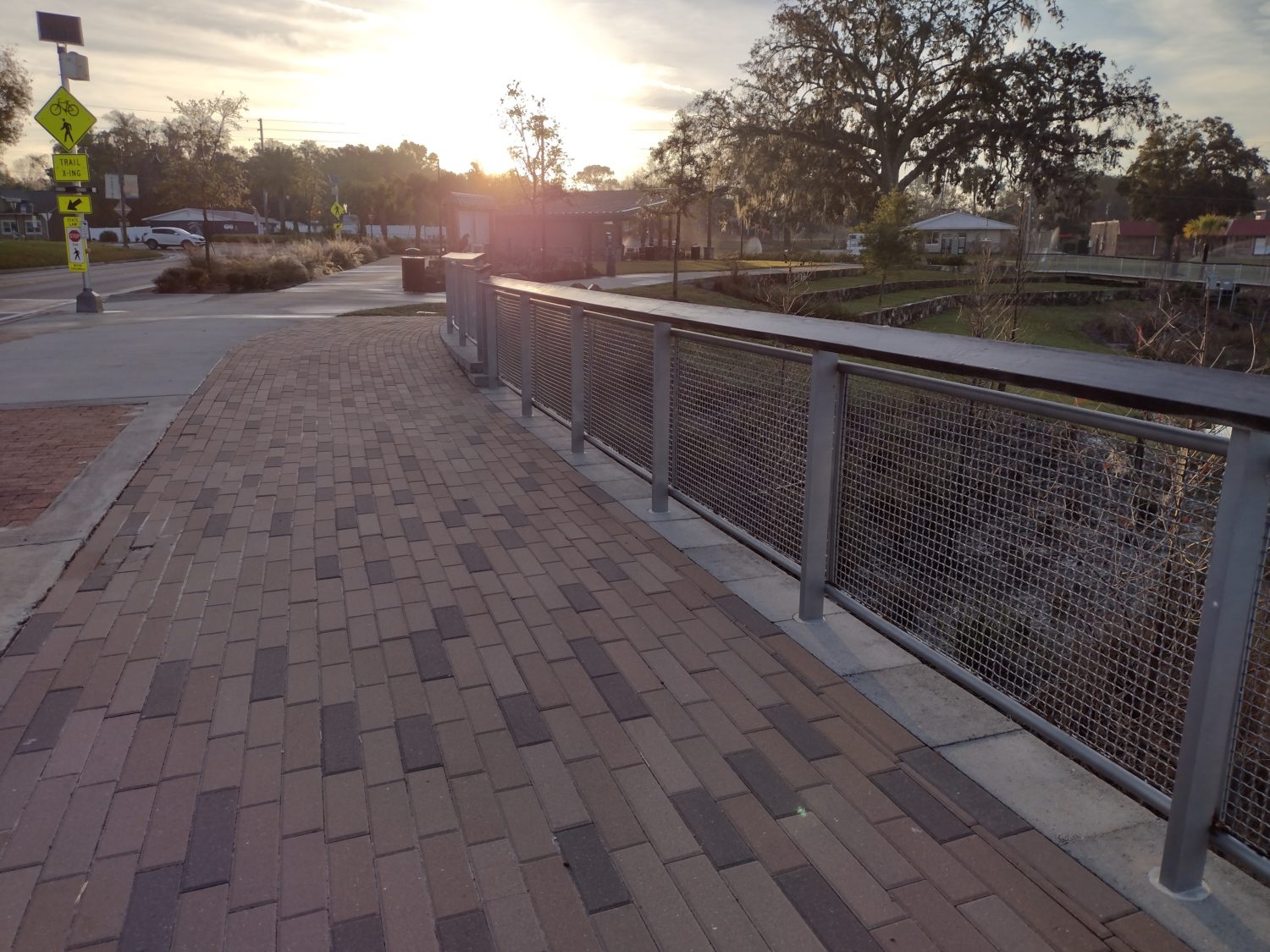
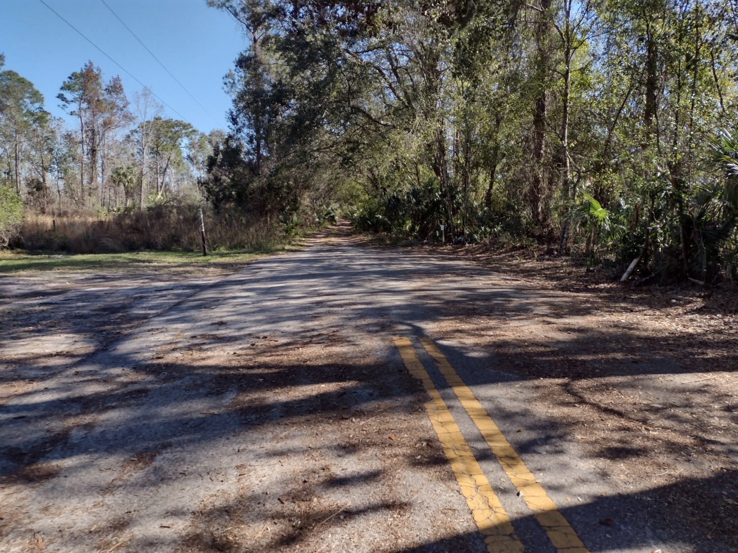
The Palatka Lake Butler Trail

This is a rail trail that I have ridden many times with Karen and her sister. We usually start in Keystone Heights and then ride out towards Palatka. For the next 3 miles, I will be traveling on this trail before turning north to go to Gold Head Branch State Park. I will return back to the same trail sometime tomorrow as I make my way through Hampton towards Lake Butler.

I will probably end up spending 3 days on this trail.

Much like with road walking, the camping opportunities will be very limited.

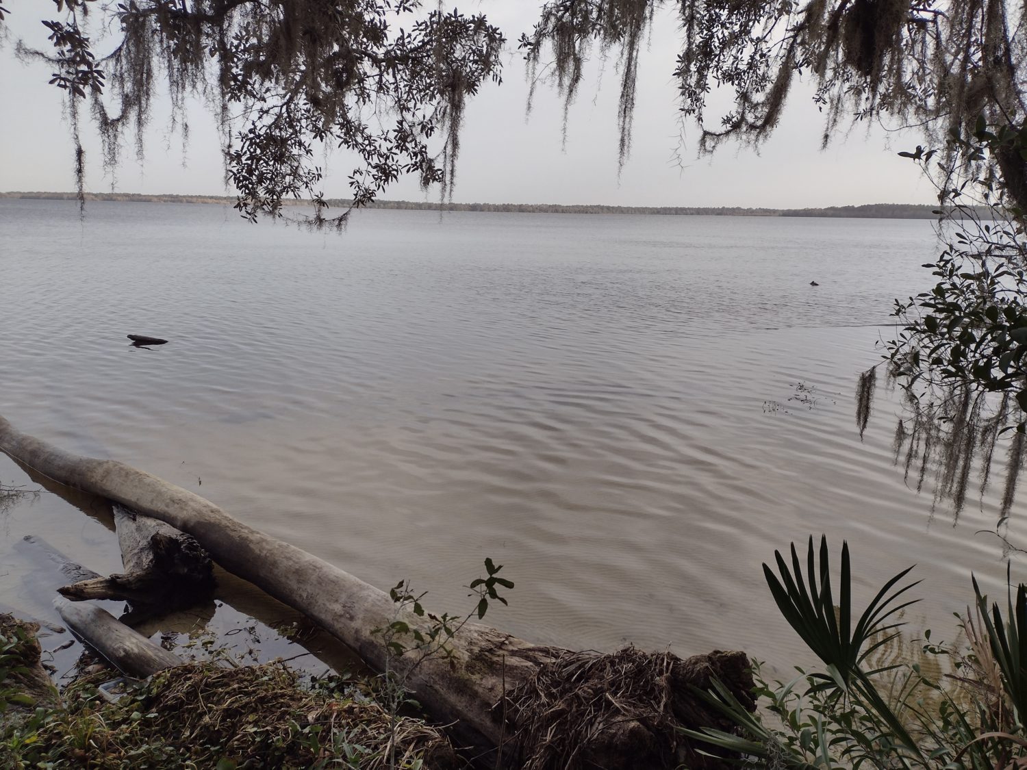
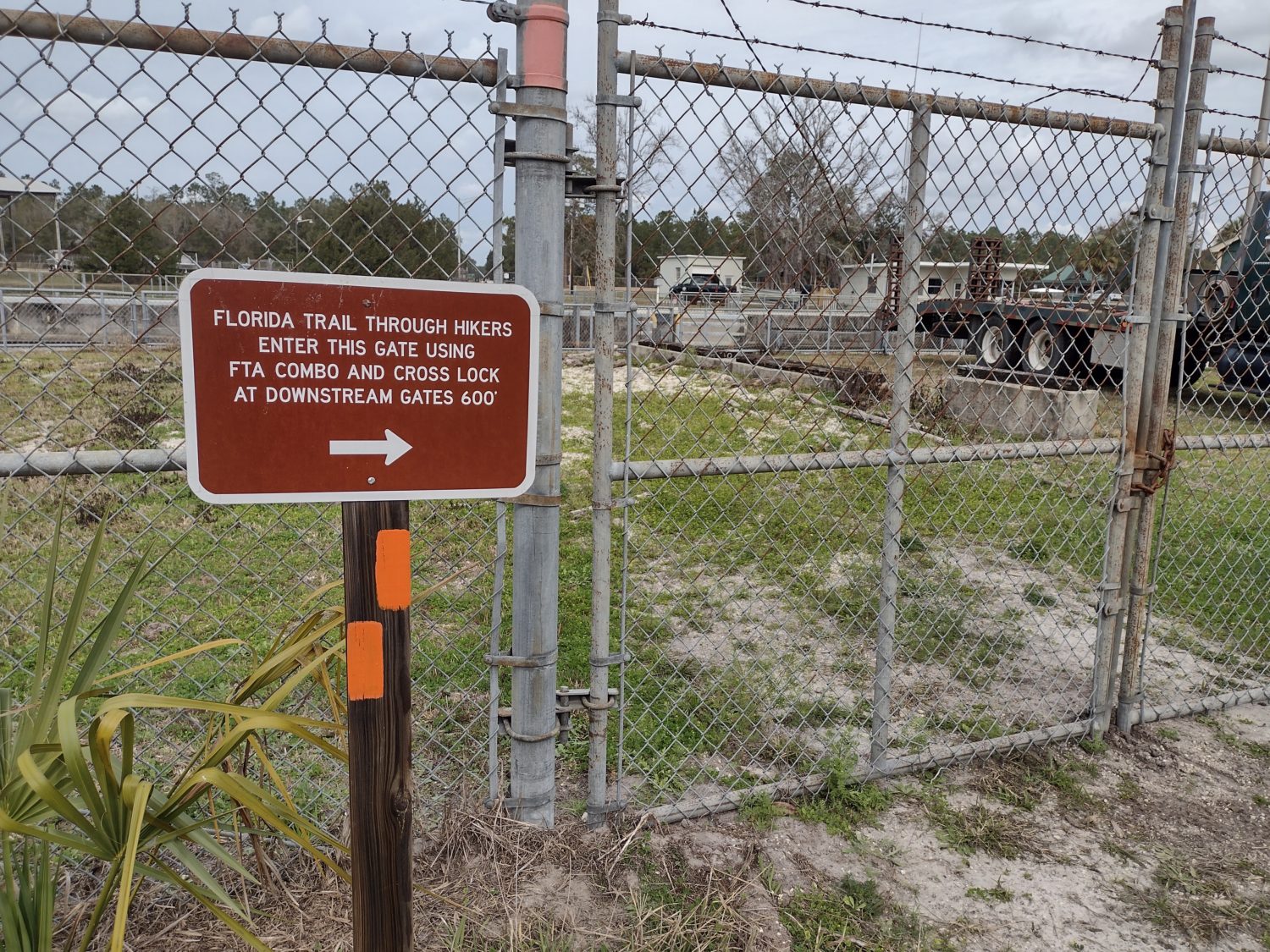
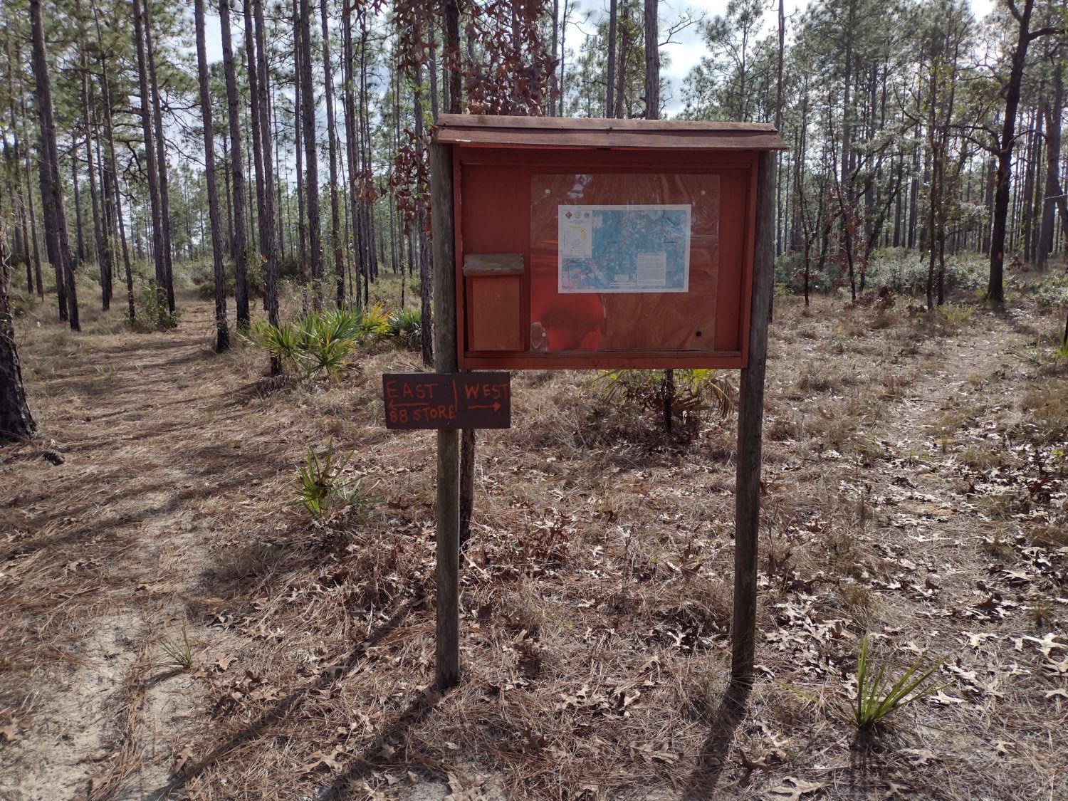
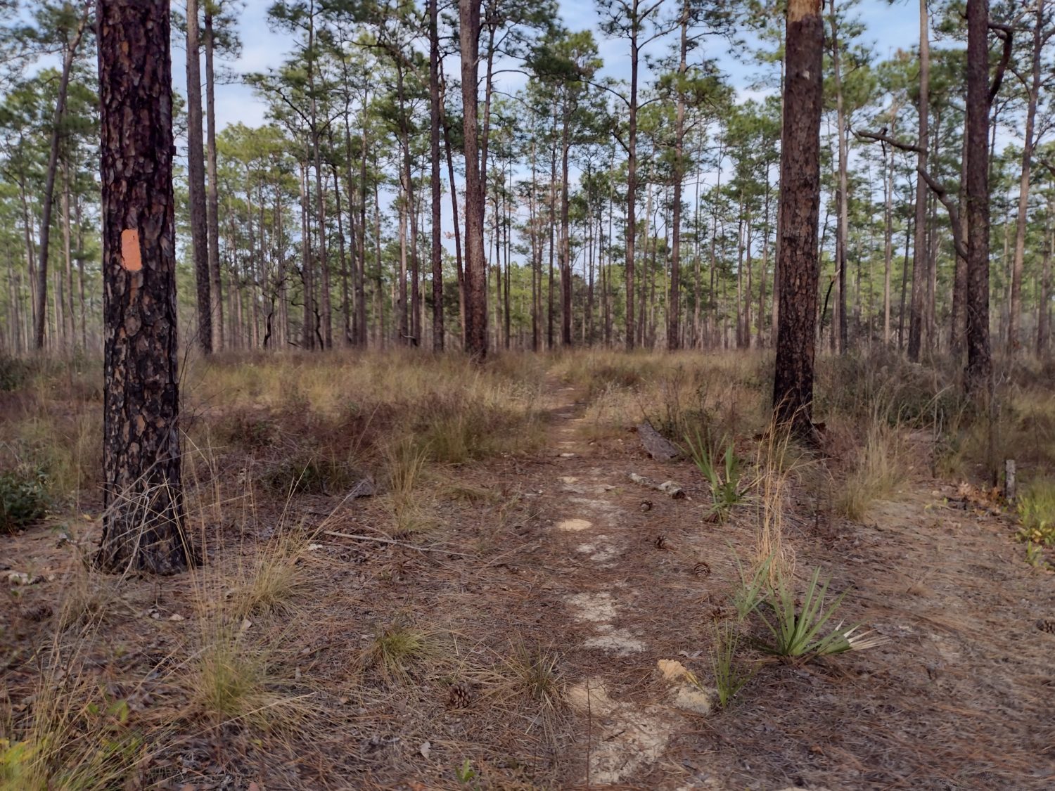
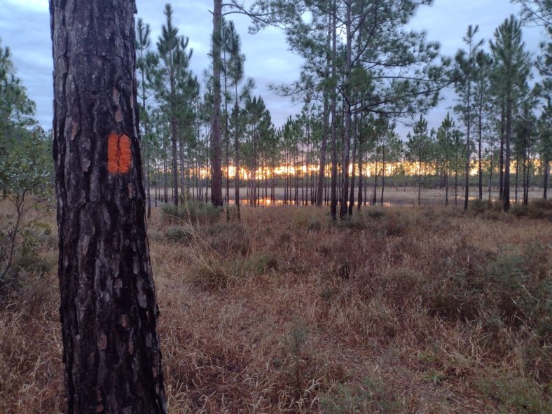
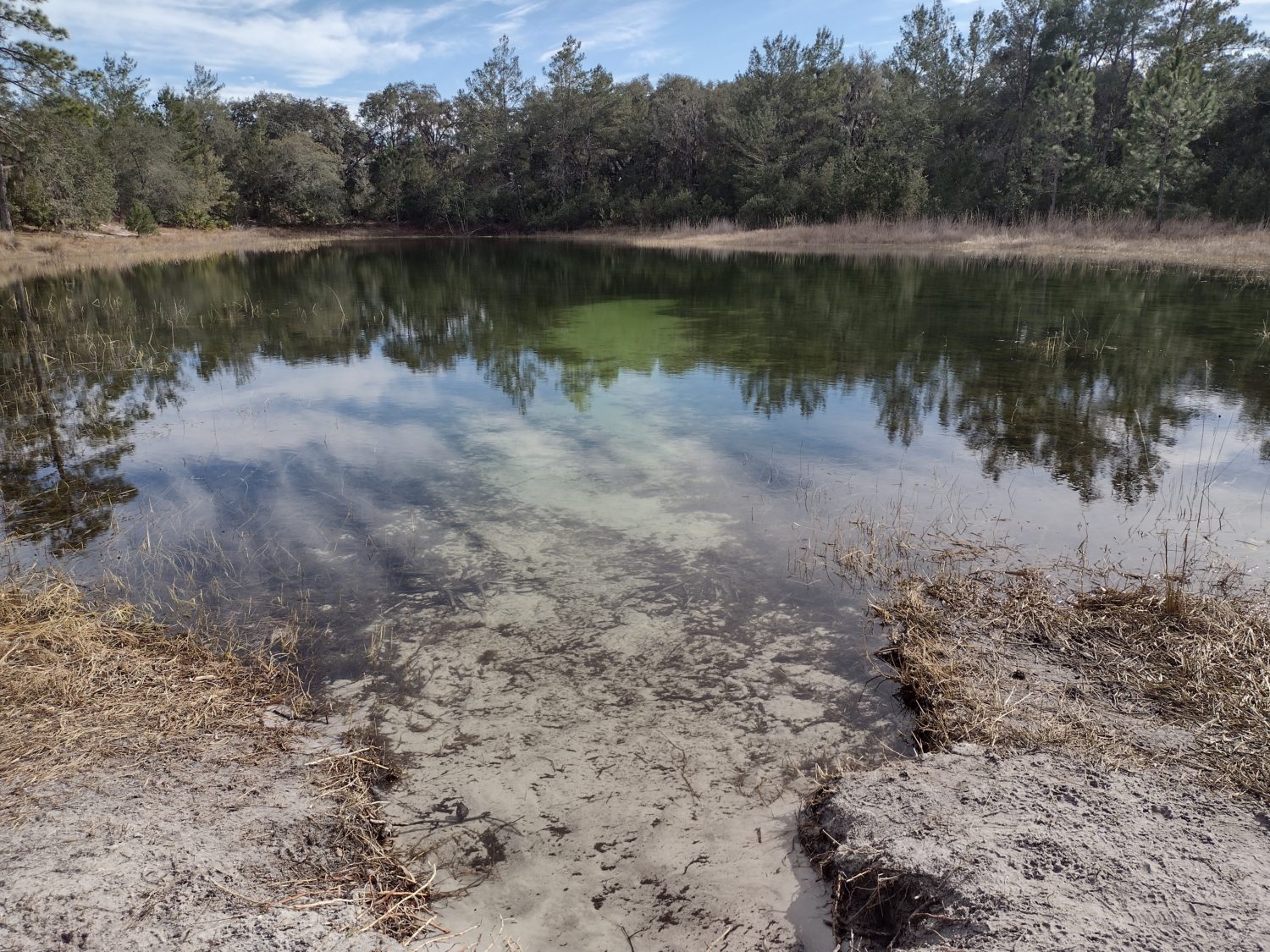
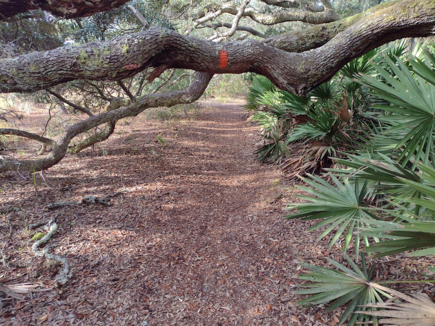
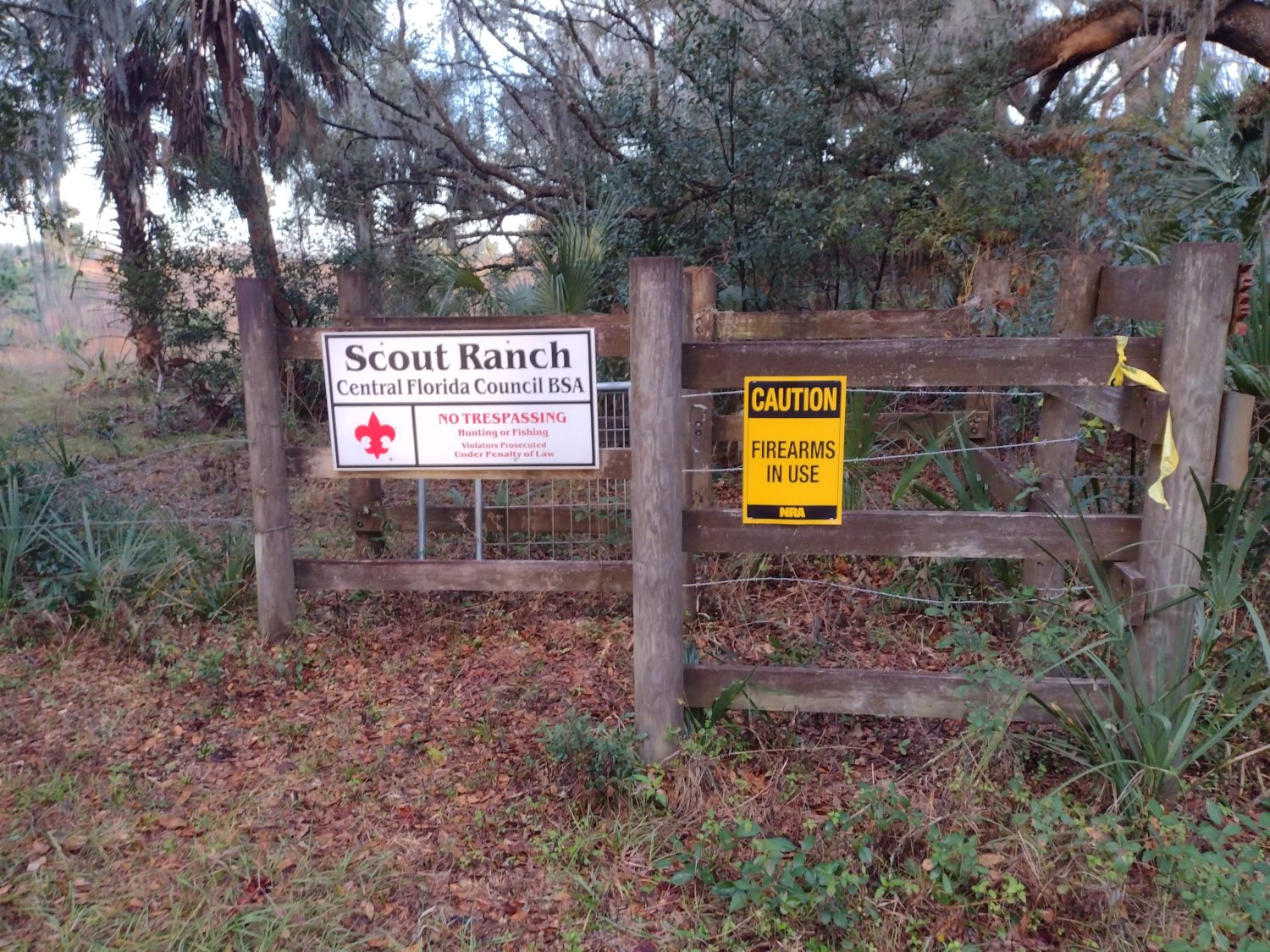
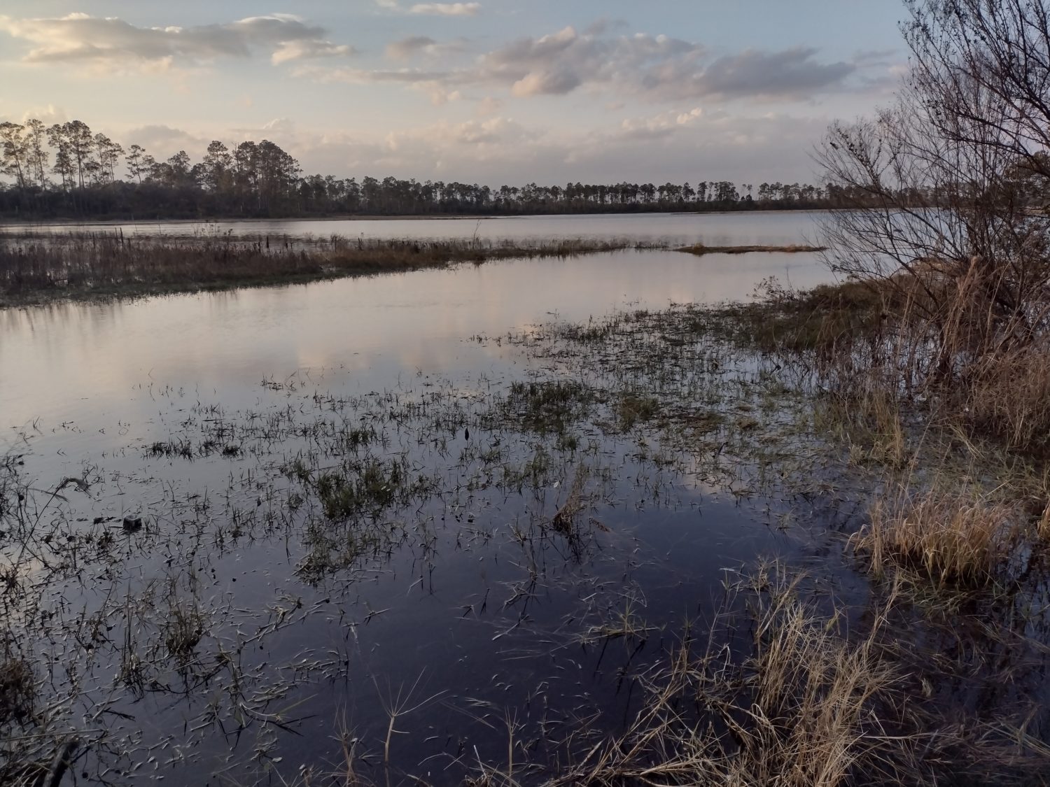
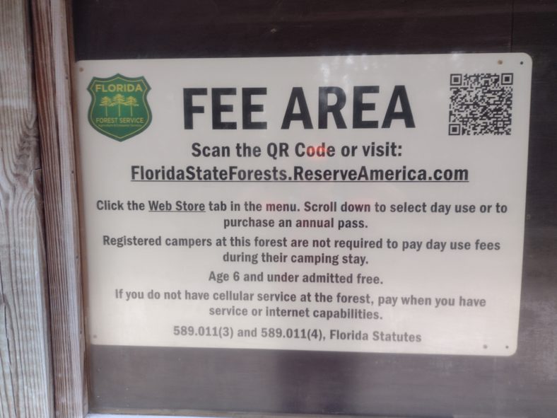
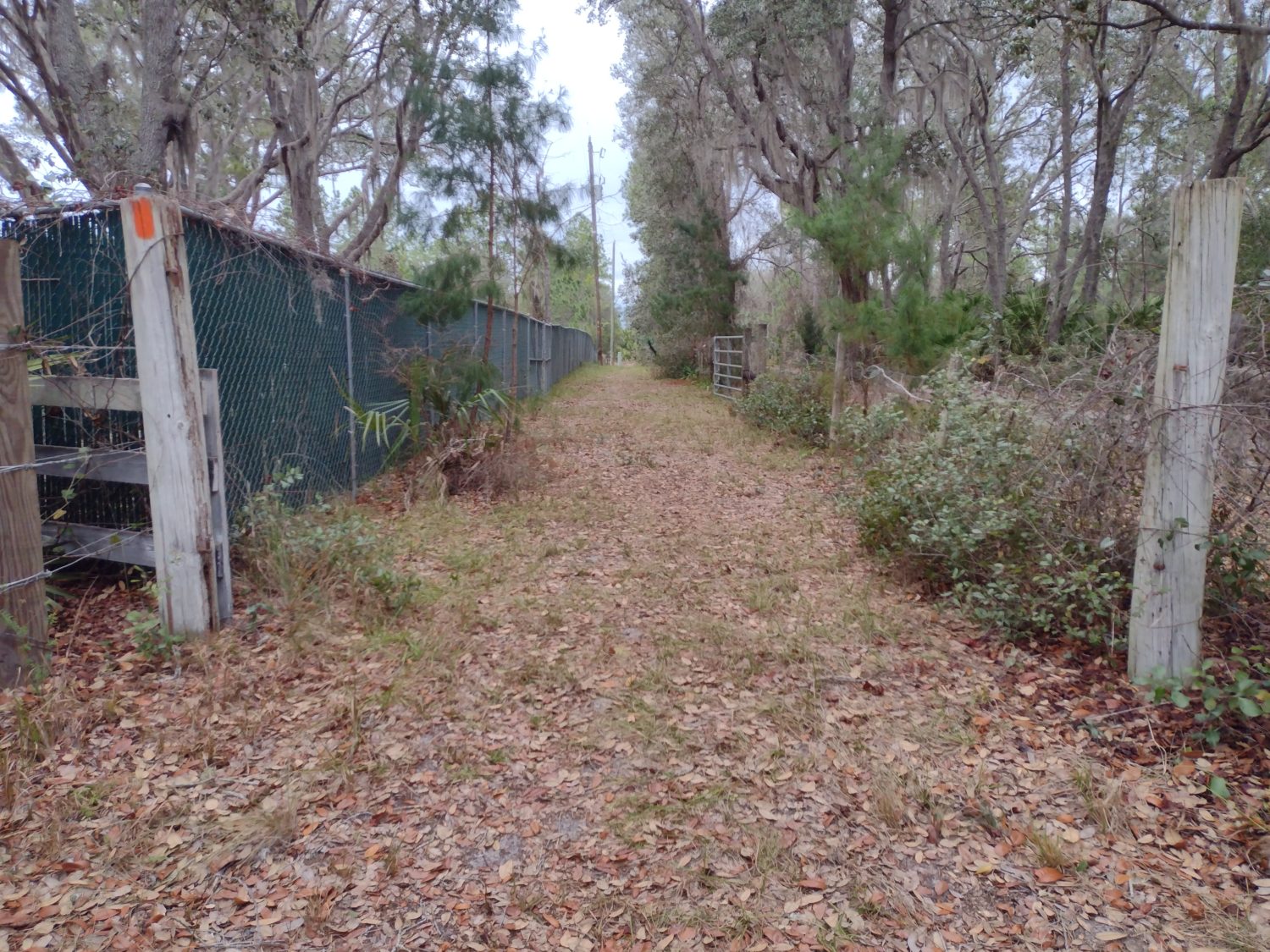
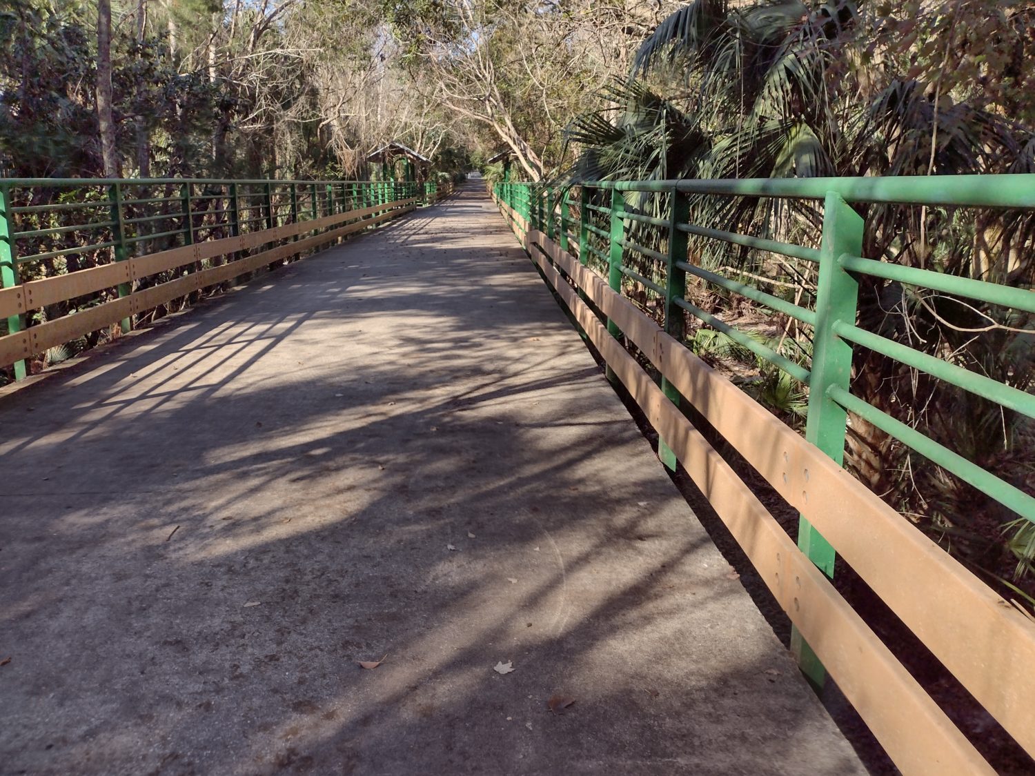
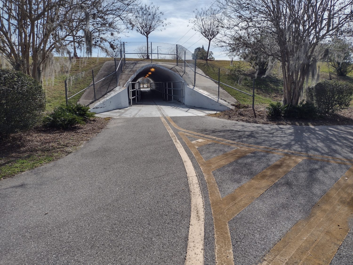
The trail turns north away from the park on some back country roads between Forest Land and Private timberland. After three or four miles it enters Etoniah Creek State Forest. I am not sure if I have hiked in this state forest before.

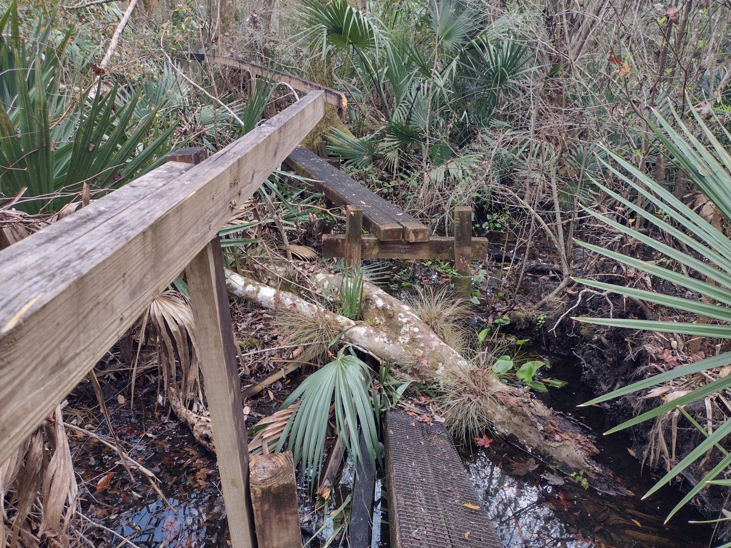
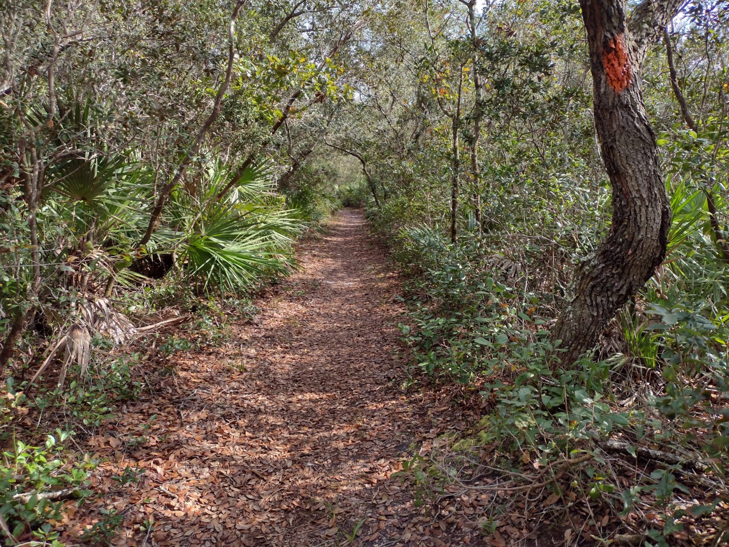
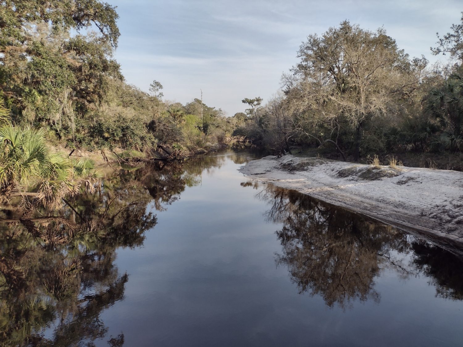
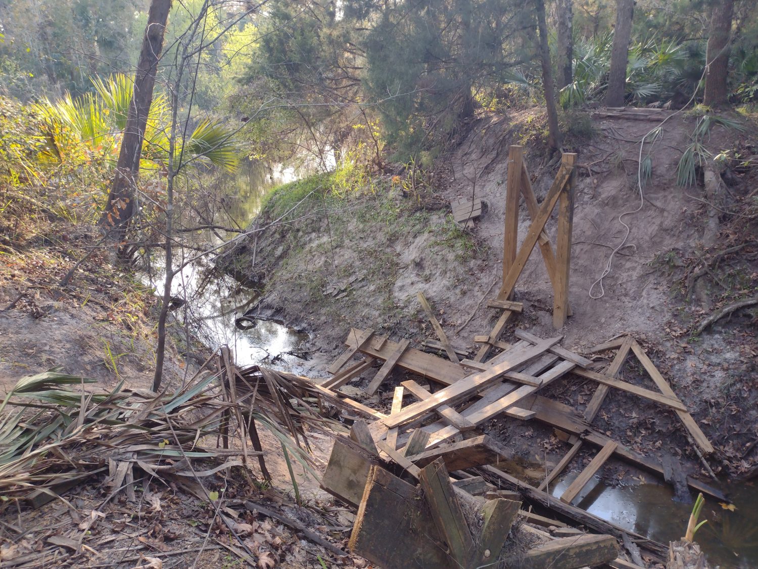
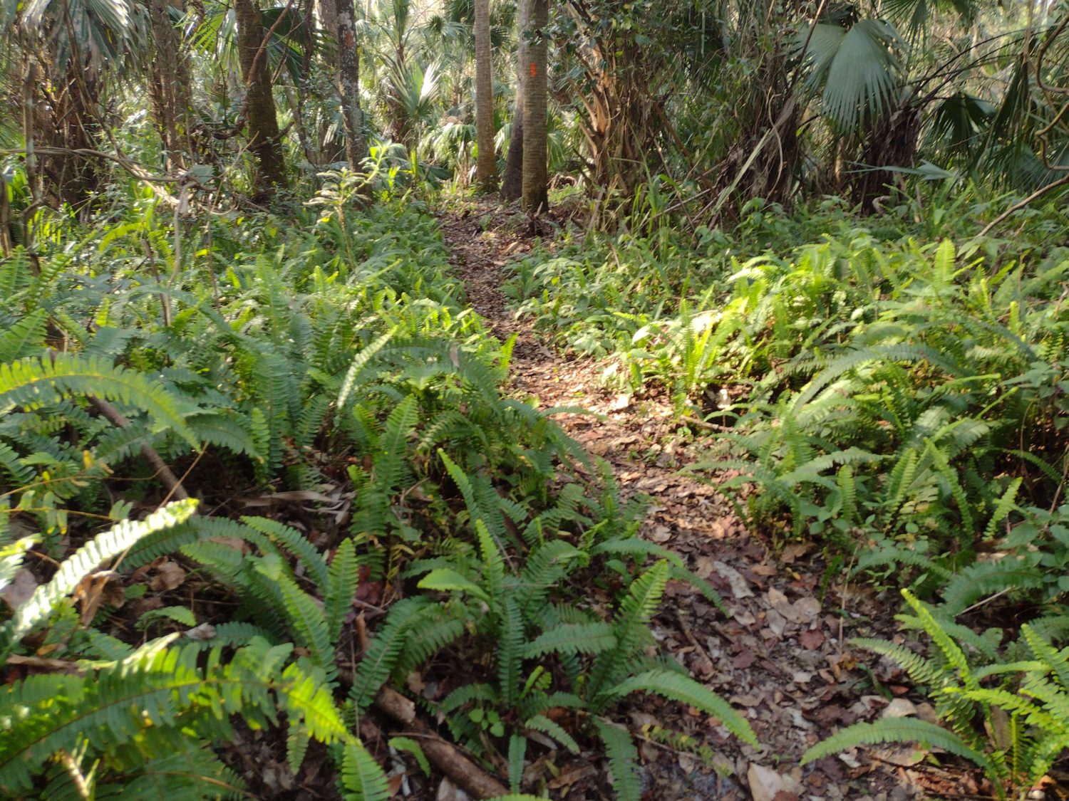
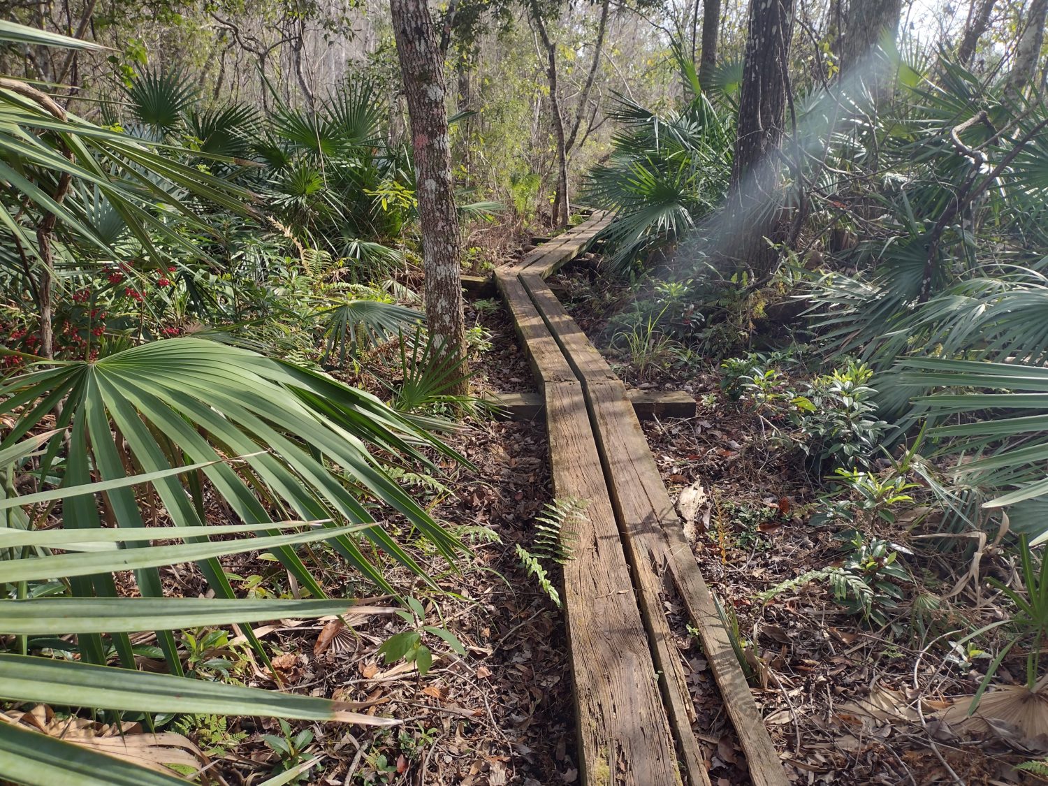
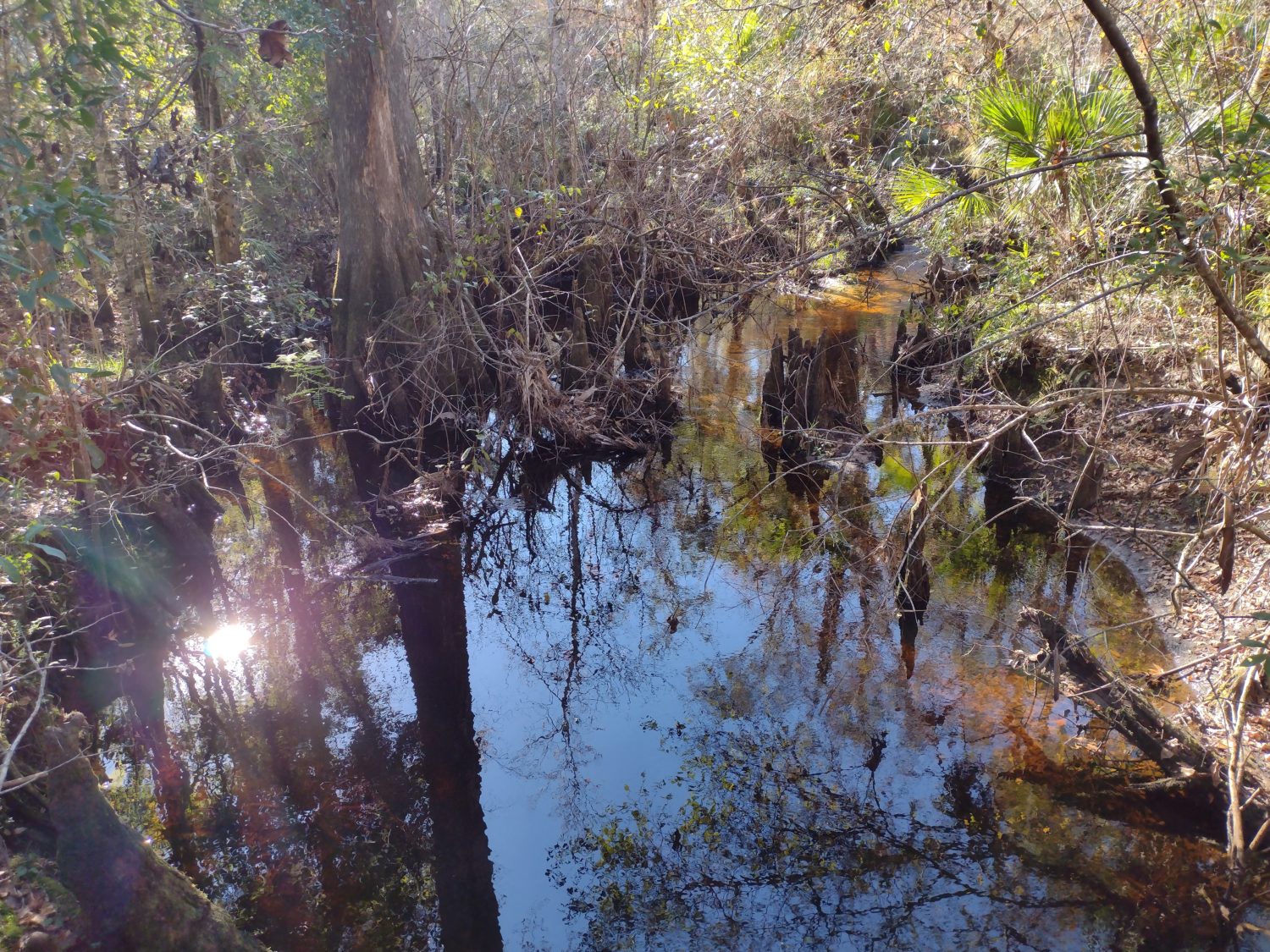
The trail itself is along a creek. It starts out at the same level as the creek and there are many little wooden bridges to cross. Some of them are pretty slippery with mold and slime on them.

If they go over a dry section I choose to walk around the boards instead of risk slipping and falling. But some of them are over water where they need to be used.

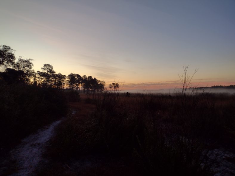
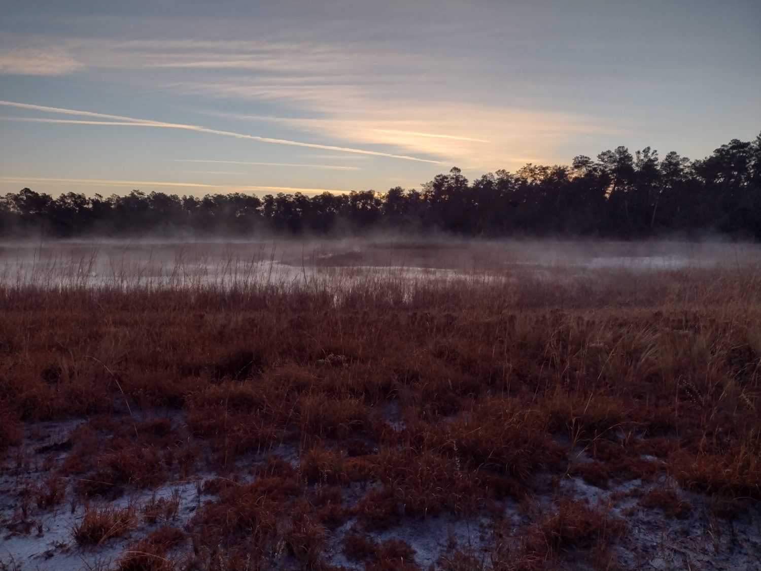
As the trail progresses, a bluff begins to form. Within about 2 miles the bluff is easily 50 ft above the creek. It reminds me of the Ravine Trail at Gold Head Branch State Park.

The Iron Bridge shelter has some Cafe Bustello in it.

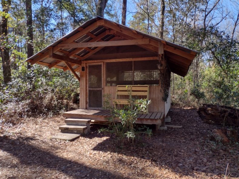
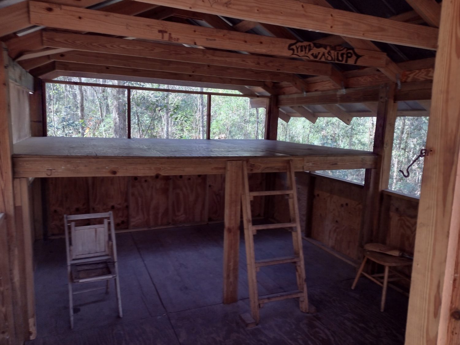
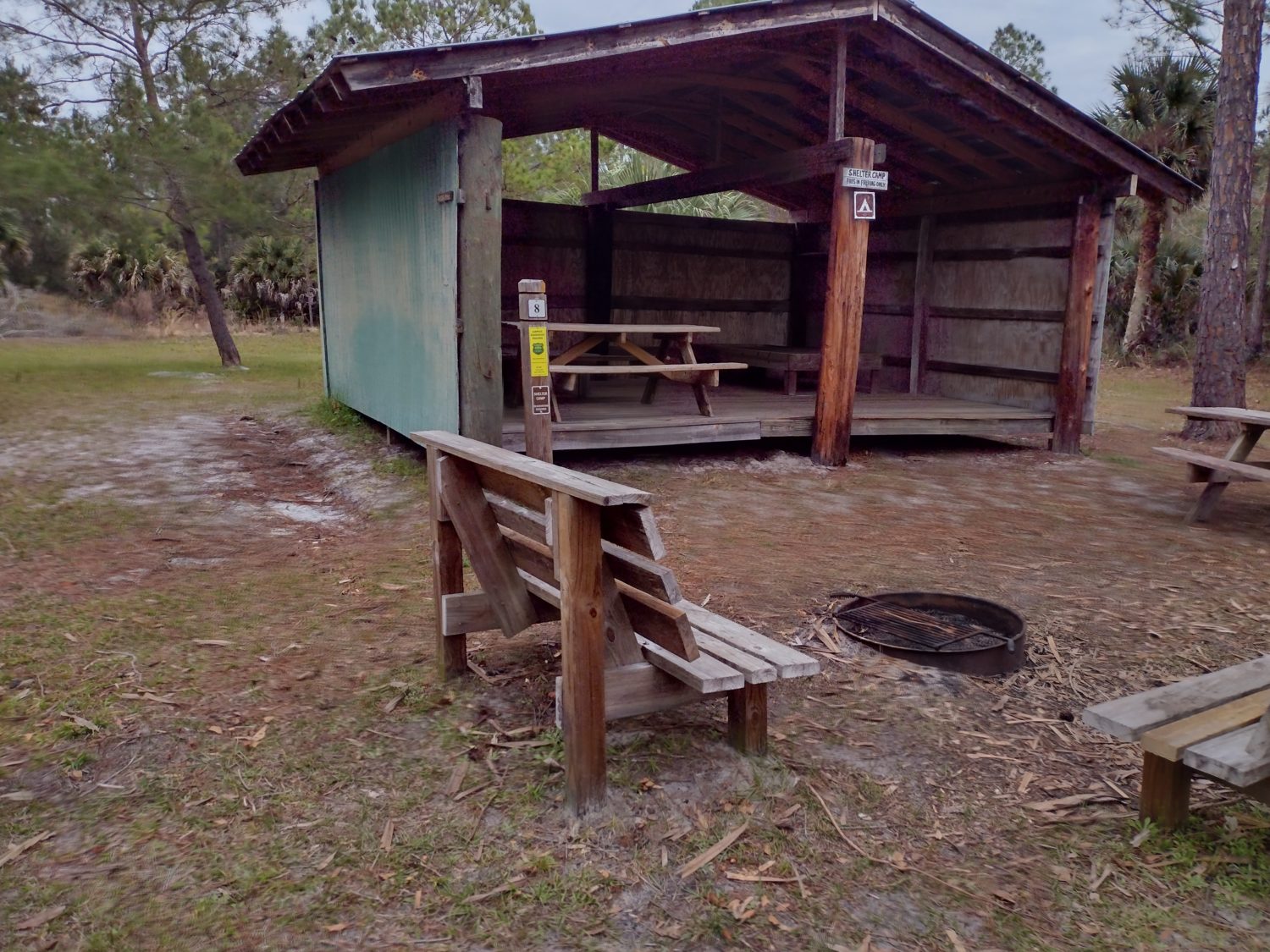
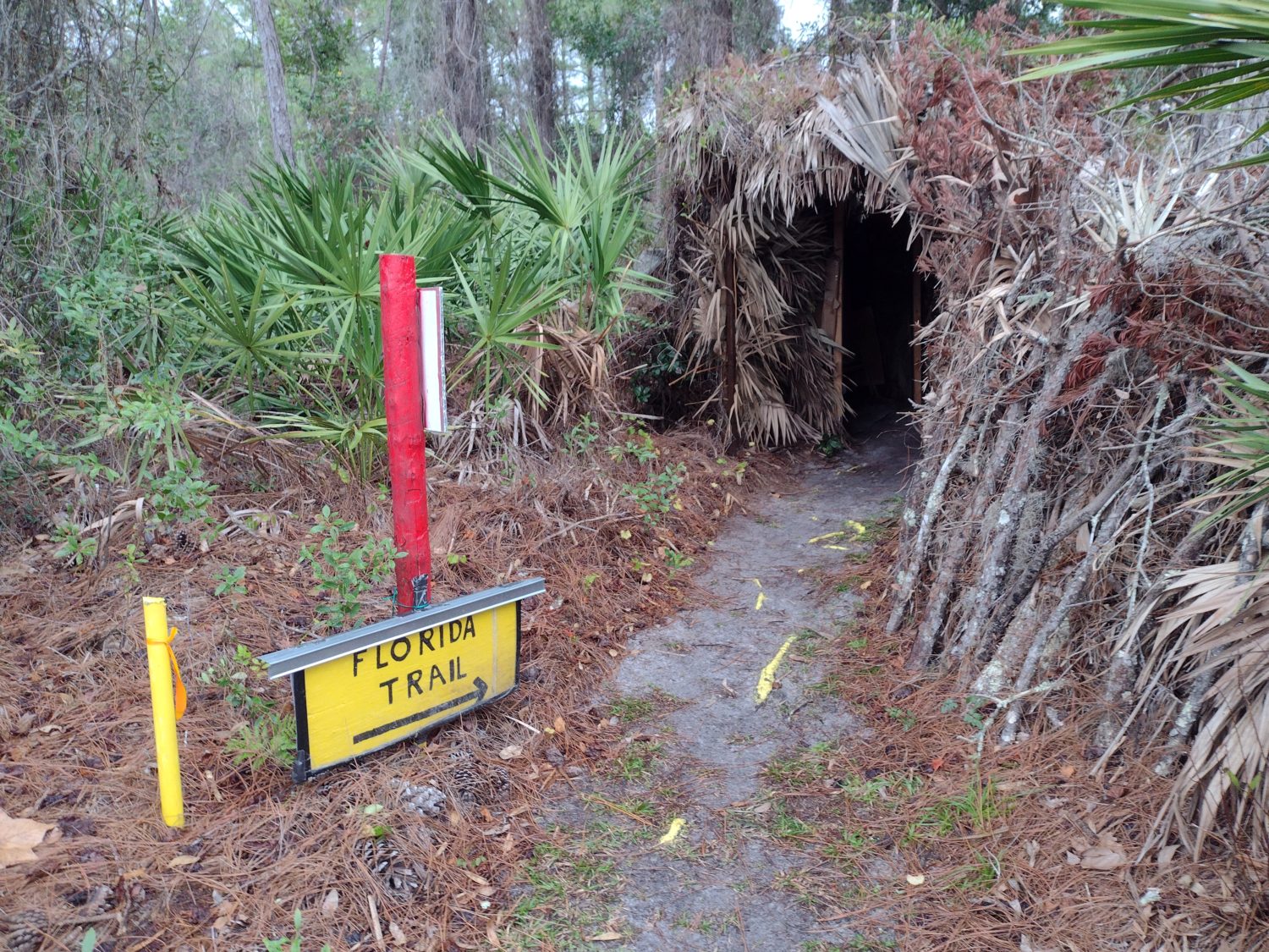
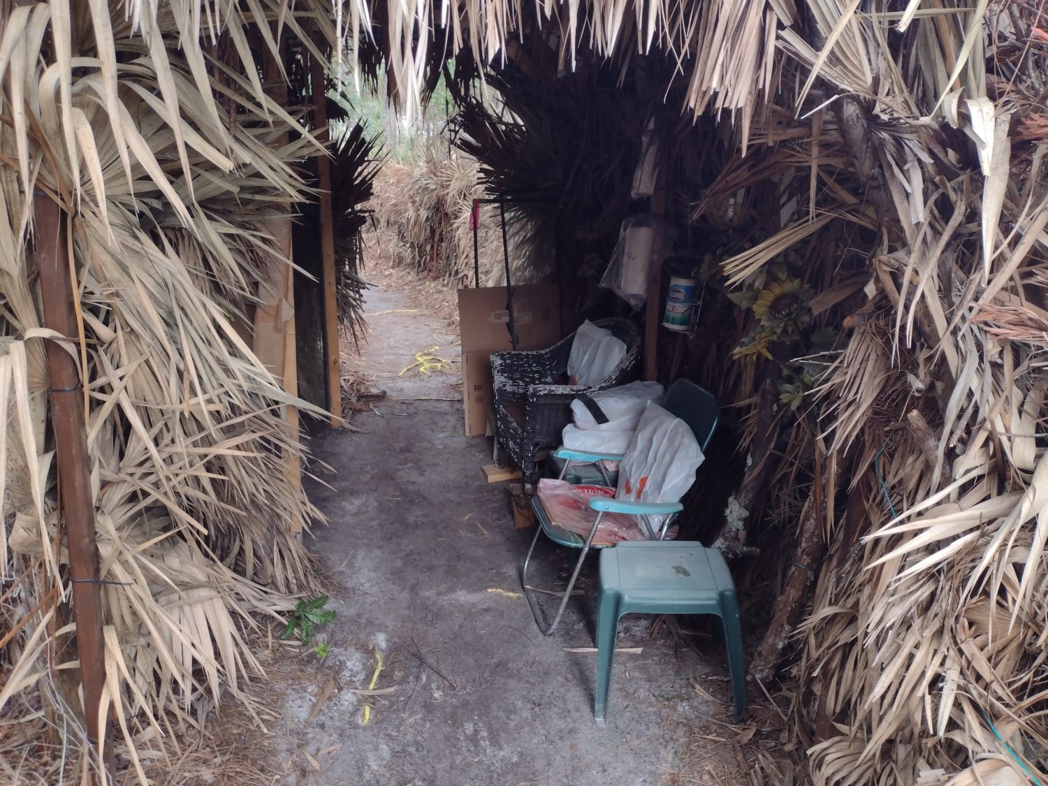
There is a shelter in the middle of this park called Iron Bridge shelter. I should reach the shelter at about 12:45, so it is the perfect place to stop for lunch. When I arrive, there is already another hiker there. It is the hiker I saw coming out of Palatka as I was going in named Chuckles.

I’m glad I caught up to him, because we have a good 30 or 40 minutes to chat over lunch. He has done the PCT and CDT but not the AT yet. So we have lots of things to talk about.

Shortly after we leave the shelter, we see a southbound hiker named Yak, who gives us the low down on the trail ahead and we do the same.

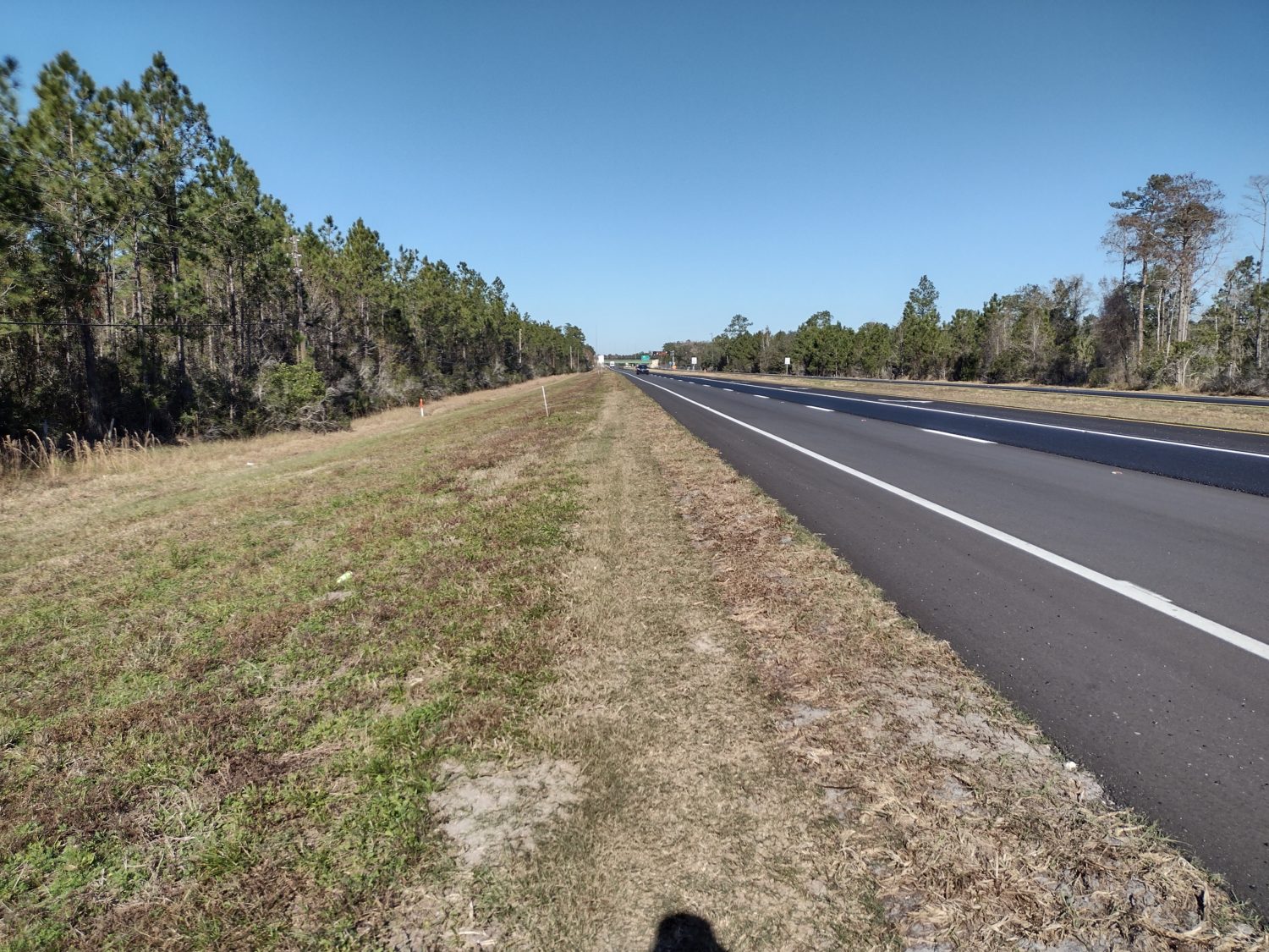
The Road Walk Before Gold Head Branch State Park

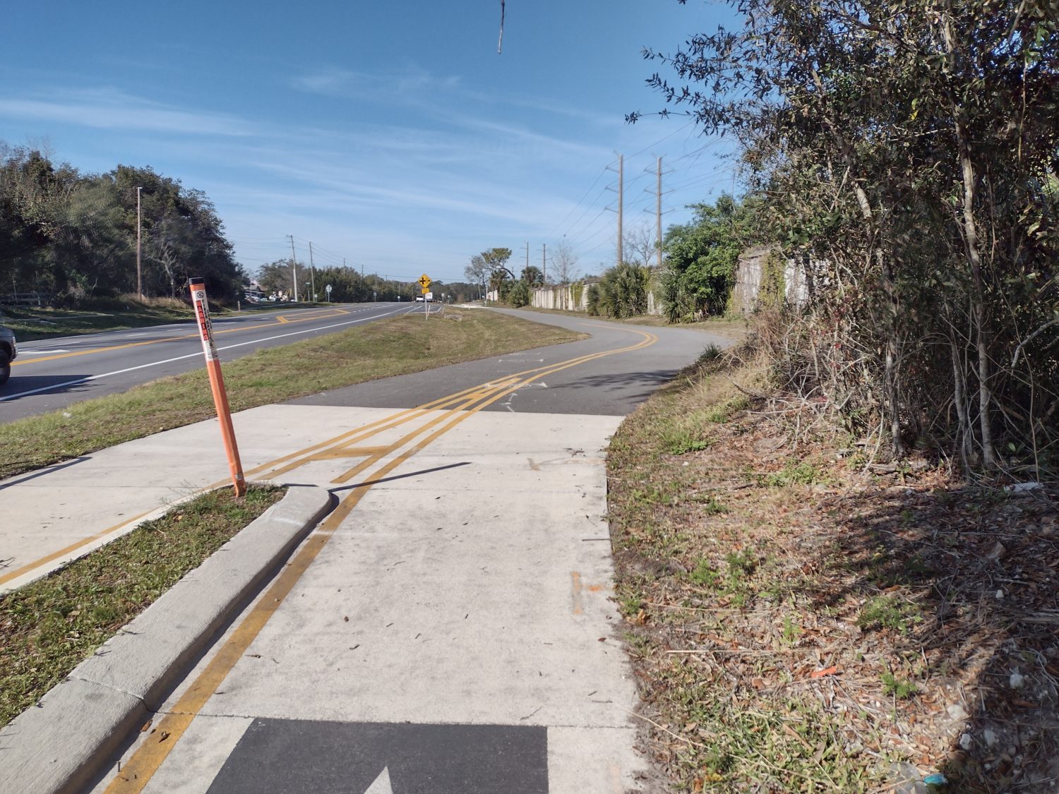
As far as mileage goes, where I should be stopping is about three or four miles short of the State Park. But the last eight miles before the state park are all road walking.

There is a campsite within a mile of the road walk but by the time I get there, it is only barely after 3:00. This is way too early to stop for the day. I have barely enough sunlight left to be able to make the road walk to get to the State Park so I decided to press on.

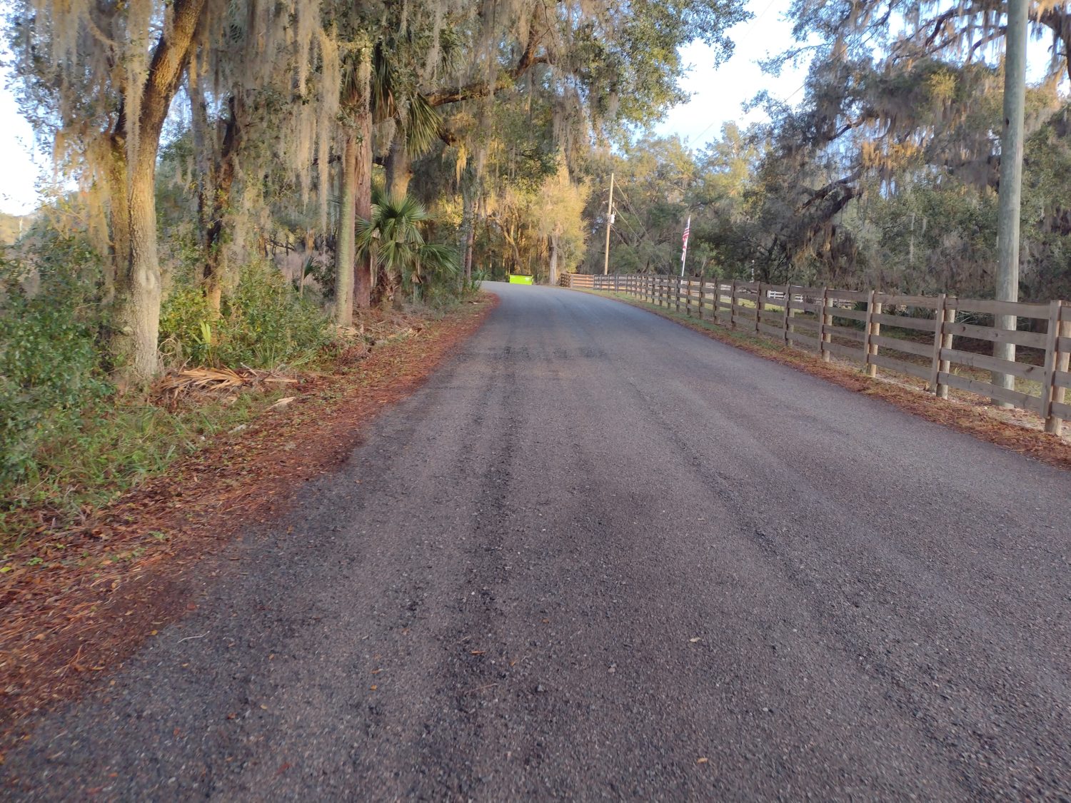
The road walk starts out with a 1 mile neighborhood road. But then the next walk is Bellamy Road, which is more traffic and a longer 4-mile stretch.

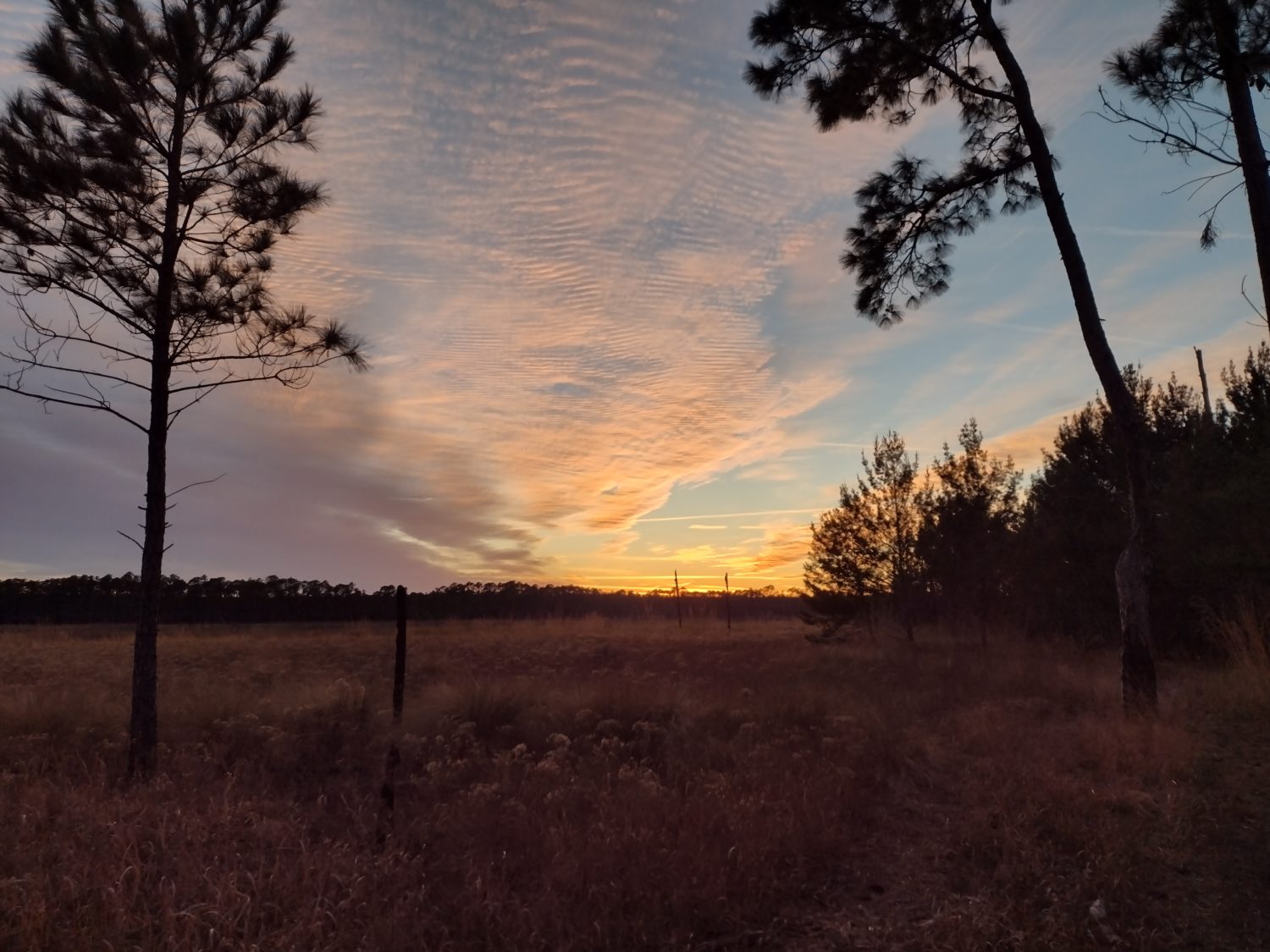
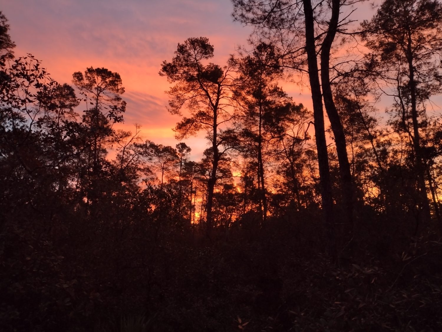
The next road is a county road with the same amount of traffic, but more curvy, so it’s at least a little more interesting. The sun is about to set so I am anxious to get to the last road.

I saw Bigfoot on the road walk.

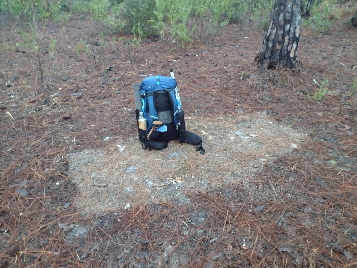
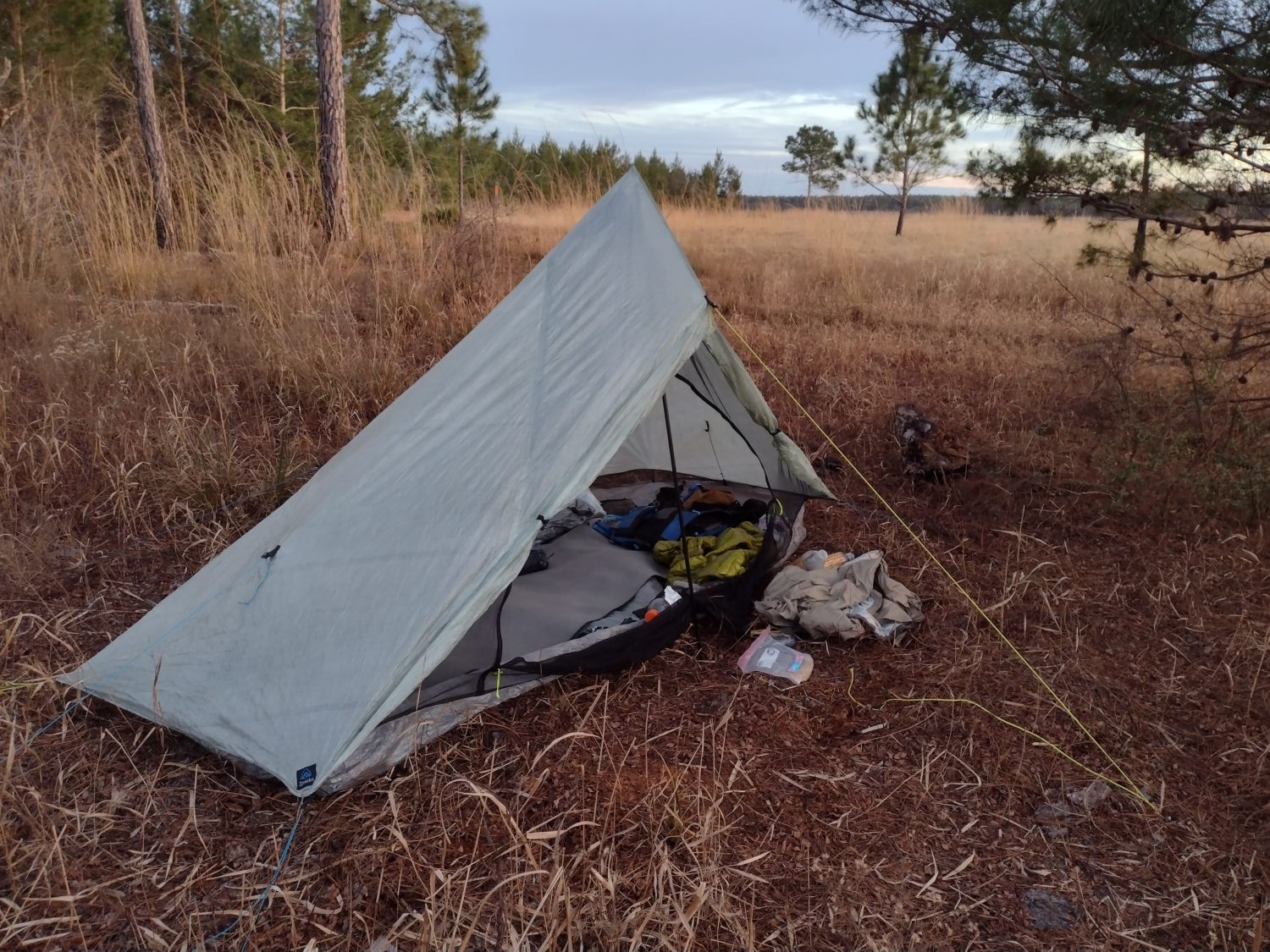
The last road is Christian Camp Road and it is a dirt road that leads all the way to the park about 2 miles away. At the beginning of this road is a large forested section that doesn’t have any no trespassing or posted sign. Since the sun has set and my daylight is limited I decide this might be a better place to camp than trying to go into the park and camping there.

I am able to find a very good spot that is about 75 yards from the road. I have enough light to be able to set up my tent and cook dinner all before it gets too dark. By the time I begin to eat my dinner it is dark, but I don’t need light to eat food from a bag.

From where I am camped, I can barely see headlights of cars as they pass by the road so I know I have good spot. I only need to use the flashlight a few times to locate things in the tent. The moon is up but only about 10% full so there is some light but not a lot.

It is supposed to get down to 35° tonight, so I am bundled up with extra layers. It’s not quite as cold as it got further south so I should be fine. As long as I don’t have to wake up and blow up the air mattress too many times that is.

Emotion of the Day

Today’s emotion is camaraderie.

Between spending a few hours with Chuckles, and talking with the southbound hiker, I actually felt like part of a community today.

The Florida Trail is a fairly solitary trail just because of the low number of hikers. But the neat part is that it is generally more experienced hikers that are hiking it. No one I have met yet is hiking the Florida Trail as their first through hike. Everyone that I have met so far already has at least two national trails under their belt.

I don’t know what the completion rate is for people on the Florida Trail, but I bet it’s very high. Possibly one of the highest of all the National scenic trails. And I think that’s probably because of the experience level of people hiking it.

Most of the people hiking the AT it is their first trail. And it is a brutal one so I think the AT will always have the lowest completion rate. The PCT had a lot of first-time hikers but not nearly as many as the AT.

These are the kind of things I think about while walking in the woods staring at my 10 millionth oak tree.

Day 28 Finishing the Ocala National Forest

Goodbye old friend. Until we meet again.

More Canal Walks

I was able to get up and get moving by 6:45 in the morning. It was kind of warm and humid last night so I’m not cold at all while while walking. The pines continue for several more miles.

As I approach Lake Delancey, the terrain changes back to scrub oak. This area looks less familiar to me as it’s been 30 years since I hiked at this part.

But as soon as I come out to Rodman dam, it all looks familiar again. The lake that is formed by the dam is quite large and impressive. You can still see remnants of trees from the forest when they flooded the river to create the lake.

The lake formed by the dam is very large.

The trail goes over the earthen dam along the road about a mile long. At the spillway, there are many people fishing. And they are pulling fish in at a pretty fast rate.

My goal is to stop here to refill water from the restrooms. 30 years ago I’m not sure if they had water at the restrooms or not, but I do remember running out of water when I reached the dam. This time there is plenty of water.

From this point on, it is about 3 mi to Buckman lock. The trail is atop the levies that straddle the canal.

This is part of the Florida Greenway. It is a failed project of it intended to build a canal all the way across the state. It was probably obsolete before they even started. But now it is a state park 1 mile wide and the width of the state.

he levees along the canal were very scenic.

From 30 years ago, I remembered these levees being barren and without trees. That could be my memory playing tricks on me. But now it is heavily wooded and quite scenic. It is a very pleasant walk.

Crossing Buckman Lock

There is a small county park just before you get to the lock. I came to the park at 11:00, so I decided to stop and make use of the picnic tables to make lunch. They also had a portable toilet which was nice.

The lock has a gate which you need to get a combination to open. The lock keeper is there from 6:30 in the morning till 3:00 in the afternoon. If you try and cross anytime outside those hours you need to combination and you’re on your own.

When I got to the gate there was a sign instructing me to go 600 feet down the fence line so I did so. When I got to the end of the fence you had to jump a fence to get to the gate.

When I got there and tried to combination, it didn’t work. I tried calling the FTA office but you can’t get ahold of a human unless you know the exact human you want to talk to. So I called the lock tender.

It was evident after 30 seconds talking with the lock tender that I was at the wrong gate. I was supposed to go through the gate where the sign was before going along the fence, not afterwards. So I walked back up to the first gate.

Read the entire sign, dummy.

When I got there, the lock and chain was on so tight I couldn’t pull the lock through to my side to work the combination. After 5 minutes of struggling with it the lock tender came over because he was only 100 yards away.

Apparently the previous hiker had latched it so tight that it would be impossible for anyone to get through day or night. I am thankful that the lock tender was there to be able to open it from the other side. And even he had troubles.

What should have taken me 2 minutes to cross the lock took over a half an hour. Joy.

After crossing the lock, It is a short road walk up the lock road to begin the backcountry road walks. The next 10 miles or so will be on small double track service roads. This is actually some of my favorite hiking.

This area also looks very different to me from 30 years ago. When forests are actively logged, they completely change character in just 10 years, much less 30.

Rice Creek

There is a big storm rolling in today. It is supposed to start raining at about 7:00 p.m. and keep raining till about 2:00. The cold front behind it is supposed to make the temperatures drop pretty quickly too.

There is a shelter on a side trail about a mile from State Road 100 which goes to Palatka. My plan is to go to that shelter and see if it is a good place to weather out the storm or if I think I should try and hitch into Palatka.

The trail starts getting much swampier. But across the worst of it there is a giant boardwalk that must be over a quarter mile long, possibly longer. You can tell it has been here for a long time, but it is in pretty good shape.

There is one section that is out from a tree that has fallen over it, but you are able to walk on the tree to prevent you from having to walk through water. This whole area is about 6 to 10 inches deep of water.

The bridge is out, but you can cross on the tree.

When I get to the shelter, there is another hiker there. I have not met him before and I can’t remember his name. He is from Tampa and has been doing sections up and down the trail just for the fun of it. But he has to return to work soon, so he is making his way back south before he has to get off trail.

And looking at the shelter, it is one of the better shelters on the Florida Trail. It is screened in and has mats from a church pew for sleeping on.

But there are huge gaps all around the screens and I doubt it provides much mosquito protection. This whole area is very swampy and I am betting around 6:00 this place will be swarming. The gables are also very open and if there is any wind with the rain everyone will get soaked. So I decided to push on to palatka.

Nice shelter, but not nice enough for a storm.

Palatka Bound

There is a trailhead about a half a mile from where the trail across is county Road 100 that leads into Palatka. It is 4 miles from that point to where to hotels are located at the edge of town.

When I get near the trailhead, I check for Uber service and it says that Uber is available in Palatka. So I go ahead and book a room at one of the hotels and then request an Uber ride.

The Uber request times out after 10 minutes so I try one more time. That request also times out. It is time to try and hitch.

I begin walking on the shoulder going with traffic which I never like to do. But if you are trying to hitch this is the way you have to do it. It is important that I reached town as soon as possible, because the rain should start within the next hour. And it will take me longer than an hour to walk the entire way.

Once it gets dark, it is clear that I am not going to get a hitch into town, so I decide to hop over to the rail trail that goes most of the way into town. After less than a mile on the rail trail the trail just ends abruptly into woods.

The woods are actually growing up from the abandoned rail bed which still has the ties and the rails.

I keep going on this for another 1/2 to 3/4 of a mile before it gets just too thick to navigate easily. I need to make my way back out to the highway again. But between the railroad bed and the highway is a ditch that must be crossed. I do my best to jump across it but I still end up getting pretty muddy.

Now I still have about 2 miles to walk on the road but I will do it facing traffic this time.

With about a mile to go, the rain begins. It is not very hard and it is not very windy, so my umbrella is effectively keeping both me and my pack dry.

When I get to the hotel it looks nice from the outside, but on the inside it looks pretty run down. They have four or five broken air conditioners just sitting in the room where they serve breakfast. This may be an interesting experience.

The room itself is not too bad. The shower curtain is barely hanging and the tile in the bathroom floor is all broken up. But there are two beds in it and they are clean and dry.

I run to the Mexican restaurant next door after taking a shower and have enchiladas. Nothing to write home about so I won’t.

I managed to get one blog post done before I am too tired to stay awake any longer. I will have to finish my posting chores in the morning.

Emotion of the Day

Oddly, I think the emotion is somber.

The national forest is familiar terrain to me. The hiking is pleasant and the scenery is nice. Even hiking the levee between the dam and the lock was way nicer than I expected, The hike on the double track roads was less than impressive.

Today also marks the last day I will be hiking north. Once I hit the rail trail on county Road 100, I will now be going west along the panhandle to Pensacola.

And even though I am not yet halfway through the trip in miles, it does seem like a halfway point turning west. But it doesn’t feel like I am anywhere near halfway done. In reality I am about 60 mi from the halfway point.

Finding that the shelter wasn’t as nice as I was expecting also put a somber mood on the evening. Not being able to Uber or hitch in to town also put a damper on my spirits. And then finding out that the hotel was in pretty bad shape just added to it.

But the internet uploaded speeds is fantastic. So that is a plus. I will spend a lot of time in the morning uploading posts and giving my feet a little rest. I will probably get a late start tomorrow.

Day 27 The Heart of Ocala

At home, laundry day is never my favorite day. On the trail laundry day is always my favorite day. Especially when it’s shower and laundry day.

Early Start on the Prairie

I began my morning routine at 5:30. These days it means take my morning meds and listen to music for 30 minutes.

As I started rummaging around in my food bag to start eating breakfast at around 6:00, I could see weird shadows on my tent wall. It took me awhile to figure out shadows weren’t coming from my headlight. They were coming from another hiker outside walking by and looking at my tent.

Of course my mind begins racing who could that possibly be. Most of the people I have so far don’t seem like early risers. I know for sure Max isn’t. But I met somebody two days ago that it could possibly be. Or it could be somebody from the bubble who was really fast and passing me while I’m cozy in my tent.

And by cozy, I mean freezing cold and shivering. I know it didn’t get down to freezing last night, but it sure did get cold. I am guessing in the mid-30s.

I am up and hiking just before 7:00 a.m. and the sun has not risen yet. It’s nowhere near dark enough for a headlamp so maybe I can start out a little earlier tomorrow. I might shoot for 6:45.

I love to start hiking when it’s questionable whether or not you need a headlamp. And if I need one for the first 10 minutes or so then that is usually about the perfect time for me to start.

Early morning hiking is the best.

I am about halfway around the prairie, so I have several more arms of lakes to hike around. The trail is mostly sandy and the grass is either short or far between. This means that my shoes are staying dry this morning which is a plus.

I remember from previous hikes, that at the other end of the prairie the trail turns straight up hill and goes into the woods. I know once I am in the woods I will be away from the grass.

When I get to that point where the trail turns into the woods, I see two people rummaging through a bear canister. I am guessing they are overnight hikers and it seems early for most overnight hikers to be awake.

As I start up the trail into the woods, I can see many tents and I assume this is where they slept last night. On the other side of the trail is about 8 or 10 bear canisters. I have never seen that many bear canisters before.

Sand and Scrub

Most of the morning is hiking through scrub oak. The terrain is very hilly here you might even say that this is the mountain region of Florida. Or at least of the peninsula. The hills around Tallahassee put these to shame.

But these hills are steep enough and big enough that they do actually cause me to breathe harder going uphill. And going downhill as gentle enough it just ends up being really fast walking. It’s not like going downhill in the mountains where you’re struggling to keep from going too fast.

The 88 Store

The highlight of the day has to be hitting the 88 store. It is about 12 miles from where I camped, so I am expecting to hit it sometime between 11:00 and 11:30.

This is where my next resupply box is waiting for me. This is also where laundry in the shower should be waiting for me as well. And if I am lucky maybe there is some hot food.

Just past the 88 store is where the east and west corridors meet. I took the east route by Orlando as opposed to the west route by Dunnellon.

About a mile before I get to the store, I can see another hiker about a quarter mile in front of me through the thin trees. We are in long leaf pine country and you can see quite a long distance through the woods. My suspicions are that this is the hiker that passed me this morning.

When I get to the store the other hiker is there. It is the hiker that I met at Farles prairie two nights ago. Apparently he has kept about a half a mile behind me the last two nights in a row.

But he is section hiking and will finish his section today at Rodman dam 12 miles ahead. He got an early start because he wants to make sure he gets to his truck which is parked at the dam before dark.

He stays for about 30 minutes before he leaves. But before leaving I find out that he works at Saint Mark’s Wildlife Refuge, where I will be in probably two weeks. Maybe our paths will cross again.

My first order of business is a shower so that I can get off all my stinky clothes. The next order of business is laundry because that is going to take the most amount of time. Once those two things are done, then it’s starting to charge electronics and drying out the tent.

They do not have hot food but they have microwavable food. A frozen burrito and a half a gallon of chocolate milk will have to do. I will probably grab something else before I leave as a walking snack.

While I am doing laundry, another two hikers come up. It is a grandfather in grandson from up north who are section hiking. They are eager to do the Big Cypress section, so I tell them all about it.

Between all the chores, the stop at the 88 store ends up taking close to 3 hours. That’s not too bad considering all the things that I got done. One of which was unpacking my resupply box into my bear bag. My pack is now heavy and full again.

Pushing Towards Rodman

It is after 2:00 by the time I can leave the store and it is 12 miles to Rodman dam. There is a locked gate just past the damn where you have to cross during business hours. It makes no sense to try and push to get to the dam today because I may get to the lock to early in the morning to be able to cross.

So for tonight I will just take a pleasant walk through the long leaf pines and see if I can get within four miles or so of the dam. And that is almost exactly where I end up at about 6:00 p.m. with plenty of sun to set up the tent and cook dinner.

Pleasant walking through the pines.

This is one of my favorite parts of the Ocala National Forest because of the sparse pine trees. There is usually just grass in the undergrowth but sometimes it’s small oak trees or palmettos. Most of the time in Florida the vegetation is so thick you can’t see more than 50 yards. And sometimes far less than that. Prairies and ponds and lakes are usually the only time you can see long distances. But in these in pine Forests, It actually doesn’t feel like Florida.

Emotion of the Day

I think refreshed is the best word to describe today.

I put on clean clothes this morning since I knew I would be able to do laundry today. Just being able to put on clean clothes is very refreshing. The fourth day of putting on the same sweaty clothes is just the opposite.

Getting a shower and being able to do laundry is obviously also refreshing. As is being able to buy anything you want from a decent size store with various food and drink items.

Just knowing that I hit another milestone to be able to pick up another resupply box is also refreshing. I knew I would make it before lunch so there was no rush this morning.

There is also no need to schedule any special destination for tonight. Just being able to walk as short as far as you want to is very refreshing.

Sometimes your resupply boxes will all have the same items in them. When that happens by the third or fourth box of the same things you are sick of whatever is in them. This box had artichokes and dates which I haven’t had on the trail yet. It is refreshing to have new items to be able to eat over the next few days, especially when they are items that I can’t purchase at a gas station.

I will wait until tomorrow before I try and figure out my timing to my next resupply. For the rest of the day I’m just going to relish my new refreshed mood.

Day 26 Juniper Springs

I am now hiking territory that is somewhat familiar to me. More of the trail looks the same than different. But that doesn’t mean that everything looks the same.

New Tent in the Rain

Last night was the first time sleeping in this tent in the rain. And I learned that I need to change the way I pitch the tent in the rain. I woke up to an inch of water in the corner of the tent by my head.

This Zpacks Plex Solo tent is a single wall tent. That means there is only one layer of material. A double wall tint would be usually an inner tent of netting and then an outer tent that is a rainfly.

Does this count as leave no trace camping?

This tent has a 4-in bug-netting sewn all the way around the perimeter of the tent. The bathtub floor is sewn to the netting and then the netting is sewn to the tent body.

Depending on the height of the pole you use to pitch the tent, the bug netting perimeter can either be angled up or angled down.

Last night I had the pole almost vertical so the tent was at its tallest. This means that the tent body was slightly higher than the top of the bathtub floor.

So when it rained last night, as rain would shed off the tent body, it was running inside the tent along the netting. I need to make sure that when I set up the tent, that the tent body is lower than the bathtub floor perimeter.

Home sweet home.

Other than that, the tent did great in the rain. I am really starting to like this tent. The material is extremely lightweight and extremely strong. It also dries out far faster than nylon.

Early Start

I was able to get packed up and moving by 7:00 a.m. this morning. I still have the majority of this prairie to circumnavigate before climbing up the sand hills. I came along prairies makes me nervous because of the chance of water.

The first few miles were fine. There were only a few muddy spots that were easy to go around. But the last half-mile proved challenging.

With just a half a mile to go, the trail comes to a section of the prairie that is low and wet and just goes out to another prairie that is also low and wet. This means that there’s no stepping around it.

So I took my shoes off and waded right through it. The water was cold and it wasn’t really muddy so it was quite refreshing. I walked in my flip flops for a while to let my feet dry a little bit. When I thought the water was done, I stopped and put my shoes back on.

But at the very last section before leaving the prairie, there was another large area of water. I couldn’t go around this one either without about a half mile detour. Homie ain’t got time for that.

I took my shoes off again and waded through it again. But this time it was a bit muddy so it took a lot longer to clean my feet and dry them off. It is still early in the morning so I don’t need the pick me up, but having cold wet feet definitely gives you more energy.

The rest of the morning is uneventful. Most of the trail is on high sandy scrub terrain. The only obstacle is brushing against wet oak twigs and leaves.

Juniper Prairie State Park

I reached the state park about 10:30 in the morning. They charge you $9 if you want to go into the park and use the picnic tables and bathrooms. Or for free you can use the bathroom at the ranger station and fill your water bottles at a spigot. They will also let you charge your electronics inside the building.

Juniper Springs entry gate.

I choose option b and found a sunny place on the side of the road where I can have first lunch and dry some of my gear out.

The tent comes out first because I know it was soaking wet. My down jacket comes out second. I probably should have dried out my sleeping bag, but I didn’t want to look like a bum on the side of the road right next to the ranger station.

I was there for about 45 minutes feeding and soaking up the sun. I was able to charge my battery and phone to nearly full in that 45 minute period.

From there, the trail immediately goes into the Juniper Prairie Wilderness. Wilderness areas mean that they cannot use chainsaws or any other machinery for trail maintenance.

That usually means the trails are more of a nightmare. When Karen and I came through this area about 10 years ago it had just been burned and was like walking on the moon.

But this time the vegetation has regrown quite rapidly. I wouldn’t say it’s pretty, but it’s a far cry from what it was 10 years ago. And there’s no crazy blowdowns or other maintenance issues. It’s actually a pleasant trail.

Hidden Pond

This pond is one of the neat areas in the wilderness. It is a spring fed pond that has a nice sandy bottom. It is great for swimming but it is also great for ticks. I have not seen any ticks yet on this trip so maybe they just aren’t out yet.

Hidden pond is a very nice place.

There is a couple with a dog swimming there when I arrive. I go to the far end and roll out my mat and begin making second lunch. I also pull out my sleeping bag this time and hang it from a tree so that it can dry in the breeze.

After another 45 minute break, the sleeping bag seems pretty dry. Drying it out will make a big difference in my comfort tonight as it is supposed to get pretty chilly.

Hopkins Prairie

This is another location that is etched in my memory. Karen and I came hear about 10 years ago to the official campsite. The water source is a hand pump that spits out the most foul tasting water I’ve ever tasted. So let’s try it again.

The trail leading up to the prairie is very recognizable. It seems like only yesterday that I was here. The only thing that makes it look different is that I’m hiking it in a different direction this time.

Familiar terrain all around the prairie.

When I get to the campsite at the edge of the prairie, the prairie also looks exactly the same. The camp host is the first campsite, so I stop and talk with him because he is outside with his dog. I tell him I am just passing through but want to get some water. He directs me to the campsite where the pump is.

The camp is only about half full. The really choice spots overlooking the prairie are the ones that are taken. The ones further in the back in the woods earn nearly all vacant.

I make my way to the famous water pump and it’s exactly as I remember it. It’s a weird hand crank thing instead of a lever that goes up and down. I pump some water and already I can smell the horrible metallic smell. I splash some of the water into my mouth and it tastes even worse than it smells. I will not be getting water here.

But I do stop at a picnic table and have another snack before moving on. I am only about 13 miles from where I need to pick up my box tomorrow. I can’t go too much further tonight because they don’t open until 10:30 in the morning. It is 4:30 now so my plan is to hike another hour or so to get me two or three miles closer.

It shouldn’t be hard to find a campsite. The ground is pretty dry but there are also lots of grasses. The grass is growing thick clumps so it would be really uncomfortable to try and camp on.

Sunset on Hopkins Prairie.

Eventually I find a good spot and can set up underneath a small sand pine tree. I set up the tent this time taking note of the angles between the bathtub floor and the outer wall. I don’t get the downward droop that I’m looking for all the way around but nothing is going upward so I am pleased with that.

Pick One Emotion

Definitely nostalgia today.

From the time I woke up, until the time I made camp, everything looked familiar to me today. I probably spent more time thinking about previous hikes than being in the moment thinking about this one.

That’s not necessarily a bad thing. But I am out here to make new memories and not just to think about old ones.

Day 25 Entering the Ocala National Forest

My air mattress is still leaking and I did not sleep well last night. Today has been a tiring day. Hot, too.

You Have to Sleep to be Able to Hike

Last night I did not sleep well at all. The air mattress is still leaking and it was very hard to get comfortable. My back is a little sore and no matter if I’m on my side or back it just isn’t comfortable.

The leaking air mattress doesn’t contribute too much to the discomfort in sleeping. In my case it’s just trying to alleviate the pain in my back.

I did wake up at one point and felt refreshed. I was hoping it was late in the morning and I slept soundly through most of the night. But when I checked my watch it was only 11:00. This is a far cry from morning.

I don’t think I slept for more than an hour at a time but I did get some amount of sleep. In the second half of the night my back was hurting less so it was easier to fall asleep.

I started my morning routine at 5:30 and was able to start hiking at 7:00. I now have to walk through the boy scout camp about 2 miles and another 1 mile to get to Paisley this morning.

The walk through the scout camp is gentle rolling hills. There are wild oranges all over the place. Though I know they will all be sour, I still have to taste one from every tree just in case I find one that isn’t.

The hiking through the Boy Scout camp is easy.

When I get to the main area of the scout camp, I can see that they are having some sort of camping event. There must be a hundred tents all over the place. It brings back memories to when I was in scouting.

The trail stays barely in the woods all the way around the edge of the large field. I could see them, but they could not see me.

Quick trip to Paisley

When I got to the town of Paisley, I couldn’t decide if I wanted to go the half a mile to the Dollar General or not. I don’t really need any food. But I rarely turn down ice cream or chocolate milk.

Just a little road walking today.

I decide to go ahead and swing in to grab a few walking snacks. The half mile walk isn’t too bad. And it will only add 1 mi to today’s distance.

The Ocala National Forest at Last

When I turn off the road from Paisley back into the woods, I am officially in the Ocala National Forest. There is a garbage can at the trailhead which is always a welcome sight. There is no bathroom or water, but I am set in both departments.

The Ocala National Forest is two major habitats. It is either palmetto and pine with or without field grasses, or it is sandy scrub oak. Any lakes or prairies usually butt up to the palmetto and pine habitat with more grass.

This is where the Florida Trail started.

The morning goes quickly, but by 9:30 I’m already getting tired. I take a 30 minute break at 10:00 a.m. just to rest my feet and catch up on my energy. I ate an ice cream cone and a protein shake in Paisley so I’m not sure why I feel so tired.

I have a little more energy after my rest, but it seems to last only an hour. The sun is out with only a few scattered clouds, so it is getting pretty warm. I want to try to go until 1:00 or 1:30 before I eat second lunch. But by 12:30 I need to rest.

I make a tuna wrap and snack on some other food that I bought in Paisley. The shoes and socks are off and the thin mat is rolled out. If I was to fall asleep and take a nap I would not be disappointed.

I get rolling again at 1:30 and I have more energy now. The miles click away effortlessly. I still have energy from my lunch.

Shortly after 2:00 is when I start in on my afternoon coffee. I like to start drinking it at 2:00 with the plan of finishing it by 3:00. This should give me plenty of energy up through 6:00.

This is typical Ocala scrub.

I have hiked this section a few times before, and many things look familiar to me. The whole National Forest itself has a vibe that is easy to connect to. The vibe feels the same as it always has.

Time to Find a Campsite

I know that I should hit Farles prairie sometime between 5:00 and 5:30. There’s a huge camping area there with a water pump and lots of picnic tables. But it will be a little bit early and I know I will want to keep going and find a campsite on the other side of the prarie.

Lets camp around this.

This prairie has multiple lakes that are pretty good in size. The map indicates that there should be camping areas about every mile all along the shorelines. I will pick whatever one I come to when it is near 6:00.

When I get to the lake, I find that the water pump has no handle. But the ground around it is wet so it must be operational somehow. I fiddle with it a little bit and find that you can manually pull the rod up and get it to spit out water.

Luckily, my water filter bag has handles on it that I can hook on the spout of the pump. This lets me use both hands to pull the rod up and it requires two very strong hands to do so. I am able to filter 2 and 1/2 liters of water which should get me most of the way through tomorrow.

For some reason I have it in my head that the trail goes left around the first Lake. But the blazes clearly indicate it goes to the right. Looking at the map confirms I need to go right instead of left.

The lake is high enough that some of the sections of trail around it are very muddy or under water. I can see that people have been blazing trails through the brush to not have to walk through the mud so I follow their lead. My shoes do get a little muddy, but not too bad.

Just before 6:00 I do find a clearing towards the lake that looks like it would make a great campsite. I decide this is where I will stop for the day. The trees at the campsite are pine trees which are no good for bear bags. 20 yards away are some oaks that I can use for this purpose.

Emotion of the Day

I think I need to pick exhaustion.

I have plenty of food, so I shouldn’t be tired for lack of food. I am doing only one coffee in the afternoon but maybe I need to have a morning coffee as well. It is possibly the quality of food that is contributing to the fatigue as well.

In Paisley I bought some cheese and your typical junk food as walking snacks, a roll of cookies, a small bag of Cheetos, and a tube of Pringles. These are all simple carbohydrates.

I have been eating keto for so long that maybe my body really doesn’t like trying to go back to carbohydrates. It is almost like an egg timer. For 30 minutes after I eat a high carb snack I have decent energy. But after that 30 minutes, I might as well not have eaten for hours.

When I did eat cheese this morning, that did seem to last for an hour or more. Maybe I need to try and focus more on high-fat foods rather than palatable foods.

Whether it’s coffee, fat, or sleep, I need to figure out a change to my routine if I want to try and do 25 miles every single day. And that is my goal from this point onward.

Day 24 Leaving Lake Mary and Orlando

Getting a new pair of shoes from Karen yesterday it’s made all the difference in the world in the comfort of my feet. All this time I have been walking in shoes that were a half size too small. These feel like I’m walking on pillows.

Gearing up Again

One of the main functions of meeting Karen in Orlando was to be able to switch out some gear. I had sent her two emails with a list of gear that I needed her to bring.

Some of the gear was different pants to hike in. The white pants that I chose for this trip are just not appropriate for hiking. Even after washing they are still filthy. They’re also a little on the thick side and retain a lot of moisture.

I had her bring just about every pair of socks I have too. I am still sticking with five pair, which is way too many for a trip like this. But I’m still unsure as to the health of my feet so in this case more options is definitely better.

I now have a full supply of tent stakes with a spare. Along with some new parts from Gossamer Gear to repair the broken sternum of strap. And I will need to use the sewing machine for a total of about 10 seconds.

The town of Paisley is just a little over a day away and has a Dollar General for resupply. But it’s less than 3 days past that to my next resupply box. So I picked up just a few things at Publix to push me beyond Paisley all the way to my box.

To my delight, even with a little extra food the pack is lighter because of the things I have been able to get rid of. A 2-lb drone being the main difference. But there is probably at least a pound and a half additional that I have been able to shed. There’s probably a pound alone in the freaky heavy flip flops I got a few days ago.

Time to Get Hiking Again

The trail resumes right outside the front of the hotel. It is still on a trail that is a sidewalk on the side of a road. But throughout the next six miles it does become a dedicated trail in the woods for portions of that length.

An actual shelter on the Florida Trail.

They have built an entirely new bridge over the Wekiva River that now includes a dedicated pedestrian and bicycle bridge. It really is far nicer than it was 10 years ago when I was here.

The morning is cool, but not cold, and the miles just tick away. Before long I am at the edge of the woods again.

Seminole State Forest

For nearly the entire rest of the day I will be in the Seminole State Forest or Seminole Wildlife Management area. The State Forest requires a day use fee of $3. I am expecting to see an iron ranger but all they have is a QR code and a link to their website. You have to pay your fees online.

The QR code will not work on my phone, so I go to the website they have listed. The website is geared towards reserving campsites which I am not doing. The sign said I could pay the day use fee at this website but I can’t figure out how to do it. Oh well, they miss out on their $3. What the heck is wrong with an iron ranger?

This is an active hunt weekend and they have signs posted all over the place. I am wearing my orange hat and red shirt so I feel safe. In fact it is over 3 hours before I see the first hunter. And I never saw anymore after those that I saw.

The narrowest trail corridor I have ever seen.

It is a real mix of habitats today. There’s some palmetto and pine. There’s some scrub oak. There’s some swampy cabbage palm areas. All of the wet trails have boardwalks over them except for one near the end of the day. I was actually eager to take my shoes off and walk through it just to cool off and wash my feet.

I like this section with Karen about 10 years ago. I remember many aspects of the hike. One of which was a very unpleasant road walk on State Road 46. I am delighted to find that most of that walk has been eliminated.

There is also another section that I remember when you skirt around some houses in a neighborhood. I remember the house and I remember the trail.

But this time the trail is very different. It looks like the home owner has had fun decorating the trail. He has built small tunnels that look kind of like Chickees. He has chairs and all sorts of first aid supplies inside one of the tunnels. It almost seems like a kids fort.

Enter at your own risk.
It is like a little fort inside.

As I am leaving the tunnels after taking many pictures, I run into the homeowner decorating the fence further down. We spoke for about 20 minutes and I learned that he is the one responsible for the reroute off of the highway. Good for him, he is now my hero. He offers me food or water but I don’t need anything since I have just left Orlando this morning.

This is another person that you kind of want to just sit here and talk to him for hours. But I need to make sure I make it out of the State Forest before night fall so that I don’t violate the day use policy.

Not long after leaving him behind, it begins to rain slowly. It rains just enough that I need to use my umbrella and my feet get slightly wet. It rains on and off for the rest of the night.

I anticipate getting to the Boy Scout camp right at 6:00 p.m. when daylight is disappearing fast. The plan is to enter the Boy Scout camp and then find a random place to pitch the tent for the night.

I do end up finding a place within the first half mile in the camp. The rain has let up, so it is perfect time to set up the tent. Once it is set up everything goes inside including me. I can cook dinner from the vestibule of the tent.

The perfect time to find a campsite.

For now the vestibule flaps stay open, but after I am done cooking the flaps will get buttoned down. The forecast shows a decent chance of rain all night long. It will be my first night of rain on the trip so far.

Emotion of the Day

Relief is the first word that comes to mind.

When I tried on the pair of shoes that I had Karen bring that I planned on hiking in, they were a little small in the toe box. I could feel my big toes pressing against the toe box. This usually means that you’re going to have very sore toenails and probably bruise them. If they were a half-size larger they would have been perfect.

But the extra pair I had her bring fit like a glove. They are very good hiking shoes, but they are orange and blue and I love using them as city shoes. Since I have just over 700 mi to go this should be the last pair of shoes that I need for the trip.

I am just relieved that I should now have comfortable shoes for the remainder of the trip. And I am relieved that I can tell a difference in the weight that I took out of the pack. If I can moderate the food that I carry as well as the water that I carry, the rest of the trip should be more enjoyable.

And that is a major relief.

Day 23 Zero Day in Orlando

Today is a day of chores and relaxing. I have a few blog posts to write, I have laundry to do, I have a supply box to mail out, and we have to eat lunch in Cocoa Beach.

We didn’t get to leave the Orlando area until nearly 12:00. The drive over to Cocoa Beach from this part of Orlando is nearly an hour and a half.

We didn’t get to Taco City until 1:00. And the tacos aren’t quite as good as they used to be but still delicious.

The rest of the day was spent driving around our old stomping grounds. We went shopping at Ron Jon’s and the Cocoa Beach Surf Club. Then we went to a new jazz club and kava bar to get some coffee. The coffee was amazing.

On the way back to Orlando we purposely took State Road 520 so we could pass by fruit stand man. He was still there when we got there so we stopped, said hello, and bought a bunch of things from him.

Dinner was at a seafood restaurant back in the Orlando area that was less than stellar. I wish we had spent more time in Cocoa Beach and could have eaten there instead. But it was a long enough day as it was without having to drive back to Orlando at night.

Back to the grind bright and early tomorrow.

Day 22 Trek Across Orlando

This section is not at all what it sounds like. I was expecting 30 miles of walking on sidewalks. More than half of it is still in the woods

Back on Trail

One of the advantages of a hotel are better options for coffee. In this case, Starbucks. Just as I did before, I got a Starbucks coffee and drank very little of it. The rest is going into my coffee bottle for this afternoon.

Another quick Uber trip to Oviedo, and I am back at the pizza shop. Traffic is pretty brisk as people are rushing to work. It is right around 8am.

Walking away from the Oviedo town square.

After only two blocks, the trail heads into a wooded section. There is a 20 to 50 ft buffer of woods between the trail and people’s back yards. You can tell this is an abandoned railroad. These are my favorite kind of urban trails.

Every few miles, there is a creek of some sort to pass, and the original trestles are usually in place or replaced with something more elaborate.

At road crossings, the trail has the right of way. The cars have stop signs. This is an uncommon thing on rail trails, but it is a nice touch.

What was once a train trestle is now a pedestrian bridge.

Where the road crossings are really large, like SR 17-92, the trail has a dedicated pedestrian bridge over the road. I did not count them, but I am guessing there were eight or ten of them today. The most famous of them is the bridge over I-4, which is a very large suspension bridge.

Sidewalks Eventually

About half way through the day, the railroad bed does run out and sidewalks return. But it is still a designated bike path, the Cross Seminole Trail. The sidewalks are still over twelve feet wide, but they now follow roads instead of back yards.

One of the fancier overpasses.

I was expecting a convenience store on every block, but this is still primarily residential. It never really got very commercial until the last mile before crossing I-4.

But even in this second half, sometimes the trail would leave the roads and enter a remote pathway under power lines, for example. These are not cool and shaded, but they are quiet and more scenic as long as you can ignore the endless string of giant poles.

Sometimes the trail is along streets.

Getting Lost

You would think it is easy to follow a bike path in a city, but sometimes not so much. I got lost twice by missing turns. I went a quarter mile past my turn each time I missed one, so I had about one bonus mile today.

When I got back on track, there was signage indicating the turn, but they are easy to miss when the same sidewalk keeps going. The second time was even when I was expecting for a turn to come up . I think I was just expecting a larger intersection for the turn.

Lets go under the road this time.

The same thing happens on the wilderness trails, too. You may miss a double blaze telling you to turn, or there may not be a blaze. But usually in the woods it does not take long to realize you are not on the correct path. It just takes a little longer on sidewalks.

Services on the Route

This section is famous for it being among many services so you don’t have to carry any food. But it is hot enough you do need to carry some water.

About half of the services are convenience stores within a block of the trail. Most of these are early on.

The other half are strip malls that have walk in dining options. Most of these are in the second half.

There are also some water fountains, or bottle filling stations near the end. There is a park early on with a public restroom with flush toilets. Fancy.

One of the places I have been looking forward to stopping at is a place called Mama’s Empanadas. My schedule puts me there right at noon. How perfect! But when I get there, the business has closed. A post in the app indicates she retired last month and closed for good. Disaster!

There are two convenience stores within a block, but there is also a new Subway next door, so I go there. It is a far cry from yummy empanadas.

Near the end of the day I stop in a Jason’s Deli for a cookie and a drink. It is getting quite warm today. I had some sort of pomegranate drink that was good, but the mountain of ice made it even better.

Finish the Day

The plan was to reach the Lake Mary Marriott at 3pm. Karen was to leave at 1pm to get there about 3:15 or so. But in typical Karen fashion, she left at 12:30 and got there at 2:40. I think she is some kind of Uber German.

When I get her text, I have just backtracked from the latest missed turn and am about 1 mile away. I have only about 3/4 of a mile across the I-4 bridge connector, then a quarter mile up the road. The day is almost done.

The famous I-4 suspension bridge.

Crossing the pedestrian bridge is very cool. The ramps up and down squiggle all over the place. You get a good view for about a mile all around up there.

It doesn’t take long to get to the hotel and I can see Karen’s FJ Cruiser and Karen inside of it. Home, at last! At least home for the next day.

Emotion of the Day

Definitely excitement.

From the very first steps in Oviedo all the way to the hotel parking lot, it was just an exciting day.

It was exciting to be hiking on a very top notch rail trail in the morning. I was excited to be eating empanadas for lunch, even though I did not end up being able to.

It was exciting to finally hike the Orlando hike I have heard about for decades.

And it was exciting to be able to be with Karen again after only three weeks, but it seems like much longer.

Day 21 The Many Preserves South of Oviedo

I passed through so many different Land Management areas today that I have no idea how many they’re actually were. There was some water and mud to deal with but not a terrible amount.

Not a Good Sign

During the evening, it was obvious that my inflatable mattress had an official leak in it. As I was packing up my gear, I found a small 3 inch segment of a blackberry vine with a few thorns on it. It was right underneath my air mattress. Mystery solved.

So now I know I officially do have a leak and I know the general vicinity where the leak will be. This at least will let me pinpoint where I need to look for the leak. These things are nearly impossible to find when they are small.

This little piece of thorny brush must have come from the bottom of my backpack. It hitchhiked in as I was setting up camp. I use my backpack as a base underneath my pillow for extra loft. But it also butts up right against my air mattress. I will have to be more vigilant when setting up camp next time especially after dark.

But other than that it was an uneventful morning. I got roasting about 5:30 and was up and moving well before 7:00.

The Orlando Wetlands Park

I took the high water alternate last night so that it would put me near the Orlando Wetlands Park. It sounds like the perfect place to walk through during the morning hours.

The regular path went right along the St Johns River flood plain. After dealing with enough water and mud yesterday I decided I will still keep doing the high water routes when they are available.

But this particular alternate route I am also altering myself. The trail officially skirts around the east side boundary outside the park. I am going to walk right through the center of the park and then rejoin the alternate on the north side.

As expected, when I get there the views are amazing. There are millions of birds everywhere and they’re at the peak of their feeding time.

I see a few other photographers out there and stopped to chat with two of them. They let me know that there is a SpaceX launch about to happen in 5 minutes. Bonus time two SpaceX launches this will be cool.

A SpaceX Falcon 9 entering a polar orbit.

I go ahead and pull up the YouTube SpaceX channel and turn the volume down very low. My timing is perfect because the countdown is at 3 minutes.

When the countdown reaches about 30 seconds, I can already see the rocket has been launched. I guess there is a significant delay on the YouTube live streams.

This is the launch of a GPS satellite and it looks like it’s on a polar orbit because it turns sharply north instead of going out east over the ocean.

There is not a cloud in the sky except for a few near the horizon. The view is incredible because of the sunrise behind it. The polar orbit also means the boosters will be landing in the ocean and not back on the pad. Because of this I don’t ever see the re-entry Burns I only saw the launch.

That was the best 5-minute delay of the trip. I can hear a very large gator bellowing behind me so I think I shall end the delay and keep moving before he gets me.

Small Preserve Lands

The rest of the day is going to be crossing many small management units. There is the Chuluota Wildlife Management Area, Charles Bronson State Forest, and many others that I can’t even remember.

Exiting the Chuluota Wilderness area to begin a 2 mile road walk to another small section.

The trails on most of them are quite pleasant. They are either through moist cabbage palm areas that might have mud and some watery areas. But most of these areas have boardwalks to avoid the water.

Not all of them have boardwalks, so there is some mud. It was not so bad that I had to take my shoes off but, my shoes did get wet several times.

If the terrain wasn’t moist, then it was high and dry. Palmetto pine or scrub Oak was the rest of the vegetation in these areas. In both cases the hiking is good.

One small area near a neighborhood had recently undergone a controlled burn. The black ground lasted for nearly a mile of trail. Palmetto’s in pines where the bulk of the vegetation they had just burned.

A recent burn smells like fresh fire.

The Econ River

The last management area is along the Econ River. That is a shortened version of the actual name of the river. I cannot spell the actual name. Just add a random number of O’s and E’s and that’s the actual name. (Econlockhatchee)

This is another section of the Florida Trail that I have hiked many years ago. It is one of the reasons that I took the east route around Orlando instead of the west route closer to home.

It is a white sandy trail with scrub and oaks. The river itself is slightly tannic and meanders back and forth like a snake. The trail is a good 20 ft above the level of the River high atop Sandy bluffs. It is very scenic.

On the bluffs looking down on the Econ River.

I like this section because it reminds me of a miniature version of the Suwannee River. The river is not nearly as wide or deep or dark. And the bluffs are not quite as high. But it has a very similar vibe.

The challenge for today is that one of the bridges are out. The app says that the trail is closed and that there is a rerouted trail that goes a little further away from the river. But when I get there, there are no trail closed signs posted.

I stick with regular trail and I’m glad that I did. When I get to the site of the bridge that is out it is definitely a location that needs a bridge. It is a bridge not really over water but more of a bridge over a ravine. The ravine is about 15 ft deep.

The bridge itself is completely gone. But the debris from the bridge has been stacked lower in the ravine about 8 or 10 ft above the bottom. That is the route I chose to cross the ravine.

The bridge is out.

But there are two other routes. There is a fallen tree across the ravine that is quite wide at about 20 inches. It would be very easy to cross on. The problem is it’s a full 15 ft above the ravine and would not be a fun experience if you are afraid of heights.

The last option is to go upstream and cross where the ravine is much shallower. I didn’t want to do that because it would just harm the ravine to scramble down it and up the other side.

As I am getting near the exit of the park, I finally meet more hikers. The first one I meet is Max, the hiker I met back at Kissimmee Preserve State Park. I recognize his tent and call out to ask if it is him. He is going to the REI tomorrow so he will likely pass me again and maybe we will cross paths again in a week or so.

The other hikers are camped just near the end of the park before it turns into suburbs. It is a couple who are trying to figure out the logistics of getting across Orlando. The hotels here are very expensive and on the weekends they are doubly expensive. This is where points from an established chain like Marriott comes in handy.

I chat with them for about 15 minutes and then head on my way because it is almost 6:00 and I have about thirty minutes of daylight left. My intent is to finish the hike to downtown Oviedo and Uber to a hotel near the UCF campus. This will leave me 17 miles for tomorrow to get to Lake Mary by mid-afternoon

Hitting the Suburbs at Last

I finally hop out to the roads and begin walking the sidewalks. I am probably only two or three miles from Oviedo. So half of my walk will be in light and the other half will be in darkness.

Since I will be on sidewalks or rail trails from now on, the darkness does not bother me. I should have street lights every once in awhile to help light my way.

This looks like Florida to me.

Within a quarter of a mile I come to a convenience store. I am not terribly hungry or thirsty, but I would like an ice cream cone. So I stopped in and get a Nutty Buddy. It is the perfect snack to munch on while I hike on the sidewalk.

The rest of the hike into town is uneventful. The sidewalks are easy to navigate and the air is cooling a bit.

When I finally get to the park where I was planning to stop, I see that it is not easy to figure out what is the official parking area. But there is a pizza shop on the corner of the intersection so I make that my new destination.

The restaurants near the hotel are going to be closing in a little over an hour. This pizza shop is open for another 2 hours. I think I will just stop here and order a pizza to eat and then Uber into the campus area.

I order a Margarita pizza which is normally just olive oil, garlic, basil, sliced tomatoes, and mozzarella. But they offer the option of a red sauce. I am so intrigued by the idea that I go ahead and order it that way.

If you are a fan of real Margarita pizza, never order it with red sauce. The highlight of the Margarita is the garlic and the basil. When you add red sauce, you totally mask those two incredible flavors. I basically had a basil and tomato pizza.

The Uber ride to the hotel was also uneventful. Since I have already eaten, showering is the first chore. As soon as I am clean, fixing the inflatable pad is the next chore.

I begin filling the bathtub with warm water. I then inflate the pad to the full amount per the repair kit instructions. Submerging an inflatable pad that is 3 inches thick underneath water is a very difficult task to do. And then looking for bubbles to appear that aren’t just air trapped on the surface is doubly hard.

I am concentrating on the area where I found the twig and where I think the leak should be. But I am not finding any bubbles. After ten minutes of wrestling with this thing in the tub, I do end up finding the leak at the very top of the pad. This is the location where it touches my backpack.

I mark the location, but keep looking over the rest of the pad to check for any other leaks. I think it took nearly 30 minutes to check both sides of the pad thoroughly. But luckily I only found the one leak.

This looks like Florida, too.

Following the instructions for the repair process was actually more difficult than I was expecting. You are supposed to adhere a glue dot, press it down firmly, then remove the backing and put another patch on top of that.

But following their directions, the side of the glue dot that I removed the backing from is not even sticking to the pad. Maybe I understood it backwards and I’m supposed to be sticking the other side to the pad.

The other side is indeed more sticky, but I think I’ve already ruined this glue dot. Luckily, there are two in the kit so I use the other one. This one sticks quite well. In fact, it sticks so well it’s hard to stick to the pad without sticking to everything else.

After a few minutes, I think I have a secure patch. As long as this is the only hole in the mattress it should be good for the rest of the trip. But now I have used both repair dots, so I cannot afford to get any more holes unless I can get another repair kit. REI does not sell them, but Amazon does. So now I get to play the logistics fun of figuring out where to ship a new repair kit.

Emotion of the Day

This may not be exactly an emotion, but today feels like a comfortable old shoe.

Even though the Econ River is the only section of today that I have hiked previously, the rest of the trails seems like the trails I normally hike in Florida. Lots of pine, lots of scrub, a little bit of mud, and a few boardwalks.

But the Econ River itself was exactly how I remembered it. It is a really nice section of trail.

Today was the first day I actually felt like I was hiking the Florida Trail that I know.

Day 20 Completing the Big Road Walk

I am glad that the big road walks are done for the next several weeks. But the mud and water are still present.

Let’s Get Rolling

I have a long Uber ride to get back to the trail. I also still have many more miles of walking on the roads.

The hotel restaurant opens up at 7:00 so I am there at 7:01. A quick omelet and a glass of milk and I am headed across the street to the grocery store to get a few things for the next few days.

It is good to be back home, even if it is for just a few hours.

By the time I get back to the hotel the Uber driver has already arrived and been waiting on me. When you schedule one in advance they get there super early. The price is also slightly higher.

We have a good talk on the ride out to the fruit stand location. The driver is familiar with the fruit stand and puzzled why I want to go there. This is when we get to talking about long-distance hiking and the Florida Trail in general.

Road Walk Four SR520

If you remember from yesterday’s post, this is a sequence of five roads to be walked. State Road 520 is another busy four-lane road that goes between downtown Orlando and Cocoa. I have to hike about 6 mi of its length to the intersection with 528.

The shoulder is pretty wide and the traffic is fast enough that I spend more time hiking the grass shoulder of this road than any of the others.

Most of the SR520 walk was in the grass, but it was not steeply cambered or overgrown.

There are a few culverts that have trees that provide some shade. There are also a few entrances to ranch and hunting areas. And some of these ranches are still part of the Deseret Ranch.

I take a break at the gate of a hunting club. One of the members is coming out as I am eating something and offers me a water. We start chatting a little bit about hiking. Even though he doesn’t know much about the Florida Trail he knows that this time of year he sees a ton of hikers go by.

Road Walk Five, SR528

When I get to the junction of the two state roads, there is a large amount of construction in the area. The benefit to a hiker is that there are extra barriers to protect me from the traffic. The downside is that the ground is torn up and softer.

Much to my delight, I find out that the road I’m going to be walking on is actually not State Road 528. It is actually Yates Road which is an access road that runs parallel to 528. Another hardly used country Road that is a pleasant Road to finish off this road walk with.

This kind of road walk is more my speed.

I take another break just before entering the next section, which is another Wildlife Preserve. It is the Tosohatchee Wildlife Management Area. You are required to phone the office when you enter and when you exit.

As soon as I enter The Preserve, I am greeted with about a quarter mile of wading and mud. I threw away my water shoes in Cocoa Beach and now have a pair of flip-flops.

I switch into the flip-flops as soon as it is apparent that I am not getting out of this unscathed. Within two steps I can tell the flip-flops are not going to work either.

With each step, the back of the flip-flop is firmly stuck in the mud. I try out all sorts of variations of twisting or contorting my foot as I step forward to try and release the vacuum of the mud. A few weird angles definitely do help but it also definitely slows me down.

When I am not even a quarter of the way through the water, I decide to take off the flip-flops and just go barefoot. I am definitely moving faster barefoot. I am relieved to find out that the water is cool and not warm. In fact, it is quite cold and on the verge of being painful.

More water, really?

Most of the rest of the Preserve is decent dry land for good hiking. But there are five or six muddy places or sections of water that need to be walked through.

Stopping to dry and clean your feet and put your shoes back on takes 10 or 15 minutes each time. So I am losing at least an hour today to the mud.

It’s Christmas Time

You exit The Preserve through a gate that begins another short road walk about a mile to State Road 50. This is the location of the town of Christmas. Is named after a fort that is nearby but not along the trail.

The post office it’s probably the biggest draw for this town even including the fort. The post office is inundated with letters from around the country wanting a postmark from Christmas, Florida. All I want from Christmas is a sandwich and maybe some ice cream.

It is a half-mile walk down the highway to get to the nearest convenience store. When I get there I order a sandwich to eat there and another one to pack out for tomorrow. For tonight it is a Cuban and for tomorrow it is roast beef.

For the rest of tonight and most of tomorrow, I will be going in and out of state forests and Wildlife Management areas. For tonight I want to get as close to the Orlando Wetlands Park as possible. I want to be able to walk through it tomorrow morning at sunrise.

Am I back for another road walk? Only a short one to get across SR50 and Christmas, Florida.

To position myself to do that, I end up stealth camping at the edge of a pasture. I am locating my campsite after sunset but while there is enough light to see the ground. There are a few prickly bushes where I am setting up but I am prepared for that with my 1/8-inch foam pad to protect the inflatable pad.

I am still full from the Cuban sandwich so I don’t even bother cooking dinner tonight. I only have one lemon candy just to have something sweet.

The temperature is dropping quickly but it’s not supposed to get terribly cold. I do not put on my leggings but I am wearing my puffy jacket and gloves. That should be all I need for tonight.

At some point in the middle of the night, I noticed that the air mattress needs a little more inflation. I am figuring since I blow it up with hot air and the cold night chills the air, that it loses a little inflation just because of the temperature drop.

But an hour later when it has deflated even more, I come to the conclusion that I must have a hole in the mattress. Great, something else to repair.

Emotion of the Day

Relief is the emotion for today.

I feel relieved to know that the worst road walk for the next month is over. I am relieved that I was able to figure out a solution to not having to camp in the middle of it. And I am relieved that it did not backfire on me. I always had a fear in the back of my mind that I would have a hard time finding an Uber driver to drop me off in the middle of nowhere.

I feel relieved to know that I am still on schedule, even though I have been moving slower and taking more zeros than planned. It is definitely easier to hike when you don’t have a destination you have to meet at a specific time. And even though I do have a destination, it is good to know that I am still on track to getting there on time.