Month: May 2016

PCT mm 68.4 – Magic shade tree

Morning in the Desert is quite peaceful.

5/30/2016

Today is different.  Water is so scarce in this part of California that the PCT association organizes a live water report.  They basically crowd source data on each water source and if it is flowing, what the quality is, etc.  It is maintained on a Google doc so you can either print it out or view it live.  I have had to view it live because water sources are drying up constantly.

I have just entered a stretch where so many water sources have dried up that there is 30 miles between sources.  And I actually screwed up my planning so I am carrying 12 liters of water over 41 miles.  That’s about 24 lbs just in water.

Let me tell you I can feel that weight.  I’m only carrying 3 1/2 days of food, otherwise it just wouldn’t physically fit inside the pack.

The hiking strategy changes when you are carrying that much water.  Instead of hiking all day, I will be walking only in the mornings and evenings and taking an extended siesta during the day.  I hiked about 17 miles this morning, 12 of that with all the water.  The plan was to hike until 2 and then stop for the afternoon.  But at about 1:45 I stumbled across a meadow with a single oak tree in it about 300 yds off the trail, so I made a beeline for it.  I was not the first to see the tree, as the grass was worn down all the way to it and under it.

Could that be a shade tree off in the distance?

Yes, that is a lovely shade tree. I think I’ll have a rest.

So here I sit under the only shade tree I have seen since about 9 AM, taking a nap and fixing late lunch/early dinner.  I charged the phone up and slept for about an hour.

Great place for lunch and a nap.

There is a very cool breeze, so I am actually wearing my rain jacket just to stay warm.  You read that right, I am wearing a jacket in the desert in the middle of the day because I have found a wonderful shade tree.  The rocks are radiating heat still, so I know it’s still hot on the trail itself.  I will wait until about 5 or 6 PM, then I will saddle up and hike another 5 hours or so, the last 2 being in the dark.  All this just to avoid the heat.  I will get up before 4 tomorrow and start hiking before the sun comes up and hike until noon or 1 PM.  I should be able to make it to within about 5 miles of the next water, which is a stocked cache of gallon jugs in the woods.

Very good camouflage in the desert.

I got going again at 6 PM as planned, but did not hike as far as planned.  After it got dark, it was much cooler, but the hiking is a little slower, so I only hiked until 9:30 when I came to a road that had good flat camping spots.  The entire evenings hike was on steep slopes with nowhere to camp, so when I saw a good spot, I thought it best to call it a night.  Carrying this much water is taking its toll.
I can tell I’m not too far from Los Angeles because the entire Western sky is a soft glow.  To the east it’s pitch black and I can see a good number of stars in that direction.
I will try to get up before 4 so I can make good tracks tomorrow before the sun shuts me down.  I can tell the pack is getting lighter as I drink down some of the water.  I’m pretty close to a normal load now.

My socks keep my feet clean, but not my toes, and the dust goes straight up my pants legs.


PCT mm 44.4 – I finally find actual trees

Early morning is my favorite time to hike.

5/29/2016

Today was a cornucopia of terrain.  I had camped in a lowland flat prairie, then had to climb the typical desert scrub I have been seeing since the border, but then there was a small stretch that had what Karen and I call beach trees (small twisted oak trees) and actually ran across the first two natural water sources of the entire trip, then finished the day in a highland ponderosa pine prairie.

Yummy water source

I got out a little later today, perhaps 6 AM.  I went by a state forest campground that had horse pens at most of the campsites which was pretty cool.  About half the sites were full but no horses.  There was supposedly water there, but I never found it and luckily, I did not need it.

Horse pens at Boulder Oaks equine campgrounds in Cleveland National Forest.

I didn’t realize how much of the day was spent climbing until I looked at the map afterwards but the bulk of the day was a steady uphill climb.  The trail is graded so you know you are going uphill for sure, but it’s not so steep that you think your chest is going to explode.  There are still some rocks to dodge, but nothing as annoying as the AT in that regards.

View of the highway during a snack break and phone stop.

I took breaks every two hours or so and nibbled on food and drank water and Powerade.  It was definitely a much hotter day, but I used the umbrella pretty early on and it really did make a noticeable difference.  It made it feel ten degrees cooler.  I was the envy of the trail as I met southbound hikers who said it was a smart idea and wished they had one.  One couple said they took theirs out of their packs before this trip and now regretted it.  I was sure glad to have it.

One of the people I met today is Peter, who just finished his thesis in Poland and is out seeing the world before he has to enter the real world.  I actually saw him heading to the border monument as the three of us were leaving it.  I also met him very briefly yesterday in the campground as I was headed over to the restroom area.  But today we met around noon and ended up hiking the rest of the day together and camping together in a pine meadow just past Mt Laguna.

One of the highlights of the day is when we climbed from 5800 ft and crossed up to 6000 ft.  The landscape changed dramatically.  Instead of being mountain desert, it was meadows and ponderosa pines.  It seemed like familiar places in northern new Mexico or Colorado.  It seems backwards in my head.  On the east coast, higher means smaller trees that can survive harsher weather.  In the desert, higher means taller trees that get more rain.

The ponderosa pine emits a wonderful vanilla aroma.

On this high ground is the small town of Laguna Mountain. The post office and it’s store was closed, but the restaurant, outfitters, and showers were open.  We skipped past the showers and headed straight for the restaurant.  Sine we arrived at 3 PM, it seemed like eating was the appropriate thing to do.  A hamburger, salad, and beer later it was time to head to the outfitters.

Peter also had umbrella envy and the next six days are supposed to get gradually hotter, so we stopped at the outfitter.  We have a thirty mile stretch coming up without water, so keeping cool is going to be important.  It was a really neat outfitter and I found all sorts of neat stuff in the hiker box to supplement my food with.  It reminded me of a surf shop, but with hiking gear.  At only 40 miles into the trail, I bet this guy does a great business.  [Post hike:  The owner’s name is Dave, and “getting Daved” is a well known phenomenon where people magically buy things they probably don’t need, but weary bodies want.]

I’m a half day short on food to get to my first PO resupply so I found a few good things to supplement from the outfitters hiker box.  He also had cool drinks in a cooler for hikers.  I was planning on topping off food at the store connected to the PO, but it was closed, so I was glad to find a few things in the hiker box to eat.  I was also able to find a sheet of tyvek that someone had discarded – SCORE!  Now I can make a perfect ground sheet.

We got out of town a bit late, so we stopped only 2 or 3 miles out of town to camp.  I made curry lentil rice that I got from the hiker box and it was really hot.  Now I know why they ditched it.  I put peanut butter in it to tone it down and seem like Thai food and that helped, but I just could not eat it all and had to bury about a quarter of it.  The first time ever I have not been able to finish a meal while hiking.

I think we have about ten miles before we hit the stretch that begins thirty consecutive miles without water.  We have been carrying water for 20 mile stretches, but 30 is more.  And I don’t just mean 10 more, it will probably feel like 20 more.

Carrying water isn’t linear, it’s exponential.  The more you carry, the more it tires you out and thus the more you need to drink.

I have the capacity to carry 12 liters, but I will probably only carry 9.  30 miles requires 6 for the distance, plus half a liter each night to camp, and two more for safety in case it’s really hot.

The view of the desert from Mt Laguna.

We had some cloud cover later in the day today, but the next week is supposed to be sunny.  We will be getting up early and probably stop hiking from noon to five then hike again until dark and keep hiking some after dark just to avoid the heat.  Fun times.

PCT mm 24.4 – Introduction to desert hiking 101

There may not be water, but the desert is full of plant life.

5/28/2016

Counting days is hard when you don’t have a 9 to 5 to synchronize you so I am going to start blogging in terms of mile markers instead of days.  Yesterday I camped just short of the 3 mile marker and today was a full day indeed.

I awoke at 3 AM rip roaring and ready to go… because I am still on East coast time. But I slept a bit more and didn’t roust until 4:45.  I slept quite soundly all night and even didn’t have any problem sleeping later.  It was well needed rest since the travel day was so brutal.

I ate an apple pie I bought yesterday and is was a good solid breakfast.  The moon was shaded by trees by the time I awoke, but to my surprise, the dawn was already glowing slightly.  By the time I got going at 5:30 it was full pre-sunrise brightness.  I crossed a railroad track before sunrise and it had a Disneyesque look to it.  It looked fake, but it was real indeed.

It looks like a Disney set, but it’s a real railroad running through a real desert.

The morning walking through the desert was quite cool but zero breeze at all.  The landscape was so foreign to me.  The plants were like none I had ever seen.  I saw two different shrubs that have blood red bark and the woody parts look identical but the leaves are totally different.  One has one inch oblong leaves like mini sea grapes and has small berries.  The other looks like juniper with nearly identical scaly leaves.

Such an interesting tree with blood red bark and green leaves.

One section had small flowers in bloom and the air was very sweet with their aroma.  Other sections with blooms had no aroma at all.

The desert had more flowering plants than I was expecting.

This shrub has whispy threads all over it. We don’t have these on the east coast.

One of the dangerous plants here is called poodle dog bush and it’s highly toxic like poison ivy on steroids.  It is green and stalky with purple flowers.  Looks harmless.  I had only seem it in the books, but I saw three different stalky plants with purple flowers.  One attribute of this plant is that is one of the first things to surface in a burn area.  Around mile 8-ish I entered a burn area and I finally saw it.  There were several dead bushes that looked like someone nailed them with herbicide.  But one of them had one green stalk and on it were purple flowers.  I am certain that it was poodle dog bush and the maintainers had killed them but that one bush had a single surviving stalk.  At least now I know what to look for.  I never saw any more.

Post Hike: This is the plant that I assumed was poodle dog bush, but the leaves are flat and curvy. I later saw the textbook perfect poodle dog bush. I still have not verified if this is a variant of poodle dog bush or not, but I don’t think that it is.

I started getting hungry and a little tired around 9 AM so I started snacking.  Since the day yesterday was so messed up and I never really ate dinner, I think I was a little short on juice.  At mile 20 was a campground and store that I wanted to reach for lunch and thought I would hit it at about 1 PM.

By 11:00 I came to a gully that was the end of a long descent and the start of a big climb.  There was a nice shade tree and a sunny patch so I laid the tarp out in the sun to dry and unrolled my pad in the shade to eat lunch.  I ate pepperoni and cheese-its and drank a whole liter of Powerade.  I lounged a good forty minutes letting my feet air out.

I set out on the climb knowing that the next five miles to lake Morena campground would tire me out.  It was warm out, but my hat and white long sleeve shirt kept me cool enough that I didn’t bother to use the umbrella.

The last mile into the campground I was hot and tired.  It had been about 17 miles and I got there at 1:45, pretty close to my estimate.

I rested a few minutes, then headed straight for the deli 0.4 mile down the road after hiding my pack in the woods.  I ate a cheeseburger and fries like I hadn’t eaten in weeks.  I ordered a BLT to go for dinner and bought a Squirt and a pint of ice cream for dessert.  I took the ice cream back to my pack to let it warm a little before eating it on my pad stretched out on a huge rock.

I napped about an hour until I loaded up and made my way to the restrooms where I could charge my phone.  All the excitement of the buses and hitchhiking yesterday had me down below 40%.  I charged a little over an hour while lounging under a tree and set out at 5 PM to try to bang out another five or so in the cooler air.

Looks like an inviting field to camp in, right? Not so fast! This grass has seed heads with barbs on it that tenaciously stick to and go through everything – including a tent floor. Camper beware.

In the afternoons, the breeze helps to cool things off a bit.  I think I made it another four or so before I was tired and just wanted to make camp and rest more. There is another campground about the same distance away tomorrow, so no need to go too far tonight.  Time for a BLT and some shuteye.

PCT Day 0/1 – Two days rolled into one

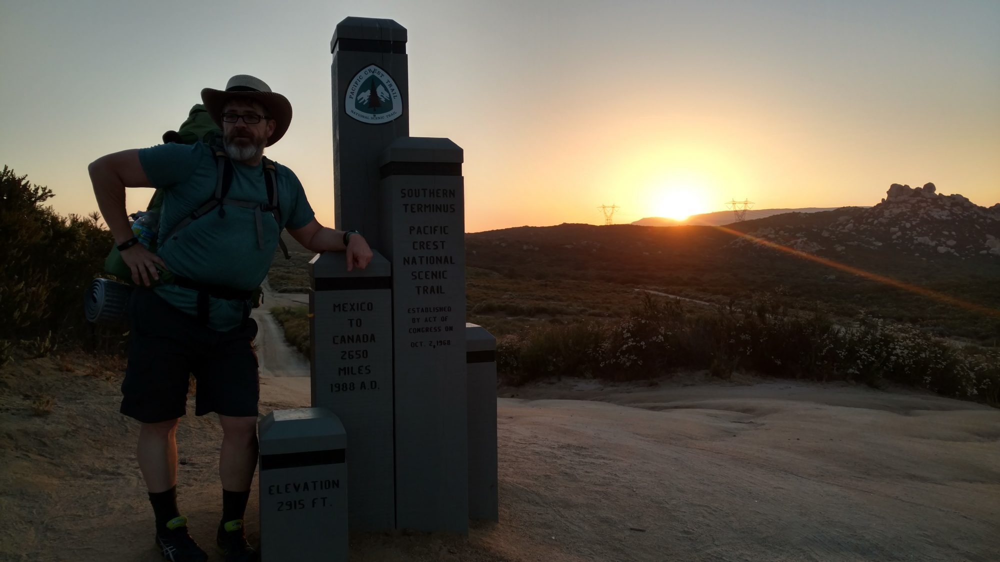
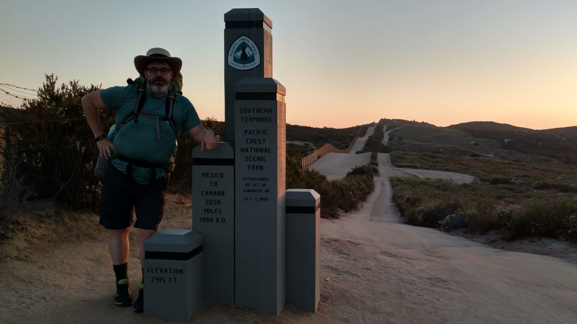
Starting the PCT in my Chi-Chi Rodriguez hat at sunset on May 27, 2016.

5/27/2016

I’m not sure if I should call this day 0 or 1.  It started at 4 am (1 am Pacific time) and didn’t end until 9 PM – a loooooong 20 hour day.  Most hikers travel one day and start the trail the next day or the day after.

Karen dropped me off at 4:45 am at the Jacksonville airport.  The baggage check-in took longer than expected and they rushed me to the front after fifteen minutes of waiting.  I was hoping I could carry the pack as carry-on luggage, but its just too darned tall to fit when it is fully packed.  So I checked the pack as luggage and carried a small food bag with documents and the foam pad.  Then the TSA screening line wrapped back at least eight or ten times.  It went quickly, though and I got to the gate with plenty of time to spare.  They were already boarding so I just walked right onto the plane.

And then the pilot announced that the previous crew reported some issues so there was a maintenance crew working on the plane.  We were delayed perhaps 30 to 40 minutes but I still had plenty of time to make my connection in Dallas.  During the flight he made up a boatload of time and I think we ended up only about 10 minutes late.  I still had well over an hour in Dallas, so I just walked C terminal for most of it.  Then the gate announced that one of our flight attendants was sick and a sub was flying in.  Then they announced she was at gate D.  Then another half hour later she was sick, too, so they were getting another one.  Needless to say, two hours later they said we finally had a crew and we could board, and that more bad weather was expected shortly.  But we did take off about two hours late and he made up some time, too.  Since the flight taking our plane was also two hours late, the cleaning crew began work immediately. When only first class had deplaned, they immediately started gleaning away with a four person crew.

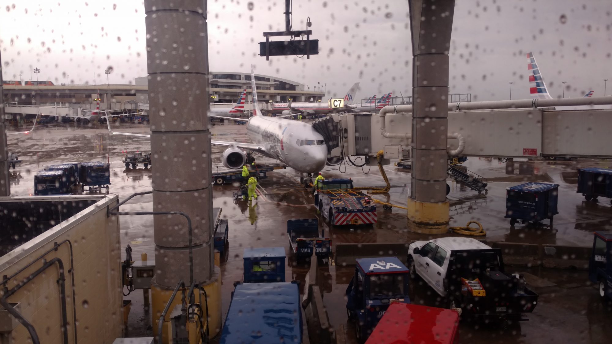
A bad weather day to fly, but I made it to San Diego with just enough time to run errands, but no sightseeing.

There were only two possible buses to get to Campo for the next THREE days because of Memorial Day weekend, so arriving in San Diego late made me quite nervous.

I still had chores to run – I had no stove fuel and no hat.   I was also getting hungry, but too full of adrenaline to be hangry.  There was not a lot of buffer in the schedule, so I had to hustle.

The pack was waiting for me almost immediately after getting to the baggage pickup so that went smoothly.  I repacked things and filled my four water bottles and headed for the bus.  The San Diego MTS website said that I could not buy a day pass at the airport but there was a kiosk right next to the information booth.  That went quickly, I got on the bus to the downtown station after only waiting about two minutes and got there in about fifteen minutes driving along the waterfront.  Getting to the trolley interchange was a piece of cake and less than five minutes later I was on the orange trolley.  That ride took a good forty five minutes to the main El Cajon bus terminal.


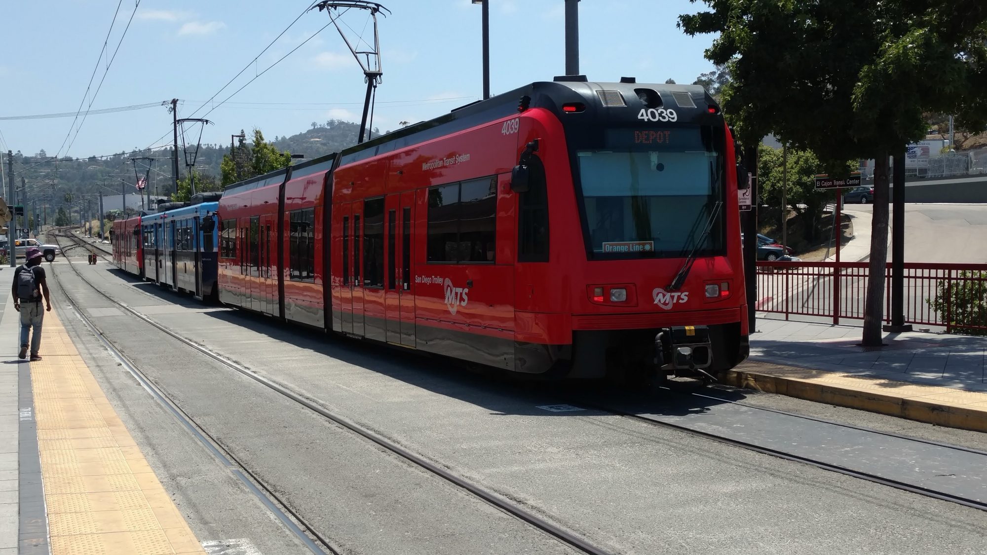
The excellent trolley in San Diego

I had about an hour and a half to wait for the bus to Campo and still had to run to the Big 5 sporting goods to pick up stove fuel and a hat.  The bus that should have been there to go to the mall was late so I found an alternate bus and took that one instead.  When I got off the bus, there was a Dicks sporting goods on my side of the road instead of crossing so i went to Dicks instead.  Finding the fuel was easy, but finding a hat was not.  Dicks has the annoying habit of scattering their hats all over the place.  I wanted a straw one but all their men’s straw hats were too big (to fit my head snugly).  Why do they only order one size?  I even looked at ladies hats, but they were all too flagrantly ladylike.  Even asking the staff for help it was not easy.  I finally discovered that the best hats are in the golf section.  I found a nice baseball hat, visor, and straw hat.  I opted for the straw hat so it would protect my ears.  I have an umbrella but I might not want to use it all the time so I opted for more protection.  It makes me look like Chi-chi Rodriguez.

Two cliff bars later I was on my way but only had half an hour to catch the 3 PM bus for Campo and I still had not eaten lunch so I made a quick stop at Five Guys.  I was hoping to hit one of the many great breweries or brewpubs in San Diego but I just did not have the time.  The burger was good and the fries taste so great, but the quantities are ridiculous.  I ate only half the fries and ditched them because I only had 15 minutes to get back to the bus depot and it’s a ten minute ride.  Google transit is quite good and led me straight to the bus stop on the other side of the mall.

When I got to the stop I noticed that the rural bus I needed to catch also stopped at this exact stop.  By the schedule it should have been there already but I was hoping it was late.  All the real-time bus info and app did not seem to actually be real-time but more of a simulation based on the schedules.  The bus to the terminal arrived first, so I got on that one to play it safe.  I got to the terminal one minute after the bus was supposed to be there but no bus.  It arrived five minutes late.  I was really anxious to make this bus since there was only one more bus two hours later and I did not want to waste more time.

A huge weight was lifted when I finally boarded the bus to Campo.

Once boarded, I found out the fare was $10 not $5 but that still seemed reasonable for a two hour bus ride.  The bus was packed and two other PCT hikers were on board.  One was from Washington state and the other was from Switzerland.  As the bus progressed through the outskirts it kept picking up more and more people.  I was able to get a seat in the back but there were many who had to stand.  Everyone was very polite and younger kids got up when an older person got on.  After close to an hour of riding, I was getting nauseous from the curves, being in a hot bus and those damn grease bomb fries.  I closed my eyes for ten minutes and when I opened them, the suburbs had vanished and desert mountain countryside was everywhere.  It was gorgeous.  And then the bus slammed on brakes.  There was an accident up ahead where two cars hit head on.  It took us a few minutes to get around it, but we did.  we later found out that there was a fatality at the accident and that the road had been shut down as soon as the rescue crew arrived on scene.  That little part is important later on.

Now that my attention was on the bus ride again, I was able to enjoy the scenery as it whipped by.  The driver was really driving the heck out of that bus on the curvy mountain roads.  Then ten minutes later he goes screeching off the side of the road.  I noticed as he pulled over the engine was no longer running.  I could also smell all sorts of clutchy braky smells.  The driver said the engine had overheated and shut itself off and that coolant was leaking out of it.  They were going to send a replacement bus but it would not arrive for three hours.  Heck, the next scheduled bus could get there before that.  But it turns out that with the road closed behind us, there might not be another bus… Or a replacement one.  After an hour, the driver said they indeed were not sending a replacement bus but a repair truck and then a different bus might pick us up in another three hours.

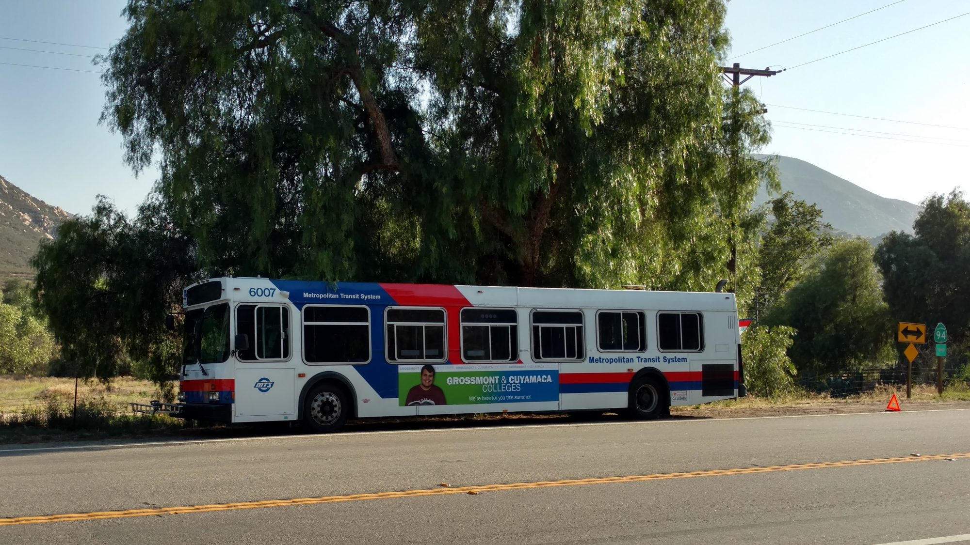
The bus broke down with 16 miles left to Campo and no traffic for hitching a ride.

The heck with that.  Two thirds of the bus had hitched on, and now us (the two other hikers) and the last eight passengers decided to do the same.  We were able to get a car to pull over every five minutes but we let the locals take the first rides.  We were only 16 miles from our destination but it was a dangerous road to walk so we kept waiting for a hitch.  We did get a ride, but only half way.

The driver dropped us off at a small store so we could hopefully get a ride from there.  But the problem is that we were now so far down the remote road and the blocked highway allowed even less traffic to grab a hitch.  There were simply no cars to hitch from that were going our direction.

We ended up chatting with a guy at the store (and every patron as they came by) but this one guy was just off the wall.  He was chatting up a storm and kept trying to convince us that the border was only 400 yds away and we should just start there instead of going the last 9 miles to the real start.  He was talking some crazy stuff and as we got closer to him we realized why.  He was drunk.  So after a half an hour of unsuccessful hitching, this guy finally talked us into the notion that he would just drive us to the border.  We never could really figure out where he was going to take us, but he was headed in the right direction and there’s no turns on the way.  So we got in a tiny car with a drunk guy (and a fresh quart of Coors) and his dog who was going to drive us down a small twisty mountain road.

As it turned out, where he ended up taking us was exactly where we wanted to go… to the store in Campo.  So after a quick thank you to get away from him as quickly as possible, we loaded up and were on our way.  The three of us had ridden the bus to together, hitched together, so we might as well hike together.

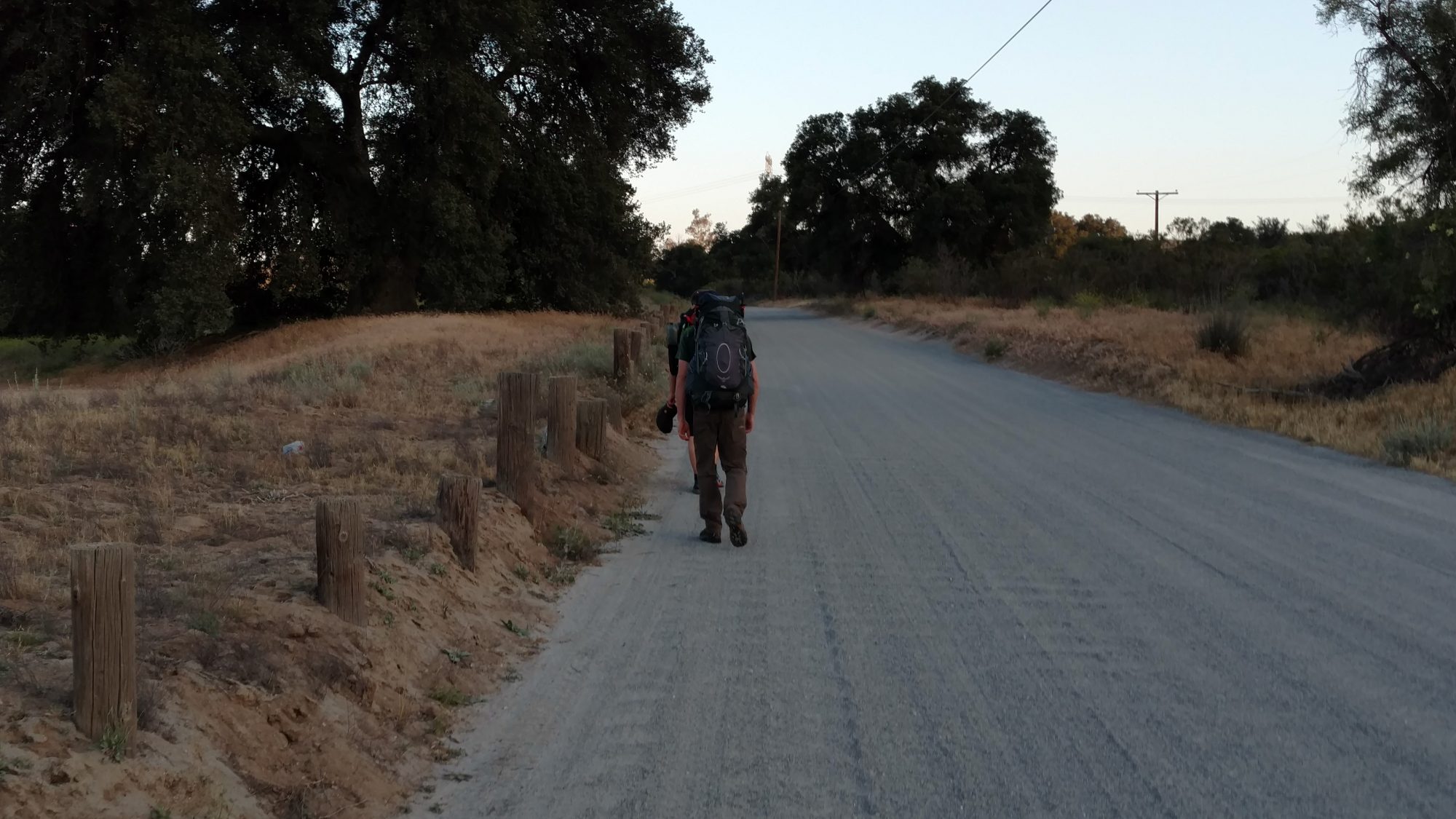
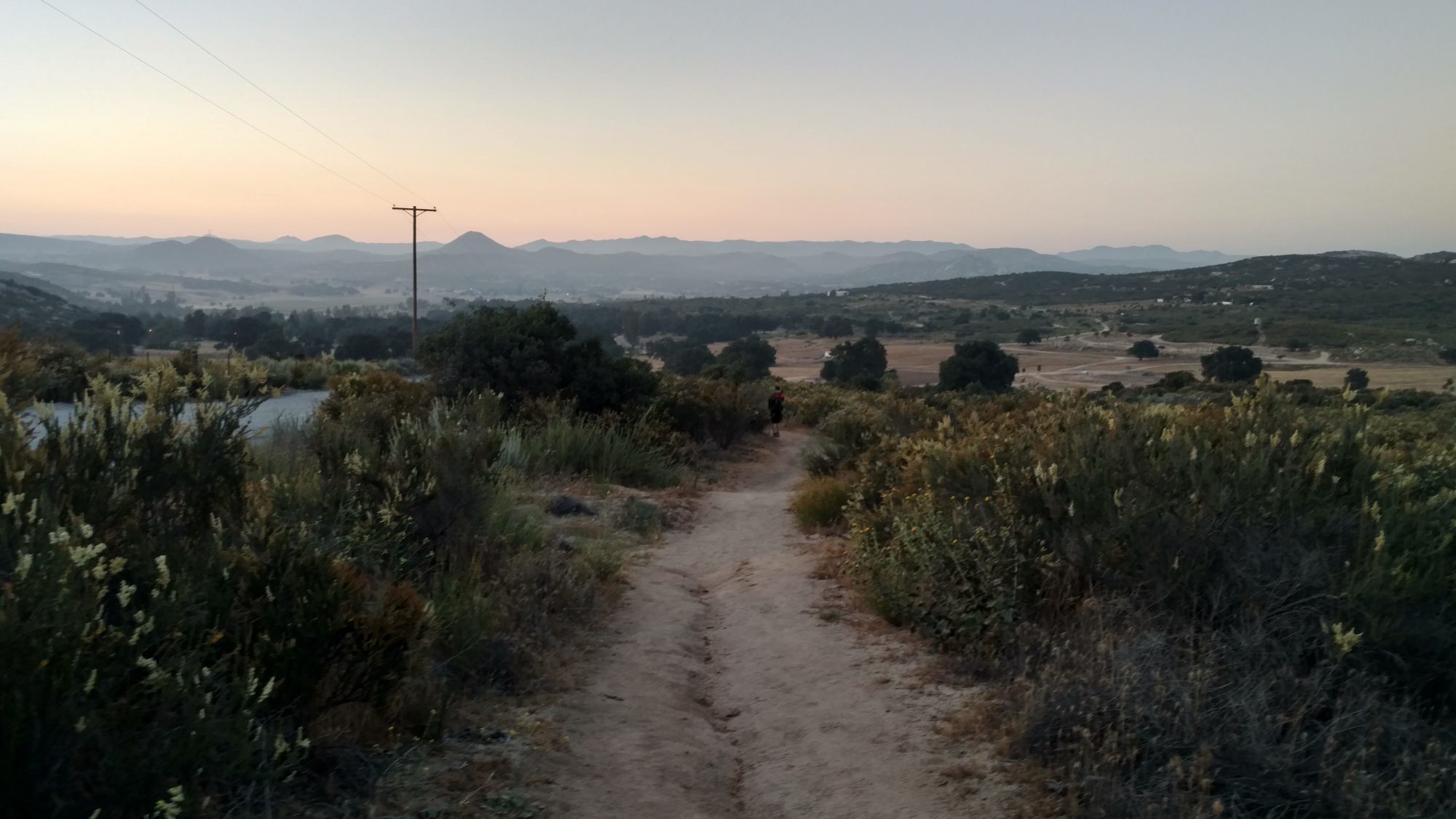
Hiking along a gravel road towards Mexico.

We had to walk about two miles along the road (a quiet one) to get to the border right as the sun was setting.  We spent a good twenty minutes taking pictures for each other and as the sun got lower the pictures got more interesting.  There’s something magical about sunset in the desert.  Enough light remained so that we could begin our hike northward.

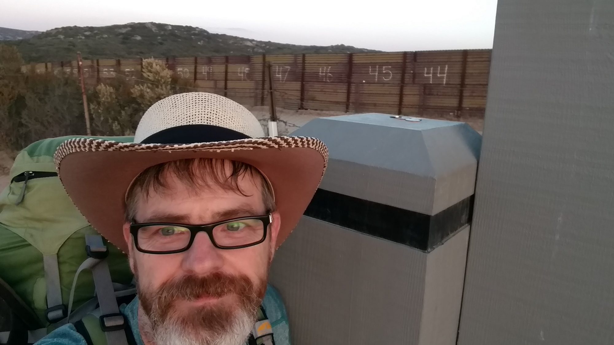
Say hello to Mexico!

Does Donald Trump know there is already a wall between the US and Mexico in some places?

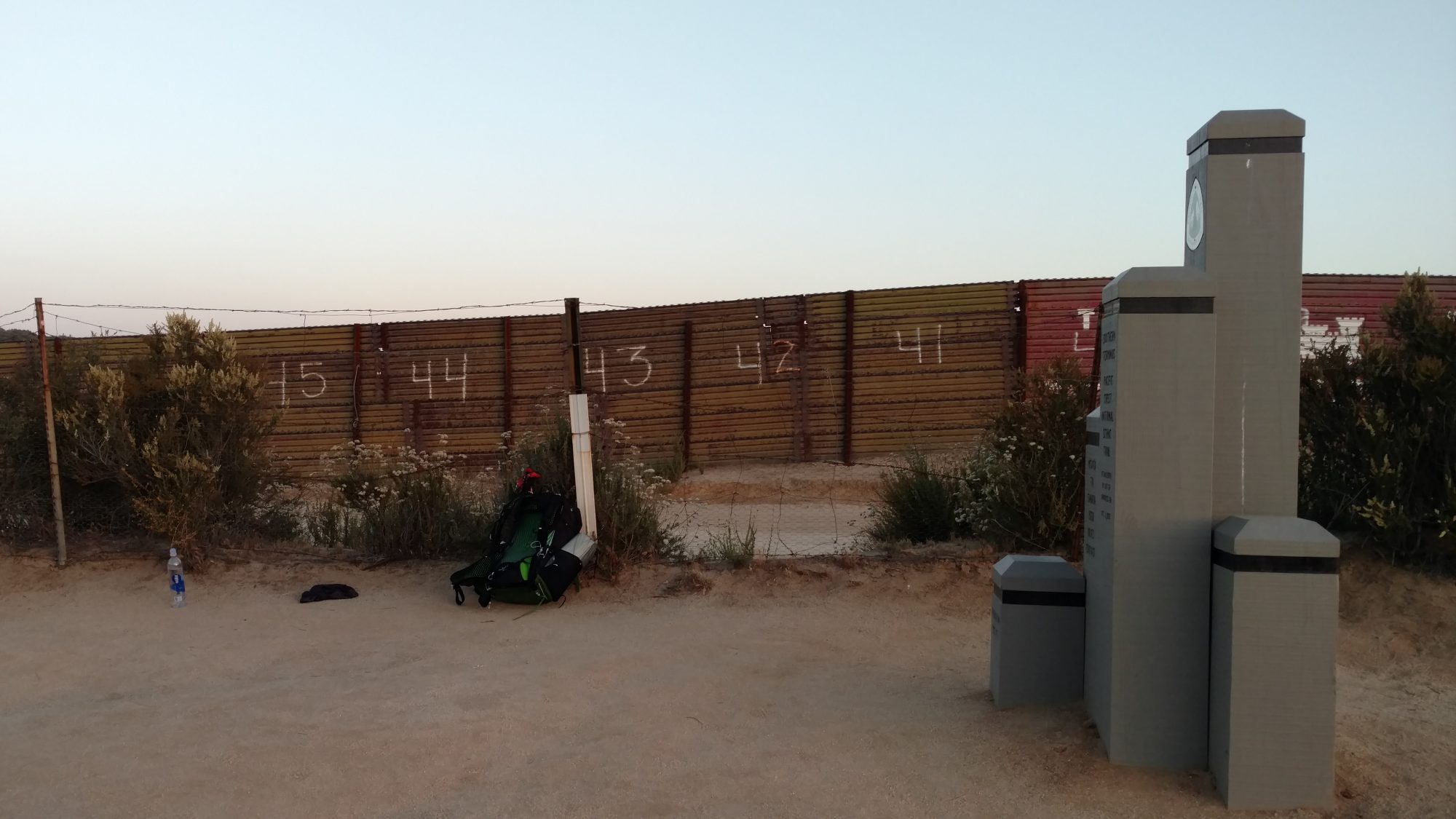
Just enough light to see the border with Mexico.

The journey begins. Canada is a mere 2650 miles ahead.

I had planned on going back to the store and camping at the museum next door that allows hikers to camp for free.  I was too tired to deal with reading the maps to look for a camping spot.  But we missed the last road back to the store so we hiked on.  The first mile is decorated with an impressive marker, so a quick picture was required.  It got dark very quickly, so during the second mile we stopped to get them out.

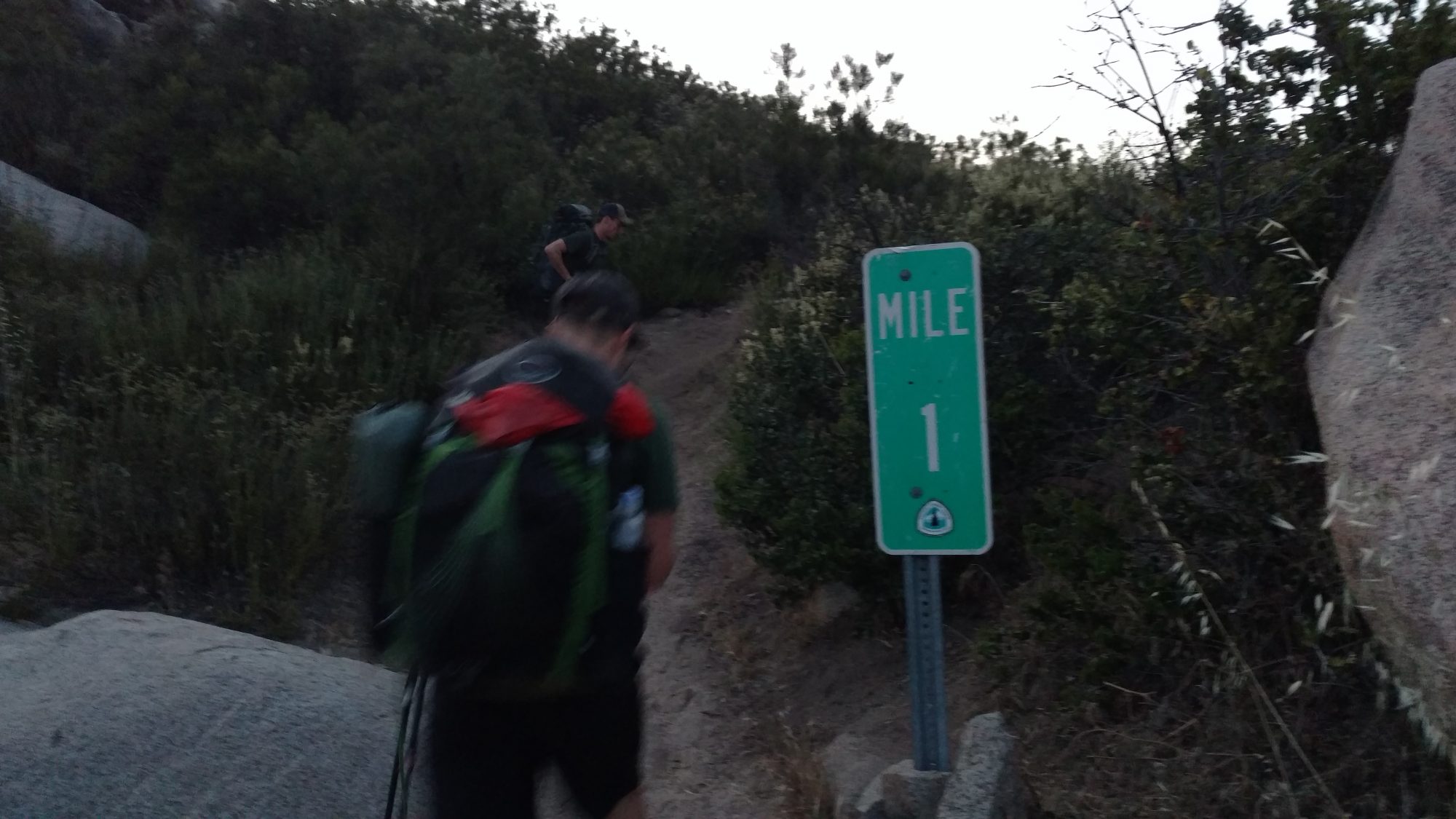
Less than twenty minutes into the hike, we hit our first milestone – 1 mile!

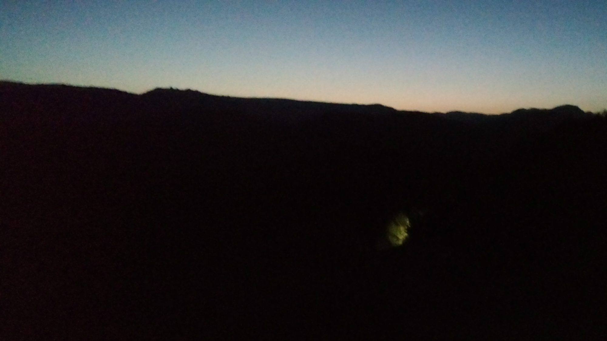
Night hiking by headlamp on the very first day.

After three quick miles, we came to a dry stream bed with campsites so I decided to stop and make camp and the other two went on.   They wanted to do about ten miles of night hiking, but I’m more interested in getting rest.

After what amounted to a 20 hour day after getting only five hours of sleep, I didn’t bother to cook dinner – I wanted to sleep.

A hiker we saw pass us going to the border near the one mile marker as we walked north walked by just before I fell asleep.  I didn’t know it at the time, but I was to meet him again later and hike and camp with him a few times.

It was a good zeroth and first day but I’m looking forward to tomorrow even more.

Reinvented Journey – The Pacific Crest Trail

The end of our Appalachian Trail hike is not the end of the story, but the beginning of a new one.  Karen has returned to work, but I have not.  This is such a life changing period in my life, that I just cannot bring myself to go back to work again.  Karen and I have discussed this over the last week and although it is going to be hard on both of us to be apart for so long, we have both settled on the idea of me taking the rest of the summer to go out west and hike the Pacific Crest Trail alone.  I will set out for San Diego tomorrow and see how close to Canada I can get by the end of August, when I will have to return for the trip to Pennsylvania for a wedding.

The trip on the AT was for Karen to experience a very social trail a bit closer to home.  I really have no desire to do it a second time without her, so I might as well experience a new trail.  The main reason for us doing the AT instead of PCT are because there are shelters on the AT, towns are more numerous and easy to access (beds, showers, and laundry), there are more people (feel less remote), more support structure (friends or family close to the trail in case we get into trouble), and some familiarity with several of the locations.  The PCT is far more remote (1/4 of the towns), the resupply options are fewer and much farther off trail, it goes through significant deserts (Karen loves having gobs of water), there are only a few shelters on the entire trail, its almost 500 miles longer, and much further away from home.  But… the trail on the PCT is better graded (no monster rock scrambles), and the scenery is absolutely stunning most of the time.  That’s the aspect that is driving me there.

So I have been repackaging our supplies over the past week to reconfigure for a single hike with different resupply stages.  And making minor gear changes.  I spoke with a fellow hiker that I met on the AT in 2013 who did the PCT in 2014 about some of the differences and I will be making a few changes.

  • The first is switching from the alcohol to canister stove – I knew about that one.  [post-hike: The canister stove worked out well.  I did not know how fast I would go through gas, so when I bought my first canister in San Diego, I bought both a 110g and 230g canister.  The plan was to use the 230g to see how long it would last, and use the 110g as the emergency spare.  The result was that the 230g lasted 3-4 weeks depending on if I was cooking lunch or not, I never touched the 110g until I got to Oregon and decided it was stupid to carry two, so I used up the 110g – they last 8-12 days.  Also, I could buy canisters at nearly every single resupply, whereas I only saw alcohol for sale two or three times on the entire trail (except for Heet in nearly every gas station).  So I would say the PCT is definitely a canister or no-cook trail.]
  • The second is switching to a tent for the first 700 miles.  The desert has few trees at low elevations, and the first 700 miles are significantly desert terrain – Mojave desert anyone?  [post-hike: I actually carried the tent for 2000 miles (until Timberline lodge in Oregon).  I don’t think a hammock is practical from Campo to Sierra City, CA unless you can pitch it on the ground.  While there are a few areas with trees, the trees tend to be too small for hammocking and there could be 100 miles between trees.  A tent is definitely more convenient.  Even the Sierras don’t have good trees for hammocking.  Next time, I would probably cowboy camp with minimal provisions for mosquito protection from Campo to Kennedy Meadows (no rain), then tent from Kennedy to North Kennedy (bad mosquitoes), then cowboy again from North Kennedy to Timberline, then hammock from Timberline to Canada.  I was happy with the tent everywhere up to Timberline, but switched to the hammock mainly for better rain camping.  I was lucky to not have to pitch or break camp in heavy rain.  But if I were, using the hammock in the rain is much easier.  Pitch the fly first, then you have a dry-ish place to sit under to cook, set up the hammock, etc.]
  • The third is moving from an inflatable sleep pad to a foam one.  They are bulky and not very comfy, but they can’t puncture.  My Prolite pad has developed a very small leak and as my friend put it “There is a lot of sharp shit in the desert.”  [post-hike: The foam pad worked great.  I used it for lunch breaks and it never failed me.  When I switched to the hammock, I switched to the inflatable pad, but I forgot to bring the Prolite when I returned to Timberline with Kevin.  Luckily, I had him using the Prolite Plus, so I stole that from him when he returned from Cascade Locks.  The first two nights I had to sleep without a pad in the hammock at around 35 degrees in a 10 degree bag, I froze my ass off.  I was wearing three layers of clothes and was still too cold to sleep comfortably.  But after I got the pad from Kevin, I slept like a baby, even below freezing.]
  • The fourth is to bring a ground cloth to protect the tent floor from said “sharp shit” and/or allow me to cowboy camp (under the stars with no tent).  I need to find Tyvek to make one, and Lowes has left me high and dry.  [post-hike: On the second day, when hitting the outfitter at Mount Laguna, I was able to find a Tyvek sheet in the hiker box that I used for the rest of the hike.  The ground in the desert is so dusty, that the ground cloth definitely kept things cleaner.  It was perfect for cowboy camping, too, where you put your sleeping bag right on the ground without a tent.  I found several outfitters and hostels (Agua Dulce) that sold Tyvek by the foot.]
  • The fifth is water.  I normally carry 2 liter bottles and a 4 liter bladder, but that might not be enough.  I will add 2 or 4 more liter bottles to carry on some of the dry stretches (20-40 miles in some cases) that I will keep inside the pack to keep them cool and then ditch them when I am out of the desert.  I have also made bottle cozys from leftover reflectix to try to insulate the ones I don’t have inside the pack.  [post-hike: I carried four 1 liter bottles plus a 3 liter bladder on most of the hike.  I started with two 3 liter bladders, but sent one bladder home in Tehachapi.  I carried six 1 liter bottles for much of the desert south of Tehachapi, and three 1 liter bottles from Timberline to Canada.  With the 3 liter bladder, I could have only carried two bottles, but I used the third to carry about 300 ml of coffee.  I didn’t need the bladder north of Timberline, but I just always carry it with me for emergencies.  In the cool weather in Washington, I would fill water only once a day – drinking one liter right there, and filling 2.3 liters in my three bottles, and that would last me 25-28 miles plus camping.  In the desert, I was drinking one liter every 4 miles.]
  • The sixth is clothing.  Shorts and a T-shirt sound nice for the hot desert, but you are better off wearing long pants and a long sleeve shirt.  I had no suitable long sleeve shirt so I ordered one and it will go nicely with the Prana long pants we bought for cold protection for the AT trip.  I’ll also probably bring a full brim straw hat instead of a baseball hat for sun protection (even though I will be hiking with a reflective umbrella).  [post-hike: The long pants and long sleeve shirt were perfect.  My shirt was white and was filthy in less than a week, so I earned the name Dirty Gil (started out as Gilligan).  The long pants did well, but ended up being too big on me after the first month – I lost 2 inches in my waist.  I carried shorts and a T shirt and wore them one day in the desert, but I sunburned badly (did not use sunscreen).  The long pants also protected me from thorny brush.  I had to tuck my pants into my socks (or use gaiters) to prevent the dust from going up the inside of my pants and making me filthy all the way up to my underwear.  I found a nice straw golf hat in San Diego and used that hat all the way to Timberline, where I switched out to a baseball hat for better rain usage.  The baseball hat allowed my ears to get sunburned, so next time I’ll use the frumpy canvas hats I hate so much.  The umbrella was a huge boost in the hot desert both while hiking and sitting at siesta time.  I had to use it inside my tent when I thought the tent tarp would block out most of the sun – it only blocked out maybe 10% of the sun, but the umbrella blocks out 100%.  I also found that road walking on asphalt in the desert is cooler than walking on sand.  The sand reflected more heat up from the ground than the asphalt did.  That’s the opposite of how it works in Florida.  The umbrella was blocking the heat from above perfectly.]
  • The seventh is battery power.  Since the PCT is more remote, I will need a larger spare battery (10,000 mAh) than the tiny one (3,600 mAh) that I usually carry because there are far less charging options.  [post-hike:  From Campo to Kennedy Meadows, there were enough outlets that I could have gone without a battery.  I bought a solar charger in Tehachapi since I knew the Sierras would be too long for even the 10,000 mAh battery.  It worked perfectly, but my battery failed at Kennedy Meadows North, and I was without a battery for nearly a week, until ordering a 6700 mAh and getting it in South Lake Tahoe.  That worked fair, but it was a goofy model that would power on by shaking it (it had accelerometers).  That’s a horrible design, as it would sometimes discharge more than it charged if I was in wooded areas.  I mailed the solar charger home in Sierra City and relied on the 6700 mAh battery alone, which was barely enough.  I switched back to a new 10,000 mAh in Washington without the solar charger.  The phone plus 10,000 mAh battery would get me 8-10 days in airplane mode, but I recently found battery saving mode which I think could extend me to 10-14 days.  The solar charger is so heavy (16 oz vs 6 oz for 10,000 mAh battery), I will only use that when I have 10+ days I know I will need to go between outlets.]
  • The eighth change is I will also not bring Crocs as camp shoes until I get to Oregon since I am not expecting much rain in Cali and the humidity being much lower will dry shoes much faster than on the AT.  [post-hike:  Not having Crocs was fine for much of the trail.  I brought flip flops instead and did use them quite frequently.  I used them as camp shoes in the desert (nearly every day), I wore them on river crossings (four times), and I wore them as camp shoes in Washington during lunch breaks when I was trying to dry my feet to help the blisters.  If I had Crocs in Washington, I could have worn socks to keep my feet warmer, but the flips were fine in the cold for the 30 minutes or so I was wearing them.  Crocs would have been better for the river crossings, but they were only needed so few times, that flips worked fine.]

Getting to the trailhead has been a whirlwind experience, too.  I made my permit request a week ago, but still have not received the permit.  I was intending on flying out Saturday and taking the bus to Campo on Sunday, but the rural buses do not run on weekends (or Memorial day).  There is a network of trail angels that house and transport hikers to the trailhead from the airport, but they are closed now (I’m two weeks past the normal season) and another one is out of town.  So that leaves delaying a few days, or heading out a day earlier and not having a layover and going to the trailhead immediately after getting into San Diego.  Check.  Public transportation in San Diego is awesome except for one small detail – you can buy a day pass for $5, but you can’t buy them in the airport – Whaaaat?  [post-hike:  Yes, there is a kiosk in the airport where you can buy a day pass]  I’ll have to take a bus from the airport for $2.25 to get to a station where I can then buy a $5 pass (plus $2 for the card).  I checked into Uber, which would be an $80 ride.  [post-hike: I met a hiker who did have to take Uber because the last bus on Friday was cancelled because of the car accident, and it cost him $140.]

The publishers of the primary trail guide (Yogi’s PCT guide) have moved their home from Kansas to California this month, so their sales have been suspended right in the middle of my effort to plan out the hike.  Needless to say, I have had to use other resources (which there are several) but I just got notification yesterday that my book has shipped and will arrive the day after I leave.  I’ll just have to have Karen mail it to me while I am on the trail and tear out the pages as I read it.  [post-hike: Karen shipped the book to me in Wrightwood, and I carried it a week before mailing it back to her.  The book weighs 2 lbs, and is just too much to carry.  Even though it has pages intended to be ripped out to carry on the trail, they are just too verbose and heavy to actually carry on the trail.  I relied on the Guthook phone app 98% of the time.  The Yogi book is really only good for the first half of the book on gear expectations, etc.  The fact that you get the opinions of 8-10 hikers, not just one, is where Yogi’s book really shines, in my opinion.]

The resupply plan has proven much more difficult than the AT, too.  The AT has far more options than the PCT, but the PCT’s options are fraught with difficulty.  The few hundred miles across the Sierra are either 10-25 miles off trail, or cost $70 to transport a package – yes, you read that right, $70 to avoid hiking 10+ miles over a mountain pass (which also takes a full day extra).  Decisions, decisions.  And I need to decide quickly, because it takes 3 weeks to transport your 5 gallon bucket by truck to the lake, then by ferry, then by horse, then by 4WD.  So they do work for their $70.  [post-hike:  After looking into the $70 Muir Trail Ranch resupply which really ends up being $130 because you also have to spend $50 getting your bucket to them, I decided not to use them.  I only wanted to ship 3 days of food, and at $130 for three days of food I decided that was not a good plan.  Instead, I loaded the canister with 7 days of food and carried another 1.5 days from Kennedy Meadows and did 25 mile days thru the Sierras and did not resupply until 200 miles at Red’s Meadow.  That plan worked, but the days in the Sierras were long and I was starving by the time I hit Reds Meadow to resupply in Mammoth Lakes.  I took a zero there to rest and camel up on fresh food.  I would do the same resupply again, but I would not skimp on the snacks and would probably have to pay more attention to calorie vs volume foods as opposed to calorie vs weight foods.  A bear canister is rather small when you get to packing it up.  Seven days fit, but I had to leave out extra snacks.  If i were not able to do 25 days, then adding a midpoint resupply via Kearsarge Pass is about the next best option, but its a tough climb over the pass and back.]

It’s going to be tough on both of us this summer to be apart for so long.  I will call as often as I can, but cell coverage is much more sparse on most of the trail.  But hopefully I can find some new places to bring Karen in the future.

One week later

We are back in Florida and Karen has already gone back to work.  This picture is from the day we got back, but you can clearly see her left Achilles is about twice the size of the right one.  I’m amazed that she was able to make it as far as she did with this level of inflammation.

Karen is not soured on hiking.  She really did enjoy the stretch we were able to hike, even with the less than ideal conditions weather wise and the physical pain.  Some pain is a part of hiking, but not that much pain.  I think we have a handle on the shoulder problems, and will work harder at pre-hike training for the next one.  And yes, we are talking about hiking again, but probably not as a six month trip.  One or two is possible, maybe I can talk her into three ;).

And speaking of hiking, I am not quite ready to go back into the rat race, so I am planning on hiking further this summer before I let the man shackle me to the desk again.  It took so long to break free, that I don’t want to let walking away from a 21 year career go to waste.  More on that soon….

Day 16 – End of the road

Today was a very trying day and we had to make a tough decision to quit the trail today.

Last night was cold but we both weathered it well.  I wore an extra layer and kept the mummy cinched down tight and the 34 degree weather was conquered easily.  I slept quite warmly until daylight when my legs felt a little cold.  Karen’s down bag kept her toasty all night.  Waking in the chilly air was pretty tough, though.  We did not have a cookable breakfast so cold granola bars it was.  And they were as hard as rocks in the cold temperature.

We started at 8 am and had 10 miles to get to Port Clinton.  The first few miles were quite pleasant and two hours later we had knocked out four of the miles.  And then the rocks hit.

Karen’s heel bothered her quite badly on the rocks and there was no shortage of them.  We had already decided that we needed to take a day off in town to reassess the blisters and see what the true culprit was.  The blister bandages still were intact so we left them on.  Usually they start to come off after 3 days or so and these had been on about a week.

Each mile got progressively slower and more painful for Karen but we did end up making it to town by 1 PM and were able to hit the only open restaurant in town with another hiker before they closed at 2.  The fourth hiker we camped with last night was the one who really wanted to make the restaurant but he never made it into town.

After lunch we were able to hitch a ride into the next town that has a motel, as the hotel in Port Clinton is closed on Mondays.  Once we were showered and able to get the bandages off we discovered that she did not have blisters at all, she has a tendon injury.  Most likely tendonitis.  Either way, it is not an injury that is likely to heal in less than a month and we really can’t realistically let that heal on the trail.  The rocks only get worse from here and there’s no sense in pushing on and making it worse.

So this is the end of our trip, as we have already booked a flight back to Florida on Wednesday.  We had some fun in these last two and a half weeks and 195 miles of trail, but we must now return home.

I asked Karen what her favorite part about the trip was and she said hiking through the farmlands.

The Cumberland valley farms was one of my favorite parts, too, and I’m glad I was able to share that with her in a way that no one can experience from a passing car.  There’s something about walking through the middle of it that makes it special.

Day 15 – Aaaaw hail yeah!

Global warming, huh.  Today started out quite brisk as we left the 501 shelter at 7am to make sure we had plenty of time to get 16 miles to the next shelter.  It was quite cold last night even in a fully enclosed shelter full of people.  Rustling, snoring people.

The morning started off bright and we both had our jackets on.  After about 9 or 10 am, the clouds rolled in and brought brief periods of rain for just a few minutes before it would stop.  Then ten minutes later start back up again.  We must have stopped to either take jackets off or put them on at least 20 times before lunch.

By about 1 PM the rain turned to hail spells and lasted well until after 6 PM.  Most of the hail was very small but one spell it was pea sized.  We ended up getting to the shelter at about 3:30 and even though the shelter was over a quarter mile off the trail, we were grateful to have reached it.  The wind was very gusty all afternoon and still is.

We were planning on camping out tonight but the wind has us holed up in the shelter.  One of the hail spells was actually light snow flurries.

Our leftover pizza from the 501 lasted us for breakfast and two lunches.  We snacked a few times on the way then ate our sub that we had packed out for dinner.  Nothing beats a day old sub when you are in the middle of the woods.  We should have cooked something warm, but meh.

The trail today was all kinds of crazy.  The blazes were quite lacking and the trail so poorly maintained that most of the way there were two or three trails in parallel that you could choose to take based on which one had fewer puddles or rocks.  In most cases the official AT was so littered with roots and sticks and small blowdowns you wouldn’t want to take the official one.  It impacts the ecosystem pretty negatively when this happens.  A wide swath of erosion will engulf this place before long.

We are here at Eagles Landing shelter and the shelter itself is pretty decent, but the area around it heavily impacted by mass camping.  The privy has a sign boasting that it is the first moldering privy on the AT in PA, but it’s nothing to be proud of.  It is overfull and not a pleasure at all to use.

We are here with two other hikers and one of them has spread a tarp over most of the opening to block some of the wind.  It is supposed to get down to 34 degrees tonight and I am only carrying a 40 degree bag that has already proven to be cold on the 45 degree nights.  I am wearing an extra fleece as protection and will wear my down jacket backwards to try to keep more of its loft rather than having it go to waste by compressing it behind my back.

We are probably going to have to take a zero tomorrow to let Karen’s heels heal better.  She doesn’t have blisters per se, but it is more like a subdermal blister or bruising.  She can be walking on flat ground and just have shooting pain in her heel for no reason at all.  If we stop for even 30/seconds it flares up as soon as she starts walking again.  The blister packs are still in good shape so we need to take them off tomorrow and see what is up.  The hotel in Port Clinton is closed tomorrow so we will have to walk into Hamburg instead.  It’s about ten miles to Port Clinton with a really steep descent then another mile and a half to the Walmart, Cabellas, and Microtel.  The weather tomorrow is supposed to be sunny and breezy and still quite cold.

Day 14 – Time for a rest

We had a fantastic night of sleep atop the ridge last night with no rain, no dew, and comfortable temperatures.  We got up early to make sure we could make six miles to the 501 shelter before the rains did.  We were out by seven and made the shelter well before eleven even with several leisurely stops at vistas along the way.

The trail was good most of the way with only one major rock scramble.  Being close to a road on a weekend day, there were a lot of day hikers out also enjoying the views.  The sun was shining and a gentle cool breeze was blowing.  It really was an ideal morning.

And then came the 501.  It is a very unusual shelter, being enclosed on all four sides and having a skylight and an outdoor shower and residential pump water source.  But the most striking feature is pizza.  The shelter is only 0.1 mi from highway 501 and the local pizza shop delivers for a $2 fee.  The catch is that they don’t start delivery until 4pm.

Since the local pizza joint did not start delivery until 4 pm, we had to patiently eat our peanut butter and jelly on English muffins and wait five whole hours.  Oh, the humanity.

Other hikers kept showing up all day so there were plenty of interesting people to meet and talk with throughout the day.  The worst part was that the rains did not come until three o’clock and it was still gorgeous outside all afternoon until then.  We felt guilty just sitting there passing the time.

But the wait was worth it.  At 4:02 we placed our order and at 4:45 we were eating pizza and a Caesar salad and had a wrapped sub ready for tomorrow.  We even splurged with a small Pepsi.  One of the thru hikers we met today ate a meatball sub and then a large pizza.  Another one ate chicken wings, fried broccoli, and half of a large pizza.  Karen and I ate only half our large pizza.

We are supposed to have nice sunny weather the next two days but it is supposed to be very windy and quite cold, as in 38 degrees cold.  42 has been our coldest so far and that one was no fun to wake up in so this should be an interesting few days.  After that, more rain.

Day 13 – Will the real Pennsylvania please stand up

Today was a rough day.  Not in miles or heat or bugs or hunger or thirst, but in rain and rocks.  The rains came at daybreak as promised and we slept in an extra hour to delay the inevitable… Packing up in the rain again.

It was not a hard rain, but just one of those annoying “need a jacket or umbrella but maybe not” rains.

The first few miles of the hike were on pleasant mining roads with only one sizable climb to get to Swatara Gap.  By the time we got to the PA 72 underpass, it was raining pretty hard.  We stayed put under the road for nearly two hours to wait it out.  The weather map showed the band about to pass us so we ate lunch to kill some time.  Five other hikers passed by and two also stopped for lunch.  Once we thought the band was past us, we set out again northwards.

When we got to the middle of Swatara State Park just past the iron bridge, there was a park ranger and two gentlemen handing out Gatorade.  We took one and drank it down quickly and moved on.  We were wet and miserable and could have taken the rail trail into the I-81 exit with restaurants and hotels, but we pushed on.  The climb up to the next ridge was a little steep in sections but the steepness made it last shorter at least.  We were not sure if we would make it to the next shelter or not for the evening but at least set a goal of an old abandoned power line as the must-reach goal.  We did make it and decided to push on and then the rocks hit….

Pennsylvania is known as Rocksylvania to AT hikers.  There are some stretches that have massive boulder fields you must scramble over.

It is usually considered that the 501 shelter (two shelters from us) is the beginning of the major rocks, but I think we hit an early patch.  Even northern Maryland had some rock scrambles but these today just seemed worse.  They were slick with rain still, many had moss or lichen on them and the majority of them moved when you stepped on them.  We decided to camp at the next suitable spot we found and we found one about a quarter mile later.

Rain is supposed to hit again tomorrow about 11 or 12 am and we only have 2 miles to the next shelter and then only four more to the famous 501 shelter.  The 501 is famous not only for the rock demarcation line, but it is also known for being a fully enclosed shelter with a skylight and pizza delivery service.

Depending on the rain and how we feel tomorrow, we may nearo (nearly zero meaning take the day off after a short hike) at the shelter or may try to hitch or shuttle to Pine Grove to try to get a hotel room.  It’s been a trying first two weeks and with the weather it’s probably time for a break.  After talking with a lot of the thru hikers from Georgia, they said the first two months of weather were excellent for them but the last two weeks have been miserable for them.  Just our luck.