Month: September 2020

Day 24 Mile 352.6 Another zero day for resupply and chores

Today was a great day to not hike.  It started raining at sunrise and has been raining all day.  I have too many things to take care of to be able to hike for more than half a day anyway, so better to just take the whole day off and take my time to get everything done.

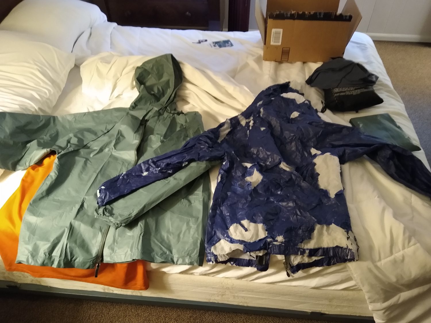
First up was to try a quick repair to the pockets of the Quest to add elastic cord where the old cord has completely failed.  Twenty minutes later, I had repaired one side, but it was only marginally better.  These pockets are just too low and too far gone.  Time to buck up and get a new pack.

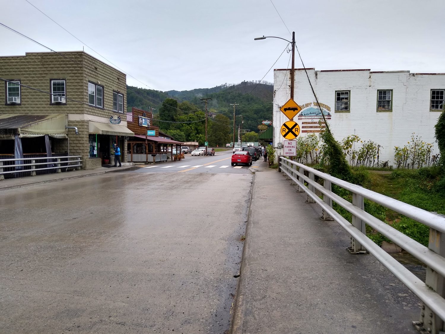
So off we set to Hot Springs, after stopping by the Post Office in Burnsville where Karen had the dehydrated dinners sent last week.  We picked them up and scooted off to Hot Springs in the rain.  It was raining pretty heavily when we got there, but we got a parking spot right in front of the outfitter.  I wanted to check their food section again since I did have some food resupply to do later on, and picked up some more Nuun with caffeine and a tiny bottle of Sriracha.  Fire makes anything taste better.  They had the exact pack I was wanting – a ULA Circuit in the exact size I needed (and others) and had a hipbelt in the right size I needed.  Bingo bango bongo – I’m set.  This pack has all the features I want except for a top lid, but I’ve been doing without one for three weeks now and can continue to do so for another month.

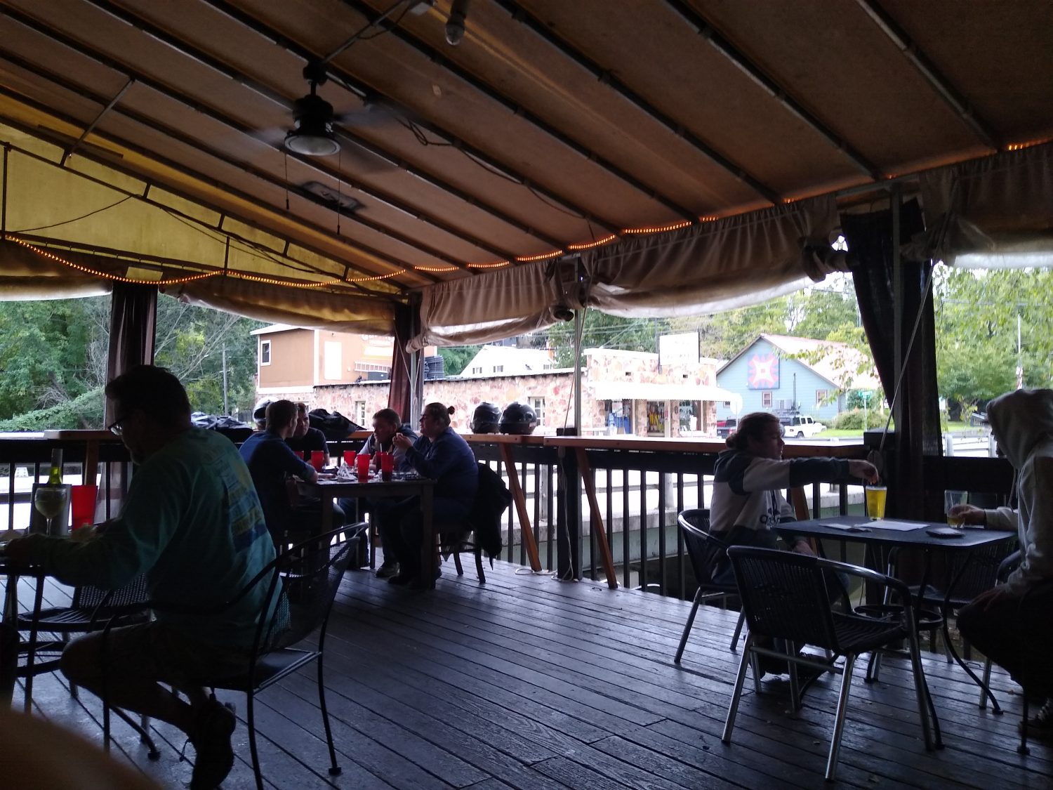
None of the restaurants in town were open yet, it was so early, and we weren’t really hungry, so we headed into Asheville to a BBQ place I have been told I need to try – Buxtons.  We got there and it was take-out only so we ordered and picked up our order and headed back home after stopping by the grocery store to finish the food resupply I needed for the next 4 days plus topping off the next two boxes to mail.

We got home and ate our BBQ.  It was good, but not great – definitely did not live up to the hype nor was it worth the price.  We still like Luella’s better.  Their collard greens were to die for, though.

So now all the food boxes are packed, the food bag for the next section stuffed, and all the other equipment swapped out into the new pack.  Other changes I am making are to add a fleece top and base layer bottoms, and swap out one of the short sleeve tees for a long sleeve one.  I also decided to switch from the alcohol stove to the isobutane one and trade a little weight for convenience.  With the dehydrated dinners you need to make sure your water is at a roiling boil or sometimes the beans or noodles won’t rehydrate fully and remain crunchy.  Crunchy beans suck.  Crunchy noodles aren’t much better.

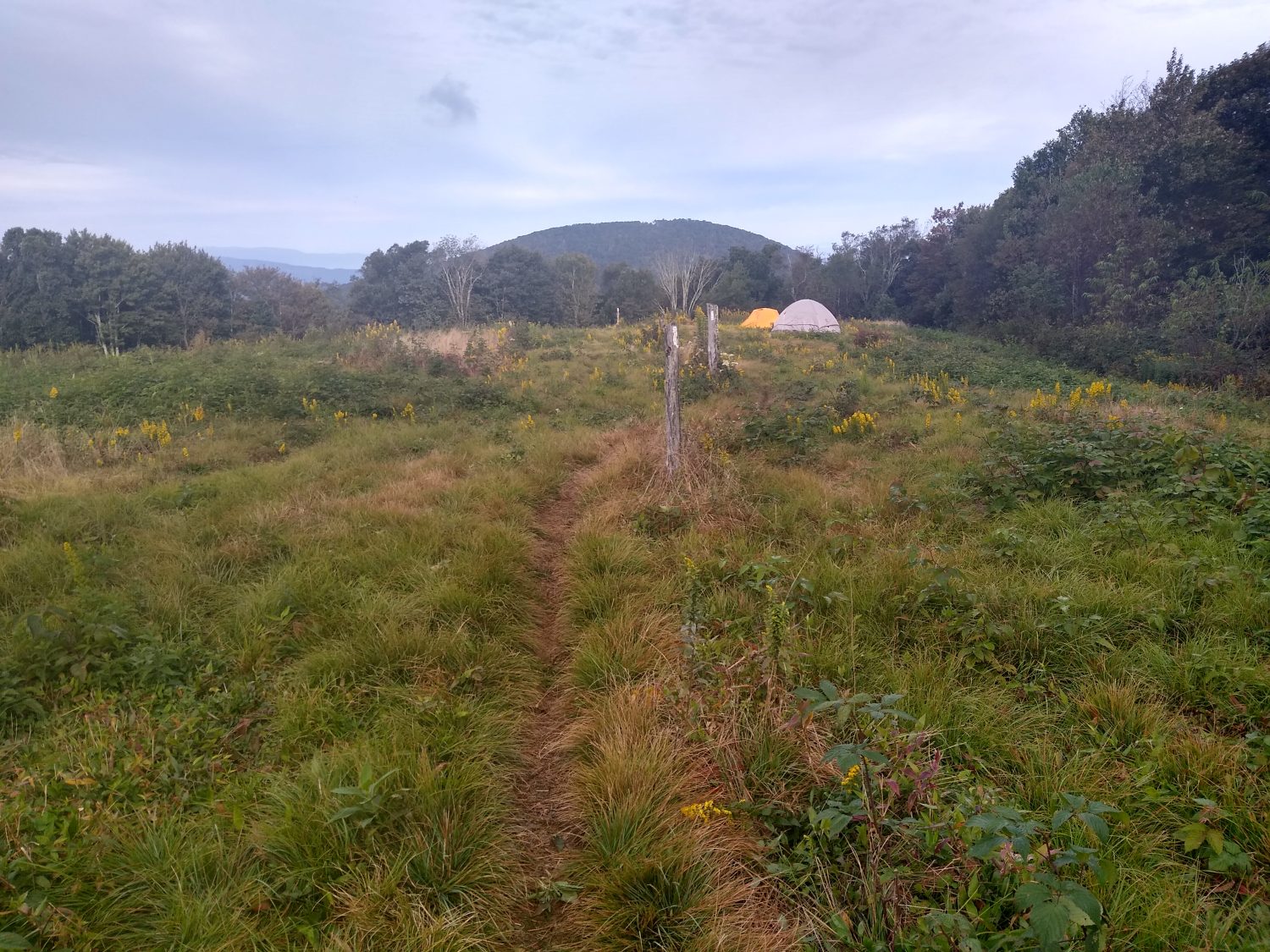
So the gear is packed; the truck is packed.  Karen will drop me off at Indian Grave Gap for one last goodbye in the morning, then she and the dog are back off to Florida for a few weeks, until it is time to repeat the process to come get me in Virginia.

Day 23 Mile 352.6 Another day of Slackpacking

There is a huge weather front coming in, so this is the last good day for hiking for a while.  I decided to take advantage of a good weather day and a light pack to knock out a 20 mile section before the rain hits.

We got up at 6am and left the house by 7 to arrive at Spivey Gap at 7:30.  It was very wet and drizzly but not too cool, so it was a good morning to start a gentle climb out of the gap.  This was the ending point for Karen and me in the early ’90s when we tried to go from Erwin to Hot Springs over Thanksgiving week.  It was way too cold, the daylight too short, and snow overnight doomed the trip to end at this spot.  My uncle and aunt picked us up at this spot in six inches of snow back then.  Today it was just wet and cool.

It was sunny by 9:30 but still cool and the sun never came out more than 15 minutes at a time.  Early in the day there was not a cloud in the sky but by 10 it was partly cloudy and remained that way the rest of the day.  I came to No Business Knob Shelter shortly after 10.  I was hoping this would be my lunch stop, but I got here too soon, so I just had a quick cookie break.  The shelter was just as I remembered it, but painted a darker brown than in the ’90s.  This was the first AT shelter Karen ever stayed in when it snowed on us.

The trail into Erwin is along a very steep cliff and there are a few good viewpoints on the way down.  I timed it so I could hit one just after noon to stop to have lunch.  The sun was peeking in and out and the trees had grown up into some of the view, so it was not that great.

At the bottom of the gap at the Nolichucky River is Uncle Johnny’s Hostel.  It was not there in the ’80s but has been there since the ’90s and it is a very popular stop.  I always stop in for ice cream, and did so this time as well.  They also had Shoe Goo which I wanted to pick up to repair the toe on my right shoe that was starting to delaminate.  It was the large tube, but since I was slackpacking I did not care much.  Just a quick 15 minute stop at Johnny’s this time and I was off again.

I had hiked this section this past June and while the trail goes up the cliff above the river for the next mile, I decided to road walk to the Nolichucky Expeditions Camp just a mile down the road. I think the road walk might have been the official trail in the ’80s but I could be mistaken about that. Anyway, I took it and was glad I did.  The walk went through the state park tubing site and was very serene along the river.  I need to come back here again some day.

Everyone complains about the long hike up from the river.  I thought it was nice and not too steep.  It was a bit rocky, but trails next to creeks tend to be like that.  There was only one quarter mile section near the top that started switchbacks in a drier and hotter section away from the creek.  It went by pretty quickly, but was definitely harder than the trail by the creek.

I came to the shelter over an hour earlier than I was expecting.  I did not have a signal, but sent a text to Karen to adjust the pickup time to be earlier and left the phone on to let the text go out whenever I climbed high enough to get a good signal.  The text went out in just a few minutes and the time was set – 5:30.  I was expecting to take until at least 6pm, possibly 7 or 8 because of all the climbing.  But that’s the difference good food and slackpacking make – you definitely make better time.

One of the tasks for today was to switch to the old pack that I used on the AT in 2013 and the PCT in 2016 (a GoLite Quest).  It was slightly larger, but a little more comfortable and did not have the same problems that I was having with the current pack (GoLite Jam50).  The main problem being the hip belt digging into my back.  The Quest was more comfortable, but after 4000 miles of use, the water bottle pockets were all stretched out.  The lower pockets was one of the features I missed, but they being so stretched out, the bottles kept falling out – the coffee bottle 3 times in the first hour of hiking before I stopped and just shoved it in the main pack section.  The Quest could not come with me on the rest of the trip.  Good to find this out on a one day trip, not the rest of the trip.

Since it is supposed to start raining at dark for the next day and a half, tomorrow will be a zero day to do chores, resupply, and drive back to Hot Springs and buy a new pack.  I almost bought one as I hiked through there last week, but skipped buying it because I knew Karen would be bringing my Quest.  Now I know I have no choice.  Off to Hot Springs tomorrow.

Day 22 Mile 333.1 Slackpacking

Yes, today I slackpacked.  Slackpacking is when you don’t carry a full pack.  Since I only intended to do about 14 miles today, I just carried food, water, jacket, toiletries, and the sleeping bag just to fill out the pack a bit.  And I was able to carry fresh food (and a soda) with me today.

Since I did not have too far to go today, we got a lazy start.  Breakfast of steak and eggs (fresh steak and fresh eggs) and some OJ we hit the trail at 9am after a quick stop at the convenience store for a Cheerwine soda and chips to go with the two sandwiches I made before we left.

The parking lot was still full at 9am.  There was a group of 4 men hikers and a group of two ladies setting off at the same time.  The weather was cloudy and cool, but not raining.

This is one of my regular routes, so I knew the terrain well – start out with a medium climb to a small bald, down across the gap to more climbing, and a few more ups and downs until the main climb up to big bald.  Intended to get to the top by a little after noon, and leave by 1 so I could make Spivey Gap by 4.  There were some sections that were steeper than I remembered, but it has been about 5 years since I had hiked this side of Sams Gap.  I hardly drank or ate anything on the climb up in anticipation of my feast on the peak.

I reached the top shortly after noon and it was cloudy and breezy, but not too cold.  The clouds were wisping in and out, and the sun would peek its head out for a minute at a time, so I did get some views, but not great ones.  There is a gravel road up to the top, and some of the high rollers from Wolf Laurel Ski Resort drove up to the top.  It takes the wind out of your sails to know they put no effort whatsoever to get to the top to see the view.

I ate my lunch while the camera took time lapse footage of the clouds – I thought it might come out interesting with all the overhead and low level fog today.  Lunch was great – it’s hard to beat a fresh sandwich while hiking.  I packed up and left right at 1 as planned and made my way to the next bald.  On that bald, they had set some bird traps to catch and tag birds before releasing them again.  They had workers manning the traps.  I had never seen that before.

I kept on motoring and near the end of the day I hit a spot I remembered, but remembered in a different place – High Rocks.  Since the clouds were close again, and I had already set a pickup time, I skipped the short side trail to the top of the rocks this time – I’ll be back again soon.

On the last few miles back to Spivey Gap, I could see fresh trail maintenance had been done on the water bars and drainage ditches.  The soil was still soft so I know it was done after the recent rains.  The Carolina Mountain Club does frequent maintenance on these trails.  Since I hike them so often, I see their changes (always improvements) over time.  They have been putting in more water bars and steps to control erosion.

I made it down just before 4 and Karen was already there.  I guess I forgot to tell her that the parking area for the trail was actually a quarter mile before the official gap.  She had passed it and had to turn around to come back to the trailhead.  As I was walking down the trail towards the road, I could actually hear her go past, then come back to the parking area.  Good timing again.

So after another shower (two in two days) and a quick trip into town to have dinner at the brewery, it’s more reconfiguring of the gear and planning tomorrow’s slackpack and the following day’s departure.  We are waiting on a package to arrive in town Tuesday morning that I will need for the future days supplies.

Day 21 mile 319.7 Time for a break

…from hiking, from rain, from mice.

Last night was one of the worst nights trying to sleep on the trail. The mice that came to visit me while I was cooking dinner never went away. All night long they were carrying acorns from outside and stashing them in various places in the shelter for the winter. But two of their activities had me beyond my wits end. Apparently mice are not good at carrying acorns as they kept dropping them all night long, one about every 10 or 15 minutes. The other was in the dark they assumed that my fingers were also acorns and would come and try to grab them from me while I was trying to sleep. If you want to know how to be wide awake in a nanosecond try having a mouse grab your finger. After the third time I’d had enough and couldn’t take it anymore. I figured out a way to rig my hammock inside the shelter so that I could sleep in it still on the floor but having a barrier between me and the mice. It worked well but their falling nuts all night long still kept me awake.

The rain did finally stop just before sunrise but with the lack of sleep and the deep hollow that the shelter was in made me get a 30 minute delayed start in the morning. I didn’t start hiking till about 7:45. I wanted to get out earlier because today Karen was coming to pick me up at Sam’s Gap just 12 miles ahead.

Yes, you read that right. Karen has driven up to North Carolina to meet me for a few days while I’m in the stretch near our place in Burnsville. It looks like I will be able to make Sam’s Gap just a few hours after lunch so that will give us some time to visit.

While it wasn’t actually raining during the day the ground was still wet and saturated and the vegetation was covered with dew. Since I knew I would have laundry soon I decided to put on a dry pair of socks instead of the wet pair I’ve been wearing the last 2 days. It made a big difference too. My feet were warm and comfortable for pretty much the whole day and even though they got a little damp they stayed mostly dry.

There are two big climbs from where I was to get to Sam’s Gap and I wasn’t sure I would have enough energy to make them in good enough time since I got almost no sleep the night before. But the climbs were not as bad as I thought and I was able to make good time most of the day.

The original estimate for arriving at Sam’s Gap was 2:00 p.m. and I was able to make it at 2:15. Not bad for starting 30 minutes late and not having any sleep.

I had hiked this section 2 years before and yet everything looked a little bit different this time. While most areas of the trail were overgrown since COVID kept many of the volunteers away for much of the summer, this stretch seemed relatively weed-free. Two years ago I remember it being overrun with stinging nettles. I also noticed a lot more steps had been installed on the trail. I am guessing most of these improvements were actually done last year.

After making Sam’s Gap at 2:15 Karen rolled up just a few minutes after I arrived. She had brought a roast beef sandwich and a bottle of Gatorade which I devoured pretty quickly. A quick drive to the house, a few beers and a steak later, and I’m ready for bed. And this time I’m expecting to sleep like a log, not like an acorn.

Day 20 mile 308.5 Another day of rain

Woke up early and got off at 7:15. The other two hikers were probably only 15 minutes behind me but they were going the other direction to the Hot Springs. As expected it rained all night long and just about the time I got ready to take off it let up a little bit but it was still raining.

And that remains the theme of the entire day.  It rained on and off throughout the day. My feet stayed wet for most of it but there were two shelters where I stopped to take breaks and I took my socks off for about 10 minutes just to let my feet dry out a little bit. But as soon as you put wet socks back on they’re instantly wet again.

Two sections of trail were on high exposed ridges with bad weather bypasses since the entire mountain was in thick clouds.  I took the ridgeline in this section about 2 years ago, so I remember the views. And they were good views. But seeing as everything was completely socked in the clouds, there were no views to be had so why bother slipping on the rocks. The bypass routes stayed about 50 to 100 ft lower elevation and basically just parallel the ridge line.

I got to Flint Mountain Shelter at 6:45. A little earlier than I expected so that was nice. The terrain today has been relatively easy and not too many rocks to slow me down.  Within 10 minutes of arriving at the shelter it started to rain pretty steadily. I was considering going further as there was a road only 2 miles ahead, but I’m glad I stopped. I was able to cook dinner and eat in the dry shelter. And now I’m listening to it raining pretty heavily all night long.

Day 19 mile 285.9 Rain all day

The day started out great. I slept in until 8:00 a.m. and then walked down to the diner and had a big breakfast and eggs, hash browns, biscuits and gravy, and a chopped steak. I also ordered a steak biscuit to go to have on the hike.

I made a quick stop at the Dollar General and got some snacks for the hike. They had sour jelly beans and those are my favorite so I’m looking forward to having those on the trail. They also had Oreos individual packs and those look interesting just to have a few Oreos instead of a big pack of them.

One last stop at the post office and I was able to pick up my rain jacket and new memory card for the camera. I’ve already taken over 200 gigs of video so I need to make sure I have a spare so I don’t run out of space. The new rain jacket replaced the one that I melted in Fontana and can finally throw away now. I hate to see that jacket go because I’ve used it for over 3,000 mi of hiking.

I was able to make it out of town at 10:00 and the rain started picking up again just as I was crossing the French Broad River. A hike up Lover’s Leap was just as I remembered. It was very steep and very rocky but it wasn’t too slippery in the rain. It wasn’t totally fogged up yet either so I got pretty good views of the town even though a lot of the trees have grown into many of the views.

After crossing Tanyard Gap and making decline and up to Rich Mountain Fire Tower I came across a woman with a dog. She didn’t have him on a leash and he was really aggressive. His hair was standing up and he was showing his bare teeth. It took her over a minute to get him under control. Nice doggy.

I rode to the shelter just after 4:00 and there were already two other hikers in there who had just arrived a few minutes earlier. I wanted to move on so I could get closer to Sam’s Gap but the next shelter was too far to make before dark. The two hikers seemed pretty interesting so I decided to stop early and stay in the shelter with them.

It turns out one of the hikers was a thru hiker from ’96. He and his newlywed wife did their honeymoon on the AT together back then. They survived the height and the marriage but it seems like he does most of the hiking these days. The other hiker it turns out does the advertising for a distillatory in Tennessee that Karen and I love to go to. I can’t wait to go there next time and start doing some name dropping just to see the owners jaw drop.

It started raining again just after we hung the bear bags so it was good timing to just go to sleep. It’s been a while since I’ve gone to bed at 8:00. We’ll see if tomorrow has some breaks in the clouds for a good hiking day.

Day 18 mile 275.0 Hot Springs at last

Hot Springs is another milestone on the trail as it’s the first town you actually walk down Main Street as part of the trail. It is also home of a great outfitter, several grocery stores, and a few motels and hostels as well as some great restaurants.

I got up at about 6:15 and in the narrow cove that I was in it was still very dark at that time. I packed up and was off hiking before 7:00 a.m. in the dark. I had to use my headlamp for about 15 minutes of hiking just to make sure I didn’t trip over any rocks or roots.

The terrain in this section of the trail is pretty level and it was easy hiking for the first two hours. There were only two mountains to climb Walnut Mountain and Bluff Mountain. The top of Walnut Mountain was a grassy field and there were several people camped out in tents on top. I must have passed at least four or five tents by 9:30 in the morning and every single one of them was still asleep. Don’t they know this is the best time to hike?

The rest of the day was pretty uneventful I saw very few other hikers. Water was plentiful in the first half of the day but a little bit scarce in the second half of the day so I stopped whenever I could find some just to make sure I didn’t run out trying to make it into town.

Once I realized I was making good progress towards town I looked up the hours of the post office and found out that they closed at 4:00 p.m. based on my current speed. I was going to get into town right at exactly 4:00 p.m. I decided to try to pick up the pace a little to see if I could get there before they closed. With only about a mile left of town I realized I was going to be 5 or 10 minutes late so then I eased off the pace a little bit and ended up getting into town at about 4:15.

The town is pretty much the same as I remember it. This is one place that Karen and I go back to every few years either to hike, go tubing, or just to hang out around the town. The first order of business was finding a place to sleep. I decided to just try the Alpine Court Hotel since it was right in the center of town. There was no one at the office. They just had a telephone number to call and they would give you the combination to a lock that would get the key to your room. It was a very weird tele hotel experience but I got a room so I’m happy.

What I am not happy about is the laundromat in town apparently closed about 7 years ago. I have a lot of stinky laundry and would really like to wash them. The few particularly offensive items I washed in the sink and hope they’ll be dry enough to wear tomorrow. If not I’ll keep wearing the same stinky stuff again tomorrow.

The cell service in town is horrible. I can barely get one bar and there is no data service at all. The hotel Wi-Fi seems to be broken but the information center works fine but I have to walk down the street to use that Wi-Fi.

Most of the restaurants are still open but half of them closed. My favorite one on the creek was still open and I got a table and was able to get a burger, chicken wings, and a beer. It was way better than mashed potatoes.

I was able to get what I needed as far as resupply at the outfitters but I will have to go to the grocery store to get cookies. I don’t know why but I’ve been craving cookies lately. And I would probably vomit if I had to eat another Frito. But for now it’s off to sleep until the stores open at 9:00 a.m. and I can finish my town chores.

Day 17 mile 257.0 Grand views on Max Patch

The highlight of the day wasn’t actually Max Patch but almost getting bit in the butt by a rattlesnake. The shelter where I stayed last night did not have a privy so as soon as I left in the morning I had to find a place to dig a cat hole. I quickly found a place, dug my hole, did my business, cleaned up, pulled on my pack and was ready to leave when I heard a noise. At first I thought the noise was squirrels but it was too slow. Then I thought “maybe that’s a rattlesnake” but it was too fast. A quick scan of the area revealed a timber rattler coiled about four feet from where I did my business. Why he waited until I got my pack back on and was ready to leave I have no idea but I’m glad he didn’t bite me in the butt.

The morning was very cool and I quickly made it down to Davenport Gap and cross the Pigeon River and Interstate 40. The Standing Bear Hostel was about a mile up the trail and it didn’t take long at all to get there. It’s a very neat campus with all sorts of little buildings decorated and lots of stonework and is very cute. I was just there to get some food and alcohol for the stove and be off again. The selection of resupply items was pretty thin but I found a few things to tide me over for the afternoon. I paid the owner and was on my way. I had to climb about 2500 feet up to Snowbird Mountain. The Coke and the chocolate milk that I just drank should help fuel my body for the climb. And it did just that. The climb took close to 2 hours but I was up on Snowbird Mountain in the beautiful warm sun and sprawled out on the grass field to have my lunch.

Where the temperature in the forest seemed like it was in the ’50s here in the sun it seemed like it was getting close to 80.  It was glorious. I sat in the sun eating my lunch for about 30 minutes and got all my damp clothes dried out in the sun.

Snowbird Mountain is memorable to me because in 1989 I camped on top of the mountain in a very bad thunderstorm and everything got totally soaking wet. The FAA tower itself looks the same but the mountainside around it all looks different now.

The rest of the day was a lot of up and down climbing. Someone had mentioned that the section was 8,000 feet of climbing and now I believe them. I realized shortly after lunch that I would be arriving at Max Patch about 6:00. The thought of camping out on top of Max Patch was very intriguing so I thought I better try to make it there, but with the up and down climbing it was a little slower than I expected. Luckily I did manage to get there about 6:15.

When I arrived at the peak it was very windy and very, very cold. There were about half a dozen tents, possibly more, already on top of the mountain. There were a lot of clouds obstructing the sunset. It was pretty but the combination of clouds and the crowds up at the top made me decide not to camp up top and keep going down into the forest where it would be much warmer.

I walked a little over a mile further to the next shelter trying to look for tenting spots along the way but nothing was suitable. I went ahead and pulled over at the shelter with the intent of setting up the hammock and it was a good choice because when I arrived there was someone who would set up their tent inside the shelter.
I set up my hammock then made dinner hung my food on the bear cables and now I’m ready for sleep. It is not terribly cold here and I hope it doesn’t get much colder in the middle of the night. I have about 19 miles to Hot Springs and I’m hoping to try to make it before dark so I will get up early and try to leave before sunrise.

Day 16 mile 238.0 Almost done with the Smokies

With the border of Great Smokey Mountain National Park just two miles away it’s all but behind me. I got to visit some places I remembered and even got a view of a throwback nostalgia shelter.

The crew I was with last night were early risers so I was able to get up at 6:30 and be out hiking by 7:00. It was extremely cold last night until about 1:00 a.m. but I was able to stay warm enough to sleep. Even getting up in the morning and starting hiking the first hour or two was very, very cold. In the sunshine it felt like 80° but in the forest it felt like 50 degrees. My hands were cold most of the time till nearly lunch time.

The hiking stayed high up on the ridge lines. It was a lot more knife-edge hiking. And the forest was mostly Douglas fir and other evergreens. I crossed the helicopter pad on a mountaintop and walked by the site of a plane wreck I had seen in the ’80s. It was definitely a military plane but I couldn’t tell what kind because there were only a few small parts strewn around.

The highlight of the afternoon was Mount Cammerer Fire Tower. I remembered going to it in my hike in the ’80s and it was just the stone structure left; all of the wood was removed. But I read in the ’90s they refurbished it again to working order so I was eager to go view it again even though it’s a half a mile off the trail. I got there about 4:00 and the view was spectacular with no clouds in the sky anywhere. I have no idea what cities I was looking at but it seems like I could see for 60 or 70 miles.

I have plenty of time to make Davenport Gap Shelter which is the last shelter in the Smokies. I got there shortly after 7:00 and there were no other hikers there so I was able to wash up and start dinner early. But it didn’t take too long for the mice to come out. They were actually crawling around my food bag while I was still cooking, the little bastards. I am set up in the center of the shelter to avoid being near any walls where they like to climb around.

I think the mice are so bad in this shelter because it’s one of the original designs that still has a chain link fence on the front. Because of that extra sense of security I think people bring food into the shelter and probably cook in the shelter and that attracts more mice than normal. This is the first shelter on the trail where I’ve actually seen mice even though I know they were probably at some of the others.

Well it’s time for lights out. Let’s see how many mice come out to visit tonight.

Day 15 mile 218.2 Clingmans Dome, Newfound Gap, Charlies Bunion

Triple whammy today and great weather.  The view at Clingmans was not spectacular but Charlies Bunion made up for it.  These are all three places I remember well but the weather is rarely good.

I was up early and out just after 7 am.  It was late enough I did not need the light.  I had two miles or so to climb Clingmans Dome, which is the highest point on the AT.  Everyone makes it out to be a big climb, but it was quite tame.  The fog was gone and the air cold and breezy. As soon as I broke out to where I could get some views, I could see that the entire area for fifty miles was undercast.  Only the tallest mountains were peeking out.  I was 1000 feet above the highest cloud in the sky.  The only bad part about the climb is all the grass was soaked and soaked my shoes and socks within an hour.

Once I got to the observation platform the clouds had cleared a tiny bit, but I could really only see the big ones like Leconte.  I didn’t spend much time up there because it was cold.  

Next up was Newfound Gap.  I expected to get there for a late lunch and got there exactly when I expected, about 1:15.  I took a long lunch there in the sun and dried everything out and changed my socks.

 It was a long climb up to Icewater Springs Shelter, one I remembered well from 1989.  Back then I had to camp on the ground and had baby skunks suck the salt out of my hair in the middle of the night.  This time it was just a quick stop for water before moving on.

Just over a mile after the shelter came Charlies Bunion, a large exposed rock outcropping with fantastic views.  It was pretty crowded with perhaps a dozen people.

I kept going to make it to Peck’s Corner Shelter, which is a half mile off trail   I got there right on time, a little after 7 and there was plenty of room.  A quick dinner and off to bed.  Who knows what tomorrow will bring.