Month: October 2020

Day 48 mile 852.5 Only 12 more miles to go

This trip is quickly coming to an end and the reality of that really only hit today. My targeted finish is Rockfish Gap which is the last road before Shenandoah National Park starts. I got an early start today just to make sure I could knock off as many miles as possible today and not leave them for tomorrow. Where I am camped now I have only 11.8 miles to go and I will try and get there between 1:00 and 2:00 tomorrow afternoon because the forecast says it’s supposed to start raining. It would be awesome to be able to get off the trail before it rains.

I had set the alarm for 6:30 but I was awake at 6:15 so I went ahead and started packing. There were several other people camping so I tried to be as quiet as possible. I packed up, ate my breakfast, and was on the trail by 7:00. It was just starting to get late but I still needed my headlamp to see the rocks.

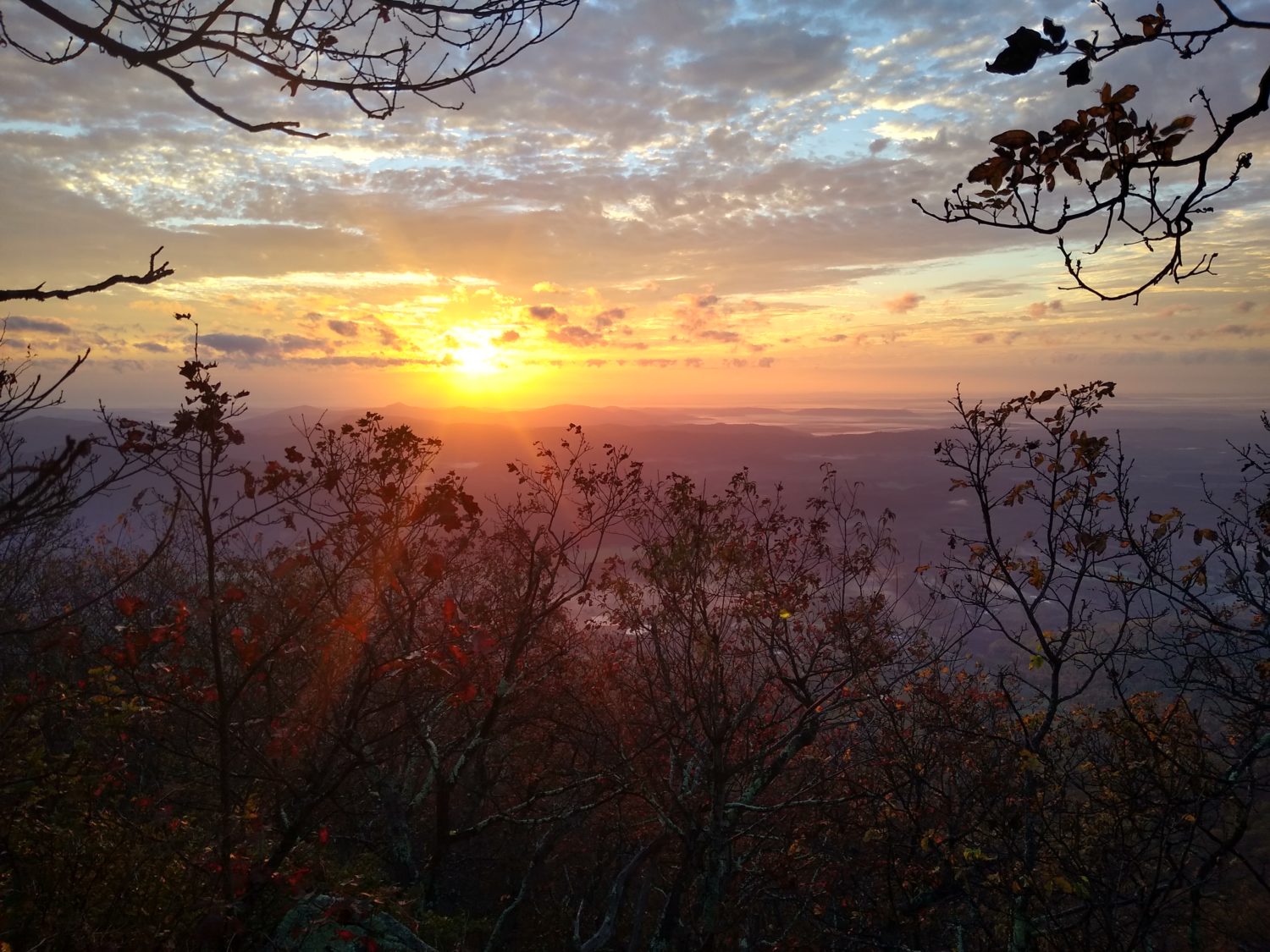
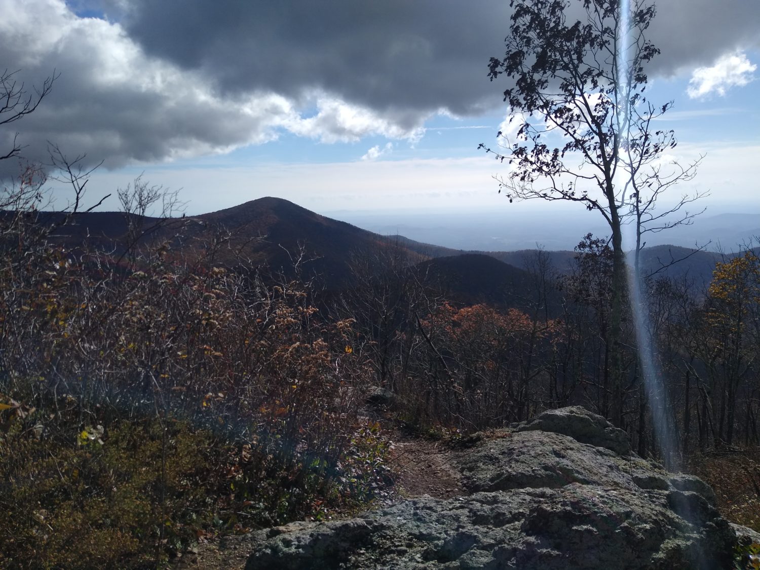
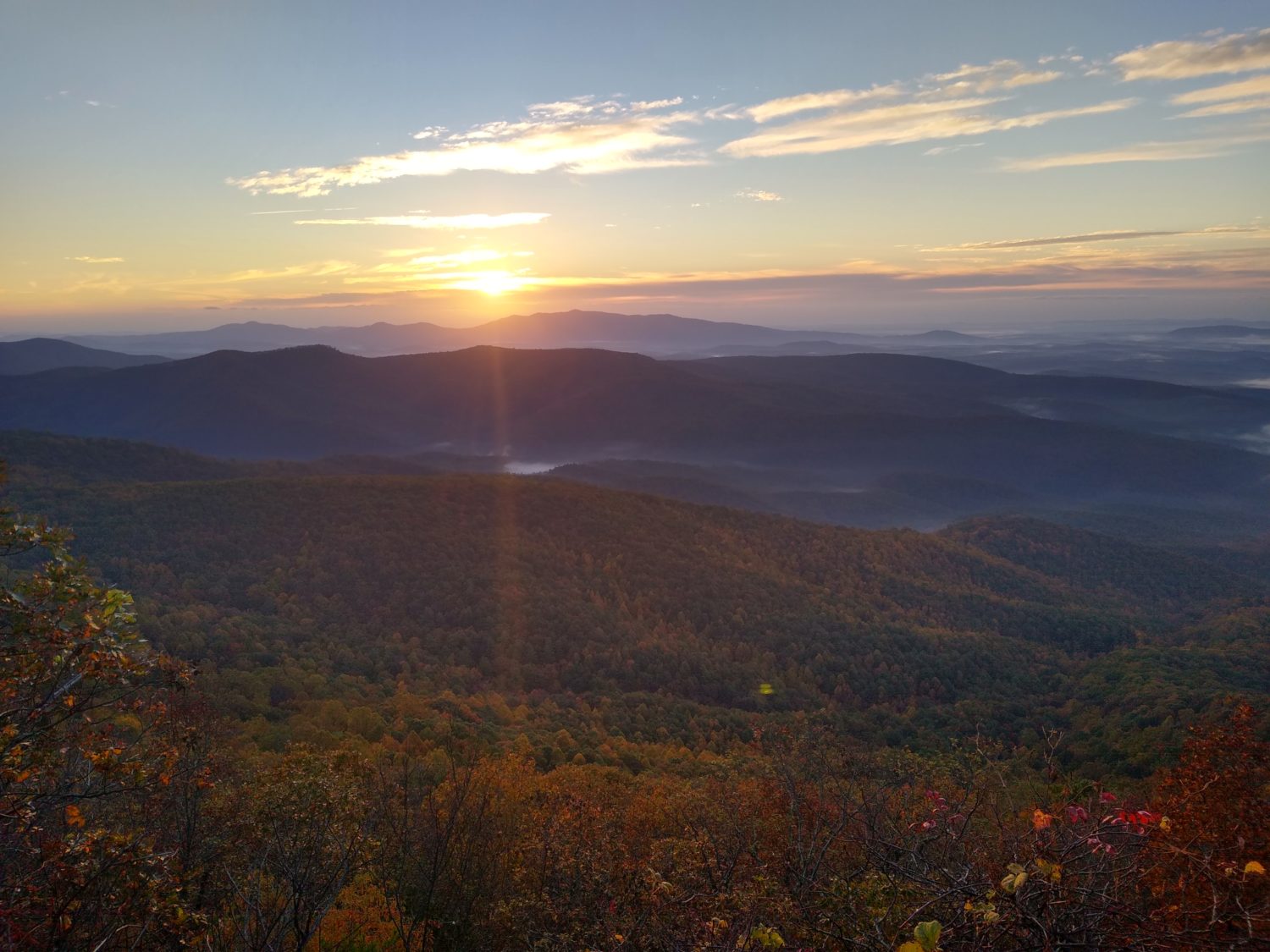
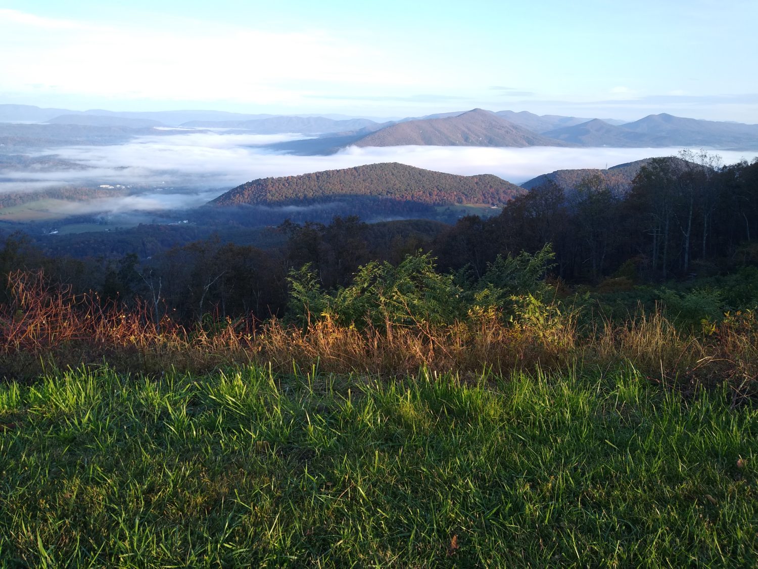
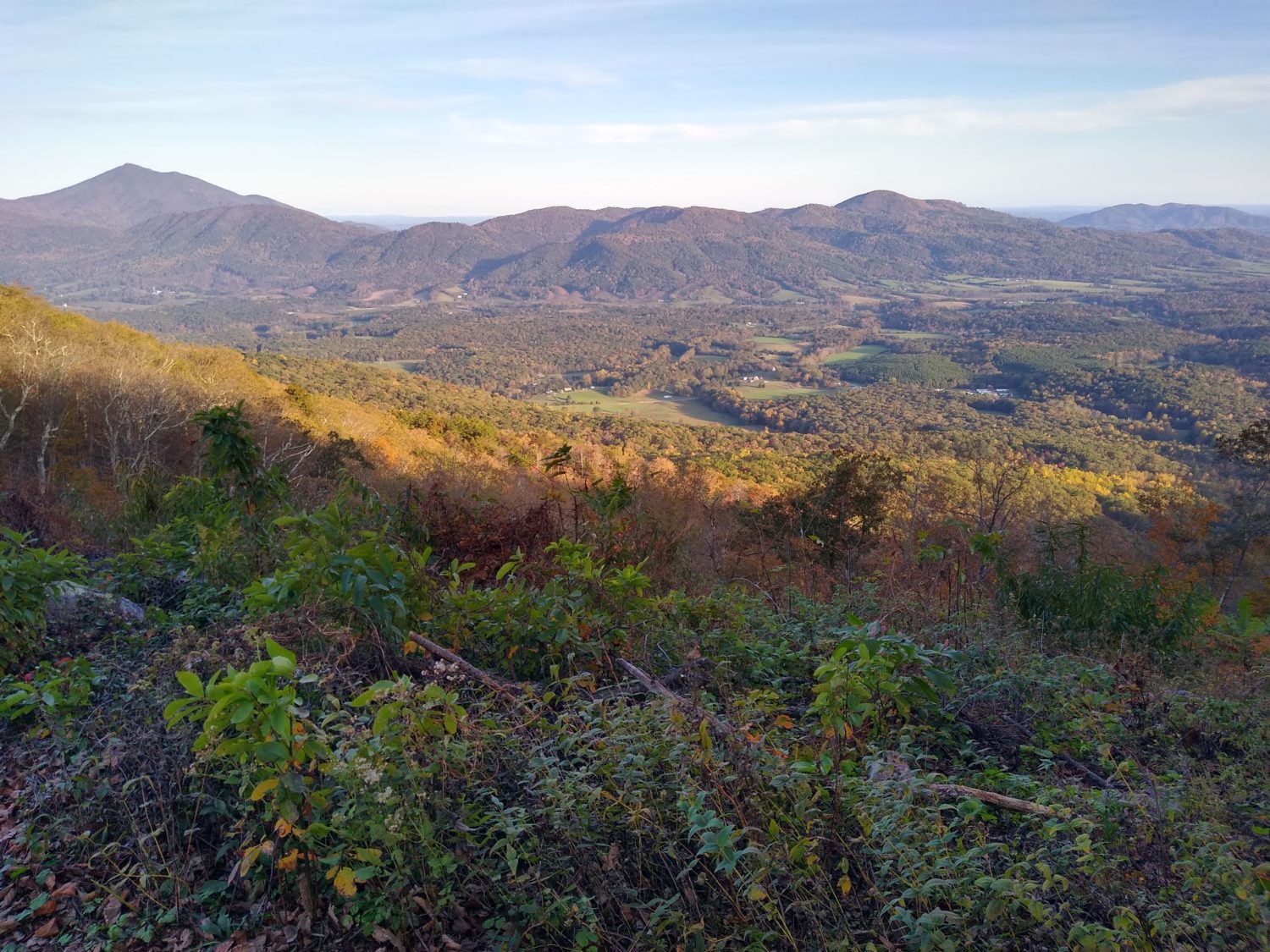
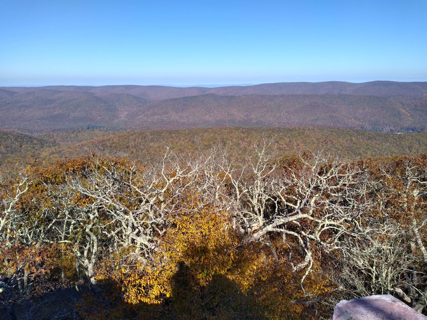
From the Priest Shelter I had to finish climbing to the top of priest Mountain. It was only about a third of a mile and went quickly and when I got to the top there really wasn’t much up there other than trees. But about 20 or 30 minutes later the trail came out to a nice ledge where I got great views from an angle I hadn’t seen before. I stopped and ate a quick snack. I would need my energy because this was a 4,000 ft descent down to the Tye River.

The hike down took longer than I thought. I passed many people coming up and several with dogs that weren’t on leashes. I don’t want to be anywhere near them when some of these unfriendly dogs meet each other for the first time.

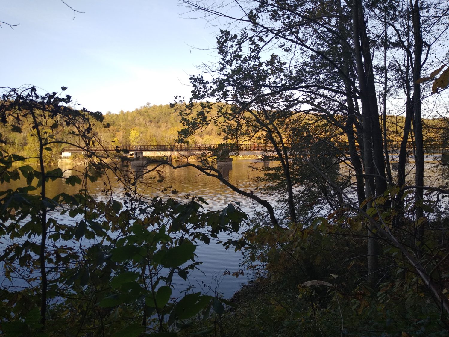
When I got down to the Tye River, it was shallower than I remembered from 10 years ago. Maybe the time of year has an effect on the depth of the river because then it was summertime and probably raining more. And then of course the trail climbs again.

2 miles from the river is a junction where the AT splits off from the Mau-Har Trail. The AT climbs around a series of ridges with rocky ledges and good views of the valley.  The Mau-Har Trail goes the other direction and goes up a steep chasm where a cascading river flows. The AT is longer but easier and since I took that route last time and I was looking to save a little time today I decided to take the Mau-Har Trail this time.

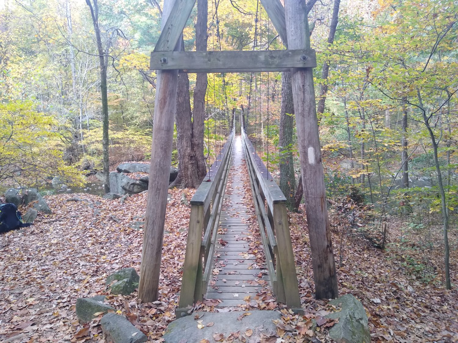
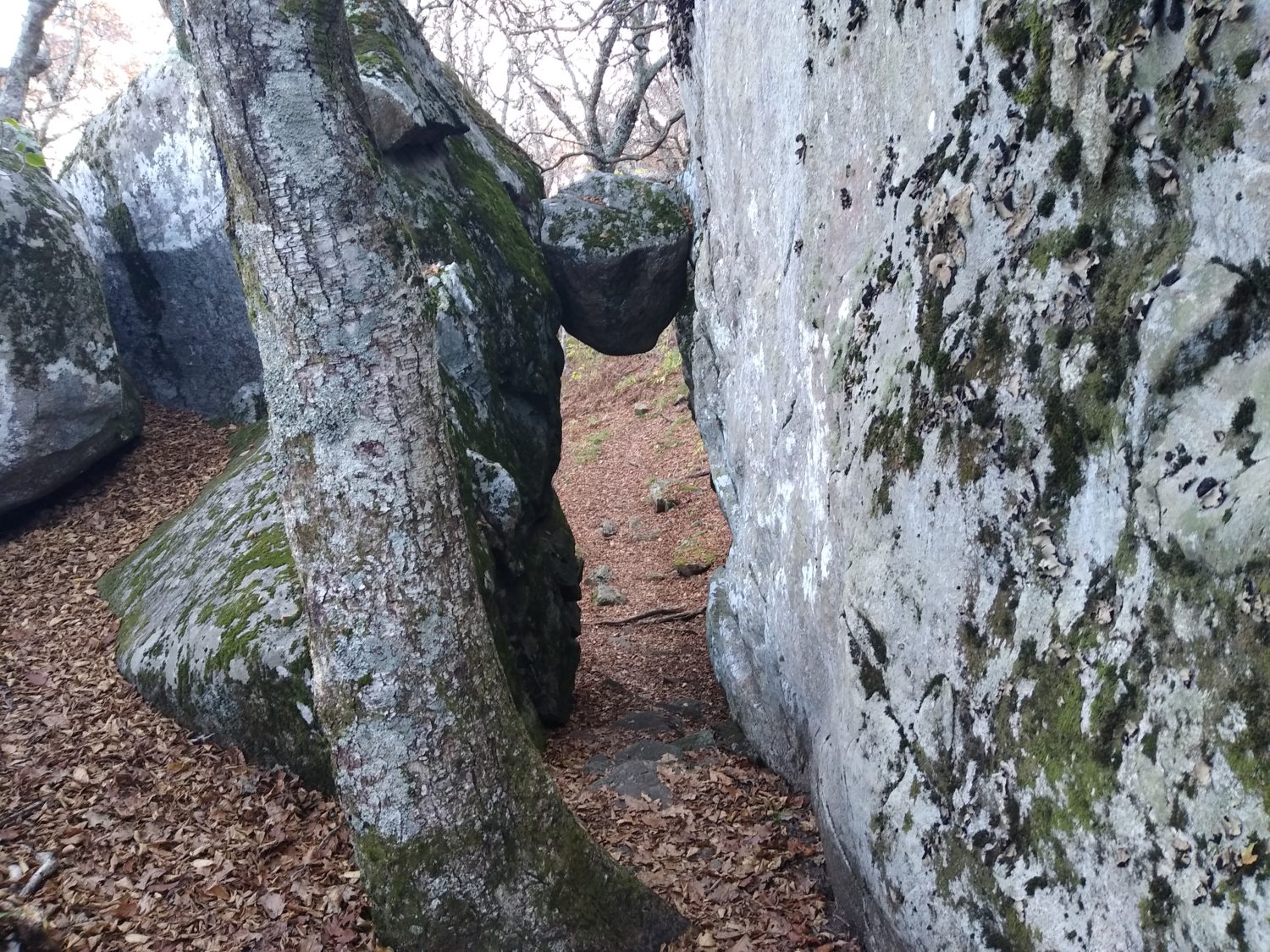
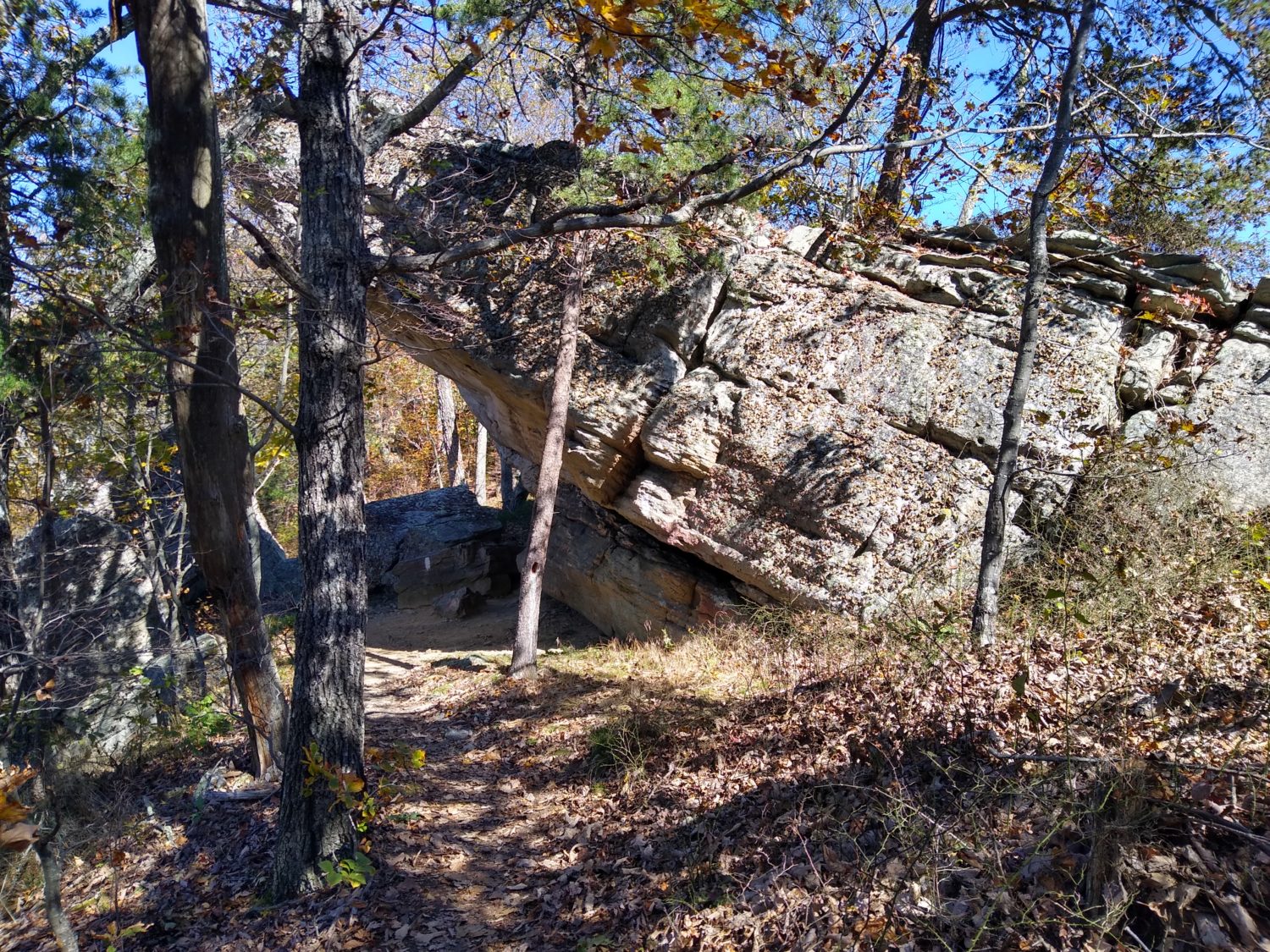
The trails started off pretty normal for about a half a mile and then turned to really steep switchbacks. At the top of the knoll where the switchbacks were taking me it then descended into a ravine. In the ravine was the cascading stream. In the stream bed was a hodgepodge of very large boulders and there were waterfalls everywhere with a deep pools beneath them. The trail next to the stream was very rocky and very steep. People who do this section as a loop with the Appalachian Trail usually go the opposite directions since this is so steep they would rather go downhill. In this case I think it is better to go uphill. Even though it’s harder you get to be looking up the cascades rather than looking down them which is a far better view.

After nearly a mile following the stream it turns directions and starts following a much smaller stream that is one of the feeders to this amazing stream. After about a half a mile that it turns to switchbacks again and continues to climb to the shelter where the trail meets again with the Appalachian Trail. I stopped at this shelter and had a snack and talked to a pair of couples who were just finishing the loop.

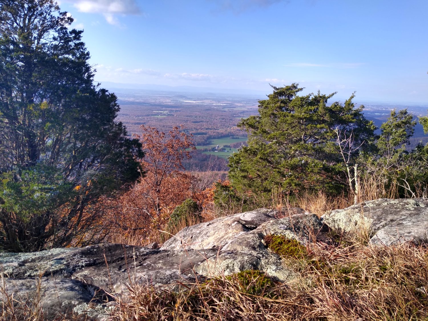
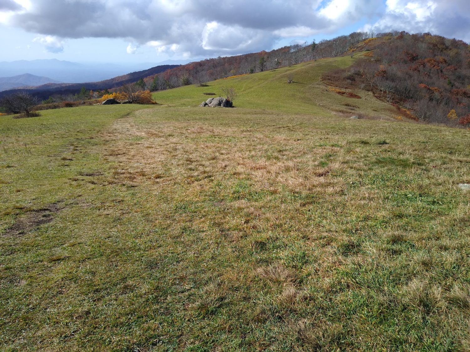
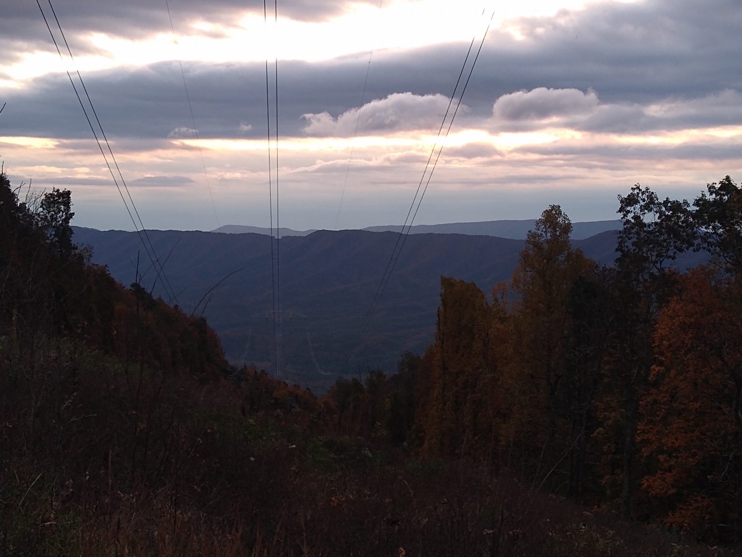
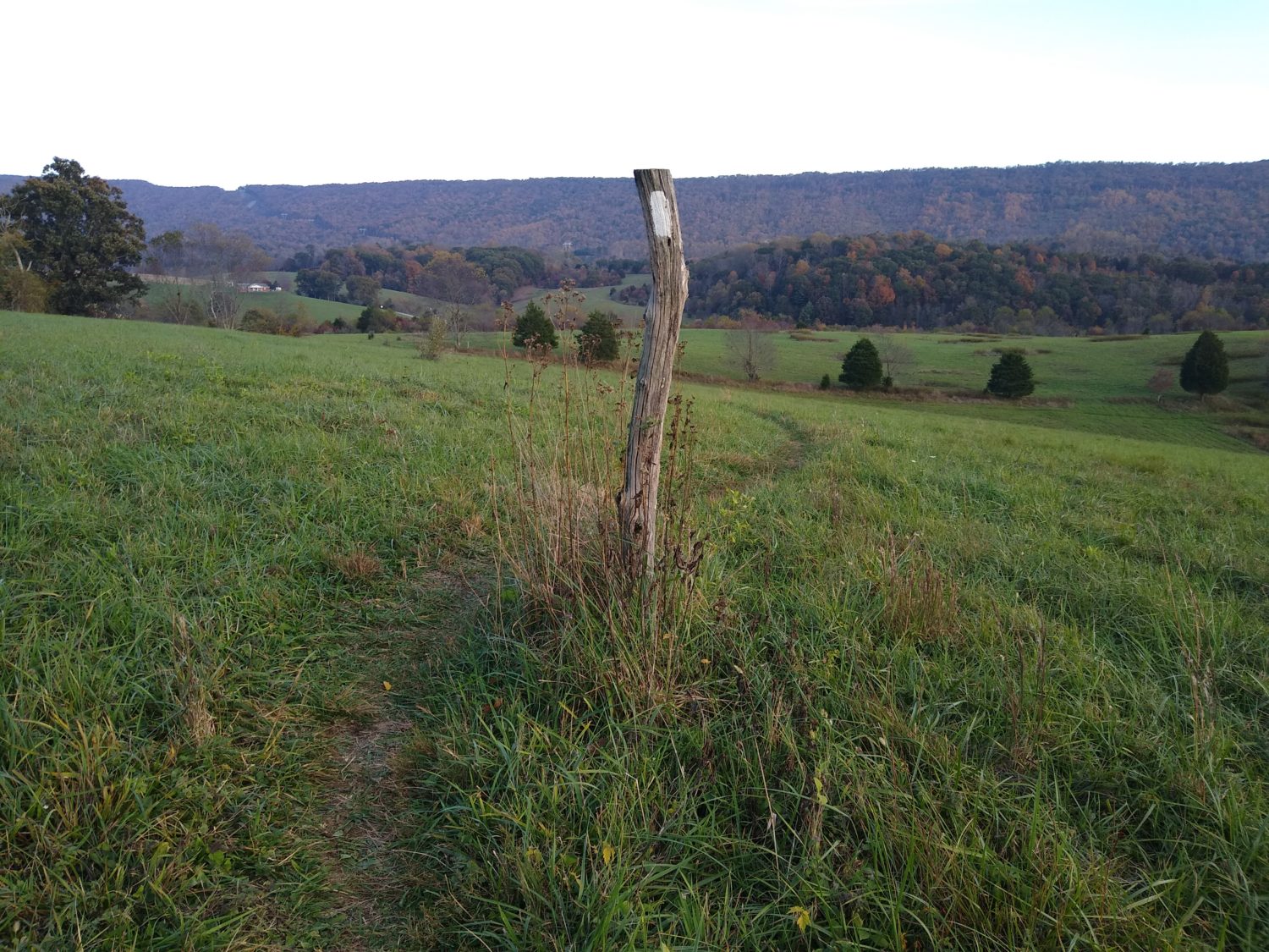
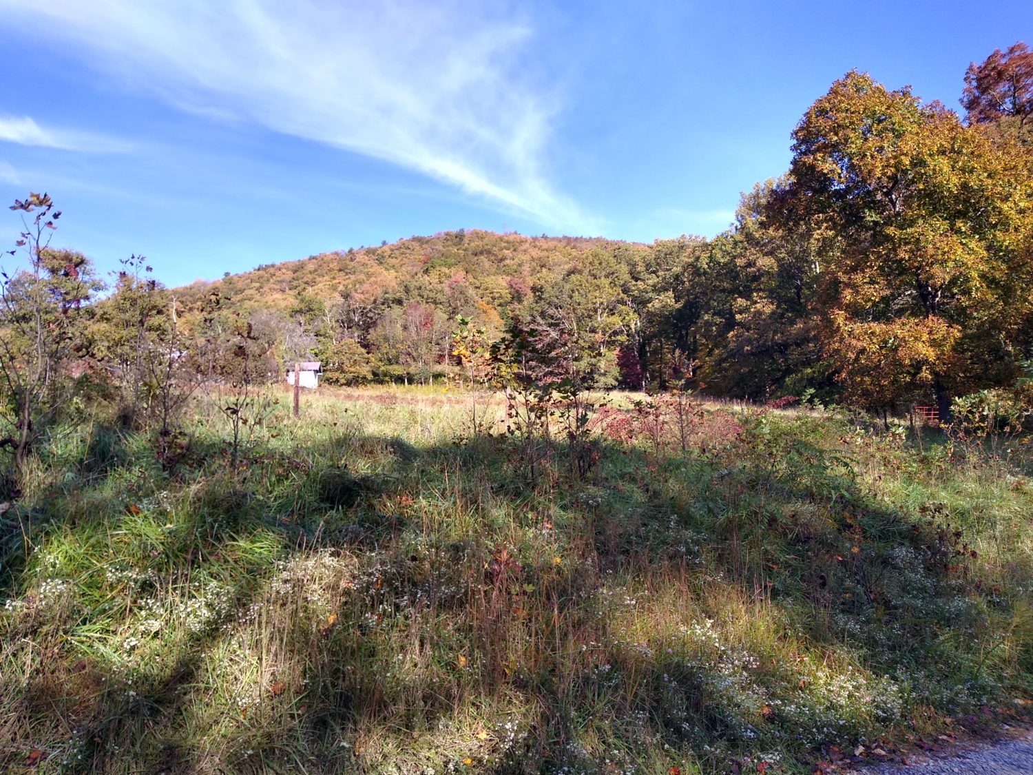
At this point Northward the trail was pretty tame and unremarkable. It came down to Reed’s Gap where there’s another parking area that was overflowing with cars. It had a nice rock wall and a pretty meadow to walk through to continue the trail. Pretty soon I was zigzagging back and forth across the Blue Ridge Parkway again. Only this time the trail was getting really rocky and very technical and was slowing me down a bit.

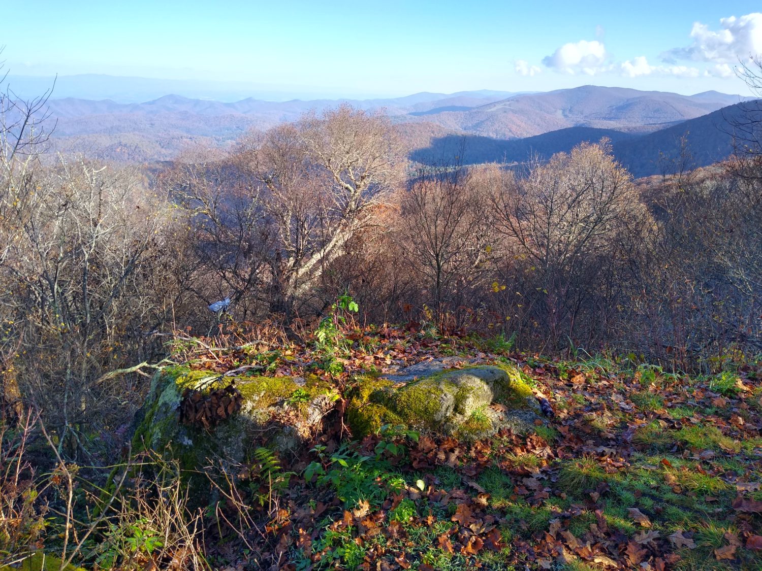
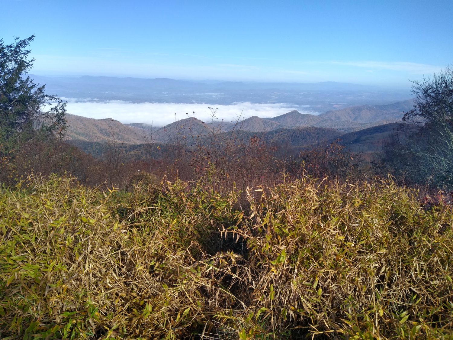
After a few miles of this rocky trail it came out to a ledge called Cedar Cliffs. It’s called that because their cedar trees all over these cliffs and these are the first cedar trees I think I’ve seen on the entire trail so far. I picked and crushed one of the berries just to smell it and it smelled really good. That’s one of the things I’ve gotten in habit of doing is pulling leaves off some of the pine and fir trees and smelling them as I walk. The Douglas firs smell the best by far.

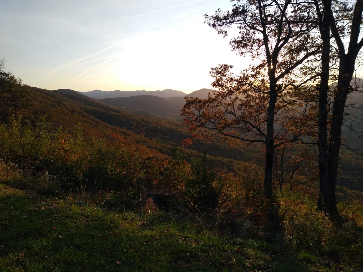
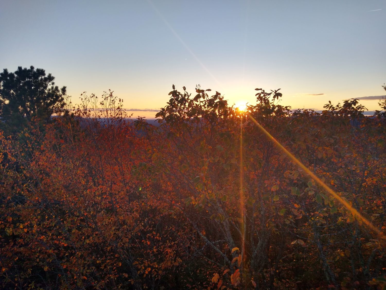
The last few miles of the day were pretty rocky again and had quite a lot of climbing. I was trying to hike till at least 6:00 but I couldn’t go too late because where the trail was taking me was very rocky and probably had small trees but for not good for camping. From the map it look like there was a dip in the ridge where there might be good camping spots. About a half a mile from that area was another set of ridges where two guys were hanging out waiting for the sunset which was about 30 minutes away. Part of me wanted to sit there and watch the sunset with them but the other part wanted to go find a camping spot get set up and cook dinner.

Dinner tonight was a special dinner. Most trips I try to have freeze dried lasagna the first and the last night of the trip. And in this case I have been saving a Mountain House lasagna that I bought for the PCT in 2016 and have been carrying since Pearisburg.

When you cook freeze dried dinners they come in a Ziploc bag that is sealed at the top. You tear the top off and that reveals the Ziploc portion and then you remove the oxygen absorber pack. Even at the right amount of boiling water which in this case is 2 cups, stir it, pencil the Ziploc and let it sit for 10 minutes or more. Well preparing this one I noticed it was defective. The Ziploc portion had become detached from one side of the bag and was just hanging free. I used an extra quart size I had and put it upside down onto the dehydrated bag to keep the steam in and then put the pot cozy on top of that to keep the heat in. 

I finished setting up my hammock and then came back about 15 minutes later to eat the lasagna. It was still fine, there was nothing wrong with it, but it seemed like there was too much water in it. I still had dehydrated spinach and tomato powder so I put some of each in just to absorb some of the liquid and it improved the lasagna 100%. The extra tomato flavor really enhanced it. I enjoyed it so much I had my extra honey bun for dessert.

I had trouble hanging the bear bag as all the branches around here seemed rotten or are too high for me to throw the rope over. Since I am low on food everything will fit inside the odor proof sack that’s inside my bear bag so I’m just putting everything in the outer proof sack and hanging the bag from the end of my hammock. I have done this before in areas where bears are the problem but I’m only 10 miles away from Shenandoah where there’s tons of bears. So I have a bag of food which includes tuna fish about two feet from my head. What could possibly go wrong?

Day 47 mile 829.7 Great views today

Aside from getting a late start today it ended up being a really positive day. There were several meadows to cross, many ledges with views for 30 miles or more, and the trail was relatively tame.

I picked through the gas station confections I had bought the night before to try to drum up a breakfast. The Jimmy Dean chicken biscuit was about the worst I’ve ever had in my life. Imagine chicken bologna sliced 3/8 of an inch thick, breaded, and slapped on a crumbly biscuit. I had a hard time eating it. The pecan pie was even worse. I think I took two bites and threw the rest away. And the lemon things that look like they should have been good we’re so dry I ate two of them and threw the third one away. The chocolate milk and orange juice were excellent though.

I told the shuttle driver when he dropped me off that I would call him shortly after 7:00 so at 7:15 I tried calling him but his phone was off and it went to voicemail. I called back every 5 minutes till 7:30 and then tried to look up names of other shuttle drivers. I tried once more at 7:38 finally got a hold of him he would be here in 1 minute. 15 minutes later he was there. I think he has been shuttling hikers for nearly 40 years. Some of the stories he tells and some of the people he met are truly amazing. You could probably talk to him for a week and never hear the same story twice.

I finally got to the trailhead and was off at 8:15. This is where the proprietor of the Dutch house B&B was sitting on a picnic bench and took some of my extra gear so that I could select back the rest of the way to his hostel. Many of the places I hiked over were also very familiar from that same 2010 trip. The meadows and things that were still green still look the same but all the woods with the leaves either yellow or totally missing it on the ground look very very different from the lush green of summer.

The climb up from the highway was very steep and very long though. I think it was about 1800 ft of climbing in 2 mi. Once I was at the top the hiking got much easier though. About 3 hours into it I came across a meadow on top of Cole Mountain. It went on for about a half a mile and I remembered it from 2010. It’s one of those Sound of Music moments.

Every mile or so it seemed like another ledge appeared and the views from these ledges were very spectacular as opposed to most of the ledges further south which were still obstructed with trees they weren’t even really a view at all. The trail in this area seemed to hug the contours instead of just going over every bump in between where I was and where I needed to be. Water was a little scarce but I was expecting that and had plenty on hand. I ended up filling up only 1 liter throughout the day and then one more when I hit camp.

I passed two southbound thru hikers and ten or so day or weekend hikers. There were also at least a dozen people who have hiked up to the meadow on Coal Mountain. I don’t blame them; it’s a great place to hike and a great view and from where they parked it’s not a tough climb. I was surprised however to see as many people who had already set up camp being a Thursday and not a Friday. It was Friday kind of numbers.

From the beginning of the day my goal was always the Priest Shelter which was about 20 miles from the highway. Getting a late start didn’t help but the easy terrain did help. Throughout the day the forecast for when I would get there was bouncing between 6:30 and 7:00. So when I did get there at 6:38 I was pretty happy about that.

There was one hiker in the shelter and two more camped nearby. The hiker in the shelter had a fire going and was storing his food in the shelter so I decided I was going to camp out too. I set up the hammock, hung the bear rope, then dragged my food and stove over to picnic table at the shelter to cook. One of the other hikers who is camped out also came over to eat dinner.

The conversation was actually pretty good. The one hiker in the shelter was a south bounder; he started August 1st so he is making good time to be this far south now. The other hiker with sectioning a big chunk of the trail and has also done the John Muir Trail in the past so we had a lot of common things to talk about between the PCT and JMT.

One of the traditions at the Priest Shelter is for hikers to write their confessions in the trail register. I’ve been thinking all day about what I want to write in there but I got here so late I really didn’t have a chance to even read any of the entries much less write my own. Maybe I’ll just write it out in the blog instead.

I have 35 miles to go before my pickup point. There is a lot of climbing tomorrow so I am uncertain if I can do more than 20 miles. The area between 20 and 25 mi from here also does not look good for camping. So depending on how tomorrow goes I may have to adjust my pickup point. If I can’t make it the full distance it looks like Humpback Rocks Visitor Center right on the Blue Ridge Parkway is the next best place. Let’s see how tomorrow plays out.

Day 46 mile 809.1 Time for laundry

I have enough food to make Waynesboro except for missing one dinner which I can improvise with, but the climbs in the heat of the last few days have all of my clothes pretty filthy. Long distance hikers on the 80 smell pretty bad, but it’s horrible when you can’t stand smelling yourself. I was able to connect with a shuttle from the trailhead, so into Buena Vista I go.

I got up 30 minutes earlier than normal to get a head start to try to make Virginia 60 before it got dark. I packed up quickly and was on the trail by 6:30. The climb out from the shelter was pretty much as I expected. There was level enough terrain and good trees that I could have hammocked anywhere within the first 45 minutes from leaving the shelter, but beyond that point it was too steep and the trees too small really to make any kind of reasonable campsite. So I think the combination of stopping at the campsite and leaving early was the right choice for me.

It took a little over an hour to get to the top of the ridge and there actually was one decent campsite there for a tent and I probably could have made the hammock work. But if I had pushed on an extra half hour in the dark and camped there I would have missed the incredible sunrise that was happening just as I got there. So again I think I made the right choice by staying at the shelter.

Last night wasn’t cold at all; I was actually warm in the sleeping bag and was only half in it for most of the night. It was the first night in a week I didn’t have to wear my gloves either, in fact I didn’t even wear a hat. And even though there was a slightly cool breeze this morning the climb up had me totally soaking in sweat. I had already changed from the long sleeve to the short sleeve and they were both pretty wet at this point.

The ridge kept climbing to higher and higher peaks but the climbs were pretty quick and did get me sweaty each time I encountered one. The peak I arrived at around 11:00 a.m. used to have a fire tower on it. It also had a plaque telling the tale of a four-year-old that wandered away from the schoolyard in 1890 and ended up on this mountain top 7 miles away. It seemed like the perfect place to stop and have first lunch other than the eerie consequences for the small boy 130 years ago.

The morning climbing along the first ridge the trail started descending very gently. Most of the midday was really gentle trail in a mix of hardwoods and pines and actually seemed a little familiar. I came upon a suspension bridge that I remember vividly from 10 years ago that I camped under with two other hikers. The vivid part is that I got poison ivy. When I crossed the bridge I walked underneath it just to check out the vegetation around there to see if it was still poison ivy and I actually couldn’t find any.  So yay.

After the bridge the trail climbs around the edge of the Lynchburg reservoir and I remember that part vividly too. Past the reservoir the trail travels along Brown Mountain Creek. This creek was settled by free slaves after the civil war and they had signage telling little stories about the settlement. You could still see a lot of stone fences and a few remains of houses mostly being fireplaces. The signs talked about the crops they grew and how they got paid and how they made a living. This would be the last water for a while so I filled up both liter bottles and also my Coke bottle with two coffee packets in it to have ready for tomorrow or for use if I needed them later in the day.

At this point I was only 2 miles from Virginia 60 which leads into Buena Vista. It was about 4:15 so I should hit the highway within the hour. The trail climbs from the creek up to the highway which is kind of odd for trails going to a highway usually always go down. So it took a little longer than I thought but I was there shortly after 5:15 or so.

Since I had been climbing out of a ravine where the creek was I had assumed that I would not be able to get a cell signal since I had not had one for hours. I was surprised to find that I got three bars up at the highway. I was also surprised to see a business card for a shuttle driver in Buena Vista. I was dripping wet and stinky so I called the shuttle driver and arranged to be picked up in 20 minutes or so. I then called the only hotel in town to make sure they had rooms and they did so I was set. I mainly wanted to stay in the hotel because they have laundry. The only other place to stay in town is the campground which has showers but no laundry. There is a laundromat in town but it would require walking at least a mile from the campground so I was happy to be able to get a room in the hotel.

Since I had a while before the shuttle driver was to arrive I went ahead and cleaned up a little bit tried to wipe the sweat off my body with my handkerchief. I then changed into my sleeping shirt because I needed to keep my town shirt clean for after showering and doing my chores in town.

After over 30 minutes I was getting kind of nervous that maybe the shuttle driver wasn’t going to arrive. There was a decent amount of traffic going towards town and several pickup trucks so I probably could have hitched if I had to but I decided to just sit tight and be patient. After about 35 minutes the shuttle driver arrived and soon after starting down the mountain I realized why he was so late. It’s a 10 mile drive but he was only driving 30 miles an hour. Now I know what to expect.

I enjoyed talking with the shuttle driver on the way down. He’s been doing this for over 15 years and he had a lot of interesting stories to tell about both the trail, the forest service, service and the town.

After he dropped me off at the hotel I arranged to have a morning pick up return trip and then I checked in. The first order of business is showering. My feet had gotten the filthiest they’ve been on the trail in weeks. It has been 5 days on trail but that’s not unusual. Next order of business was checking my food supply to see what I needed to purchase. Since I would eat dinner here really the only thing I was lacking is a breakfast for tomorrow and two more breakfasts.

With my shopping list in hand I headed towards town to check out either the Chinese restaurant or the Italian restaurant. They both had similar ratings but since I haven’t eaten Chinese in a long time I decided to go there. It was okay but not outstanding. On the way back I stopped at both the Family Dollar and the Exxon picking through the selections they had for breakfast. I’ll eat the heavier things in the morning and pack out the lighter ones for the next 2 and a half days. I only have Thursday, Friday, and Saturday until 3:00 left to hike the last 55 miles to the trailhead in Waynesboro. I will have to hike a minimum of 20 to 22 mi for the next 2 days to make sure I have enough time to finish on Saturday before 3:00. That should be doable.

Day 45 mile 789.0 Rocks and rivers

Today I finally crossed the James River. But to get there there was a lot of climbing and there were a lot of rocks involved. I know it’s probably not more than the normal amount of rocks for the Appalachian Trail but my feet were sore today and they noticed every single one of them.

I got up about 6:20 and didn’t get on trail until a little after 7:00. I wanted to get out a little earlier than that to make up for the short day yesterday but it’s still in early enough start to need the headlight for 15 minutes. A couple that camped with me probably got out 15 or 20 minutes after I did.

As is the norm for most shelters, the morning started with a climb. I was close to the Blue Ridge Parkway all day but didn’t get near enough to see it very often and didn’t get down to any of their overlooks. The first major climb of the day was to get up to the top of Apple Orchard Mountain. I don’t know why they call it that because there are no apple trees, but there is an FAA tower at the top of it that looks like a giant golf ball that hums. There was someone camped out in a tent in the grass right near the tower when 30 ft away there was a great spot nestled in some trees away from the wind.

There were quite a few rocks all around the peak of Apple Orchard Mountain. They weren’t terrible and there were not miles of it but I’ve had a crack on my big toe on the right foot that’s been bleeding for a few days and each rock seemed to find the exact spot that the toe didn’t want to be touched. Not only that, there were little rocks hidden by the leaves that I kept stepping on, and when they’re very pointy they cause serious pain when you step on them with all your weight. That’s been the only problem I’ve had recently -making sure my feet stay healthy and not sore all the time.

Later in the morning I did come to an overlook that had a father and daughter talking to their wife/mom on the telephone. We chatted a bit about the trail and my experiences and he asked if I needed any food. I was tempted to say yes but I said no. But honestly a Coca-Cola would have been really good about then. Luckily this overlook was close enough to a parking area and the parking area did have a garbage can so I was able to get rid of some trash that I had been carrying. That’s one of the good parts about the Blue Ridge Parkway – there’s lots of garbage cans as well as lots of good views.

Thunderhead Mountain was the next one to climb and it had about the same amount of rocks near the top. If the entire mountain were all rocks it would be unbearable but luckily it’s usually only the top 100 or 200 ft. And for a 1500 ft climb that’s not too bad. But it does slow you down.

There were no opportunities to sneak off trail today to find some place to grab something to eat, but that’s okay, I’m coming up to the James River and if I need food badly enough I can just hit Glasgow. I had estimated that I should hit the river at about 5:30.

The climb up to the last ridge before the river was graded really well and followed the contours of the mountain. Once it started to descend it got a little bit steeper but it wasn’t too bad. I knew that the trail would descend down to the river pretty quickly but then follow the river for about a mile to get to the footbridge to cross it. Since the graded trail was pretty nice I actually got to the river just a little after 5:00. Walking along the river went pretty quickly but there were a few little rocky areas that slowed me down a little bit.

The footbridge is built on piers that look like it probably used to be a railroad bridge but this is a brand new bridge designed specifically for foot traffic only and it’s about a thousand feet long. I noticed they had signs on the bridge saying “no jumping” but I remember 10 years ago seeing video of bunch of people jumping off the bridge into the water. The water is dark enough you can’t really tell how deep it is so there’s no way I would jump off of it. It’s at least 20 ft above the water.

Crossing the road and beginning the ascent of the other side was pretty uneventful. There was a shelter not too far up the trail that I would hit probably before 6:00 and I would have to decide whether or not to stay there or try to push on a little further. I made better time than I expected and actually got there a little bit before 6:00. 

I looked at the map and from the shelter the trail climbed really steeply. Probably more steeply than anything I had encountered today. The ridgeline was over 2 mi away and would take probably an hour and a half to climb. That would put me well after dark getting to the top and judging by the contours it didn’t look like there would be any camping either on the way up or maybe possibly at the top. Some of these peaks lately have had rhododendron or mountain laurel on the top and those are horrible for hammock camping. 

I had gone a pretty good distance today and the next road leading into Buena Vista which is my next plan stop is 20 miles away. If I get up a little early I should be able to get to the road in good time. That will give me the option to either go into town if I can get a shuttle or a hitch or keep going a little bit further. There’s no official camping or shelter within 5 mi of the other side of the road but the contours look a lot more friendly than the mountain I’m currently on.

I’ve been taking a tally of the food that I have left and I think that I can make it all the way to Waynesboro on the food that I have with me but I will be down to the last bits of food if I push that far. If I have a good day tomorrow I will probably try to push forward. But if I’m struggling I may go ahead and go into town. Today was pretty hot and I am getting pretty stinky. Since I had extra time at the shelter I went ahead and took a sponge bath that was a little more in depth than the usual nightly routine. We’ll see how tomorrow goes.

Day 44 mile 767.2 A day of memories

Since it has only been 10 years since I’ve hiked the section there were a lot of things that looked very familiar to me. And a lot of coincidences that I didn’t realize until after they happened.

I got up at what I thought was an early time but ended up getting on trail just after 7:00. I had to use the headlamp for about 15 minutes even though the sun was not quite officially risen but was making the sky a beautiful orange color all around me. I was still near the parkway and the trees around the park were pretty thin so even though I didn’t get unobstructed views of the sunrise seeing it through the silhouette of the trees was still a neat experience.

It was close to an hour before the trail actually snaked back on to the parkway which surprised me since the night before it had been every 15 minutes. I never got a good unobstructed view of the sunrise but I did get some unobstructed views of the James River Valley below on the other side. The river produces enough moisture that the entire valley was under cast in fog. It was easy to tell where the river flowed to the valley just by looking at where the fog was. I will be crossing that river in a few days.

After the trail left the parkway it seemed to do a lot more climbing and descending. It seems I’m back in a stretch which is basically just hiking up and down mountains instead of following a road. I know I’m never far from it but I’m not exactly following the parkway anymore and I rarely actually see it.

I came across the shelter just after 10:30 in the morning so I decided to go ahead and stop and have first lunch Even though it was a little early it was important to have a shelter for this lunch because I planned to eat my salad. Fixing a salad on the trail requires a picnic table because you have to slip open the top and bottom of the bag and then slice open the seam and fold out the plastic to make a large place setting to mix and eat the salad. This was a kale salad with lemon vinaigrette and asiago cheese. It was easy to mix up without spilling any and it was quite delicious. I’m kind of sad that it’s the first salad on the trail and probably the last for a while.

After the trail left the shelter it went down to Jennings Creek. I remember the name but more importantly I remember that it has a great swimming hole. When I was here 10 years ago it was in June and it was a great place to swim. It October it’s not exactly the first thing I want to do.

There was a campground that had a sign at the intersection that listed all the food they had for sale and their telephone number for a ride from the trailhead to the campground. I looked at the comments on the Guthook app and they said that the shuttle wasn’t running but they would open the grill and cook great hamburgers and milkshakes. Even though I still had tons of food it’s really hard to pass up a cheeseburger and a milkshake. I contemplated doing the road walk and then walking past the campground to rejoin the AT a few miles further but it would mean missing the next shelter which I had planned to stop at to have my normal lunch.

I decided to just stick to the trail and do the next climb which was actually a lot harder than I was expecting. When I finally got to the shelter near 2:00 I was excited and happy that I had not taken the detour to get the cheeseburger. This was one of the most memorable shelters on the AT. It’s a two-story shelter but looks like it’s a three-story shelter because it has all these sub levels. It was built in 1992 and just has the most interesting design. I didn’t stay there in 2010 and I wouldn’t stay there this year either but I would love to come back just to sleep in that shelter.

I headed on and the rest of the day was more climbing and descending. I’m already missing the parkway. I was due to hit the next shelter out about 5:30 and then there was another shelter after that 5 mi further that I would love to be able to hit. But the climbs to the next shelter were tougher than I thought and I didn’t get to there until a little after six. There was a southbound couple that had just gotten there a few minutes earlier who were resting in the shelter and I needed water because I was almost out. By the time I got my water and got back to the shelter it was close to 6:15 and I only had another 30 minutes of good hiking light and there was no way I was making another 5 mi so I decided to stay at the shelter.

When I walked behind the shelter to check out the privy I recognized the campsites and then realized this was the shelter where back in 2010 a hiker named Sandstone had hiked out a salad kit and prepared it exactly as I had done at this very picnic table. In the 10 years since I had seen him do it I’ve never done it myself and I thought it was neat that the very day I do decide to do it was the same day I hit the shelter where I learned how to do it. Spooky.

I prepared dinner and had a nice chat with a couple who was southbounding. We talked a lot about the AT and also the PCT.  They decided to pitch their tent and I decided to stay in the shelter so now I’m curled up in my sleeping bag on a hard floor. It’s starting to get pretty chilly but I have extra layers in case I get cold. Since I didn’t get as far as I wanted to today I’m hoping to get out early tomorrow and have a good day. Maybe the climbs will mellow out again.

Day 43 mile 747.4 Hello Blue Ridge Parkway

Now is where the interesting part of Virginia begins. For the next few days the Appalachian Trail will zigzag across the Blue Ridge Parkway. I have already crossed it three times and come to five overlooks but I have many more in the days to come.

I slept in this morning till 7:00 and ate breakfast at the hotel. I checked Uber to see if I could get a ride to the grocery store and got a driver to accept within seconds. I was in Kroger for over 30 minutes trying to find all the things I needed for the next 4 days. And as usually happens there were some impulse buys to eat at the hotel, in this case chicken wings and sushi.

I got back to the hotel shortly after 9:00 got everything packed up and was able to head out on trail by 10:00 a.m. The packing of the food was no easy chore. I made sure I was not hungry when I went to the grocery store but I still bought too much food. I have hard boiled eggs to eat every morning along with apple pastries. I packed out a small package of fake crab meat to have with my Thai peanut noodles, a deli sandwich to have either today or tomorrow, and a fresh salad bag mix. All that is in addition to the four days of food I intended to buy in the first place. So I guess I really bought 5 days worth of food.

The trail out of town was actually pretty nice considering it was between an interstate and a highway. It was noisy but pretty. It started out through a grove of black locust, wondered by some houses and then went over a few meadows, and then finally headed into the woods. The first shelter was about 6 mi out of town and I hit that about 12:30 so I stopped to have lunch. Oh yeah, lunch was a chicken biscuit I bought at the gas station on the way to the trail.

Between drinking all the caffeine over the last 2 days, or maybe a little dehydration, or maybe the beer I had with dinner last night, something was giving me a headache that lasted almost all day. I took two aspirin at the hotel before I left but I knew that wasn’t going to do anything if this was from caffeine withdrawals. If you play with fire you’re bound to get burned. I’ll have to go easy on the caffeine for a while and by go easy I mean drink only half of the coke I also bought at the gas station on the way to the trail.

After the shelter the trail kept going up and down as it went over small ridges sneaking its way over towards the Blue Ridge Parkway. It was probably 3:30 or 4:00 by the time I hit the first crossing of the Blue Ridge. For the next few days I will hear cars almost constantly as they drive down the Blue Ridge Parkway and I will either see the road or cross the road about every 20 to 30 minutes. It sounds annoying but it’s actually fun because they do actually clear the trees down the slopes from the road to ensure that the motorists have good views. They don’t normally do that for hikers but we get the benefit of having lots of great views. The bad part about that is that the trail usually goes right through these clear-cut areas so it’s a jumble of dead trees and little saplings biding their time before they too get chopped down. But if you’re not looking at the ground the view is wonderful.

From the map I had identified a little area where the trail snuck away from the road a few tenths of a mile out on a piece of the ridge. When I got there it was still about 6:00 p.m. and it was too early to stop so I kept hiking onward. Just before 6:45 I found another little area that look like it might be far enough away from the road so I walked out on that little bridge and it stayed pretty flat for a while and found a good place to pitch the hammock and also to hang the bear bag.

I made camp and started cooking my Thai peanut dish. I ate the crab meat while the noodles cooled. After eating I had a dessert of a fried apple pie. It’s basically an apple turnover. Oh yeah, that’s one more thing I bought at the gas station on the way to the trail. It was really heavy but it made an awesome dessert. I could hear deer snorting around me as I was eating and by the time I was ready to get in the hammock I could see their eyes just a hundred feet from my campsite. Let’s hope they don’t have any bigger furrier friends. I have a lot of food in my bear bag.

Day 42 mile 730.3 The rest of the Virginia Triple Crown

The Dragon’s Tooth, McAfee Knob, and Tinker Cliffs are known as the Virginia Triple Crown. The Tooth was yesterday, and the Knob and the Cliffs awaited me today. Unfortunately it also awaited hundreds of day hikers.

I wanted to get up extra early to make sure I had a jump on the day and that I could make Daleville before dark. But it was really cold last night and all I could muster was 6:00 a.m. wake up. I also fell for the headlights coming up the trail trick again. I thought I spotted a hiker climbing up the switchbacks to the top of the ridge where I was camped. But they seemed far enough away that I wasn’t going to wait for them this time. About the time I was getting my shoes on I realized it was headlights from cars in the valley below and not hikers.  Oops.

I don’t know exactly what the temperature was but it was definitely in the 30s and probably the coldest night yet. I wore my leggings and fleece on top of my long sleeve shirt to start the day. I didn’t get rolling till right at 7:00 a.m. but I still needed my headlamp for about 15 minutes.

About 15 minutes after putting my headlamp away I came across a campfire burning right in the middle of the trail high up top the ridge amongst some rocks. The fire was burning pretty well but I couldn’t find anybody around. I called out looking for the campers but nobody responded. I’ve been realized that someone had abandoned this campfire still blazing. Jackasses. There was trash all around so I threw the trash in the main part of the fire which looked pretty secure and pushed the burning pieces together. Anything that was not burning I moved out of the way and anything that was barely burning I pulled out and tried to knock the embers off. I had less than a half a liter of water and had several miles to go to get any so I couldn’t afford to try to put it out with my water. I would have needed two or three liters to put this thing dead out anyway. I did the best I could and moved on.

By this time I was getting warm so I took my fleece off. With my gloves on I was actually pretty good temperature wise. The ridge that I was walking now was very narrow and very rocky so I’m very fortunate to have stopped where I did to camp. If I had gone any further I would have had to go at least three more miles to find a place to be able to camp. And I’m glad I didn’t night hike until 11:00 p.m.

By the time I got down to the parking area for McAfee Knob I was amazed to see that the lot was completely full, actually over full with some cars blocking in other cars. There was another parking lot down the road and people were walking single file up from that lot as well. Today was going to be a busy day on McAfee Knob.

The knob itself is 4 mi from the parking area. The trail was thick with hikers and it took right at 2 hours or maybe just a little less to get up to the knob. I passed probably 50 or 60 people on the way up. I also passed probably 20 dogs, some of them barking hysterically and fighting. When I got up to the knob there were about a hundred people there. Early on the hike from the parking lot I met a guy coming down who said he camped up there and that at sunrise nearly 300 people were crowded on the rocks. 100 is definitely better than 300 but it’s still a lot of people. People were lining up to take pictures on this famous rock. It is the most photographed location on the Appalachian Trail.

On the way up there was a group of hikers that was taking a group selfie and after they had taken it I jumped in and said take one more so they did. The same group was on top of the knob now and one of them was donning a dinosaur suit and was inflating it. Oh yes, I must get a picture with the dinosaur and I did.

Once the AT passed the knob the trail got much much quieter. But I was surprised to see that I was still having people pass in the opposite direction every two or three minutes. These people must be doing the Triple Crown and must have just come from Tinker Cliffs where I was headed.

I finally made it to Tinker Cliffs about 1:45. Perfect timing for third lunch. Yes I said third lunch. While eating on the rocks I met a hiker that was doing the Triple Crown and she explained the route to me. They use a different ridge and can actually make a circle and loop together all three of the landmarks. Another hiker approached that I had passed earlier was also hiking northward. He was finishing his last section to finish the AT and was going to the Maryland-Pennsylvania border. He was only planning on going 10 mi for the day. I didn’t have the heart to tell him I was planning 20 plus.

From Tinker Cliffs it’s right at 10 miles into town and leaving at 2:00 would make it right at 7:00 when I should get to town. This is right at the limit of how late I wanted to hike. I headed on and the trail, once it dropped off the ridge, got much easier. It was graded well and not too rocky and didn’t go up and down too much. In the middle of this stretch I’m at another southbounder and we chatted a while. He mentioned that the ridge just before Daleville was pretty rocky. This was not good news because it could potentially push me past seven.

I made sure to drink and snack enough and had another coffee to make sure I kept my energy up. About 4 mi from Daleville it did get quite rocky and I slowed down quite a bit. But luckily with the easy trail I had gained about 30 minutes, so with this slow down I should still be able to get there by 7:00. As luck would have it I did end up getting to town at 6:45. Yay me.

I also did another experiment throughout the day with my heart rate monitor. Early in the day on high effort climb I did record high 130s for a heart rate. This is exactly what I would expect. But after lunch I was only recording 120s. And by 6:00 p.m. again 102 was about the highest I recorded even though I felt like I was hiking just as hard and I was definitely breathing just as hard. I guess I’m just flat out tired and when you’re tired you can only go so fast. The data doesn’t lie.

Highway 220 was very busy and it took me several minutes to be able to cross. My hotel was only a couple buildings down from the trail. It’s the same one I stayed at 10 years ago. When I got there it was way nicer than I remembered. They have definitely upgraded since then. It’s a Super 8 by Wyndham.

I got checked in and showered quickly because now it was approaching 8:00 and I needed to get dinner. Instead of trying a half a mile to the barbecue joint I ate at the Mexican restaurant right out in front of the hotel. I ate there 10 years ago as well and it was delicious this time as well as the last time.

Back at the hotel I started laundry. While the laundry was going I started planning out the next resupply for the next week. I don’t want to carry 7 days worth of food but the options in the middle are not great. Buena Vista is the best option at about 4 days but it’s 10 miles off trail and will require hitchhiking, finding a cab company, trying Uber or Lyft, or hoping I can find the number of a shuttle. I have not had good luck with Uber this trip and I doubt hitchhiking will work during COVID, and I don’t think there are any taxis in Buena Vista. So I think I’m down to shuttle drivers. I will pack for 4 days of food and pray that I can get the Buena Vista easily. There is a Food Lion there.

Speaking of Food Lion, that is one thing I was not able to do tonight. It was well after 10:00 before my laundry finished and even though the grocery is open till 11:00 I just don’t feel like walking around in the cold and dark a half a mile down the road to go grocery shopping. Grocery shopping will have to wait until tomorrow.

Day 41 mile 707.2 Longest day yet for a sunset

I hiked extra hours and extra miles today for two basic reasons. Reason number one: to try to get a sunset at Dragon’s Tooth. Reason number two: to be able to get into Daleville tomorrow instead of Sunday early in the day and waste half a day. I started out the day hiking in the dark at 6:45 and finished the day hiking in the dark at 9:45.

I got up extra early because I wanted to make sure that today I could get more than halfway to it. It was fairly warm last night and I didn’t get in the bag until the middle of the night. But as usual somewhere between 4:00 and 5:00 it got pretty chilly. I woke up shortly after 6:00 and was on the trail just after 6:45. It was still dark until about 7:15 so I had to use the headlamp for about 30 minutes as I made the big climb up to the next ridge.

This ridge was interesting because it had big rock cairns on top. And we’re not talking three or four, we’re talking 20 at least. And these aren’t the little “guide your way” style either; these were large. The smallest were about 5 ft across; the largest at least 8 ft across and 5 ft tall. Looking at the comments in Guthook someone said they had seen these before as apple storage. I didn’t see any apple trees and most of these were just solid piles of rocks. The ones that were formed well enough to look like they could actually be a storage system of some sort was totally filled with miscellaneous rocks on the inside. They put the pretty rocks on the outside and just filled the middle with trash. I don’t think these were used for apple storage; I think this was just a farmer clearing his field of annoying rocks.

I did my usual first lunch at 11:00 at a shelter picnic bench. If you mix mayonnaise and tuna and sriracha sauce and put it on a wrap it makes a pretty good lunch. The hot sauce gives it that extra touch that makes you feel like you’re not eating hiking food.

I was making good time in the middle of the day to get to Trout Creek. This is a special place to me because this is essentially where Don and I didn’t actually quit the trail but this is the last actual trail miles we hiked. It was 4th of July weekend and we were running low on food so we got a ride from here into town to pick up our resupply boxes and it’s when we hit the trail from Daleville that we actually decided to quit. If we hadn’t quit there and kept going we would have missed about 35 miles of some of the most spectacular sections of the trail. This is where the Dragons Tooth, McAfee Knob, and the Tinker Cliffs are. McAfee Knob is the most photographed place on the entire Appalachian Trail so to say you hiked it and not have a picture of McAfee Knob would just be odd.

So that is why Trout Creek is so special to me and I had planned to do a lot of video recording there. But as soon as I walked up to the road someone got out of their car and came over and asked if I wanted a beer. They were doing “trail magic” but they were actually interfering with my special moment. I had planned on stopping and eating a second lunch here so I did that while this person asked me a bunch of questions. I finished my lunch quickly, made and drank a coffee, thanked the person for the conversation, and headed across the bridge. The other disappointing part is this bridge has been sagging the same way for 30 years but just this spring they replaced all the boards so it’s no longer sagging. How dare they fix up my special place. I noticed the trailer that Kelly lived in is still there. Kelly made his breakfast in the morning and is the one who took us into town to pick up our packages. If that person had not been hanging around there I would have investigated a little. I could tell someone was living there but I have no idea if it was the same person.

So I walked across the bridge and started up the other side and did a few video recordings there but it just wasn’t the same as being right there at the bridge. Oh well. Dragon’s Tooth awaits and with the distance and pace that I’m expecting I should get there between 6:00 and 6:30. That should be perfect for catching a sunset.

The first half of the hike up to the ridge was pretty much like I remembered it: just a steady climb. But when I got up to the ridge and started the Question Mark Bend around towards Dragon’s Tooth I had not remembered how rocky it was up here. There was a ton of up and down scrambling across rocks zigzagging back and forth across the ridge. If not for the fresh coffee at the river I would have been dragging ass. But the coffee and jelly beans had me fueled and I was going about as fast as could be expected.

On one of the climbs up on the ridgeline that was a steady, long, uphill climb, I switched my watch to heart rate mode to see how high it was getting. During the first week of the hike on a climb like this it was in the high 130s, almost 140. But I was amazed to look down and see 102. I can’t imagine my fitness is that much improved that my heart is working much less to do the same amount of work. I also doubt that caffeine would have an effect of lowering my heart rate. If anything you would think caffeine would make it even higher. But I was going full steam and still my heart only got up to 102. I might do more experiments in the future when I haven’t had caffeine.

I got to Dragon’s Tooth at 6:25 and had forgotten that it was a side trail away from the Appalachian Trail. It looked just like I remembered it. There was already a guy at the tippy top taking pictures of the sunset with a nice camera. Unfortunately to the west it was heavily wooded so you really did have to get almost to the very top to get an actual shot of the sun. I climbed up there too; it was a very scary climb. The sun was going down in some clouds which made the sun have a setting effect even though it was almost a whole diameter above the horizon. That’s perfect because I don’t want to wait too late as the climb down on the north side is the one I remember being really treacherous. I don’t want to have to do that in the dark.

I climbed down and started the hike down at around 6:45, or maybe a little earlier. I got a quarter mile down before I had to pull out the headlamp since this was the shadow side of the mountain. The hike down was actually worse than I remembered. I only remember it being about a quarter mile of really scary stuff but this went on for over a mile. At the two campsites closest to the Dragon’s Tooth there were people camping there with big fires. I did not intend on stopping there since I wanted to cover as much mileage towards Daleville as I could today to make it easier to get there tomorrow since I knew I would have the headlamp out and be night hiking I might as well really be night hiking and try and cover some miles.

I picked a spot about 4 mi from Dragon’s Tooth that would be a good place to reach to trim some distance off. It was a stream so chances are there would be plenty of camping near it. It was also in the middle of two meadows. When I got there I noticed that there really wasn’t very much flat ground to camp on and none that seemed to have trees good for hammocks so I decided to keep going past the second pasture and go up the next ridge until I found something flat enough and clear enough with good trees that I could pitch the hammock. It turns out that I had to go almost to the top to find an area suitable.

It’s pretty cold tonight. It’s already in the 40s and supposed to get down to 36. That’s about the limit of the sleeping bag that I have so I will wear extra layers tonight to make sure I stay warm. If it gets too cold I’ll have to wear my rain gear as well. Luckily the wind has died down a little bit so maybe it won’t be so cold. I made sure I ate a really good dinner to make sure I have enough energy both for sleeping tonight and to hike tomorrow as I still have 23 or 24 miles to go to Daleville. That’s still a long day. I will try and get out early again tomorrow so that maybe I can get to Daleville before it gets dark.

Day 40 mile 679.3 Rocks and pastures

The day started at 7:10 with rocks and a climb and the day ended at 6:45 with miles of pastures. It’s hard to even remember the middle at this point.

I slept pretty well last night even though I was fairly close to a house. At least close enough to see their outdoor lights. It was cool in the morning but not terribly cold so I dressed in my short sleeve shirt because I knew I had a climb coming up. The climb started out pretty normal but towards the top it got pretty rocky. Little did I know the next 3 miles we’re going to remain quite rocky and slow me down quite a bit. It was only 9:30 as I was exiting those piles of rocks but I was already worn out and tired. I thought I had a pretty good breakfast of a big giant cinnamon bun but it was long gone by the time I exited the rocks. I had to stop and eat something twice before I got out of them.

Luckily the rest of that ridge was pretty level and not so rocky so I was able to pick my pace up after I had eaten something and rested a little bit. About an hour later I came across an area that had a really good view to the northwest of the next ridge but it was just the ridge; there were no houses or anything to look at down below. The fall colors were in full swing on that ridge as they were on the one that I was standing on. By the time my trip ends I doubt there will be any leaves left on the trees.

The middle of the day was another climb over another ridge that was tougher than I expected. I knew it was going to be an 1,800 foot climb but the trail was steep or rocky but not steep and rocky at the same time. When it’s steep but not rocky it hurts your Achilles tendons because your toes point so high up in the air. I need some sort of rock or root to put under my heel so I don’t have to overflex my Achilles tendon so much.

By the time I got over the second climb and got to the last shelter that I would pass for the day it was 4:45 in the afternoon. Far too early to stop. The next ridge was supposed to be dry or have streams that are run off from cow pastures so I filled up with water from the stream below the shelter.

The end of the day was filled with walks across pasture after pasture. I must have walked across five or six of them anywhere from a quarter mile to a half mile each.  Hiking in the wide open gave me a chance to see the thunder clouds that were headed my way. It’s supposed to start raining at about 10:00 p.m. until about midnight.  As I write this in my hammock, I can hear things falling around me but I can’t tell if they’re raindrops or leaves. I’m pretty sure they are leaves right now but soon they will turn to rain. I wanted to make sure I was passed all the cow pastures before stopping because the last thing I want to do tomorrow is walk across a meadow that has fresh rain on it.

Day 39 mile 659.2 A full day of glorious sunshine

The weather couldn’t have been better today. It started out a brisk 43° in town and ended up probably close to 70 in the afternoon. The sun was shining all day and hardly a cloud was in the sky. It’s such a stark contrast to the last few days.

I got up at about 6:30 and began packing and eating breakfast. It was about 7:10 by the time I got out the door and it was already light enough to walk. It was much brighter than 7:10 in the woods.

The ground and grass is very dewy just early in the morning. And there were several grassy fields I had to cross but luckily I was able to find wide enough cow paths that I kept in my shoes dry.

The trail skirts around the edge of town making its way towards the river. There is a separate pedestrian bridge across the river adjacent to the highway. You walk across New River heading directly to the Celanese gypsum plant. The plant makes a lot of noise and I realized now that’s what I was hearing yesterday when I thought I was hearing the highway 3 miles away. I was really hearing the plant whole time. Another interesting thing is that it appears as if most of the fog is really just steam coming from the plant. And halfway across the bridge I could see vapor from my breath which I couldn’t see on either bank. The other really odd thing is the air smelled like chicken wings. It had an acidic vinegary smell to it. Either that or maybe I’m still hungry for chicken wings.

Once you cross the river you go down a flight of stairs to get to an underpass to cross under the highway. This underpass is actually the entrance to the plant. The trail moves away from the entrance road up a gentle hill and then starts climbing onto one of the small nulls that overlooks the plant.

I don’t know why but factories like this intrigue me. There must be a million miles of pipe and dozens and dozens of liquid containing silos and tanks. It’s a mix of shiny stainless and dingy rusty iron. And steam spewing from at least 100 different places. And someone knows what all 100 sources of steam are for.

After this first small ridge the trail descends again to the road that leads to the landfill. The trail stays pretty close to the road and eventually by chain link fence with barb wire on top of it is just 10 to 20 ft to the left of the trail. While on the right side of the trail anywhere from 10 to 50 feet are posted no trespassing signs. I could see structures to the right but other than a trailer couldn’t really make out what most things were. I thought at one point I saw a treehouse but I’m betting that it was a complicated tree stand because less than a half a mile later I did see a guy sitting in a tree stand waiting for deer. I waved to him but he didn’t wave back.

When I was almost to the top of the main ridge, I spotted a trail maintainer spreading rocks on the trail. He actually carried a bag of rocks at least four miles up the trail just to dump them on the ground. I sat and talked with him for 5 or 10 minutes. I asked him about the trail reroute done a few years ago to move the trail further away from the gypsum plant. He indicated that there was probably a lot more politics than publicly known for the reasons for the relocation. He said the new trail was graded a lot better and an easier hike than the old trail. I would probably agree because the new trail was very well constructed and a very even grade. But it didn’t need another bag of rocks. After he asked me where I was from he mentioned that Florida’s football program was halted for a COVID-19 outbreak. Since the cell service was really good up here I looked it up and read about it after I moved on.

Not far from where I left him the trail turned to a meadow and then the shelter was visible from the top. I sat at the picnic table to make a tuna fish wrap and ate quickly and moved on. This was an early 11:00 lunch.  On the other side of the meadow I saw another hiker sitting on a rock doing the same thing.

The maintainer had mentioned that this ridge was 12 miles long. On this side of the ridge there were meadows and otherwise fairly level ground. But around the middle some of the sections turned rocky and were slower to traverse. It seems like that 12 miles would never end. Most of the ridge looked identical to the rest and it actually got a bit boring.

I saw maybe six or seven hikers all day. Only two looked like thru-hikers. None of them seemed to want to stop and talk. That was okay by me as I needed to keep moving anyway. I knew there were two shelters coming up towards the end of the day, one of them would be too soon to stop and the other one would probably be just out of reach.

The trail turned into a lot of dense rhododendron. I got to the first shelter at 5:30 and that was way too early to stop. It looked like it was already full of hikers so I just waved to them and kept hiking. The next shelter was only four and a half miles away but there was a lot of climbing to get up to it. I estimated that I would get there about 7:30. That would be after dark but perhaps I could find some good camping before then.

The next 2 mi after getting down to the creek you would think would just follow along the creek. But for some reason they took the trail pretty far from the creek and several hundred feet up away from it. I’m assuming it’s because of property boundary issues because I would hate to think that the trail designers were actually insane. The two miles along the creek were very rough going. By the time I got to the road again to cross the river it was just about 6:30 and there would not be much light left. 

Shortly after crossing the river and the road I found a good campsite amongst a grove of white pines. Normally white pines have too many branches to be useful to hammocks but these look like they have been stripped up pretty high and they were spaced perfectly apart to string the hammocks. I am just over a mile short of the shelter which is fine. I was able to hike a full day without the headlamp so that is a good day. 

Tomorrow has more ups and downs so I will try to get out early. I think tomorrow is supposed to be a sunny day but Friday it is supposed to rain again so I am not looking forward to that. I’ll just concentrate on tomorrow for now and I’ll deal with Friday on Friday.