
Don’t get too excited there’s still a lot of road walking. But the day starts on a trail and ends on a trail so that’s a good day.
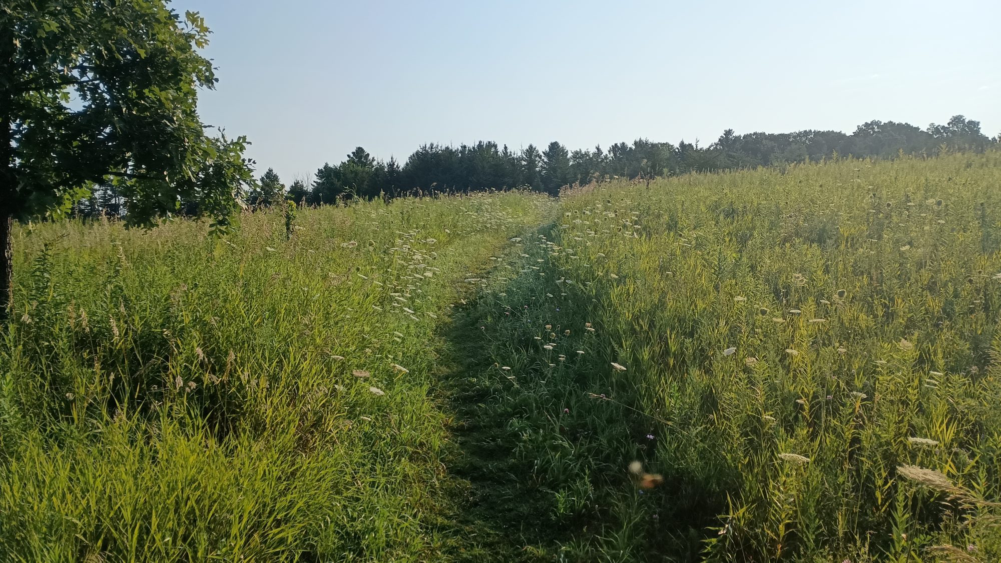
Even though the grass was freshly mowed, my shoes still get soaked walking in the grass within about 10 or 15 minutes. The morning is cool but it is full sun with no cloud cover. Luckily there is tree cover so I don’t need to use the umbrella yet.
The first 3 hours of the day feel like a pogo stick. I’ll hike on a trail for a mile then on a road for a mile then on a trail for a mile and a half then on the road for a mile and a half. This repeats all morning until the final one mile road walk into a small town with a restaurant and a gas station.
The only break from the Pogo routine is in Elkhart Lake. This is where the Road America track is. For nearly an hour as I circle around the racetrack I can hear they have an event going. I’m not close enough to see the track like I was with lime rock in Connecticut on the Appalachian Trail. But I did take a little video where you can actually hear the sound of the cars in the distance. But I can’t figure out how to add video to a post. Try the url https://ewokthetrail.com/wp-content/uploads/2024/08/VID_20240808_0838465472.mp4
It is only 10:30 in the morning, so I will stop at the gas station first and try and dry my shoes out while I drink some Gatorade. I kill 30 minutes then head over to the restaurant and have a brisket sandwich and fries. I bought a coke at the gas station but I will wait until this afternoon to drink it.
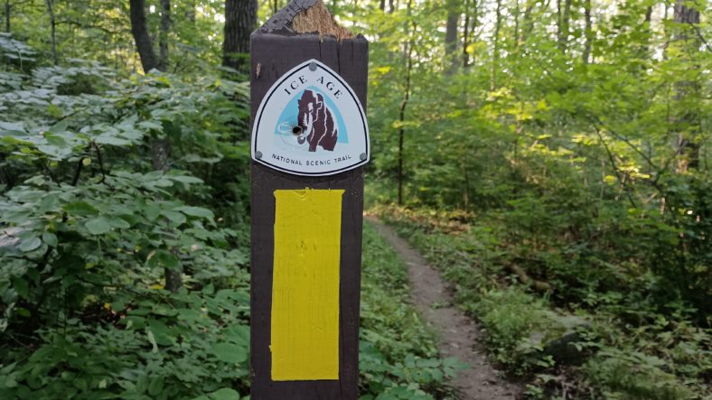
The one mile out of town is the last road walk for the day, and it is just now 12:00. I am now entering the Kettle Moraine. I’m not sure exactly what that term means yet but I’m sure I will find out. It looks like for about the next 40 miles I will be crossing roads instead of following them.
The downside to having trails to hike on is that the mosquitoes are very thick and the trail actually has some elevation to it so I’m not hiking as quickly. On the roads I go about 3 mph like clockwork. On this Trail it’s closer to two and a half but can creep up a little bit if the trail is flat.
The way the trails are laid out here feels like the Appalachian Trail. There’s not much elevation change to the terrain but they make sure that the trail sees all of it just because it is different and unique.
That’s what makes the Appalachian Trail so difficult. It was designed to string together existing trails for the most part. And the existing trails in every town where trails to go to the highest point near the town. So therefore the Appalachian Trail goes about as high and low is it possibly can in each particular area.
The trails here in Wisconsin are the same. It’s not everyday you find a mountain made out of rocks and sand deposited by a glacier. So let’s see how many of them we can climb. It’s not as steep as the Appalachian Trail but it is slowing me down a little bit.
Slowing me down is actually better for the body because it distributes the abuse around more areas of your body instead of letting it concentrate on fewer. Walking on flat ground you can overdo it without really even knowing that you’re about to break something. Walking in up and down terrain kiss your body more time to tell you when it’s too much.
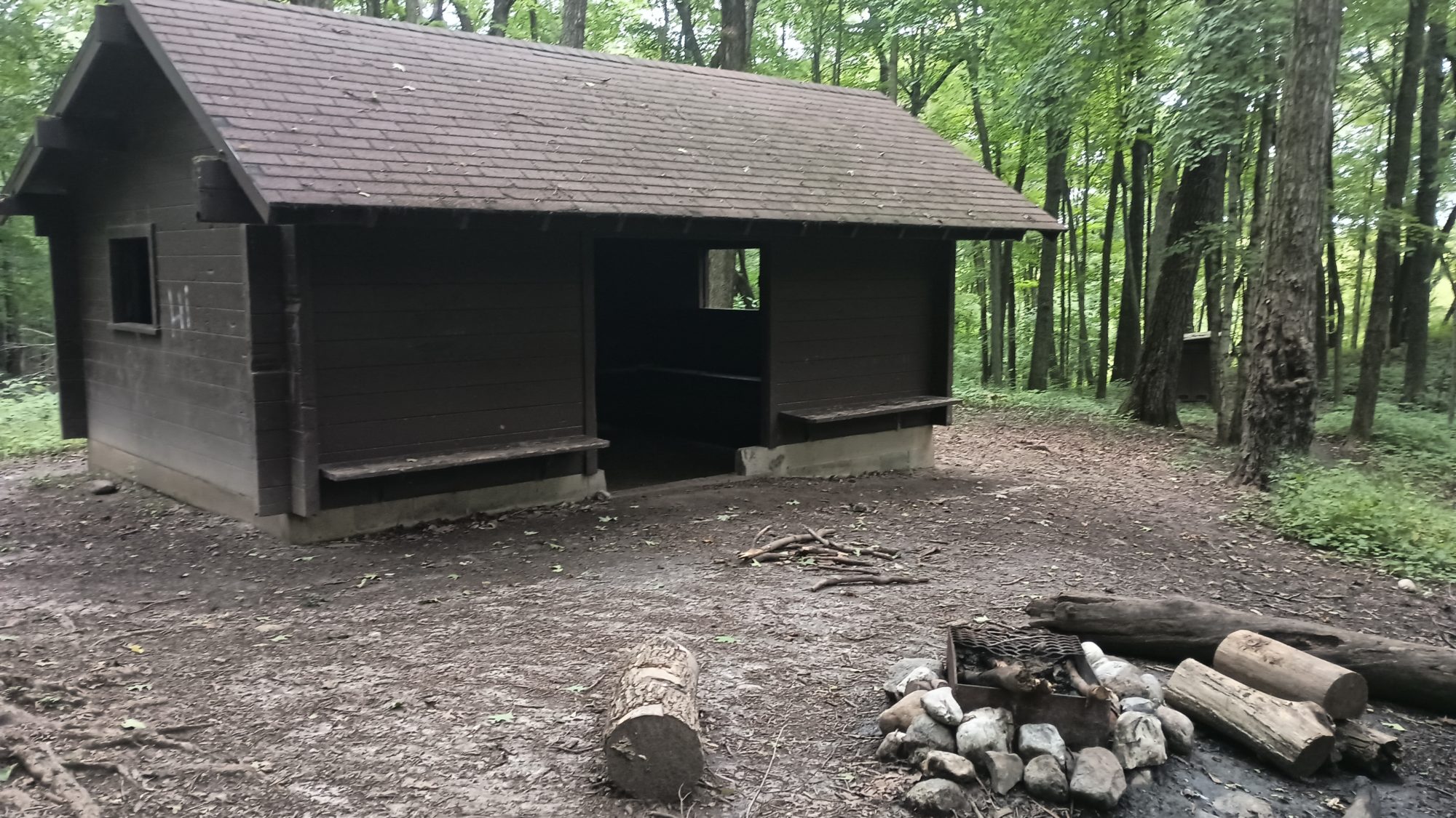
The shelters in this park are three-sided concrete buildings with a doorway and two windows on the sides. They have either dirt or concrete floors. You must call to reserve one if you want to use one. I don’t want to use them because I want to be protected from the mosquitoes. But I do intend to camp nearby.
My goal for the day is shelter number four. This would give me a 20 mi day with a mix of road and Trail. I should get there by about 5:00.
But right now all I can think about are mosquitoes. They are absolutely Non-Stop. I’ve got bug repellent on and I’m using my bug net but there’s still annoying. When I come to a highway where I need to cross underneath it through a tunnel there is a really strong breeze. The strong breeze blows the mosquitoes away so this is where I will take my break.
I relax for over 30 minutes in this spot. This is also where I will drink the majority of the coke since it is close to 2:00. Like clockwork before my break is over I can feel my energy returning. Caffeine and sugar is a wonderful combination. To take best use of it I should start hiking now so I can burn the sugar as fast as it enters my blood.
Drinking the Coke does help in the afternoon. But by the time I reached the shelter I am pretty tired. I was going to use this stopping point to decide if I should try and push five more miles or not. The day after tomorrow would be a short 10 Mile day so if I could knock half of it out today and half of it out tomorrow I could actually eliminate an entire day from my schedule.
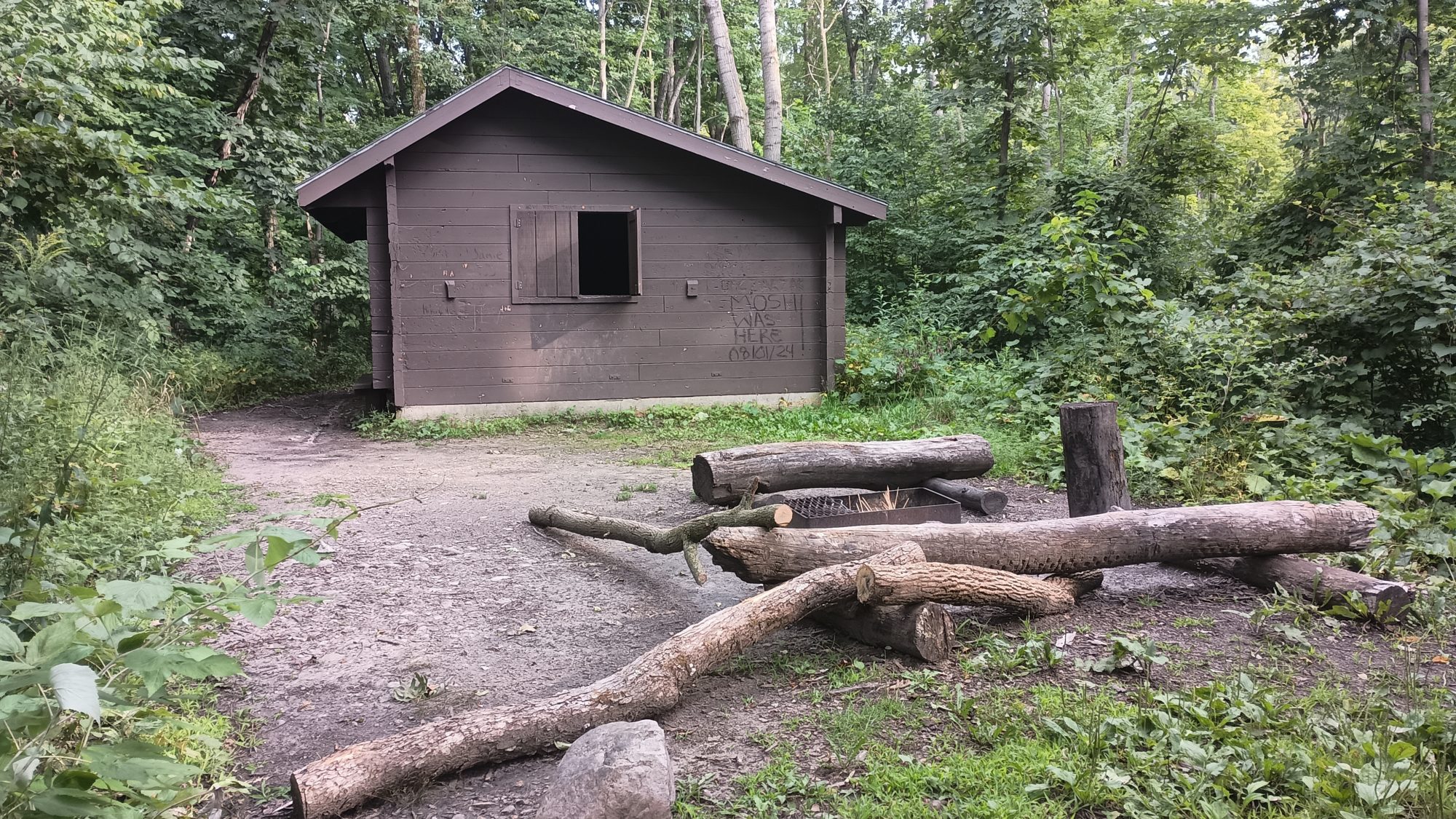
The shelter is on a high point and there is a good breeze. The good breeze means there’s almost no mosquitoes. But there is no level ground around the shelter to pitch my tent in the floor is concrete. So I will not be staying at this shelter.
Looking at the map at the point 5 mi beyond this it looks like a low-lying area with swamps and lakes all around. I have the time and the energy to make it. But I am certain that it is full of mosquitoes. The next high ground looks to be about 8 Miles and that’s too far for tonight.
So the very next high point I can find is only a quarter mile further on the trail. High points mean breezes and no mosquitoes. And they also mean that the ground is potentially level or at least level enough. As long as the vegetation is not too thick and it is not too Rocky it should make a good campsite.
After only 10 minutes of hiking I am there. The high point on the left is fairly heavily vegetated so it’s not such a good spot after all. But to the right of the trail is a gentle knob that didn’t show up on the terrain map. There are three or four places that are flat enough to pitch tents and look to be free of trees or rocks. I pick one and set up camp.
So with the decision made to stop here, it will leave 20 or 21 miles for tomorrow and about 10 for the day after that. The 10 Mile point is my resupply where there are several restaurants. And there are also hotels.
I will wait until tomorrow to decide if I intend to go into town or to just keep hiking past it after resupplying. I know I will be hiking through little towns where I will only need to carry one day’s worth of food for a few days. But I don’t know what the camping situations are and the mix of Trail and roads. So the 10 to 30 miles after the town will decide whether or not I stop in the town.
Emotion of the day, Excitement
Annoyance from the mosquitoes was a close second but there’s plenty more days for that emotion to win later in the hike.
I was excited to find out there was a restaurant and not just a gas station in the town this morning. I thought I was going to be eating a frozen burrito out of a microwave.
I was excited to find out that this 40 mi section is going to be more hills than Meadows. I like Meadows but they get old especially in the morning with dewey grass to soak your feet. I would much prefer forest trails in the morning to make some miles with dry feet.
Tomorrow should be nearly 100% on real trails and not road walking. Only half of today was on trails. So maybe tomorrow will be twice as exciting.
Recent Comments