
The campsite last night was awesome. There’s absolutely no dew in the morning, and the soft pine needles made me sleep well. In fact, I almost overslept. But I did manage to get out around 6:45 which isn’t too bad.
Lots of mosquitoes came out late last night but this morning there are none. I refilled all my water last night so I am full and ready for a full day of hiking.
And today is one of those interesting days where I’m not sure how it’s going to end out. There is a section of road walking towards the end of the day. I have three options. Option A is the hike a short 18 Mile day and camp out before the road walk. Option B is to have a medium day of about 27 miles and try and get a ride into the town of Merrill and stay in a hotel. Option C is to do the entire road walk and a 32 mile day and camp at the county campground at the end. All three options are equal probabilities at this point.
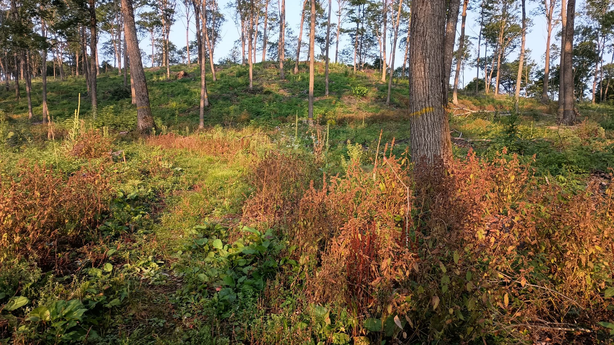
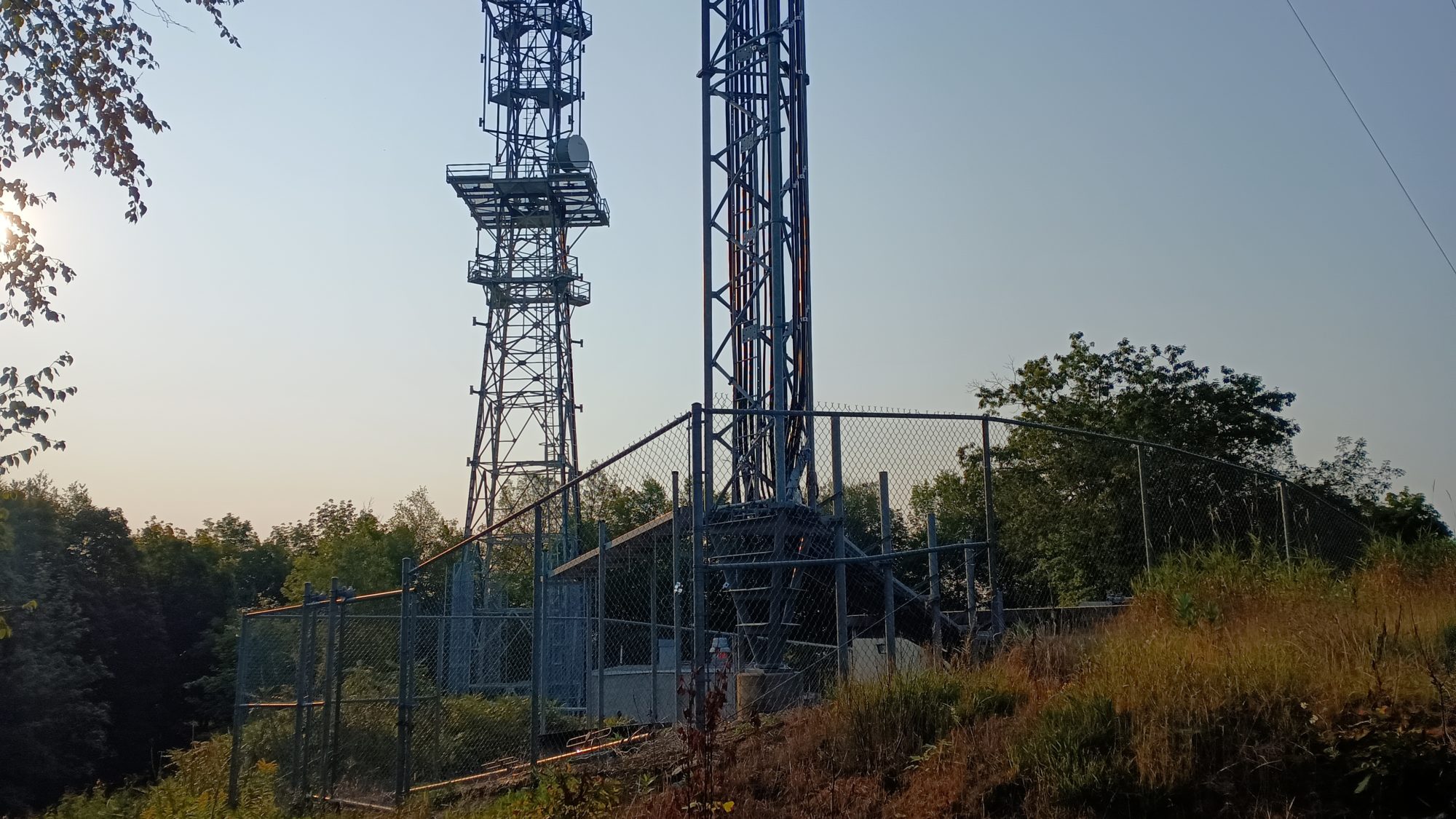
The morning hiking has many ups and downs. The first landmark is called Tower Hill where there is a communication tower and it just happens to be the highest point on the IAT at just over 1900 ft. So I expected the ups and downs but what I did not expect is this area has been recently timbered so the trail is a bit beat up and not very pleasant to look at.
When I get to the tower it’s not very impressive. There isn’t a view and you’re just looking at a radio tower and a cell tower so there are actually two towers. But there is a bench so I sit and take a little break to have a snack. There are some workers there working on the tower and they look at me like I’m from outer space. I don’t talk with them other than to say hello.
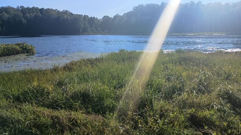
The entire day is more of the same. There are ATV trails all over the place along with other trails like snowmobile trails and eventually mountain bike trails. Only a few sections are wet with dew so my feet stay damp but not really wet.
The major problem with the trails is the sheer quantity of them. There is some sort of intersection about every two or three tenths of a mile. And with so many intersections you’re bound to miss a turn. Throughout the day, I ended up missing three turns. Each mistake involved backtracking about a quarter of a mile for the first two, but the third was a big mistake.
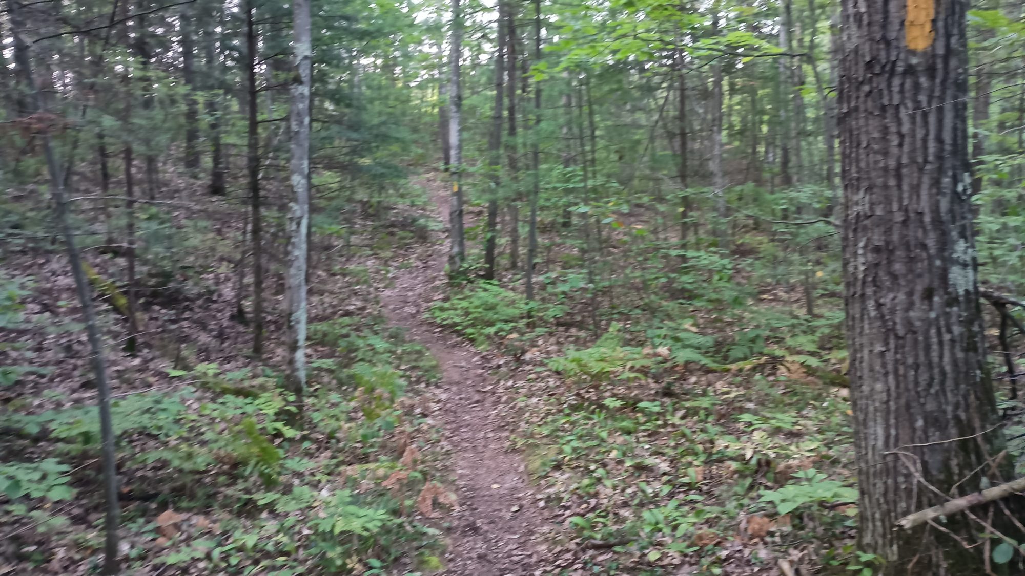
I must have gone down a mountain bike trail for over a mile. When I came to an intersection with four trails I was puzzled to see strange colored markers and nothing yellow. Luckily there was a mountain bike trail map at that intersection, and indeed I have been on a black mountain bike trail for over a mile.
This is not good news when you know you have a potentially 32 mi long day. The mountain bike trail map does have the Ice Age Trail on it as well, so I find two options to get back on track without having to backtrack the entire mile.
One option has me angling a little backwards but directly towards the Ice Age Trail. The other option has me angling forwards and eventually meeting back with the Ice Age Trail. The forwards option looks like it has lots of twists and turns and could potentially have a lot of climbing, but I would waste very little mileage. The backwards option will cost me miles but get me back on the trail quicker. I choose the backwards option because there is less uncertainty.
It takes nearly 30 minutes to get back onto the right Trail. I was expecting it to be more like 15. So the scale of my mistake is actually larger than I thought. No matter I am on the right Trail now and I still have the possibility of completing option C before dark.
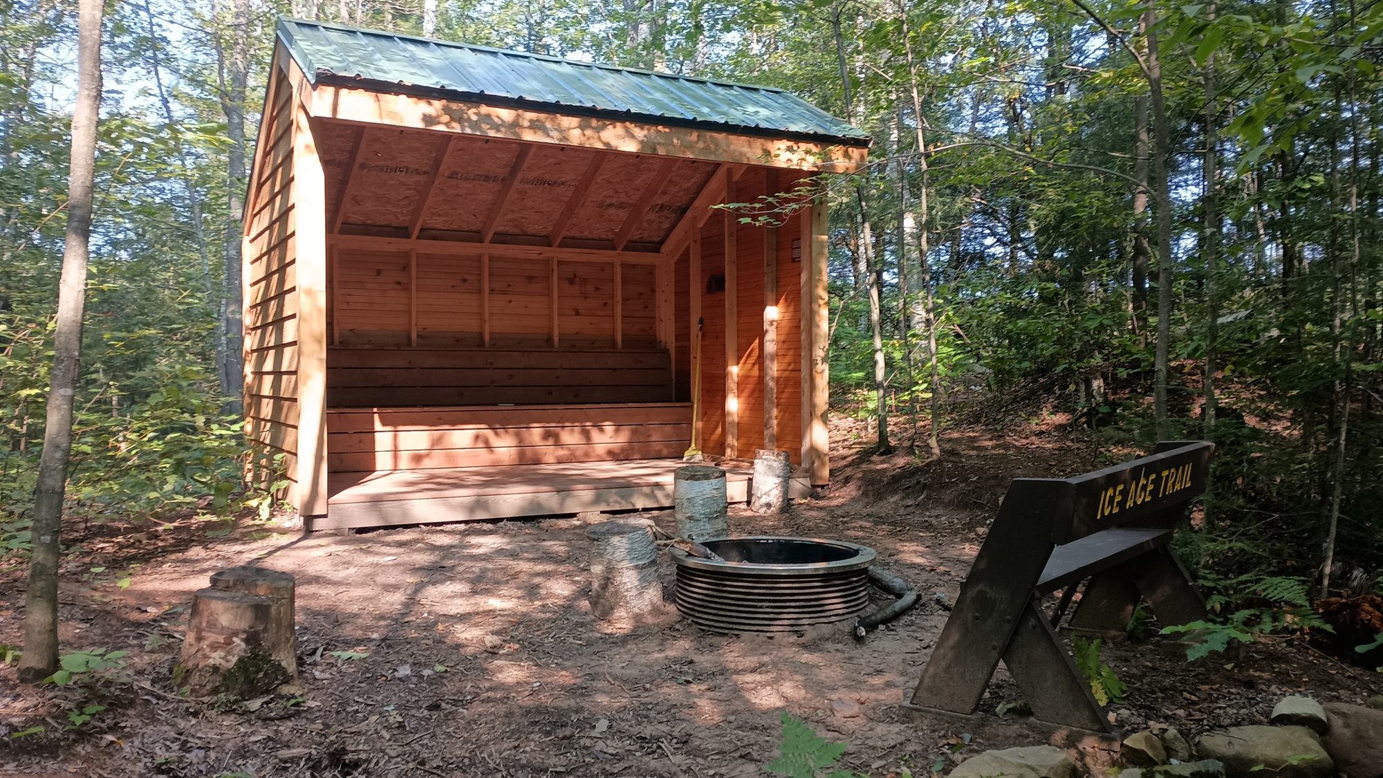
This section has two shelters. One looks brand new and one looks only a few years old. They aren’t really set up for overnight camping the way Appalachian Trail shelters are. But they would definitely do in a pinch. They are very well built.
I am doing a two coffee day strategy today. I drink half a coffee at 9:30 then the other half at 11:30. Then my third half coffee at 2:30, and the last half at 4:30. I make it a little later in the day because I know this could potentially be a really long day. But overall the strategy is a success. At no point during the day do I feel tired or sluggish, other than at the end of steep climbs, which is normal.
By the time I get to the last camping area before the road walk it is 4:30 which seems really early in the day to stop so I’m not keen on option A. Despite all the missed turns today I’m surprised I was able to make it this early, but I was hoping to get here a little earlier.
So right now option B has me getting at the first Park at about 6:30, and the option C campsite park at about 8:30. The days are getting shorter and it is getting dark around 8:00 p.m. so option C is not looking great.
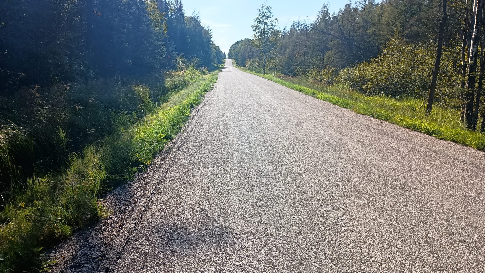
I am road walking not quite full speed but very briskly. I don’t want to walk too quickly at the end of the day and overdo it. But at the same time I don’t want to waste any daylight.
I get to the park at exactly 6:30. I only have half a liter of water which is not enough to camp with but there is a hand pump at this park so I go ahead and fill both bottles and camel up at the same time. I open both Uber and Lyft at the same time and try to get a ride into town while I collect water. Neither ride service ends up being able to find a driver which is what I expected.
There are outlets here but they are not functional, and I just discovered that my battery bank is completely drained. Earlier in the day my handheld camera cut out in the middle of the recording because it had run out of battery and so I was charging it for about an hour while hiking. What I didn’t realize is then that one hour it completely drained all of the juice I had remaining.
My phone is down to 40%, which only gives me one day of usage if I conserve. Which means if I can’t charge at the next campground then I will be totally screwed for the next 2 days. The app on my phone is the only way I have to figure out how far it is from point to point, including road walks, camping, and water.
I load my pack back on to my back and get ready to head out for the last half of the road walk. But after only about 10 steps I hesitate and decide to see if I can find a taxi service. There is one so I call and they say they can have a driver there before too long. But they can’t elaborate on what too long is. I will wait 1 hour before giving up on them. That would mean road walking for an hour and daylight and an hour and darkness. Not ideal conditions but things are getting a little dicey here.
In the midst of all of this I also end up breaking my reading glasses. Now a Walmart is even higher on my priority list. After 40 minutes I start to get a little nervous. The park closes at sunset and the residents are all looking at me a little suspiciously. I think they are all assuming that I am going to try and camp here tonight.
Shortly thereafter I get a phone call from my Wisconsin number that I don’t know. I sure hope that this is the taxi service so I answer it. Indeed it is Larry from the taxi and he needs more direction on where this park is. All my fears have melted away with one phone call. His concern is getting to me before dark so he can find me. My concern is him getting me to before dark so I don’t get harrassed by the residents.
I had not made any reservations since I wasn’t sure I could even get into town. But now that I have a phone call I go ahead and book a room. There are three hotels in town, none of them I have points to get for free. So I choose the one that is on the same side of the highway as the Walmart. Cobblestone suites it is.
I checked the weather and all sorts of things in this 40 minutes before I got the phone call. It is supposed to rain beginning at midnight through noon tomorrow. My foot has been sore most of the afternoon, and seeing that there is rain in the forecast and I have a ton of chores to do, I decide to book the room for two nights and take a day off tomorrow. I am still 5 days ahead of schedule so I actually need to start slowing down and this day of rest will help a lot.
He arrived shortly after 7:30, with about 30 minutes of daylight to spare. The sun is just starting to touch the horizon. It is a 15-minute ride into town and he drops me off while there is still a little bit of daylight. I get all the quarters I will need for laundry but I won’t do it until tomorrow. For tonight it is only shower and dinner, and not even any blogging. Five soft pillows have my name written on them.
While the trail guide says today should have been a 28 mile day, my Garmin tells me it was 32 and a half miles. Those missed turns really cost me a lot of mileage. If I had to have hiked the full option C, it would have been a 39 mile day.
That would have definitely forced me to take a zero at the campground, which seems like one of the worst campgrounds on the trail according to the comments in the guide. I am really happy that I was able to get into town after all.
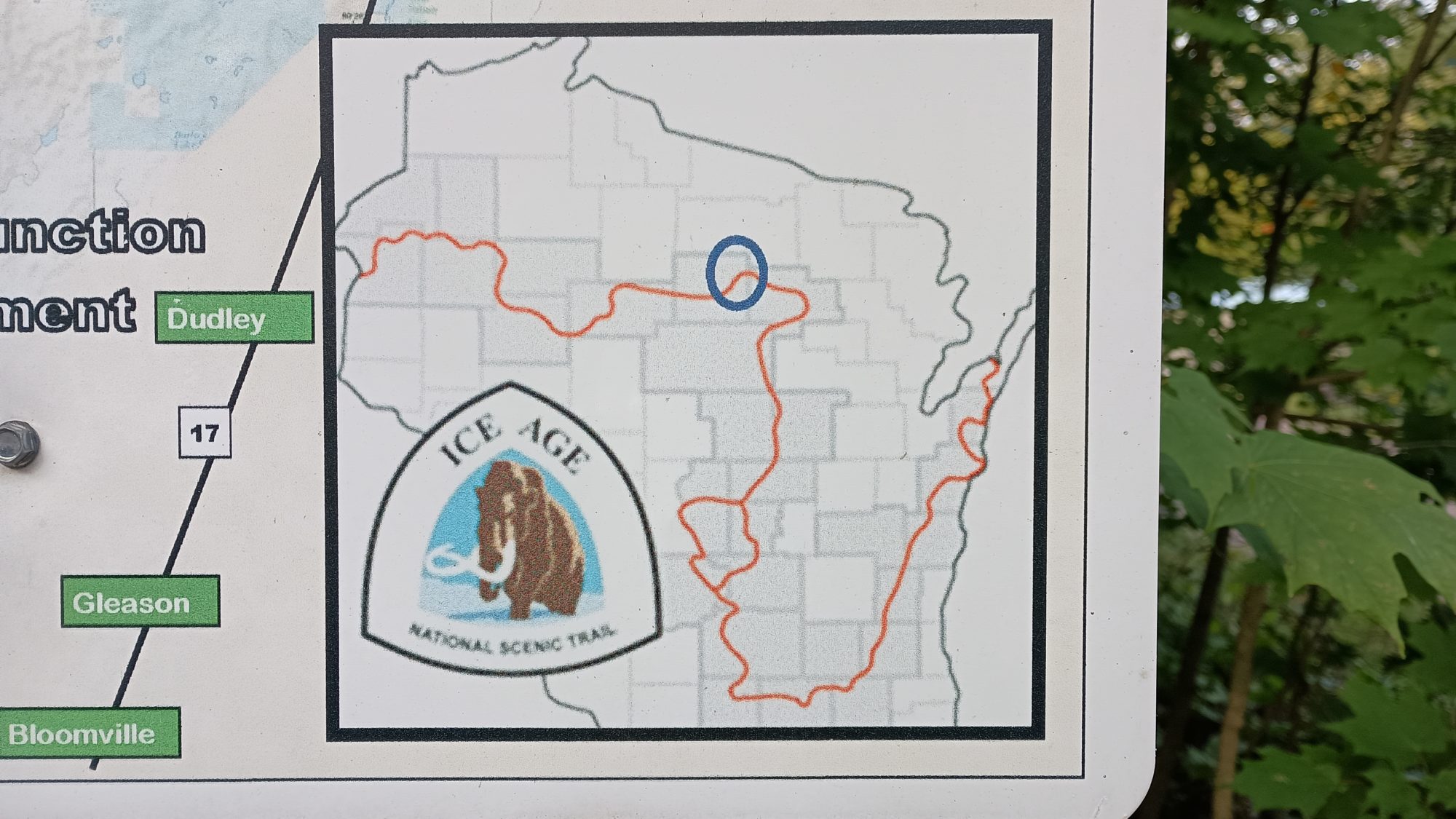
This map will give you a sense of how far I have come across Wisconsin so far. I started on the east side then made my way south. Then headed Westward and took the east side of the little loop in the middle. Now I am about done with moving more northward and it’s all about going Westward towards Minnesota.
Emotion of the day, Frustration
The morning today was fantastic. I was hiking quickly, I had plenty of energy, and the trail was manageable. It’s after my lunch stop at about 1:00 p.m. where things took a turn for the worse.
Missing a turn is common. I have probably missed half a dozen on this trail so far. But to miss three, especially on a day which could be well over 30 miles is disheartening.
The blazing was very inconsistent today. Nearly half the blazes were not the standard 2×6-in yellow box. They were using yellow painted arrows and all sorts of interesting things.
And after backtracking on the first two missed turns, it was a case of walking on a road and the trail jutting out 90° from the road not at an intersection. It’s not uncommon for trails to do this, but there needs to be a post or something visible along the path you’re currently on.
They don’t use posts in this section at all. Yet some other sections use posts even when there’s perfectly good trees they could use.
They also don’t use the double blaze properly. On one of the incorrect turns there was a double blaze pointing me to the left even though I saw a trail leading to the right. This one I discovered within a quarter of mile so it wasn’t too bad. But what looks like happened was there was an original blaze on a piece of bark that was peeling away and they put a new blaze on exposed wood making a double blaze when they really didn’t mean to. Well I fixed that double blaze for them by tearing off the bark with the blaze that had no point in being there. Perhaps this will save the next hiker the same headache.
Not knowing if I would be able to get into the town of Maryland or not was also frustrating. I didn’t expect to get Lyft or Uber service, but those first 40 minutes not knowing if the taxi would really come or not was very unnerving. I was not looking forward to the possibility of road walking in the dark for an hour.
Recent Comments