
I was awake at 4:00 a.m. and just could not get back to sleep. So I got up and started packing at 5:00 just to be fully ready by the time breakfast opened at 6:00. It was the same sad affair as yesterday, so I’m glad I bought two hard-boiled eggs at Walmart to have this morning. But their Yoplait yogurt was good.
I gave Uber a try for 5 or 10 minutes with no luck. But the taxi answered immediately and had me picked up in 5 minutes. I had a good chat with the driver about Aspen trees and wolf behavior. Yes, there are wolves up here.
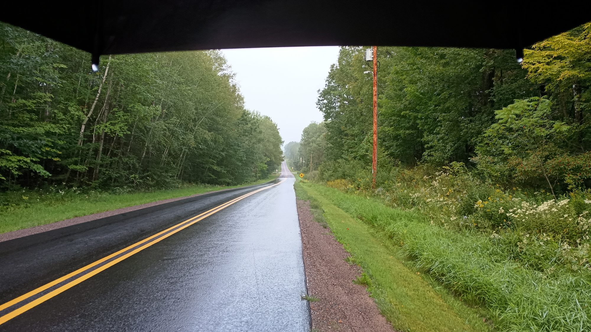
I was back out at the park and on the trail at 7:00. It was very overcast but not raining. It was cool enough that I wanted to wear gloves, but not so cold that I needed to wear gloves. But within 10 minutes it started missing and then raining gently. It rained and misted for nearly an hour which was about half of my road walk this morning.
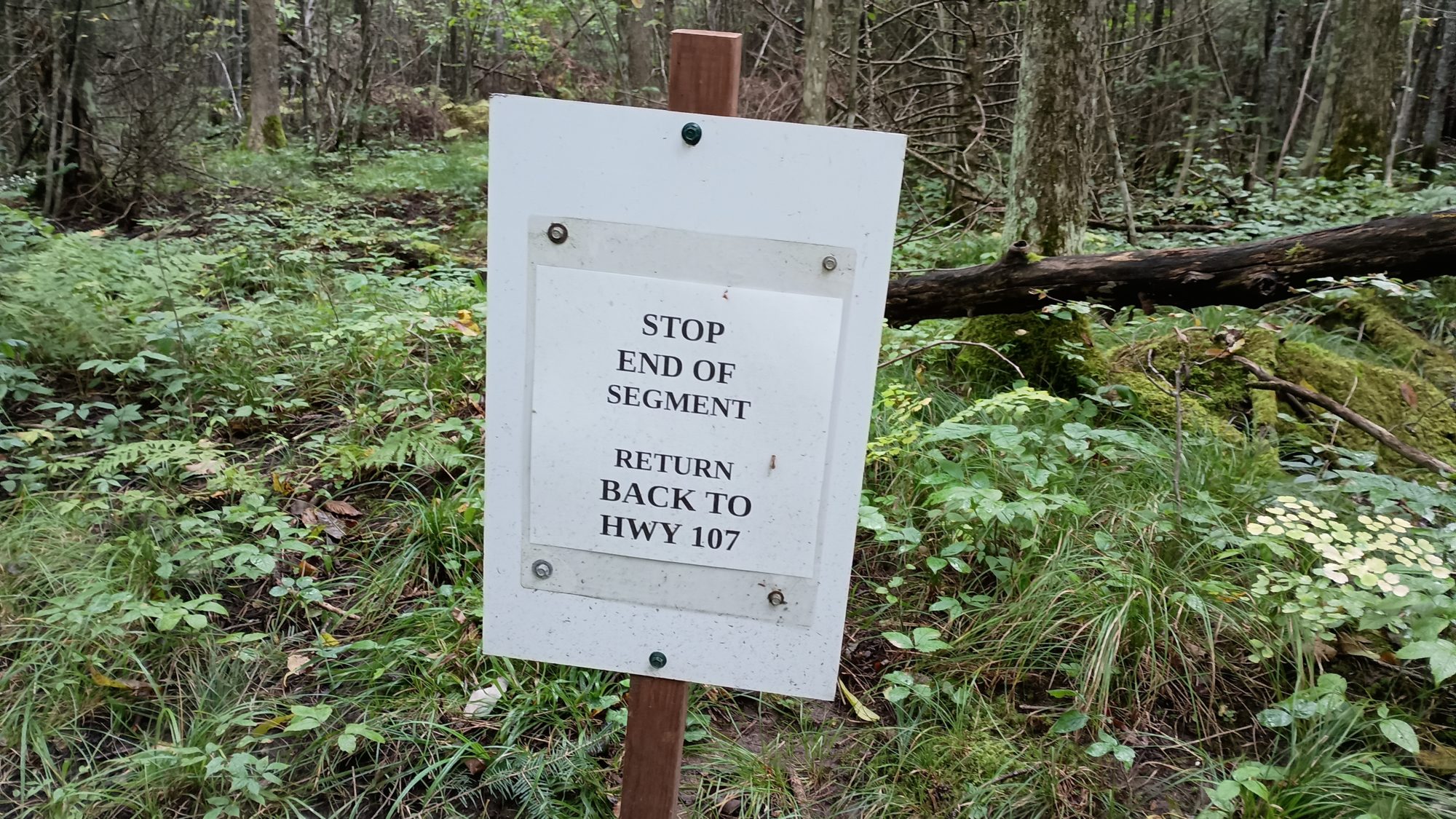
By 9:00 I was down to the trail section of Grandfather falls. This trail is 1.7 mi out and then you turn around and come back. I am assuming that there are some falls at the end of the trail. Spoiler alert, there is only a sign to tell you to turn around. There are no falls on the trail.
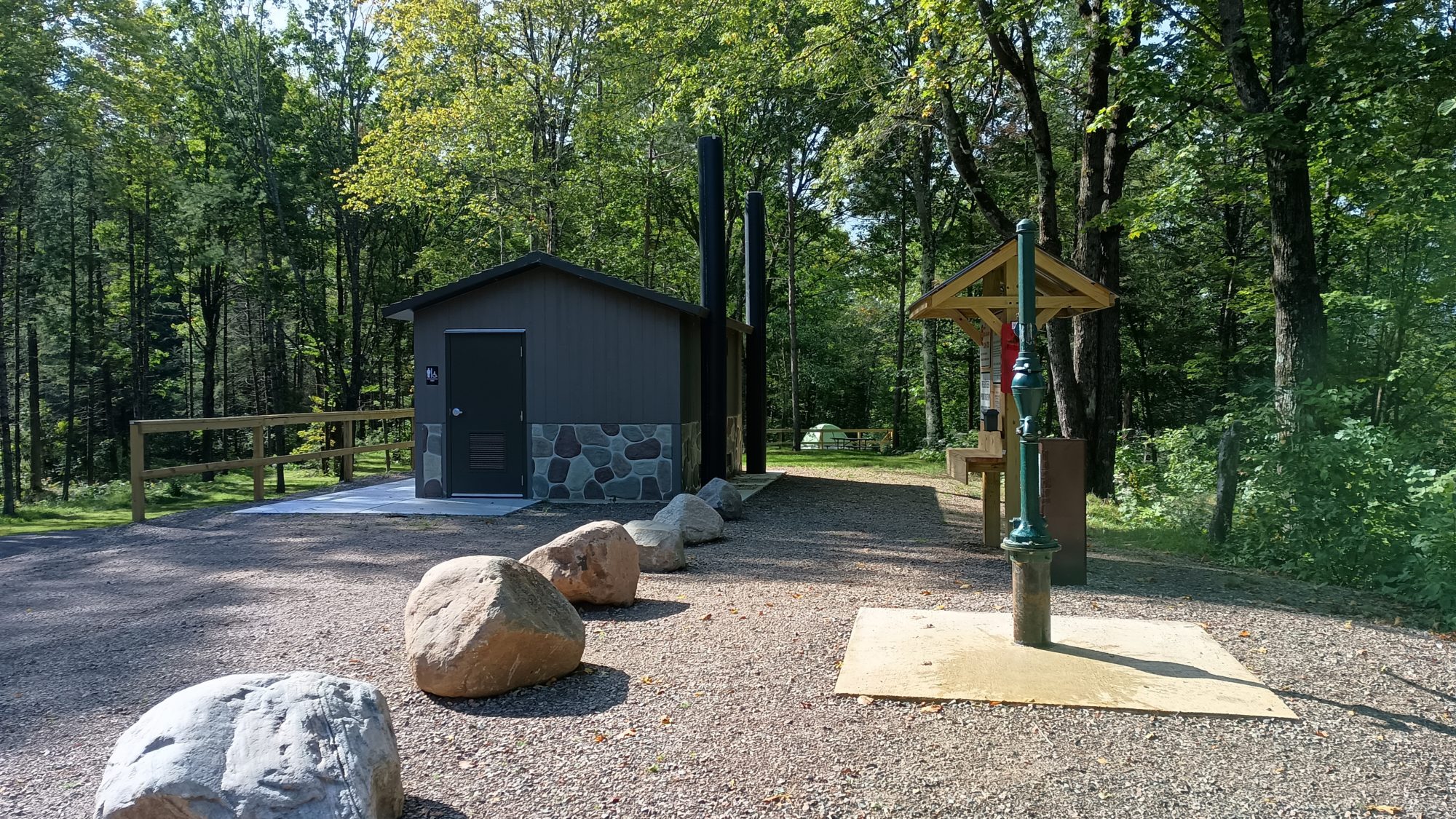
Back on the main trail it heads through the county campground where I could have camped Wednesday night. It is a brand new facility with brand new pit toilets and a brand new hand pump for water. For $20 a night it’s reasonable, but it literally is just 40 ft from the road. Not having any electrical outlets was a deal breaker for me since my battery pack was dead.
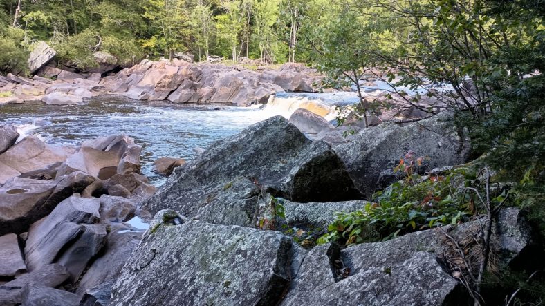
The trail now winds along the Wisconsin River up towards the hydroelectric plant. There is a pretty high rate of flow on this river, but the flow almost stops when you get above where the outflow of the hydroelectric plant is. There are plenty of rapids and it looks like it would be fun to canoe or kayak.
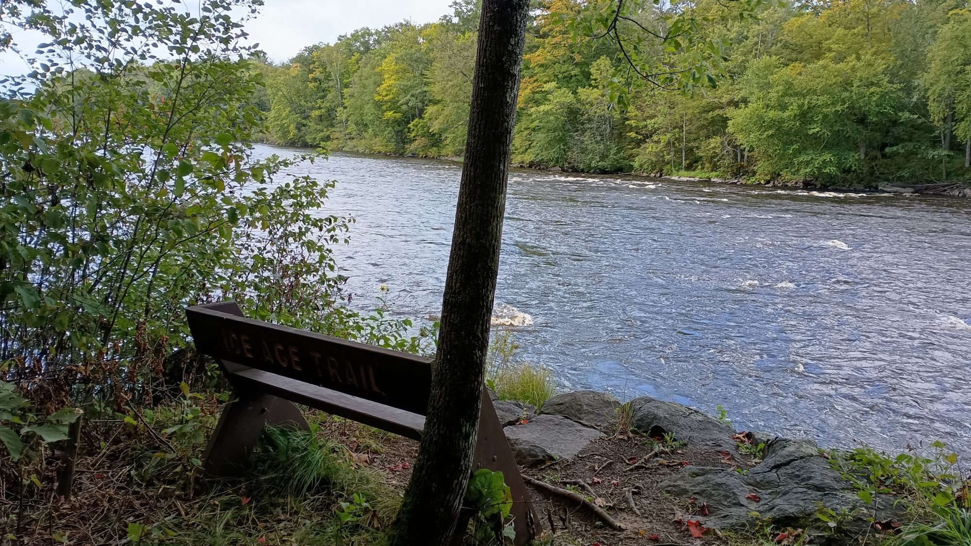
It was 11:00 by the time I made it all the way up to the headwater, so I stopped and had lunch while viewing the rapids and the spillway for the dam.
There was a group of school age children in a group of about a dozen of them hiking past me. The trail goes up the east side of the river above the dam about a mile to a bridge that crosses the river to get to the west side. The trail then comes down the bank of the river almost all the way to the campground.
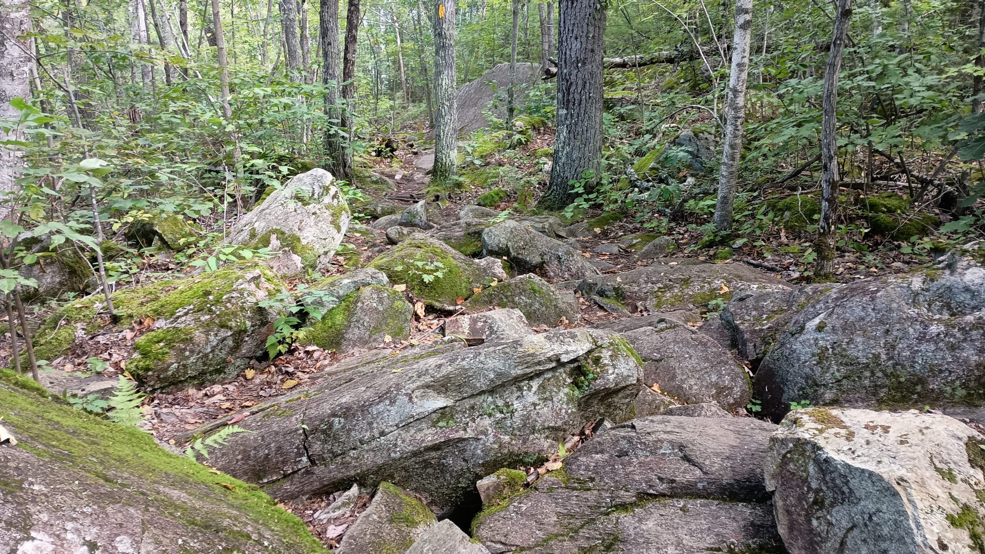
I have been hiking for over 2 and 1/2 hours and I have basically just crossed the river and that’s it. The entire morning is a lot of hiking to not cover much ground. The West bank was also extremely rocky and the trail was difficult. And now the trail heads west on special purpose trail mixed with snowmobile trails and back roads. There is one small road walk of less than a mile on a gravel road.
Much of the ground here is very muddy and swampy. I end up getting my shoes wet about once every hour. Just about the time my shoes are dry they get wet again. This happens literally all day from 1:00 p.m. until 7:30 when I stopped to camp.
About half of the woods are also recently logged. There is nothing but trash trees and little Aspen’s growing. It’s not a pretty sight.
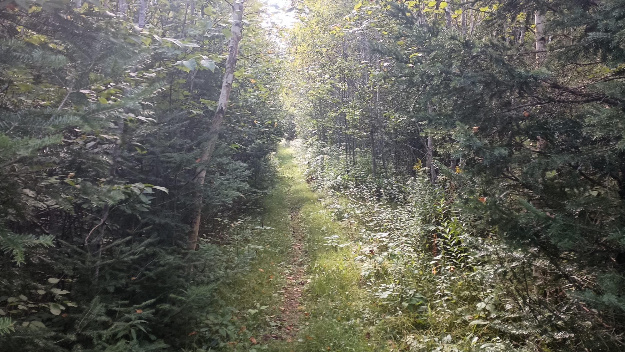
The woods themselves when it is dry are nice to hike through. There are sections of hardwoods and sections of evergreens. Lots of white pines and spruce.
At about 4:30 in the afternoon there are two streams to cross within 100 yards of each other. I go ahead and put my flip flops on to cross both of them and walk between them. They are both about 15 to 20 yards across and only 8 inches deep. When I get to the other side the trail is very overgrown and then there’s nowhere to stop and put your shoes back on. So I probably hike a quarter mile in my flip flops through the briars until I find a big tree I can sit on.
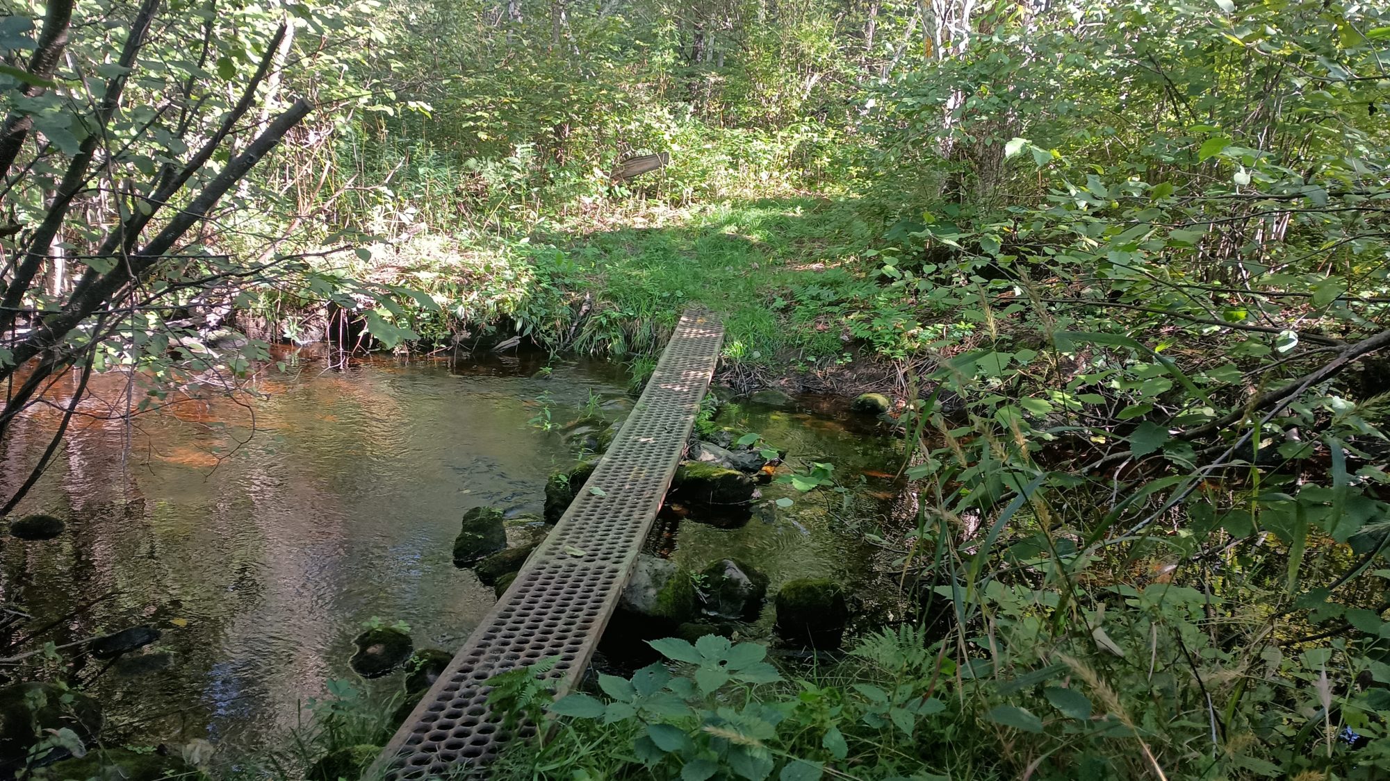
This river is not much wider than the others I had to forward, yet this one has a really nice metal grated bridge going across it. Dry feet for me.
One point in the guidebook says that there are three massive white pines next to one of the rivers. Things written in guidebooks regarding size are usually an exaggeration. But these three white pines were the largest white pines I have ever seen in both width and height.
I am trying to cover about 30 miles today to make tomorrow a short enough day to make into town. Since I got an early start at 7:00 a.m. and considering I had to get a ride from town, this is possible to do.
But the trail was a lot rockier and rougher than I expected. So the spot I am trying to get to will take until at least 7:30 or 8:00 p.m. and by then it is getting dark. I am trying to find places on the trail that look like their high enough to not be swampy. But just because the ground is high doesn’t mean it’ll be flat enough or free of obstructions to be able to camp on.
At 7:30 I’m still about a mile from where I wanted to end up but the sun has gone down and I have less than 30 minutes of light left to make camp. I find a spot that’s large enough to put a tent and very gently sloped so I go ahead and stop here. If I had gone to extra 20 minutes to get where I wanted to finish there’s no guarantee I would be able to find anything in the dark. This spot will have to do.
It is supposed to get down to 34° tonight and my sleeping bag is rated for 30 degrees. Experience tells me if I don’t wear my fleece I will be cold tonight so I go ahead and get into it as soon as I get to camp. I cook dinner first then set up the tent. By the time everything is set up dinner is cool enough to eat.
And my timing is good because it is just now 8:00 and it is too dark to hike without a headlight. And finding a campsite by headlight is nearly impossible.
Emotion of the day, Frustration
I know the national scenic trails are all about showing off what the area has to offer, but some of these trails are ridiculous. The 1.7 mi out and back of Grandfather falls was completely pointless. If it was a loop then it would have been forgiveable. The mileage of an out and back like this is not included in the overall length of the trail. That is totally absurd.
That’s right, the 28 mi that the guidebook says I hiked today was actually 3.4 mi longer because of the out and back the isn’t even counted as part of the 28. This trail is actually going to end up being longer than the 1,150 miles it claims to be.
It was also not fun having some really difficult sections of trail with rocks and other annoying sections of trail with mud and weeds. I have to cover the exact same distance tomorrow that I covered today. 28 mi by the guidebook plus 1.5 off trail into town.
If the trail is as rough as it was today, I don’t think I can make it before dark. That also frustrates me.
Recent Comments