
Today is the last day of the hike. Would I do it again? I am not sure….
Reveille
The last day of a hike is always weird. Each hiking day is usually connected to the day after it – setting up for making the Post Office, the check-in time at a hotel, or something else that happens in the future. You have read about many of those if you have been following along in this blog.
But today is just today. The only goal is to finish in time for lunch. And with 10 miles, some on the beach again, that means heading out early. And for today, early means 7:30. Breakfast starts at 6:30, so it is not a hurried morning by any standards. I also removed a few more things from the pack that I know I won’t need.
Walking Through Pensacola Beach
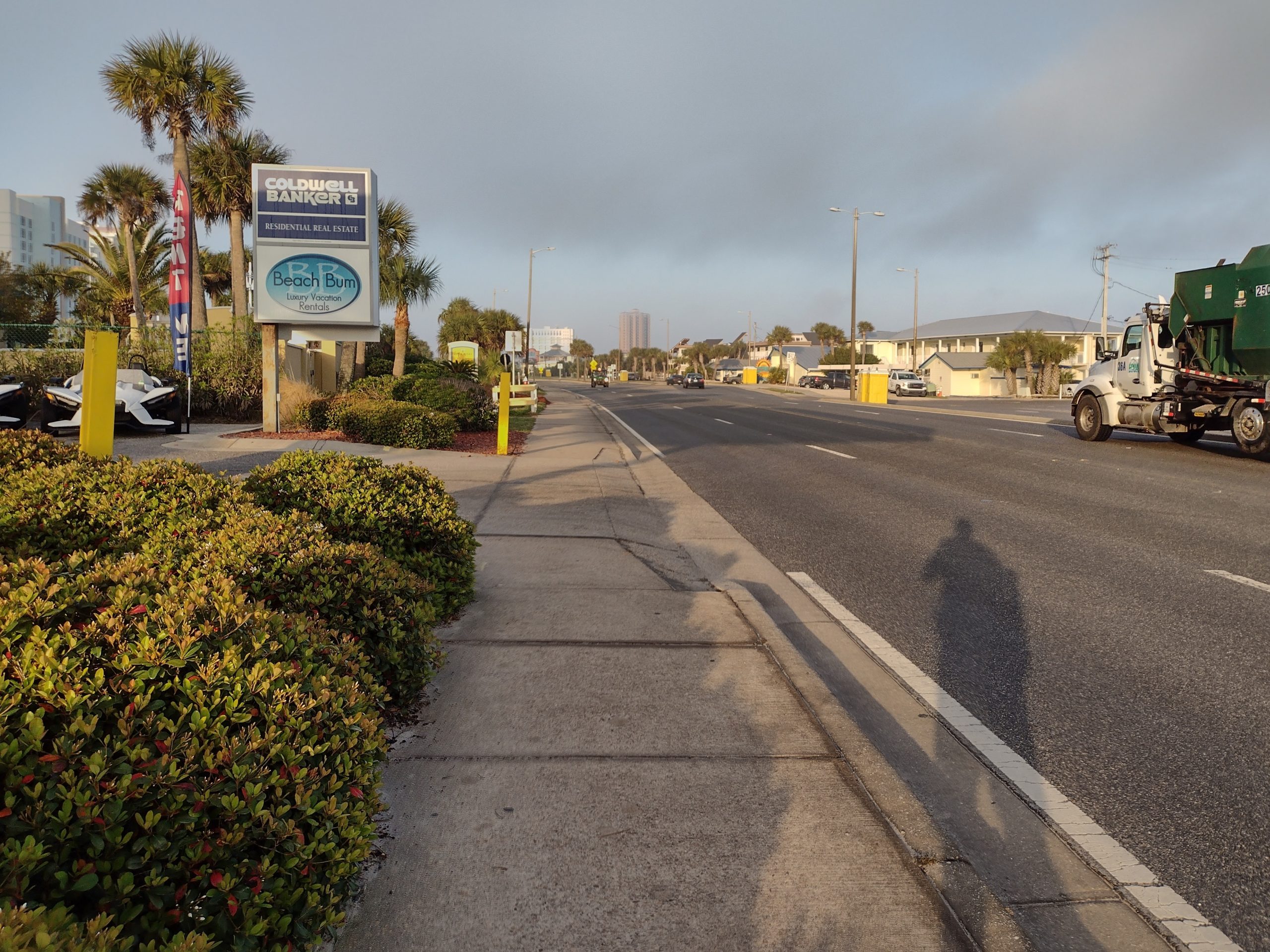
The hike begins with more town walking. The bike path will be the hike for the next mile or two. I can’t pinpoint why, but I think I like Pensacola Beach and Ft Pickens road better than Navarre Beach. I guess it seems like a better mix of residential and commercial businesses to make a more well-rounded community.
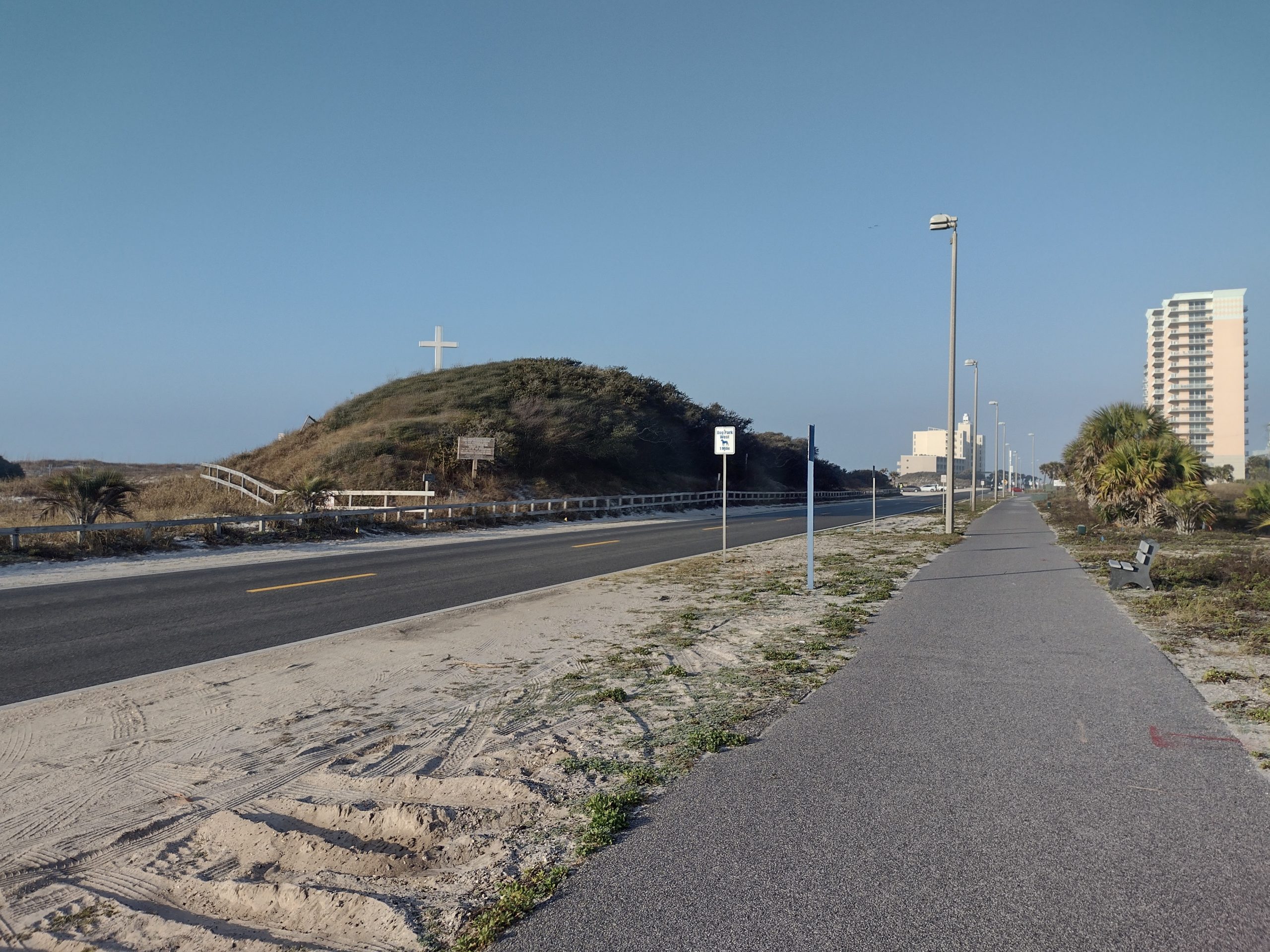
Ft Pickens road turns from residential to another National Seashore. At this point, the bike path ends, and there are no bike lanes on the road. it is more beach walking.
The tide is similar to yesterday and is nearly high. I can’t tell if it’s rising or falling, but there is a decently packed surface to walk on if I stay just close to the water’s edge. A few small spots get steep, and a few small spots get soft. It is the same experience as yesterday while walking on the beach. The weather is similar, too – overcast with the sun barely peeking out a few times, and strong wind.
I can actually see some of the rip currents drawing water out into the deeper ocean. There is a rip current warning going on right now and the surf flags are at yellow (moderate risk). The water is nice and medium blue but turns dark about 80 yards offshore as the water deepens.
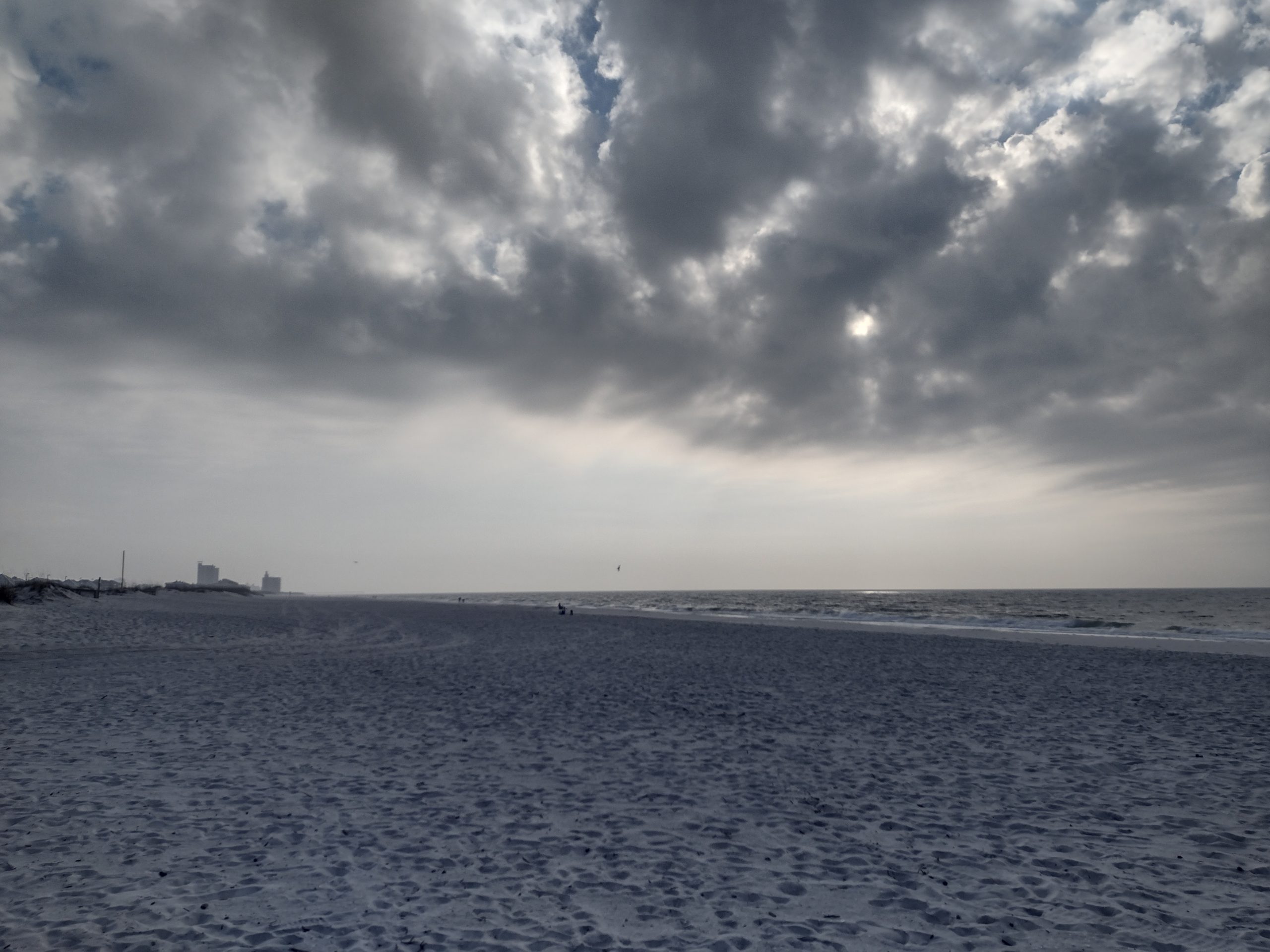
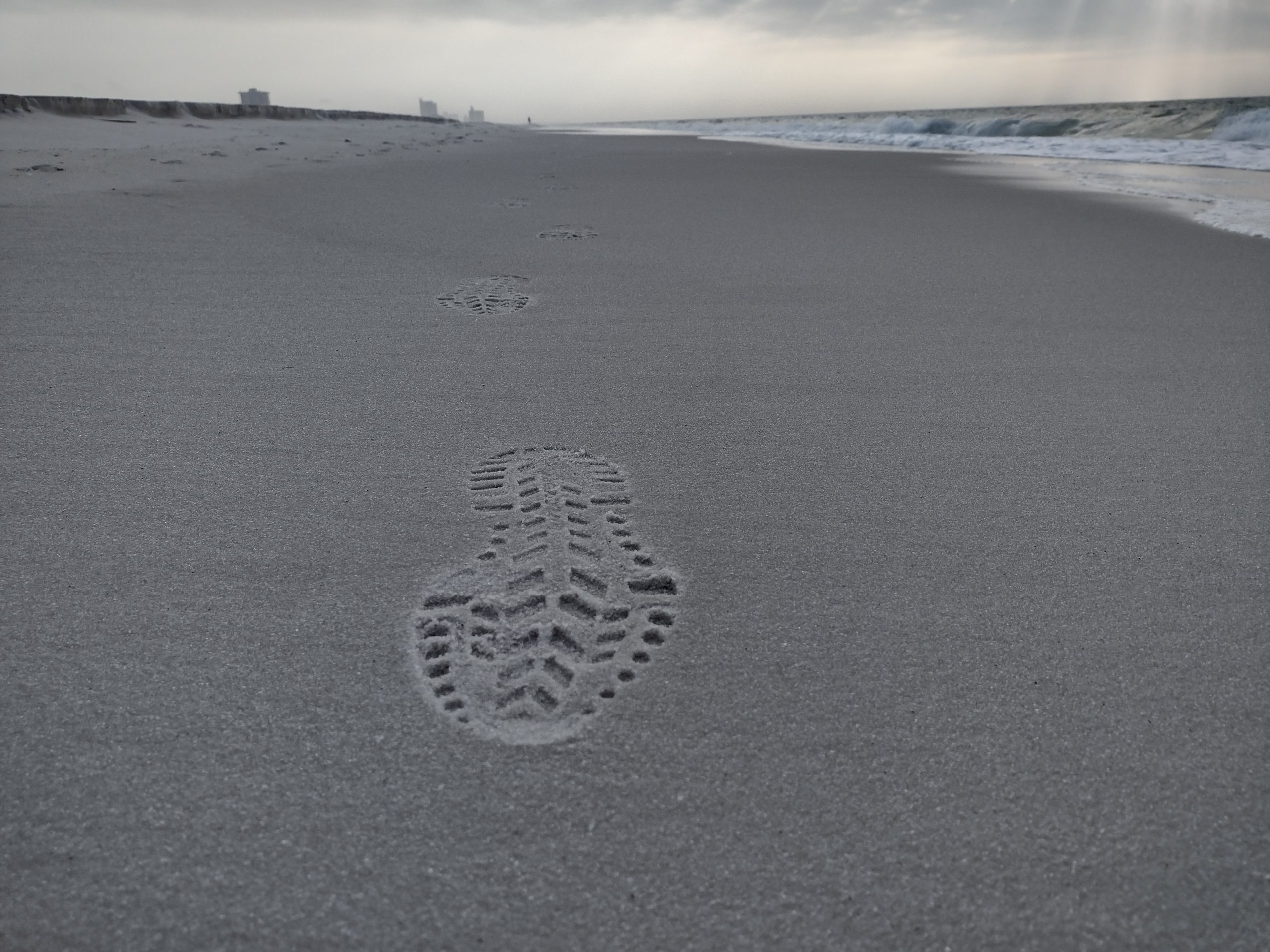
I last longer on the beach today, about a full hour before my feet are getting sore from the slope, so I decide to try out the road when it gets close to the beach. The road here has a bike lane, but only about the normal 4 feet of width instead of the wide 5 feet of yesterday.
I can see the buildings ahead and see that I almost completed the beach hike completely. There was only about a half mile left before the trail comes back to the road. I am less than three miles from the finish and have less than an hour left to go.
Fort Pickens Park
I have been hiking in Fort Pickens park for the last hour, but now the buildings and gun batteries are visible to me so it seems to me like this is the beginning of the park. The trail goes back to the road from one of the beachside parking areas. There is a huge gun battery facing the beach. The trail crosses the road and begins the dunes walk at the base of one of the largest ones.
When I get onto the trail, I am delighted to find that it is a trail that goes through wooded dunes, not sanded dunes. The trail is crushed gravel and not soft sand. There is also quite a bit of shade, so this will be a great two-mile finale for the hike.
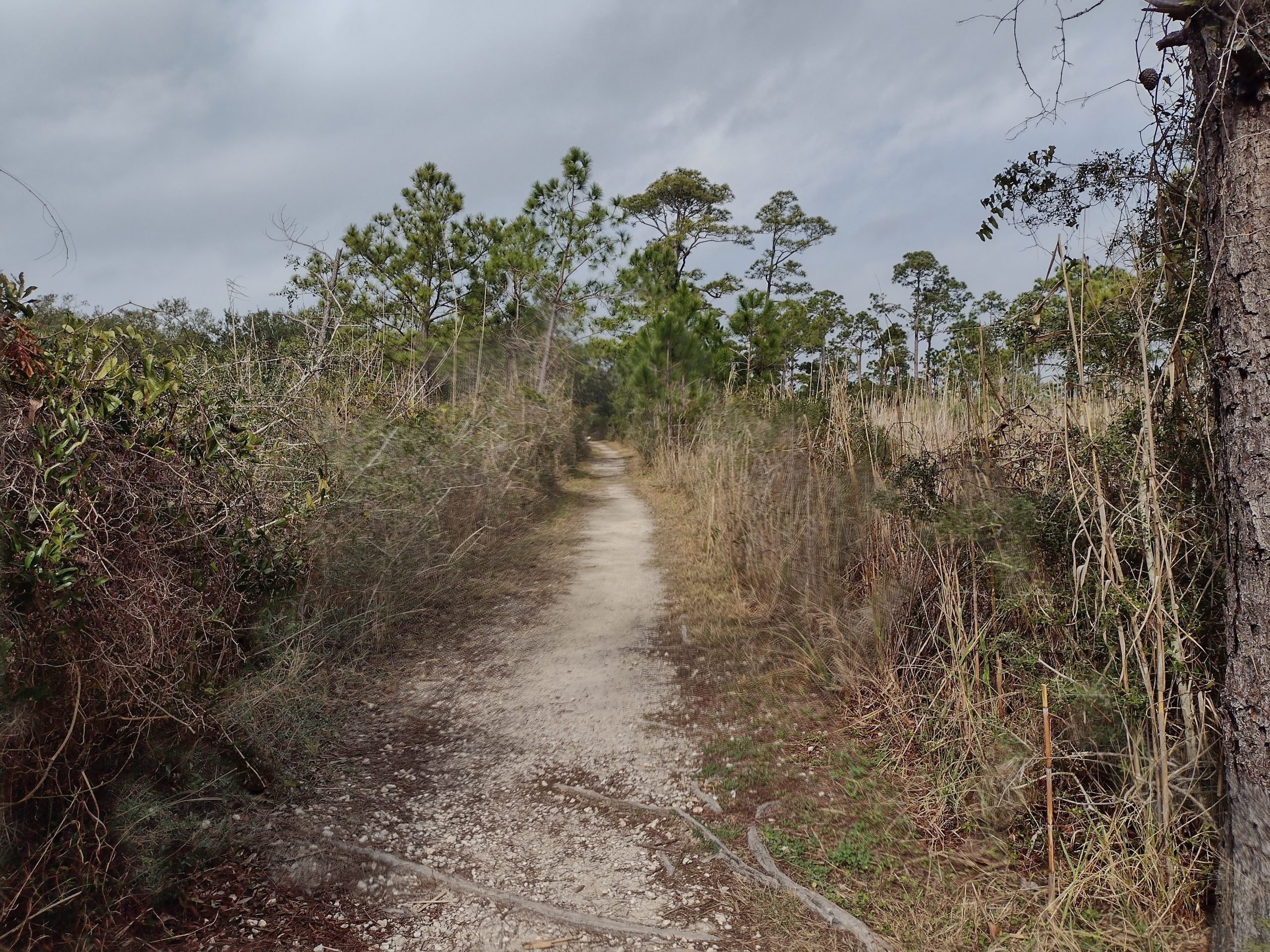
The trail goes right through the middle of the campground. It is a sardine-style campground. The camping spots are packed together very tightly with very few trees like many RV parks are. It is not like a State Park campground at all. I do not think I would enjoy camping here.
There are a few other people day hiking on the trail as well. It is a nice trail for a beach area. Near the end, an estuary pops up. I am tempted to go down and taste the water to see if it is fresh, brackish, or salty. I assume it is not fresh since it is so close to the water, but there does not seem to be any connection to the bay.
I get excited when I see the wooden bridge over the end of the estuary. I know that I am now just a few tenths from the end. I am hiking briskly, straining to see the end as the trail curves gently to the left.
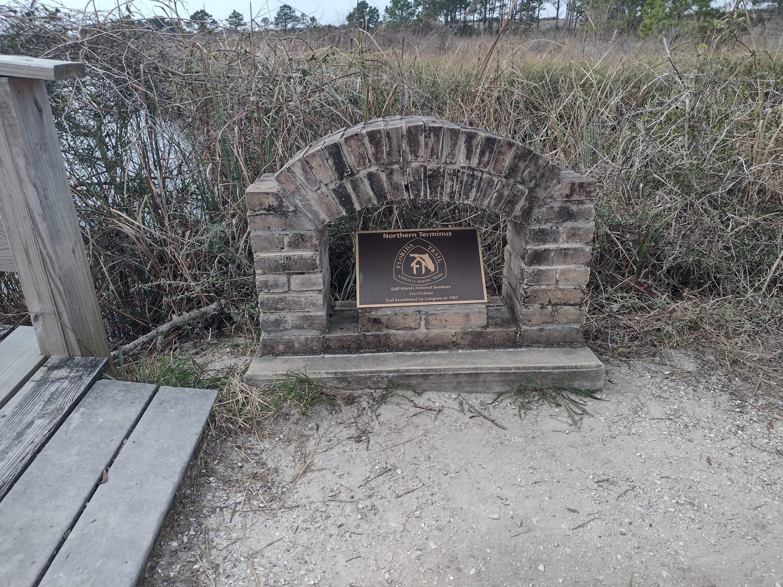
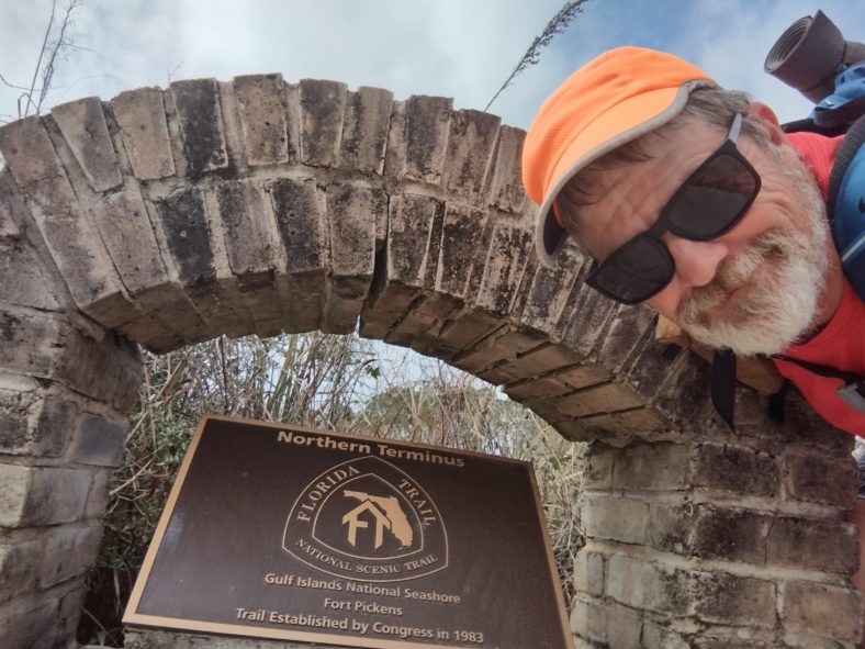
I finally can see the parking area, and I spot Karen parked right where she can see the trail and me coming. I can see the kiosk at the end of the trail, but I cannot find the terminus monument. Where can it be? It should be here somewhere. I search all over the parking lot, but I cannot find it. How can you miss a brick monument?
I consult the app, looking for information. It turns out the monument was at the wooden bridge, and not at the end of the trail. What? It’s called a terminus.
Terminus – a final point in space or time; an end or extremity.
https://languages.oup.com/google-dictionary-en
Well, apparently the northern terminus for the Florida Trail is a few tenths of a mile from the end. Then why is this trail not marked as a blue trail like every other parking access trail? Some things just don’t make sense.
So I load back up and start heading backward on the trail. As I approach the bridge, I can see the monument tucked to the side of the trail at the northwest corner of the bridge. Holy smokes, I walked right past it without seeing it.

I go back over the bridge and get some video shots of coming over the bridge and seeing the monument. I feel like a fake. But I get my video, I get my photos, and it’s time to go back to the car and head out.
There is a ton to see in this park, and Karen had to buy a 7-day pass to get in, so we will leave now and come back tomorrow to explore. We will be meeting her cousin for an early dinner, so it is back to the hotel and shower for now. I have many blog posts to catch up on, and some work to do (including an all-hands call).
The hike is over. It does feel like it is over and I am ready for it to be over. It was a nice ending, being able to catch up with Jack and Mickey again and hike a few of the last days with them again. They will be finishing a few days later, as they delay their ending.
It is also nice being able to get picked up at the end instead of turning around and backtracking out of the national seashore. That would be a seven-mile backtrack to get out of the National Seashore to see if you could catch an Uber somewhere.
Emotion of the Day
I would like to pick something like joy or accomplishment or something befitting of the end of a long 1100-mile two-month journey like this.
But the crazy monument thing is just consuming my every thought. I am bewildered.
The rest of the day was great. I had fun walking on the beach, I had fun walking down Ft Pickens road, and I had loads of fun on the last dunes trail. Everything was great, right until the end wasn’t the end.
I am just bewildered that the end of the trail is not the terminus.
I think I need to get more active in the Florida Trail Association. There are many little things that could be improved to make the Florida Trail a better hiking experience.
Would I do it Again?
Right now, no. But I’m sure my mind will change over time as it always does. I will say that the stench of hiking in humid areas is not as fun as in arid areas. I know I will hike again, but I think I will look for a desert trail next.
Recent Comments