Apparently I misnumbered day 23 as day 24. So if you have already read day 24 25 and 26, then the next day for you to read will be 26 again because I am about to renumber all of them to correct this problem. It happens.
I also don’t do a superb job with editing and spell corrections either. Doing this on a tiny phone is hard enough but doubly hard when you’re tired. Fixing capitalization problems probably is 70% of the editing effort. Every time I say the word Trail it wants to capitalize it. See it just did it again.
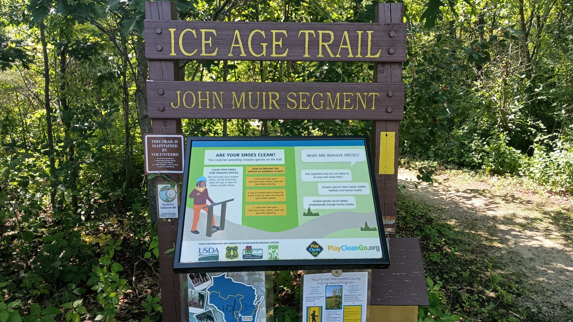
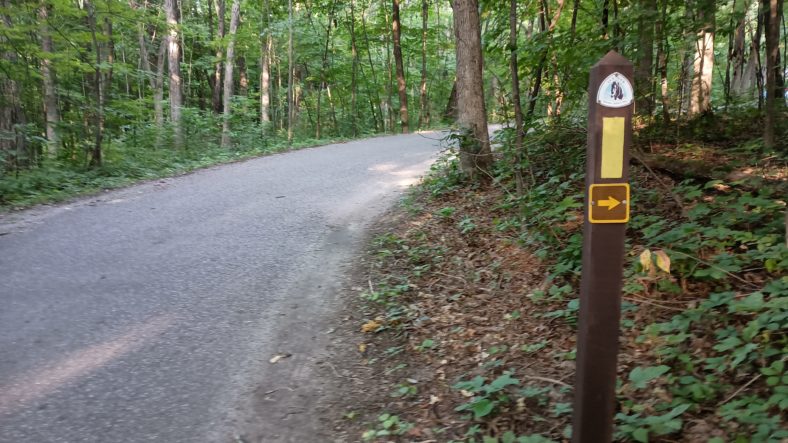
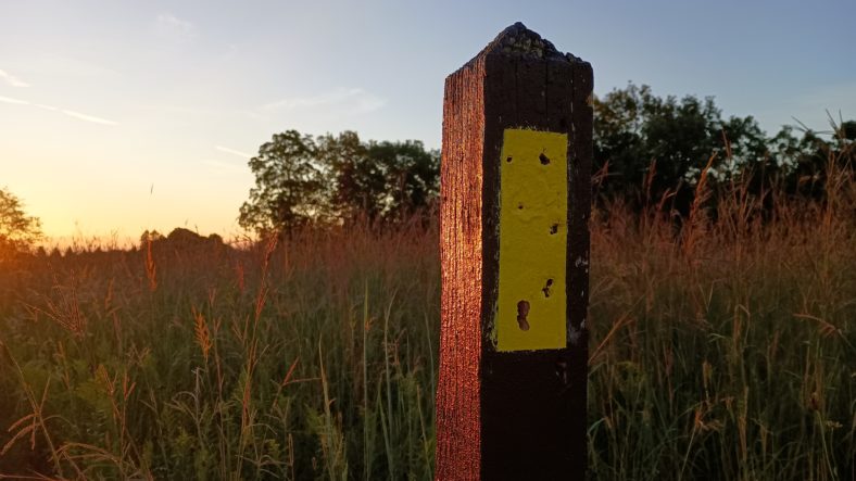
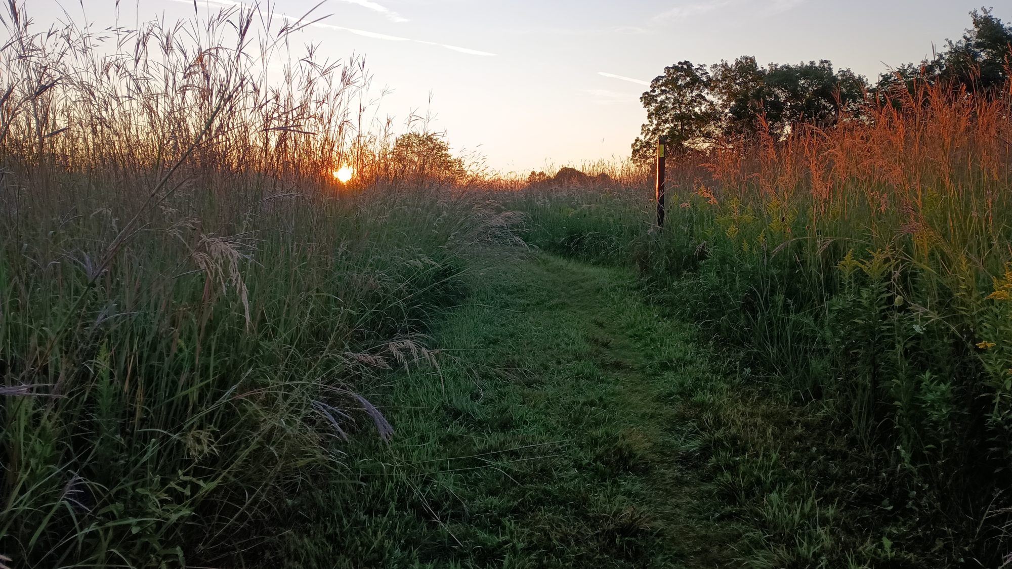
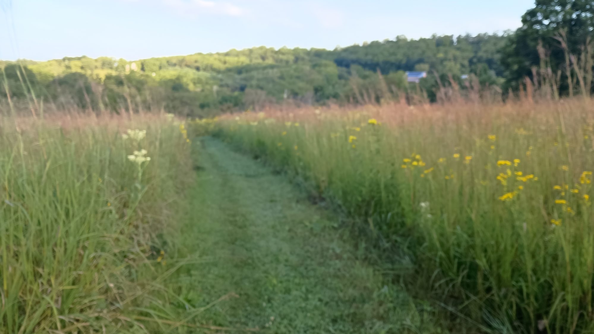
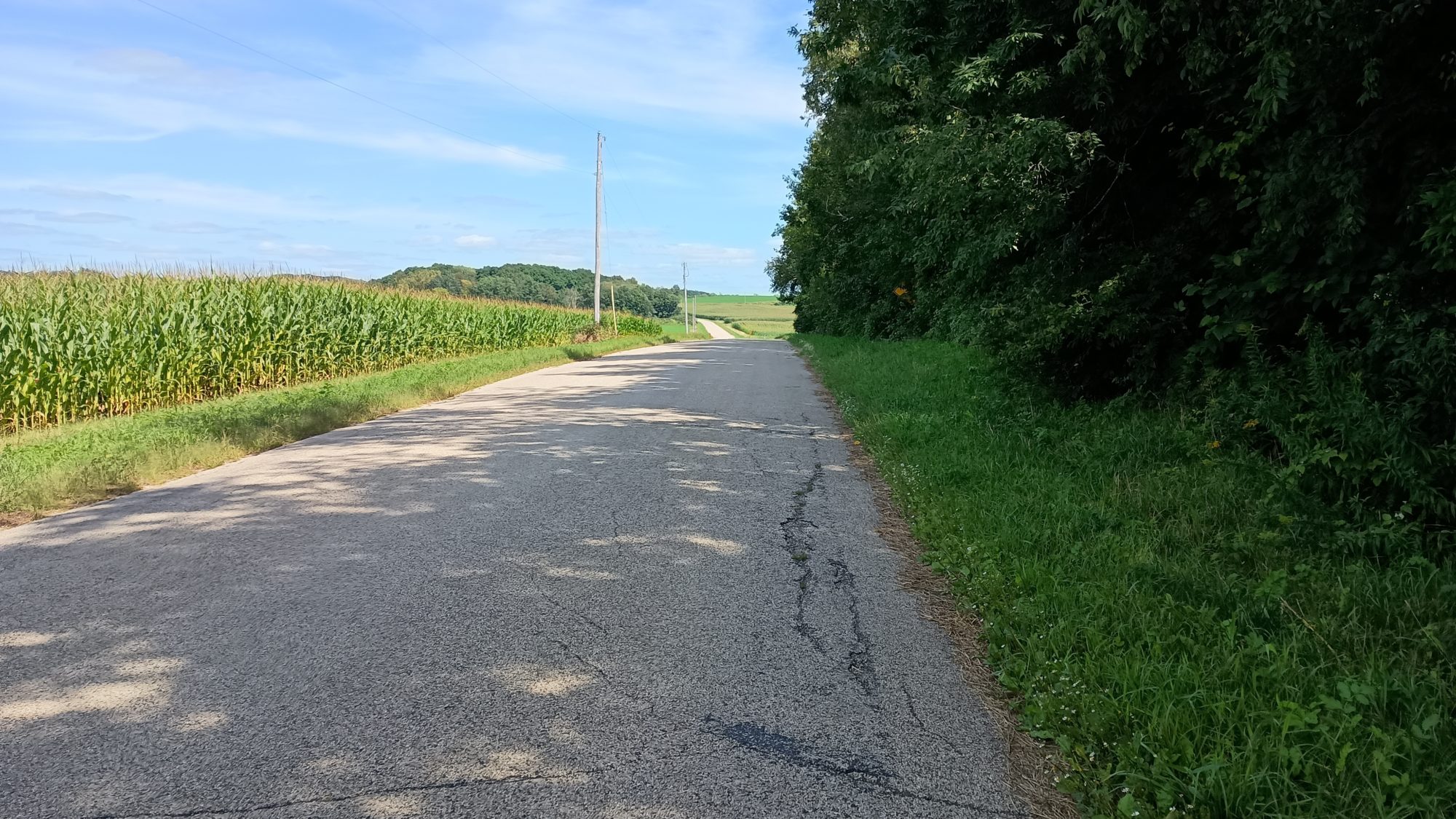
Today is all road walking except for 2 miles of trail in the middle of the road walk. I finished all the official Trail in town last night so today I leave from the other end of town. I will meet up with the green route about halfway to John Muir county Park.
I didn’t wake up till 6:00 a.m.. this is the latest I have slept in on the whole trip. Today is a perfect day to sleep in because I’m in no rush as my mileage isn’t very long. I think with my alterations to the green route it will be around 20 or 21 miles today depending on where I stop.
I went to the breakfast room at 6:30 and met someone from Galesburg Illinois. I have some good friends and Galesburg, so I asked them if they knew them. By some stroke of luck he did know them and we took a selfie and sent it to them via Facebook. I wish I was a fly on the wall when they read that message. I will have to harass them a bit later.
It was probably around 7:15 before I got out of the hotel and started hiking. The beginning of the route is a road that parallels the highway, so the scenery is not great and the traffic is medium. They can’t all be stunning.
After about 3 mi it turns onto some smaller roads. The route all morning bounces between really small roads and medium use roads for short distances. The last three or four miles into John Muir Park I am on the suggested route. I get there just before noon so I stop at the picnic area and have lunch. I also refill my water bottles but not completely as I only have about 9 or 10 miles left to go and I still have a nearly full Gatorade.
There is a woman there with two young children and the children ask if I’m hiking the Ice Age Trail. I was really impressed that they even knew that the trail was. They look to be about three and five. I told them I was and that made them happy.
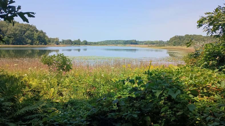
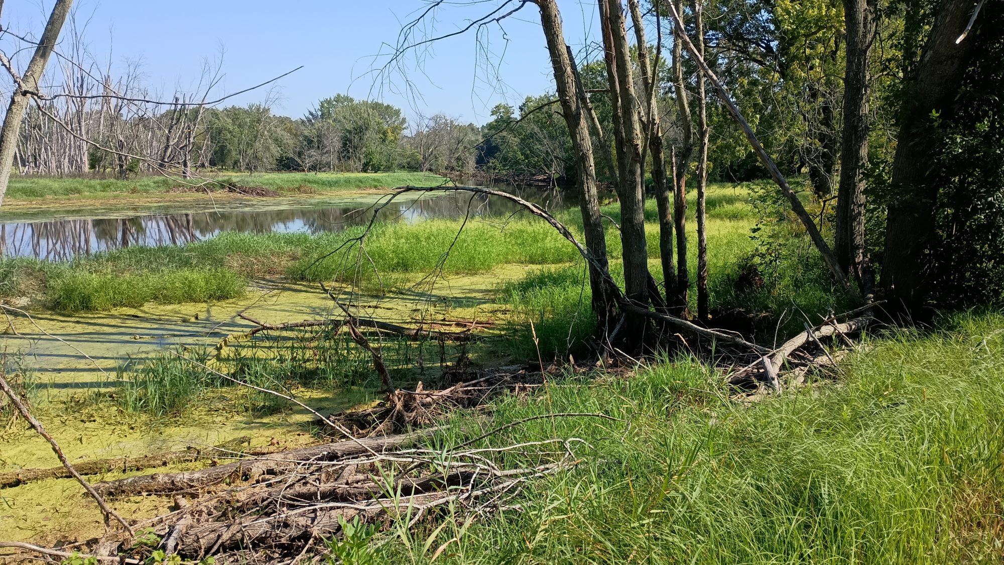
This park is the boyhood home of John Muir. It is a large lake with a trail that goes all the way around it. There is one stream that is an outflow of the lake and one stream that is a spring-fed source for the lake. The childhood home is up towards the spring but it is not open to the public.
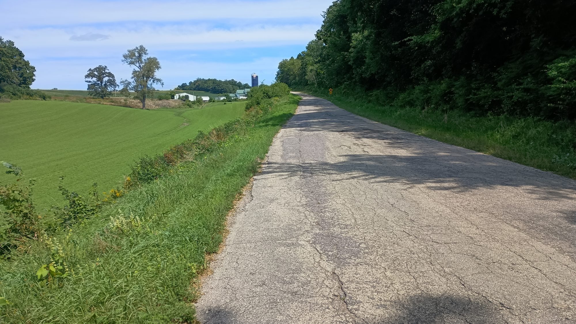
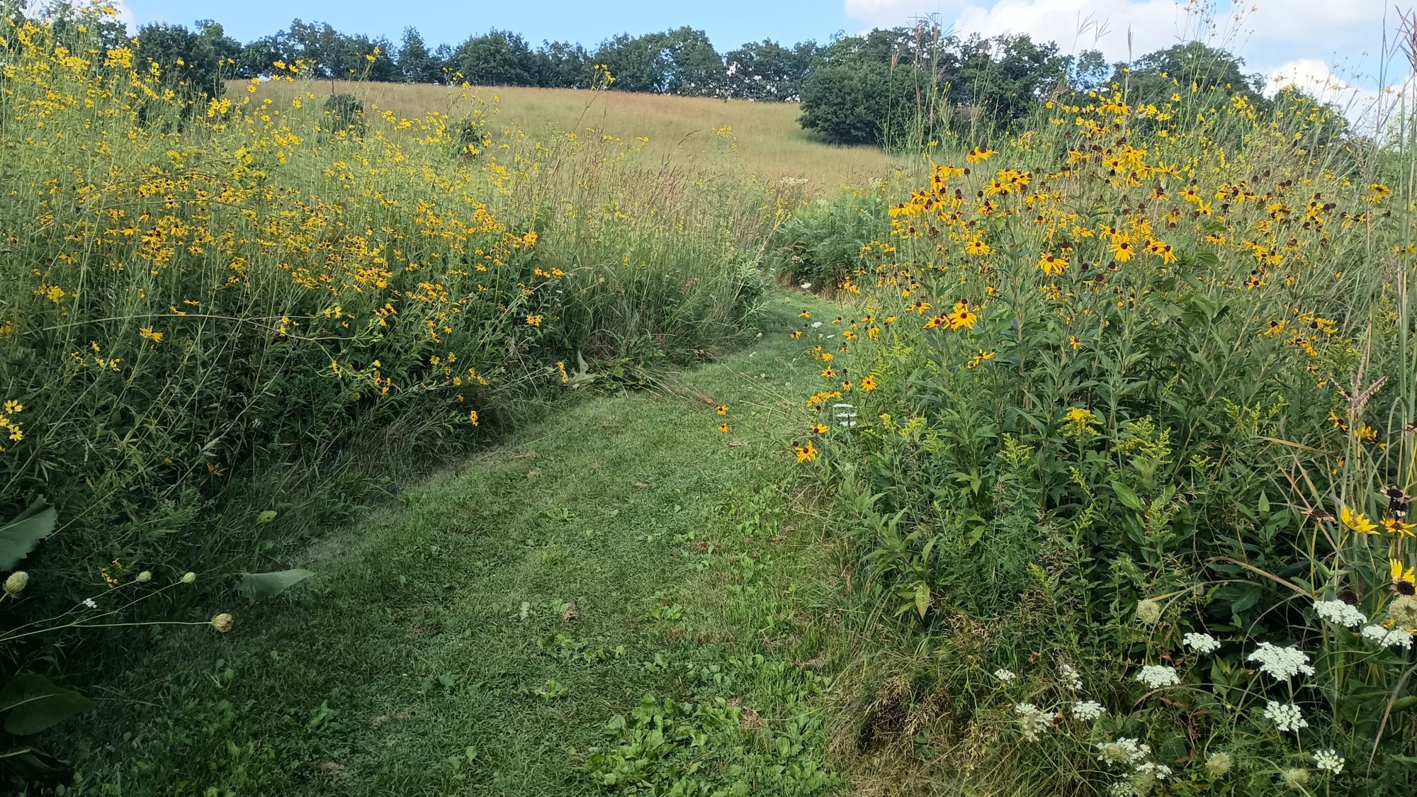
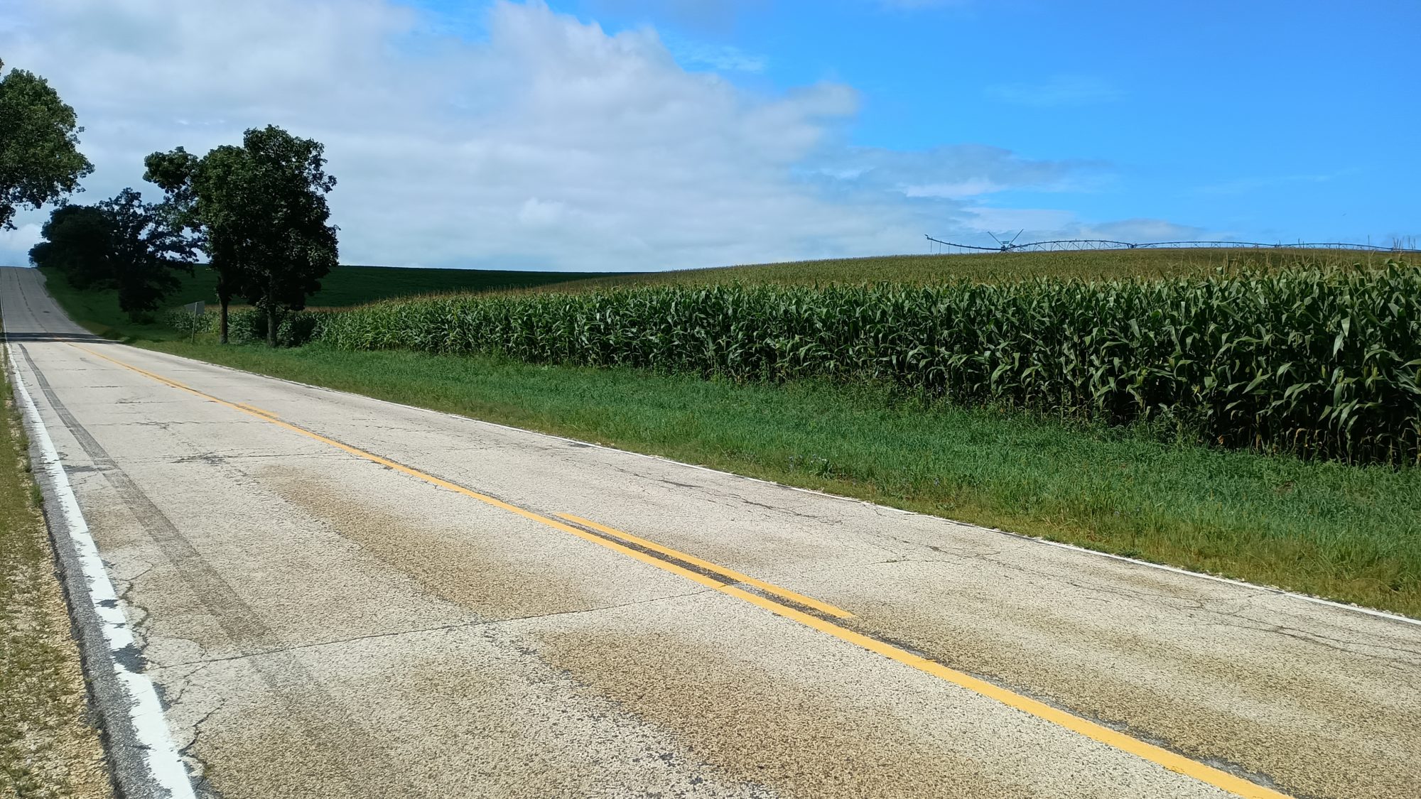
After another half a mile over some Meadows it’s back to road walking. This time I am going to veer pretty far off the suggested path. This suggested path goes North then East over North-South and East-West roads. The route I am taking goes diagonally straight into town but will have more traffic.
I have already walked this particular road for a mile or so and it was not too bad of a walk. There’s a car about every 60 seconds and there is not much of a shoulder but I can step off when I need to. The bad part is I am committed to the full 9 miles. If it doesn’t work out there’s no way I can turn around or cut off towards the suggested route.
It is also getting quite warm by now at least in the upper 80s. My umbrella helps but if there’s no breeze it is still hot. If there is a breeze then it is bearable. The next 3 days are supposed to be even hotter.
I take a break under some trees to rest and drink my coffee. After a 30-minute rest I have a lot more energy now. The combination of rest plus coffee is amazing. I have about six more miles into town.
The afternoon goes by uneventfully. As I approach town there seem to be more stores than the guidebook indicates. The guide book really undersells some of these towns.
This is the smallest turtle I’ve ever seen in my life. He made it across the road safely, too.
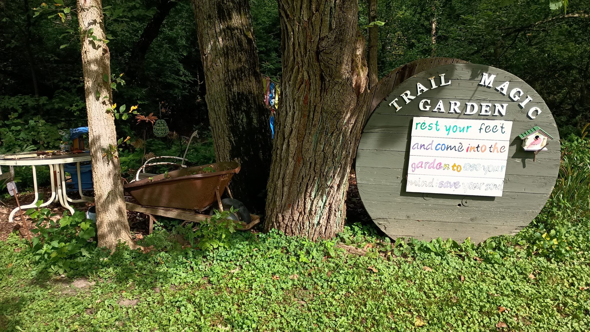
My first target is Rendezvous Paddle and Sports. It is a restaurant that also brews their own beer. I have one of their IPAs which is only the second beer of this trip. It was quite delicious and paired well with the hamburger and fries. The staff there recognized that I am an IAT hiker and wish me well.
My second target is a campground. There are two to choose from. The first one does not answer the phone, but the second one does. Winner. It is a mile and a half down the road. It takes me 30 minutes to get there.
They have two tent sites and I take the one that has a nice tree to pitch my tent under to keep the dew off of it overnight. They have a pretty well stocked camp store, so I buy things for breakfast. Next up is the showers.
Tomorrow is going to be all road walking so I will have to plan my water very carefully. Plain old woods are easier to hike in than roads.
Emotion of the day, Boredom
There wasn’t much excitement today. It started with road walking and ended with road walking. The park in the restaurant or the only highlights.
The park was a little bit of a let down. John Muir is a pretty famous guy. I’ve seen his Redwoods Park and I’ve seen his Trail in California. Those are Grand features. This park was just a trail around the lake. I guess I was hoping for more educational materials on his life and activities. Or at least to be able to see this childhood home.
The restaurant and beer were good though. And this campground is pretty nice. I sat in their air conditioning for an hour after my shower doing my blogs. But now as I sit in my tent it is warm and muggy.
Tomorrow is supposed to be hot but the day after even hotter. I think much worse days are about to come. So I guess a little boredom isn’t so bad after all. Stay tuned for misery.
I woke up early and got about 90% packed before before the breakfast opened at 6:30. I don’t have a super long day today so I don’t need to rush but I still have to get an Uber ride back to the trailhead. I don’t end up making it on to Trail until about 8:15. I wanted to use Lyft but they couldn’t find any drivers within 5 minutes so I switched to Uber and they had one 10 minutes away.
This trip is partially an experiment I’m conducting to compare Lyft and Uber. So far there are no surprises. Uber is more reliable and more expensive. Lyft is just fine, they just don’t have as many drivers.
The trail wanders through the campgrounds for at least a mile if not two. It takes me by the camp store so I stop in to buy a Coca-Cola for my afternoon caffeine. Hey, why not? After all, I’m carrying a Marie Callender’s microwave meal for lunch.
There is a little bit of elevation to the trail but it’s not steep. It feels like the PCT, but looks like the AT. The weather is still pretty cool so it is very pleasant hiking. This section of Trail is supposed to last about 8 miles.
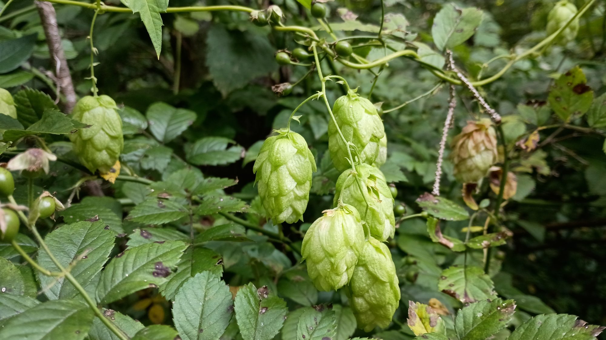
I am delighted to find a wild hop vine growing right next to the trail. I pick one of the cones and it is almost mature. It has a fairly heavy amount of yellow lupulin within the petals. I tear one open and smell it and it has a wonderful aroma of a piney / citrusy hop like maybe a Cascade. I pick another one and put it in my camera bag so that I can smell it for the rest of the hike. Or at least until it stops smelling.
The trail ends at a parking area with about 20 cars in it. I did not see a single hiker leading down to the parking lot so there must be many trails leading away from here. I am done with trails for the day. I have 19 miles of road walking ahead of me.
The first half mile is flat, but the road turns up a steep slope for a solid 3 miles of climbing. It is still cool and there is a decent amount of shade on the road so it is not unpleasant hiking other than the huffing and puffing. I do need my umbrella for sections of Sunny road because it is warming up.
For the first 3 miles of the road walk I will be following the suggested route. But after that I will fear more Northeast where the suggested route keeps going north. My route is about 3 miles shorter but also has a least three miles on a busier highway. I am hoping it turns out to be in my favorite or at least an even trade.
Around 12:30, I pass a wooded area that doesn’t have any No Trespassing signs, and has a wonderful rock to sit on. This looks like a wonderful place to stop for lunch.
The chicken alfredo pasta survived the trip up the hill. It is still a little bit cool. I wonder if I should have actually microwaved it before I left. I might try that next time because I have a feeling I’m going to be doing this again. Even cold it tastes pretty good. But it is not evenly mixed in the container so I have to use my spoon to get a little bit of sauce and a little bit of noodles and a little bit of vegetables in each bite.
I also have a Milo’s lemonade that I sit on during lunch. The Rock in the shade and the almost real food makes a pleasant little 10 minute break.
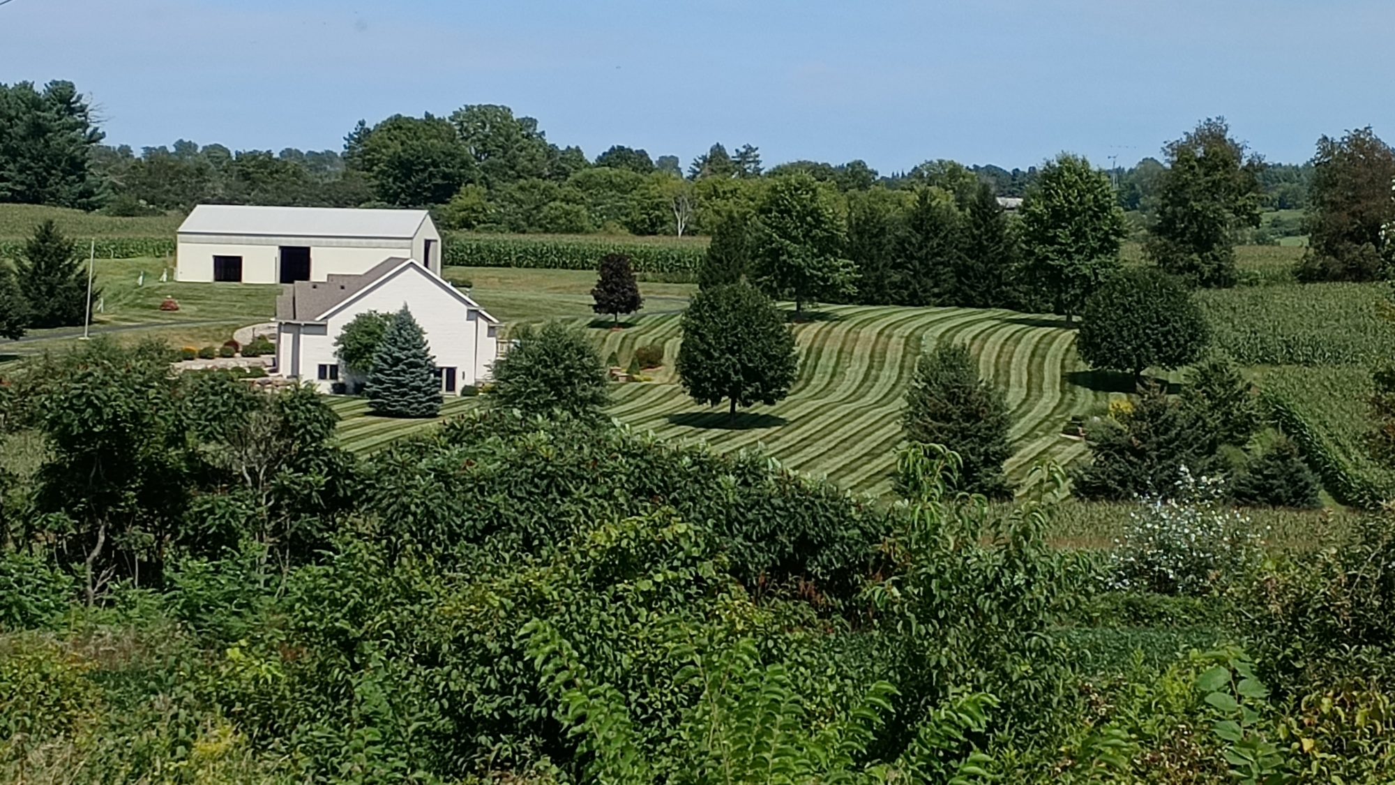
This guy’s wins the mowing award of Columbia county, Wisconsin.
The roads on the route I have selected are very desolate. I am starting to figure out that if there is no paint on the asphalt then they’re probably is not much traffic. Every time I come to a road with painted lines the traffic increases. And as the shoulder width increases so does the traffic. I might be able to use this with satellite view to scout out roads in the future.
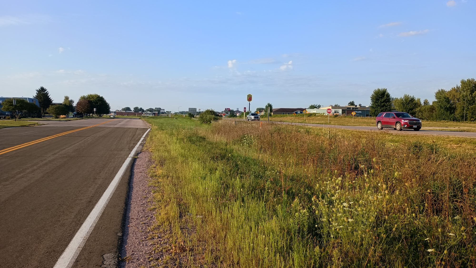
When my small roads end and the large road begins, I still have nine miles to my final destination. The large road is about what I expected. There is a car every 30 to 60 seconds sometimes more. But there is 3 ft of paved shoulder and about 6 to 8 ft of rock shoulder. So even though there is a lot of annoying and loud traffic, the walking is actually pretty good and pretty safe.
The only exception around Bridges when I have about 5 ft for me between the barrier and the white stripe. The bridges are short no more than 40 yards. But there are two interstate overpasses that are a good 200 yards and above a rush of traffic below. When you can see heavy traffic below and heavy traffic right next to you, it almost gives you a vertigo like feeling. It was really unnerving. But luckily lasted only one to two minutes each time.
There is a BP gas station at the first interstate over change, so I stop and get my obligatory ice cream. I should have gotten a Gatorade too, because my water is really hot. I have plenty, it’s just not pleasant to drink. It’s supposed to be 15° warmer over the next week so this might end up being a common theme. I wish I had not sent my oolong tea back home, because it makes drinking warm water quite pleasant. Hopefully this will be the end of the heat waves.
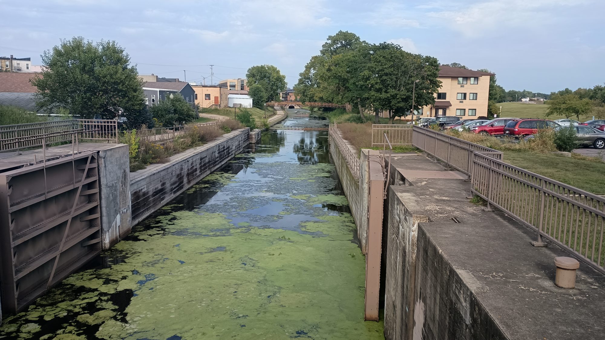
When I get to the bridge that crosses the Wisconsin River I am now on official trail again. It starts down a residential street a block away from the river. After a half a mile or so it goes behind the houses onto a trail along the canal. I followed the trail to the end of the canal then I can backtrack up to the street and start heading my direction northward towards the hotel.
I think I have about three or four miles to the hotel from here. I was originally planning on eating somewhere downtown before heading to the north side of town, but I’m just not that hungry so I keep walking. There are nice sidewalks the whole way so it’s easy walking even though there is a decent amount of traffic on the roads.
Less than a mile from the hotel I passed by a Jimmy John’s. A good deli sandwich would make an excellent dinner tonight. It would also make probably the cheapest dinner I’ve had on this trip so far.$11 later I have a sandwich and a bag of chips in my pack. I drank four or five cups of ice water in the time it took them to make my sandwich. Cold water is wonderful.
I keep hiking towards the hotel and see the Aldi grocery store that is across the street. This is where I was planning on buying my resupply. But I also noticed there’s a super Walmart on the left side which is the same side as the hotel. I think the Walmart will be easier to get to so this is where I will resupply.
After checking in and taking a shower I take some mental notes about the number of meals I will need for the next 4 days while taking into account the number of restaurants I will be able to stop and eat at along the way. I really don’t need that much food but I’m sure that once I get in the Walmart I will buy too much anyway.
I didn’t do too bad in the shopping department today. I did double up on sweet things – buying both snack cakes and cookies when I really only needed to buy one. I justified the double purchase saying to myself that the snack cakes were for dessert tonight and then I was only carrying the extras. Lying to yourself is so easy.
Emotion of the day, Comfort
While the day did drag on until 7:30, it was not a stressful day. Not even during the 5 mi of the busy highway. The first 8 Miles on the trail was very cool and relaxing. I could have hiked this in autopilot mode for weeks.
The first part of my road walk was on very desolate roads, and even gave me an opportunity to relax in the shade on the steps of a small Church. I don’t think I saw more than 25 cars that entire section.
And the wide shoulders on the busy highway didn’t add any stress to that section even though it was noisy and obnoxious. And I think I finally found my Wisconsin rednecks. Four or five cars honked at me as they drove by. I assume they were not pleased with me hiking along the road. But who knows. At least no one screamed out a window “get a job” or something like that.
And the only stress of shopping in a Walmart is making sure you don’t buy too much. I did also buy one more Mountain House dehydrated meal for this next section. I am really glad to know that Walmart carries them regularly.
Knowing that I would get a shower again tonight and be able to eat anything I wanted was very comforting.
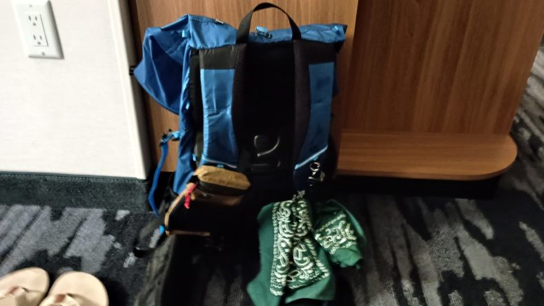
Oh, I almost forgot the most important part of the day. My pack no longer stinks like stinky man-dog piss! That is immensely comforting. When the temperature gets into the mid-90s in a few days, that is going to be extremely important.
Chores, chores, chores. People think hiking is all fun and games. But there is a large amount of work that goes on in between hiking.
I went to the super Walmart next door after breakfast to get cleaning supplies and an extra t-shirt. I thought I had thrown away my camp towel at the last hotel, but after cleaning my pack I found it stashed away in a pocket where it shouldn’t have been. That’s one less thing to buy at Walmart.
Well in the camping section I discovered that Walmart sells dehydrated backpacking meals. This is a wonderful surprise. So I go ahead and buy one for the next week. I also pick up some food for lunch since there are not many restaurants near the hotel.
The first order of business is cleaning. I completely empty everything out of the pack and begin washing it in the sink with a combination of shampoo and body wash. After I rinse it gets another cleaning with just body wash. Then it gets another rinse and a thorough dousing with an odor block. Then it gets another rinse and another application of odor block. I leave it hanging upside down from the shower head in the shower to drip dry for an hour.
I then snag a towel from the gym and take my tent outside in the grass to clean it as well as I can. After that I clean the inside of the tent and get all the dead mosquitoes out of the roof with a washcloth. It gets a light dusting of the odor block and then hung up in the room to dry.
In the meantime I have two days of blogs to catch up on and post pictures of. I also eat the wonderful frozen items I bought from Walmart for lunch. A can of spaghetti for a buck – you can’t beat that. Roll back those food standards while you roll back the savings. I managed to get all the laundry done at the same time. Multitasking for the win.
The next order of business is the hardest of all. I haven’t really planned out the second half of the trip with regards to food resupply and especially camping for the next week. I managed to break down the longest food carries to 4 days by adding another town stop which will require an Uber ride. 4 days of food weighs far less than 6 days of food.
When it’s finally time for dinner I go ahead to the place next door called the Pizza Ranch. I didn’t realize it was basically a pizza buffet with a hot bar and salad bar. I should have gone before 4:00 because it would have only been $10 at that time. It was actually a lot better than I was expecting. Mid westerners have the deep dish crust down pat, but they still don’t understand the concept of thin crust. It’s supposed to be a crust not a cracker.
Back at the hotel, I’m still writing out plans until after 8:30. I have been doing chores non-stop from 6:30 to 8:30. That’s 14 hours of chores. That’s longer than a full day of hiking.
Emotion of the day, Happiness
It took multiple cleanings and rinsings but I think I have all of the dogs stink out of the pack. I could still get a faint smell from the phone sleeve so I gave that an extra dose of the odor block.
I have the next 5 days planned out in detail and the following week in a rough draft.
Walmart had everything I need plus the bonus dehydrated dinner. As far as objectives and completions, everything is checked off. That makes me very happy.
The campsite in the woods kept the tent nice and dry in the morning, but the bottom side is always moist and picks up a lot of dirt from these tent pads. I would much rather have the bottom dirty and the top dry. The dead things stuck to the tent still smell pretty bad though.
I am up and out by 6:15 and the trail quickly turns into meadow walking. The grass has been cut recently but the weeds from the side overlap the trail and get me pretty wet pretty quickly. The shoes are soaked within 15 minutes.
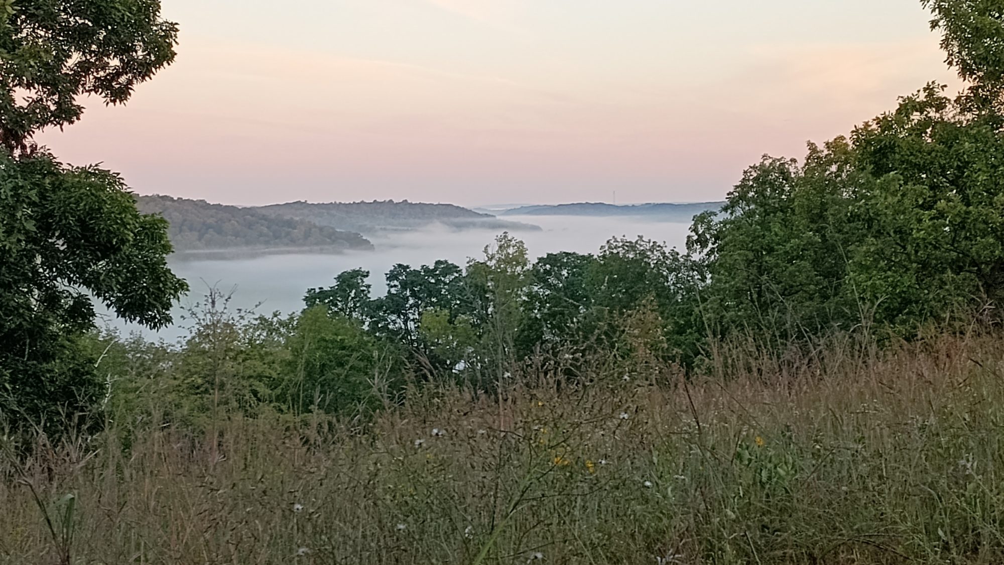
The sun is just starting to rise and making interesting patterns of sunlight filtering through the trees into the fog. When I first emerged from the campsite I could see that the town was under cast. Thick fog blanketed the town but just above that layer it was crystal clear.
I ate a small breakfast this morning because I am only 3 mi from the next town of Lodi. As I enter town there is a diner which I’m planning to stop at. I am there in less than an hour eating a breakfast skillet with hash browns and corned beef hash. I stopped by a gas station next to pick up some Gatorade and M&M’s for the road walk today.
The trail doesn’t take a crazy route through town this time, but it does do something unusual that caught me off guard. I thought I was on a trail that was taking us out of town, but it turns out it’s just an out and back trail to the high school. I was confused when the trail ended but then I remembered this was another skinny lollipop trail.
At least I didn’t have to force myself to hike it. The first half was a really nice hike through some woods not far from houses, and the second half was mostly a meadow walk to the high school.
After making it back to the park where the lollipop trail started, it is down to real road walking again. It starts out as houses, then moves to light industrial, then it is rural again. It is only a few miles to the first trail section.
On this Trail section I run into a volunteer who is weed whacking the trail. We stopped and talked for 5 or 10 minutes and then we both moved on. The trail dropped me out on to another road where I resume road walking.
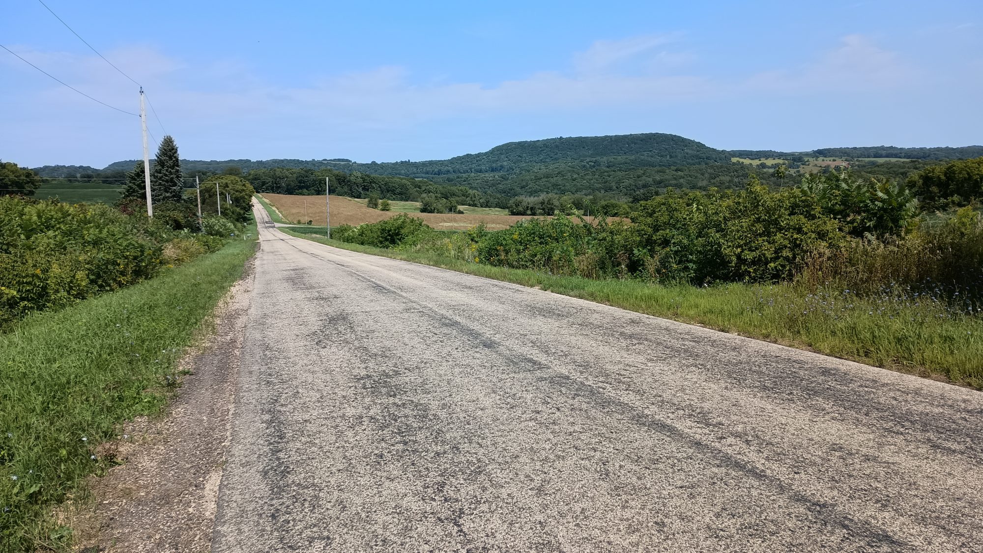
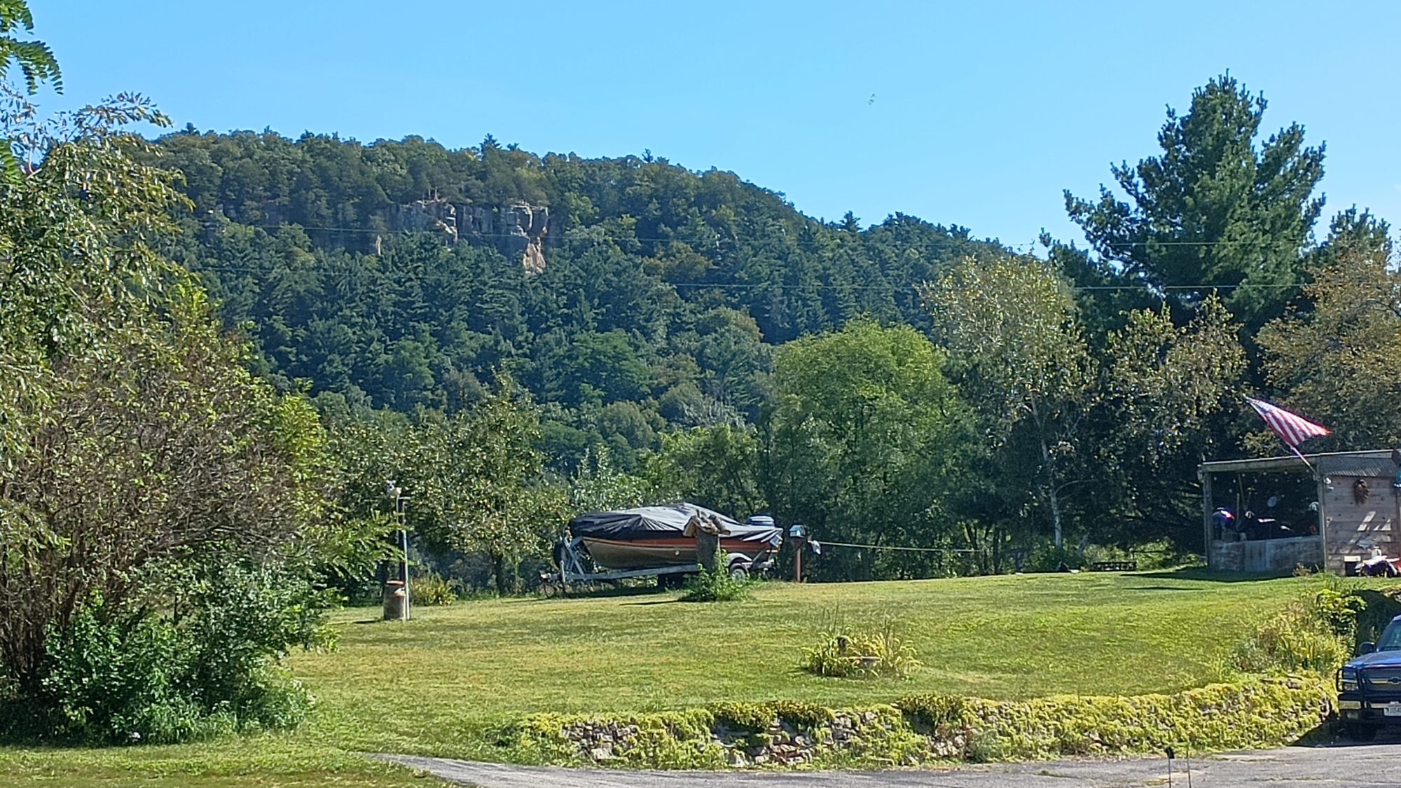
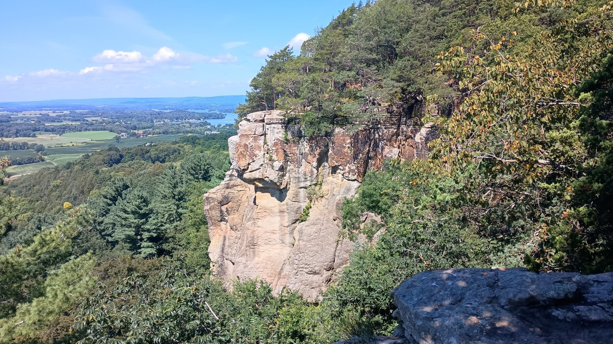
As I wander down one country road, I can see a Ridgeline to my right with some rock outcroppings. If this was the Appalachian Trail, I would be certain that the trail would be heading in that direction. After a quick look at the map zoomed out a little bit I realized that is indeed where I am headed.
When I get to the trail section there was a parking lot with several cars in it. I could hear voices from The cliffs as I pass below it so I imagine I am going to pass all of these people coming down as I am going up.
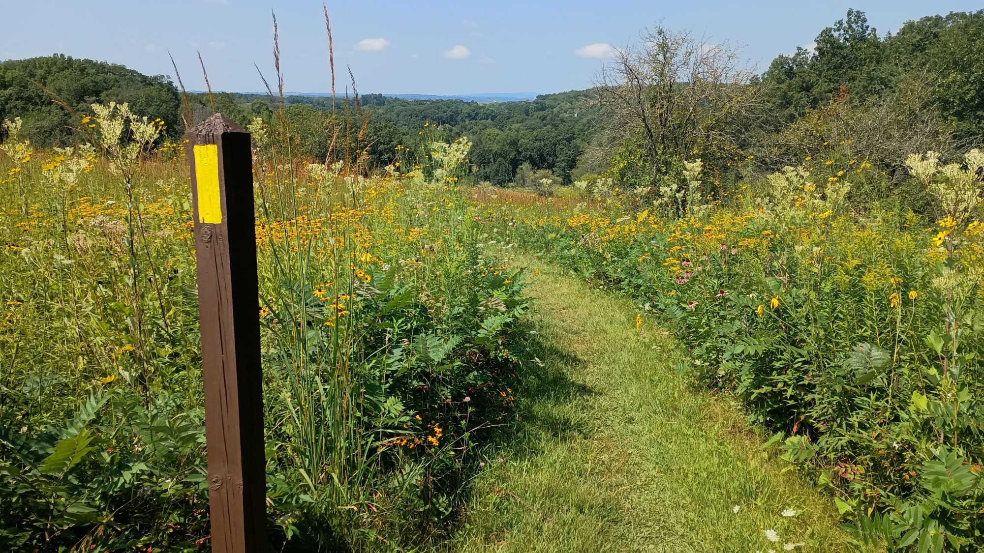
The climb is very gentle and changes between woods and Meadows all the way to the top. There are four or five places where you can cut out from the trail to the rocks and look at the valley below. I take a small break to drink some water and have a snack. It is still pretty early in the day. It is not even noon yet.
I hit another parking lot on the other side. So it is back to road walking for me again. The next excitement is passing a section of road that is being resurfaced. As I walk along it, I can see that they have been working on it, but there is no one doing anything today.
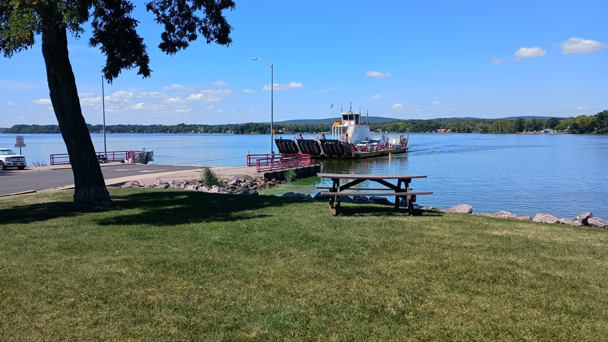
By 1:00 I make it down to the Merrimac ferry. There are bathrooms with a water fountain and an ice cream shop on the south side of the ferry. I partake of all three facilities. Just as I am finishing my ice cream the very arrives in the begin loading cars. I hustle up and walk on to the ferry with about 10 other pedestrians and maybe 10 cars.
The ferry ride is 7 minutes long and very peaceful. With all the barricades and bridges for the walkways in the up position you can’t really see anything so it’s a little boring. But once on the other side there is the same bathroom water and ice cream stand. It is now after 1:00 so I eat my lunch and then buy some popcorn and more ice cream. I don’t begin resuming my road walk until 2:00 p.m.. It was a nice fun break.
The road walk this time is only a few miles and enters another trail section that is again a mix of woods and meadows. Except for the Rocky outcrops all of the trails today are exactly like this. I estimate that I should make it to the park headquarters by 7:00 p.m. based on my current rate and distance.
It is about 5:00 p.m. by the time I hit the parks South entrance. From here I begin climbing a mountain that I know is going to have another set of Rock outcroppings. I can see them off in the distance but I can’t see the ones that I will hike after this set. I know that through the park I will go up over a mountain down to the lake and then up over another mountain to the headquarters.
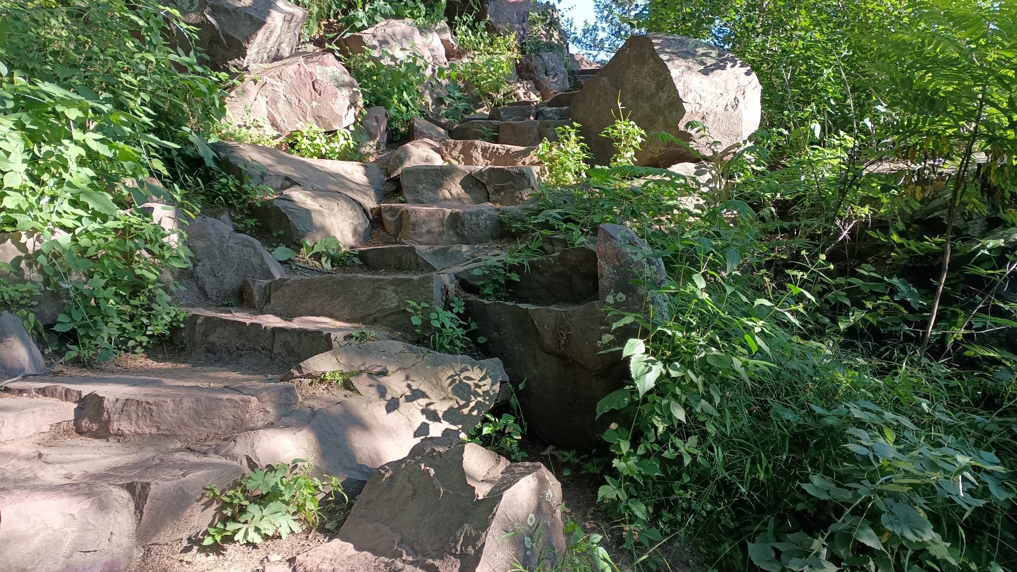
The climb up is not bad and I don’t really slow my Pace at all. As it gets near the top of the trail actually becomes paved asphalt as it nears the rock outcroppings. On this mountain there are about 20 places you can peek out and see the view below. And as I look at a few of them I can see there are some mortared rocks. This must be the work of the Civilian Conservation Corps in the 1930s.
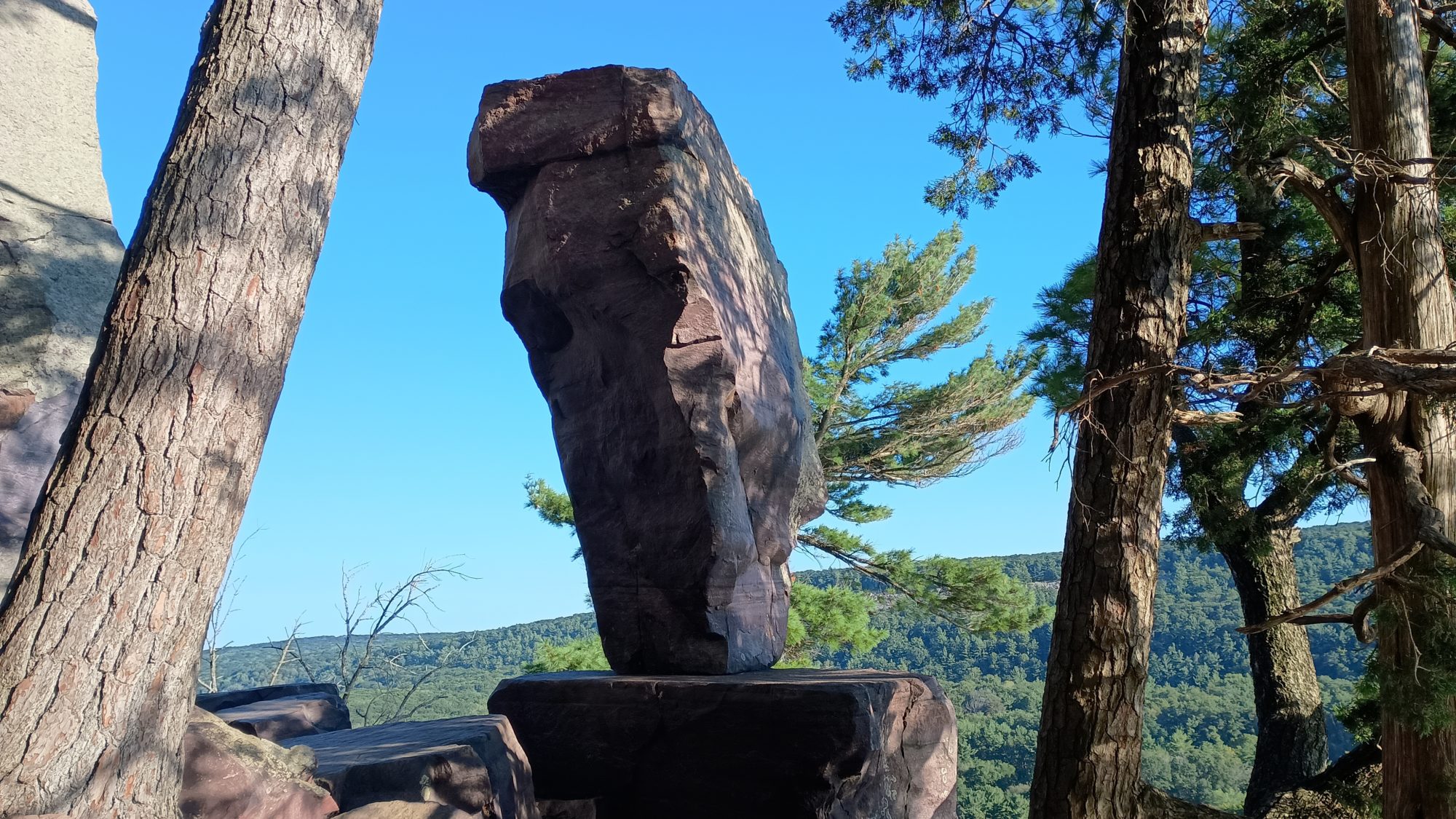
Balanced Rock is the last landmark before going down to the lake. The trail is very Rocky now and hard to follow with twists and turns all over the place. There are signs pointing towards balanced Rock but they are hard to follow sometimes. Whenever I am unsure which direction to go next I just look for mortar around the rocks.
Once I get to balanced Rock it is a little bit of a letdown. I was expecting it to be much larger. It looks about 10 or 12 ft tall but balances on a base that is barely over a foot wide. More impressive than the rock is the rock work that is the trail. This is some of the steepest trail I have ever been on including the Appalachian Trail. Without all the rock work it would be nearly impossible for most people to scale up or down.
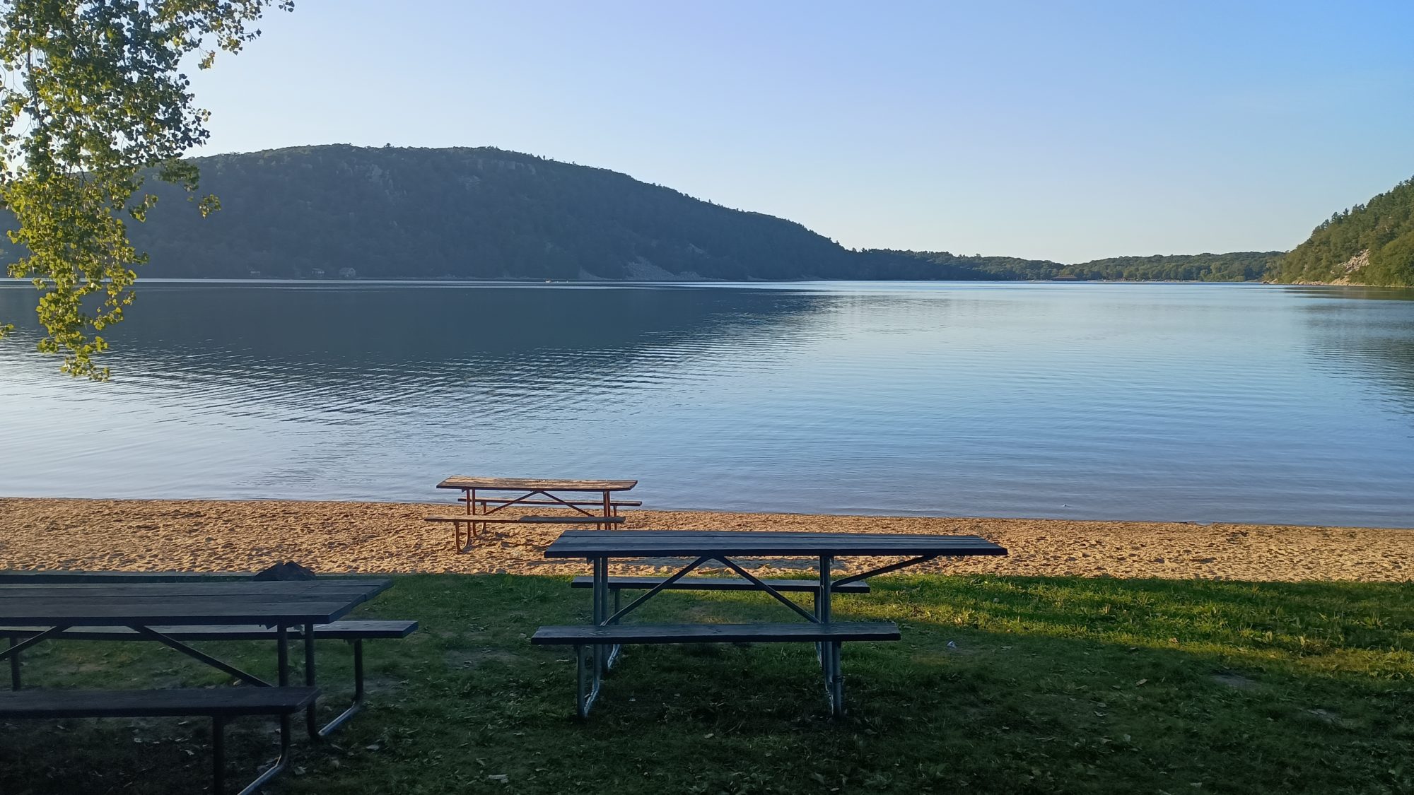
Once I make it down to the lake I had for the vending machine to grab a soda. Even though I have already had my caffeine and I would not normally drink caffeine this late I know I have one more big climb and will need the energy. The machine is out of every single item except for diet Pepsi, so a diet Pepsi is.
The climb on the other side of the lake isn’t nearly as steep as what I just came down. But it is still very slow going and I don’t reach the headquarters till after 7:30. I have already booked a room for two nights in a town only about four or five miles away but it is too far to walk before dark. My plan is to walk the exit road of the park to a business where I can catch an Uber as long as I have cell signal.
I have a very faint cell signal at the exit of the park but I am able to use the Uber app even though it is very very slow. I am able to get a car and he shows up in 10 minutes. It is well after 8:00 by the time I get to the hotel. I get quarters and soap for the laundry but for tonight it is nothing but shower and bed immediately. I don’t even bother to go out to eat. I just make some Ramen in the microwave and go to bed.
Emotion of the day, Surprise
Today was a day of surprises. The mix of road walking and trails all day was well balanced. I am used to the road walking being the dominant portion. So that was a nice surprise.
Having not one but three ridges to climb with rock outcroppings in good views was also a surprise. I expected at least one in the State Park but the first one was a bonus.
I was also surprised at how steep the trail down from the East ridge in the Park West. I was also surprised that the entire ridge was composed of pink quartzite. These rocks are pretty slippery, and if it was raining this would be downright treacherous. The texture of the rock is about like marble. But there is not a grainy structure like granite has to grip your shoes. Thank goodness it is sunny and dry today.
There were just a few drops of rain last night, but this morning the tent is dry as a bone. The tent is a little dirty on the bottom because I had to set it up on dirt, but it is nice having it dry for a change. I am able to get up and out by 6:20.
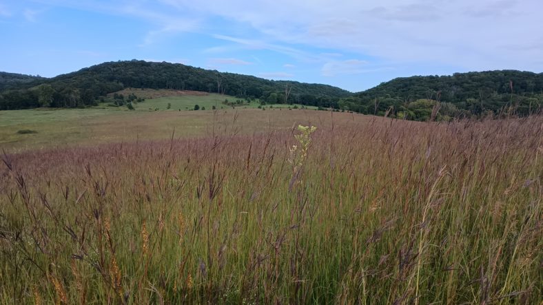
Much if the morning is walking in dewey meadows again. But the grass is well trimmed and my feet are not getting too soaked. One stretch has a lot of weeds to the side but my umbrella can push them away without getting me too wet.
Most of the day is going to be road walks between four and six miles that lead from trail section to trail section. Most of the trail sections are less than 2 miles long.
But the first road walk leads me back into the same town I left last night. I will be within about 5 blocks of the IAT headquarters again. Are you actually okay with that today because I need to refill my water bottles. Luckily I find one only two blocks in that direction that I can refill from.
Back to road walking again. My feet are damp but not too wet. I have about 3 mi to the 1st trail section. This section is referred to as the lollipop because you hike out a trail, do a loop, then return on the same trail back to the exact spot you started at from the road.
I get the bright idea to do this as a slack pack. I go in the trail only about a 10th of a mile and then stash my pack in the meadow. I then lock the mail and a half loop without my pack. I carry only my phone in my wallet. Those two items never leave my side.
Walking the loop without a pack is a real treat. It hardly feels like working at all and goes much quicker. When I return to my pack I head to the parking lot but I find a bench to rest on and have a little snack.
The next road walk is about 4 mi to another park. This time we enter one end of the park and then exit about a half a mile at the road. I am tired by the time I get to the park so I go ahead and eat lunch even though it’s not quite noon yet.
This is where the pissed off part comes. I have my pack leaning against one of the posts and I am a few feet away with my shoes off putting some butter on a tortilla. A guy drives in and lets out his dogs. I hear him yelling at one and the other one comes over and sniffs me in the face. He is a cute German short haired pointer and he has a ball in his mouth.
He takes his dogs and heads out to the dog park. I finished my mini lunch and start packing up. I go to check my phone and notice that it is slightly wet. Then the worst realization comes over me. That jackass let his dog pee on my pack and didn’t even bother to tell me about it. That’s the pissed on in the pissed off within a span of about 3 minutes.
The dog has peed on my right strap where I keep my phone and did a pretty good number on it. I try to rinse it off with some water but I don’t have much left. I have to hike to the other side of the park to get water. So I don my dog pee smelling pack and begin hiking.
It takes about 30 minutes to get to the other side and it is a well-stocked facility. They have flush toilets and an outdoor fountain and bottle filling station. I fill my bottles and dry and wash the strap a little better. It’s totally soaking wet but it’s really hard to rinse a foam strap with all the crazy webbing on it. I wonder how long it’s going to take for this smell to get out.
The next road walk is a pretty long one – over five miles. And the whole time I am steaming mad. Why didn’t the guy have the decency tell me what his dog did. I was sitting 5 feet away.
The next park section is another out and back returning to nearly the same spot. I am still pissed off and think about skipping this section. But I have plenty of time to still get to my campsite so I might as well do the slack pack thing again.
I am so glad I went ahead and did this loop. It goes by an old homestead that had an apple orchard all around it. I am surrounded by dozens of apple trees and they are of many different varieties. Every time I see an apple that looks different I go ahead and try one. Some of them were mediocre but several of them were really outstandingly delicious.
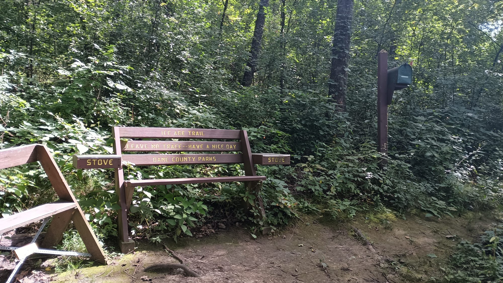
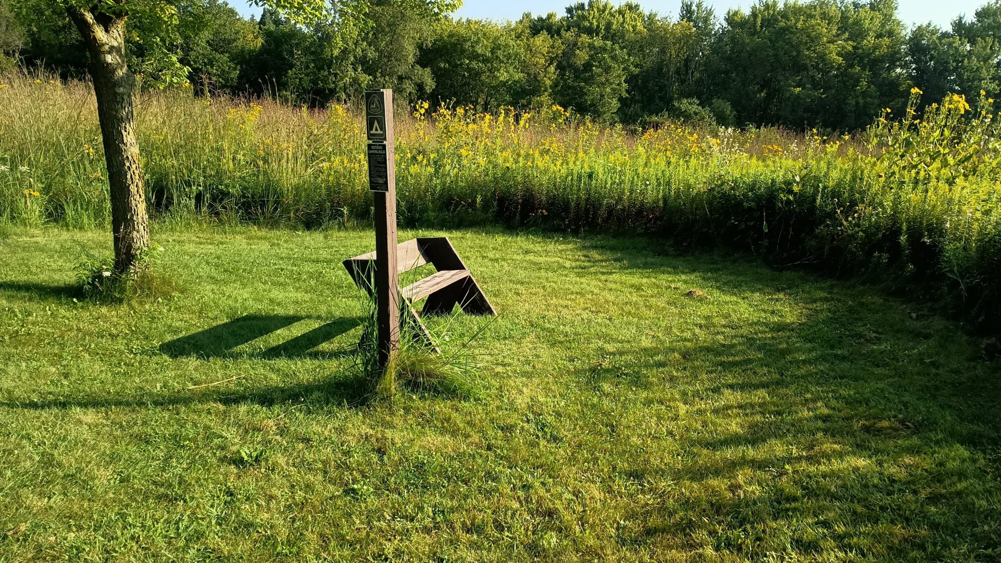
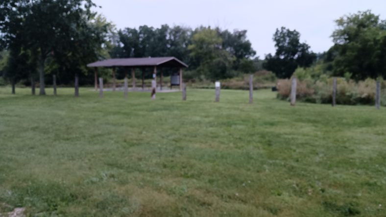
The other highlight of this little section is another DCA camping spot. It actually has a trail register in it so I go ahead and sign it. It also has an interesting bench arrangement for cooking food with stoves. It’s like a his and hers kitchen.
It is back to more road walking to the next section, so I drink the Starbucks coffee I packed out yesterday. this should feel me for the next few hours.
The next trail section is another out and back that returns to almost the same place and is almost 2 miles. I still have plenty of time so I go ahead and do the full loop. I have been able to keep to the task of hiking every trail mile despite my foul mood.
It goes out along a meadow to the end of a ridge line. At the end of the ridge it climbs to the top and then returns on the top of the ridge. The views are nice but the behavior of the dog owner is still consuming me. After all, I have a constant reminder entering my nose.
One bonus to this section is two houses that have set up water stations. One house just had a small Ice Age Trail sign with a gallon of water sitting in front of it. The other one had a sign out by the road pointing to a garden area they have set up with chairs and a cooler full of water. I stopped at the second one and had a drink of water.
The last section for the day is to hike 1.6 miles up to the DCA campsite. This will make for a 28 plus mile-day and I will get to the camp site by about 6:30. I took several breaks today so this is good timing.
Tomorrow should be a much better day. I will get to eat breakfast in a town just 3 mi away. And then I get to ride the Merrimac ferry. Then I end up at a campsite when I will decide if I want to camp or try to Uber into town for a hotel. It all depends on how my mood goes tomorrow.
Emotion of the day, Pissed off
If not for that dog in his owner, today would have been a perfect day. That happened a little after 11:00 and really did sour the entire afternoon.
The guy could have at least said something. Hey my dog just peed on your backstrap you might want to wash it before you put it on. Not a word.
And even though all of the out and back trail sections were annoying, they were all nice sections of trail. I really enjoyed the apple fiesta because it came at the perfect time of day when I was getting a little hot and thirsty. I think I ate 7 or 8 apples. An apples have a lot of fluid and sugar in them. Nature’s Gatorade.
Today is a busy day. I spent all of my time yesterday catching up on blogging and doing laundry but I still have one more day to post. I get the last day posted and then head down to breakfast at about 6:45. Too sad little biscuits some chocolate milk and a banana are on the menu for I grab another banana for the morning walk.
It takes a while to get everything packed and ready to go. I decide to use Uber today instead of Lyft to compare their prices. As expected Uber is about $5 more but the driver arrives pretty quickly.
By the time I get back to the grocery store and on the trail it is about 8:20 in the morning. It’s about the same schedule as earlier in the hike so it should be a casual day.
I have two targets for the day. The first Target is the headquarters of the Ice Age Trail in Cross Plains. The second target is the distributed campsite just a few miles outside of town.
I am also curious to see the distributed campsite that is in the Town of Verona only about a quarter of a mile from the grocery store.
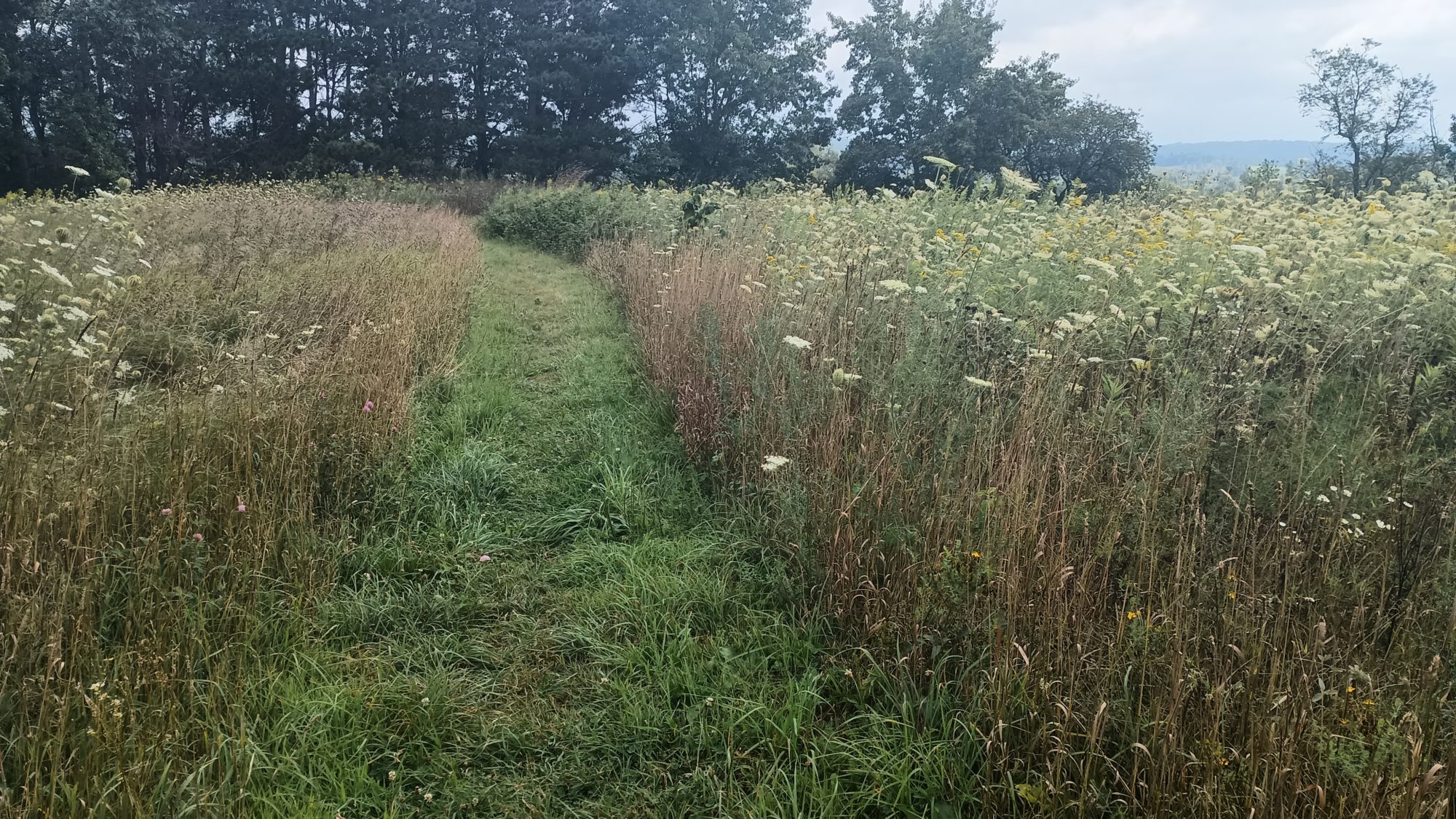
I am hoping for mostly bike trails this morning but it turns out to be mostly Meadows. The Meadows have been mode recently so the grass isn’t really high but it is totally saturated with dew. My feet aren’t getting soaked but they’re definitely not dry.
When I get to the distributed campsite it’s a bit of a joke. It literally is just a little wider margin around the post where they’ve mowed the meadow back a few extra feet. If I had pitched my tent here my guy line would have been staked in the middle of the trail with the back of my tent all the way against the meadow. About four or five more feet of mowing would make the site usable for up to four tents. I am guessing this site rarely gets used.
There are small sections of bike trail in between the meadows. They are more like connector sections to the meadows. I take a quick break on a bench to eat my banana and drink some water.
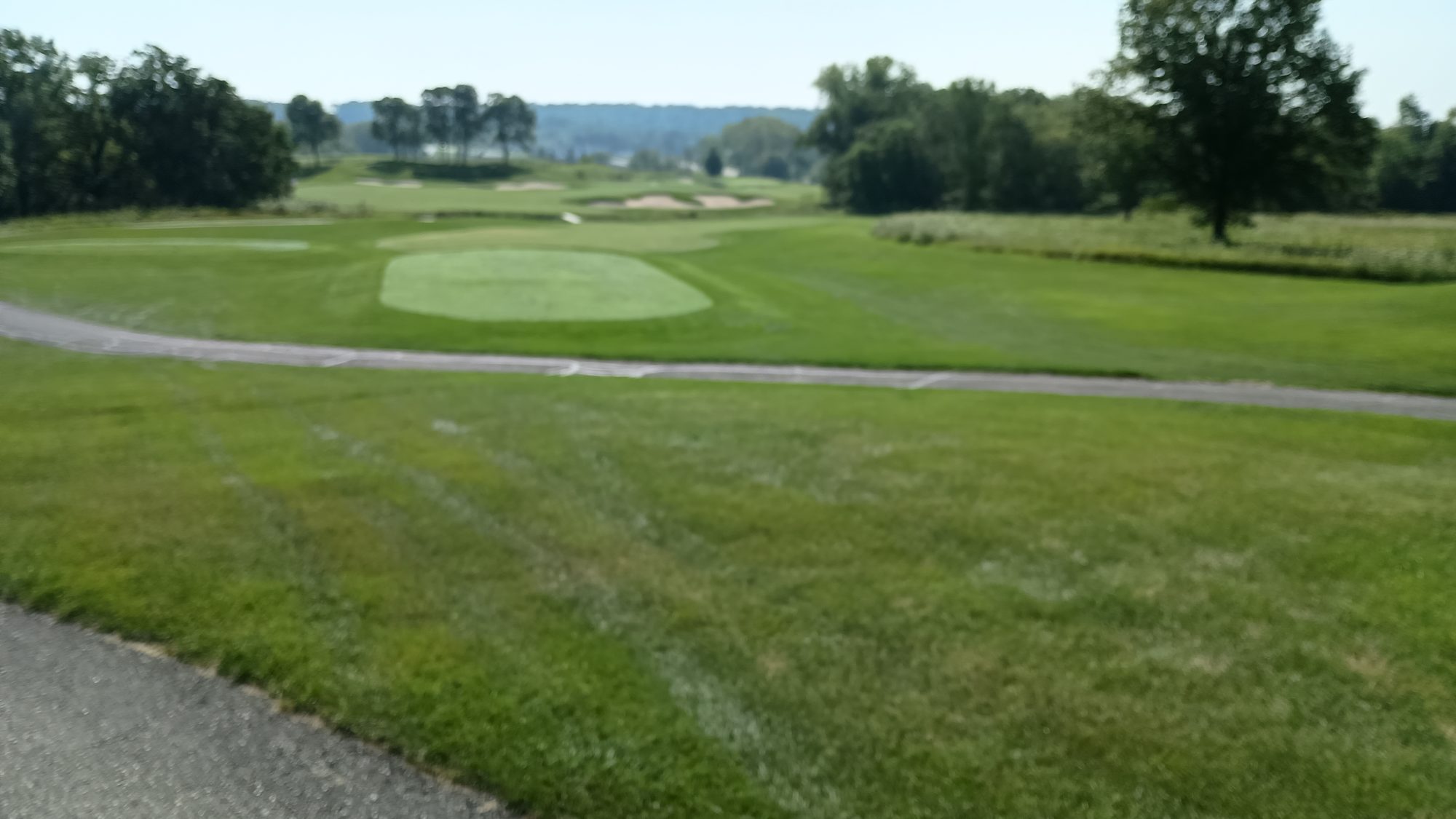
After a few miles the meadow turns towards the Wisconsin Badgers golf course. It must follow the golf course for over 2 miles. I have a very slight headache so I stop by the clubhouse and grab a soda to see if I can knock it out with caffeine. Well, caffeine and sugar. I down the Pepsi within about 2 minutes.
For the next few hours I definitely had more energy. But the headache is still lingering in the background.
There are one and two mile road walking sections to link up different meadows and wooded areas. I find some apple trees along the way so I ate two or three apples while I walk.
I decided to stop for lunch at about 1:00 in a wooded section just as it emerges into a meadow. I take my shoes off and let my feet hang out in the sun to dry while my body stays in the shade. As I am eating the sun is creeping up my legs so it is my built-in timer to let me know when it is time to go.
It is 1:30 when I get up to leave for lunch. I have seven and a half miles to the headquarters and that should get me there at exactly 4:00 p.m. which is perfect because they stay open until 5:00.
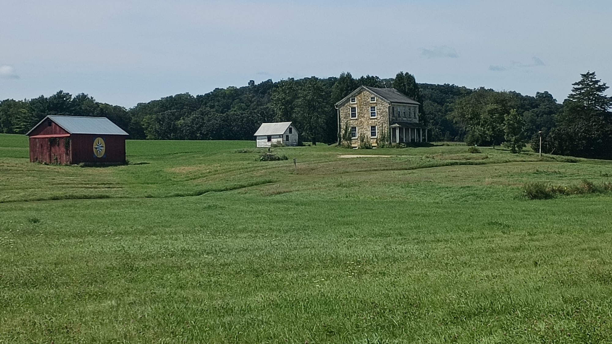
The rest of the afternoon is uneventful. Instead of stopping to make hot coffee I just pour my coffee and sugar into the remainder of my water bottle at 2:30. I do this well still moving on a road walk. It goes by 198 acre farm that is for sale. Anyone interested? It has a really cool looking stone house.
Just about a half a mile before hitting the headquarters the trail crosses some train tracks. I can hear a train in the distance so I make haste to get to the tracks before it arrives. I want to make it across the tracks in case it is a long and slow train. It turns out it was one engine and only two cars so I hurried for nothing. But I got some good video footage.
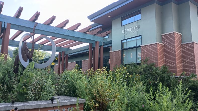
They have routed the trail literally right up to the front door of the headquarters. There is no way you could miss it. I go inside and chat with a few of them for nearly an hour.
It is fun sharing my perspective with them and hearing their perspective and reasoning behind some of the road walking routes. One thing I had not considered is that they own property that just doesn’t have trails on it yet. So when I show them on the map one of the alternate courses I did instead of their suggested course, they point out the plot of land they own adjacent to their route. In a few years time their route will make far more sense once you see the trail section.
After bidding them farewell, I had to the other end of town to grab something quick to eat for dinner from the gas station. A prepackaged burger and chicken sandwich it will be. I also get a Starbucks doubleshot for tomorrow afternoon and an ice cream for the walk back to the trail. The ice cream is long gone by the time I make it back to headquarters.
The trail leaves the north edge of town by walking down some neighborhood roads. I checked the map to see how far before we turn off onto a trail and I am surprised to see the dot is right on the trail. I look up to my right and see a sign in between two houses leading me up the hill. Talk about perfect timing.
It’s a little bit of a climb up the hill but not too bad. It should be about a mile and a half further to the campsite area. I am taking my time because I have plenty of daylight left and I’m not exactly hungry after the ice cream.
When I get to the distributed camp area it is one of the fanciest I have seen yet. They have a designated tent pad and three other areas designated for cooking, disposing of dish water, and hanging bear bags. The tent pad is just gravel but at least it’s flat.
I set up the tent and then walk over to the food prep area to eat my sandwiches. The mosquitoes are not horrible but they’re bad enough that I basically just walk around in circles while eating. The sandwiches are still warm so they’re not too bad. I doubt I will get these again in the future though. One of the ladies at the headquarters had given me some cherries so they end up being dessert.
Emotion of the day, excitement
While leaving the hotel was not exciting the rest of the morning and afternoon was. I was eager to see the DCA near the grocery store. It turns out that one was a disappointment. By the way, DCA is distributed camping area.
Walking along the golf course was really fun. It seems like the course went on forever and would never end. It looks like a really fun course to play, but I haven’t played golf in close to 30 years.
Normally meadow walking is not my favorite thing to do, especially in the morning when everything is wet. But these Meadows were groomed well enough that it was really quite exciting. The flowers right now are just huge. And it was rolling hills all day. It wasn’t exactly a Julie Andrews moment but it was close enough.
And then getting to the headquarters and being able to chat with them for such a long time was exciting for me. They said they only get about 30 people a year to stop in and talk. I know more people through hike it than that but maybe more people hike after hours or on weekends when the office is not open.
I’m glad they were open and I’m glad that I stopped in. It will give me different perspectives on the rest of the trail.
I wanted to make sure I started my routine before 5:00 so I could get up and moving and leave the snowmobile path as early as possible after sunrise. I was camped near a bridge and I could hear two bicycles pass by, one of them even before 5:00. I wonder if either of them saw me.
Since I am camping in grass, the tent is soaking wet. I have everything backed in the pack before I get out of it so that only the pack has to sit in the wet grass while I roll up the tent. There is no point in trying to keep things clean or dry I just have to roll up the soggy mess and put it in its stuff sack. It has a waterproof sack so it won’t get the rest of the things in the pack wet.
The ankle is stiff this morning and it takes at least 10 minutes for it to warm up. It helps to start out slow and just let the pace naturally improve. There is a tender spot on one of my toes that I will have to keep an eye on but it is not causing me any issues while hiking.
I was a little further from the road walk then I thought last night. I am 2 miles away from where the trail is closed and I have to take a detour of two miles around about one and a half miles of trail. The trail is closed because of an unsafe tunnel.
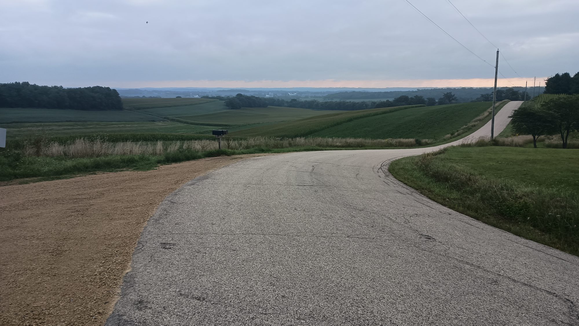
Comments in the guide suggest that the reroute is pleasant. And when I get to it I find that the comments are true. You can see several large farms and the rolling hillside of this area. The road turns four or five times and every time it does the scenery completely changes.
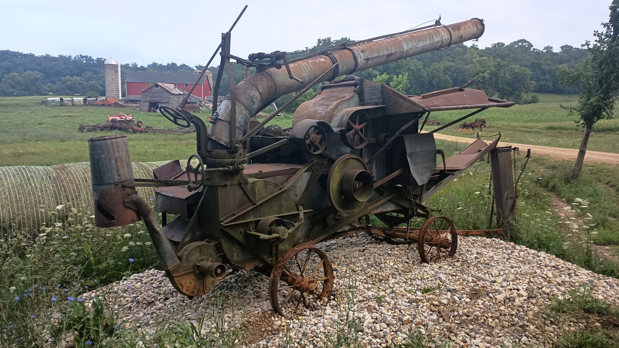
One of the last farms that I walk next to has a vast collection of older implements for their tractors. They have two of the oldest combines I have ever seen. You can tell that this thing was probably tricky to operate in its days there are little wheels and knobs to adjust nearly every aspect of its operation. Modern ones are far more automated.
The detour route finally makes its way back to the rail trail. But after only a mile or two it is time for road walking. They have us detour about 2 mi on a road to reach a section of about 6 mi of dedicated trail. Then it looks like about a mile of road walking to get back to the same rail trail I am on now. These 9 miles of Trail look like they replace four or five rail trail miles and bypass an entire town. I hope these 9 miles of trailer worth it.
One benefit to this longer section of Trail is that it passes by a county park with a hand pump and electric outlets. I am in need of water and can always charge my devices. I spend about 30 minutes there letting my battery charger do its thing. It is a pretty nice park.
There is still a little bit of road walking left to get to the trail section and it goes by quickly. When I get to the trail section it starts as a grassy hike through a meadow. It is late enough in the day that the grass is not really getting my feet wet. But The Meadows are all starting to look alike now.
I can tell from the map that there is going to be some elevation changes here. It looks like we will be hiking up and over eskers again. It also looks like it is hardwood forest so I am expecting mosquitoes.
The mosquitoes do come but so do the apple trees. I managed to find a really good size apple that has no worms in it and it is one of the sweeter ones that I have found on this trip. There are so many different kinds of berries on the trees around here but I have no idea what any of them are.
To my surprise, more of the trail is in Meadows than hardwoods as I was expecting around the hills. The elevation is not as steep as the map suggested either. It ends up being a really nice 6 Mile section of trails. I can see why the long detour to get here now. And I also end up seeing about a dozen day hikers on this Sunday morning.
By the time I make it back to the rail trail, it is 2:00. There is a bench at the intersection and I pause to think about making coffee but it is a little too early. I will just hike on to the next bench and make it at 2:30 or 3:00.
The problem with this plan is that no more benches appear on the entire length of this rail trail. There have been more benches on this trail than any trail I have ever seen but not on this particular rail trail. It is after 3:30 before I find the bench at the road intersection and can make my coffee. It is at least three miles of road walking to get to the trails leading into town and I need to make sure I have enough energy.
After my 30 minute coffee break, I am off. The road has no shoulder and has several hills but has very little traffic so it is not that big of a deal. But the last mile is on a very high speed road with a ton of traffic. I am basically walking in the ditch for the entire mile.
The trail section finally comes and it is more meadow walking. The weeds in this meadow are gigantic. They’re over 6 ft tall. I should have known because the name of the park is Moraine Meadow.
I am hot and worn out and decide to try and get a room as close to Verona as possible. All of the rooms in this town have been booked up for weeks but there are adjacent towns that have had vacancies. I end up getting a Fairfield Inn about 14 miles from where I will end up. I will have to Uber to the hotel.
As the trail approaches town, it goes through neighborhoods, transitions to bike paths, and sometimes sidewalks. It seems to change every quarter mile or so. And through these changes I miss one of my turns. I stay on the sidewalk where the trail turned off onto a wooded trail. Instead of backtracking I just bushwack across the field to catch the trail.
There is also a section of closed trail that I will have to detour around. The detour is blazed with yellow markers, but there is no alternate track in the app. This is a several year detour so it would be nice if they could put the detour as an alternate in the app. If I get lost on The detour it will be serious cross-country travel through swampy areas to get back to where I need to be.
I managed to not get lost on the detour but it was a bit longer than the regular trail. I can see the grocery store that is my ending point but the trail goes way past it and then snakes back. I stick to the official Trail so that I can make it easier to resume tomorrow morning.
Once I hit the grocery store I make a mental list of things I will need for the next 4 days. It is very dangerous to go grocery shopping while hungry. I managed to keep things under control and under purchase what I will need. I will take inventory tonight and then come back in the morning if I need to buy more. But what I discover in my research is that the very next town has another grocery store, so I probably didn’t need to buy anything at all. I have not been very successful in buying groceries on this trip.
I hail a Lyft ride, and the trip will only cost $16 and a driver accepts my request in under a minute. This is at least a good sign. I change into a clean shirt and wash up just a little bit so that I don’t smell horrendous in the driver’s car. I barely get everything packed up again before the driver shows up.
At the hotel it’s the normal things. Shower, get coins for laundry, go find food. On the way into the hotel I saw that there was a Five Guys on the next block, so I head there. As I am sitting eating the free peanuts while waiting for my burger, I noticed there is a Dickey’s Barbecue right across the street. I wish I had seen that earlier. I just cannot win at the food game.
Emotion of the Day, Anticipation
Today was a long string of unknowns. Would my secret camping spot be discovered? Would the tunnel detour be pleasant or a pain? Would the road walks be pleasant or dangerous? Would the mosquitoes eat me alive? Would the sun come out and bake me? Would trying to get an Uber to a town 15 minutes away be a disaster?
It turns out that only two roads were too dangerous to walk on in my opinion. The mosquitoes were not as bad as other similar sections of trail. And the sun stayed hidden by clouds for much of the day.
The most unpleasant part of the day was trying to find a bench to make coffee on. That section of rail trail had thick vegetation on each side and not an inviting place to just park on the ground. It also had a ton of bicycles.
Everything worked out in the end as it always does.
There was a fair amount of rain last night but after closing the flaps I kept nice and dry inside the tent. I was able to wake up around 5:00 and get all my packing done and out of the park by about 6:15.
The first order of business was to run to the other side of the park and throw away my garbage and to use their vault toilet before proceeding on my road walk.
It was a good morning. It was was very peaceful and I didn’t even see a car for at least an hour. With the early start I should be able to get to Evansville before 10:00 a.m. without any trouble.
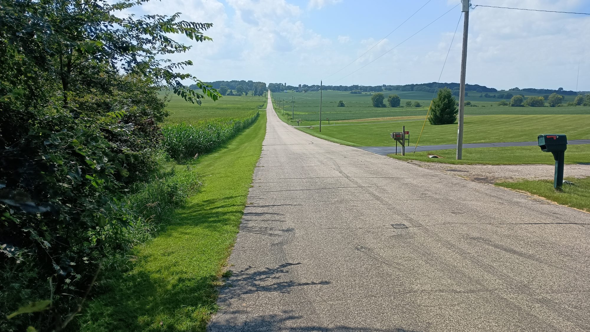
The suggested route goes north and makes some back and forth bends. But to the south, if I am willing to walk on the busy road for about a mile, I could probably save 2 miles of walking. After doing one mile on the busy road instead of taking the small back roads I decide to stay on the busy road because it is more direct and the traffic is not bothering me at all.
It was a good choice because it comes to a gas station with a McDonald’s in it, and I could use a biscuit this morning. So I stopped for a quick break and charge up my electronics while I’m sitting there, which is a bonus.
I’m trying to remember the last time I’ve been to a McDonald’s and the only time I can remember for sure is in 2016 on the Pacific Crest Trail. I really do think it’s been 8 years since I’ve been to a McDonald’s.
About a half a mile up the road, I meet with the suggested connecting route coming in from the north. The connecting route has us coming in from the east almost to the center of town. The connecting route turns north and then becomes the official trail in a park with a lake. The whole point of this exercise going to the north end of town is just to hike through this park.
The trail then turns south back towards the center of town. Within a half a mile I can actually see the point where they turned us north just a few blocks ahead. I have walked over a mile and a half and effectively gone three blocks. That’s how this trail goes. No matter where you’re coming from or going to they are going to take you to every little park in memorial in the city.
The trail exits town to the south and ends up following a road that goes to their main high school complex. It then turns to a trail in between the high school and some houses and then exits on a road. It feels really weird walking right through the middle of a high school complex like this. I get the creepy “what do sex offenders do?” thought again. I stop at the baseball field before leaving to sit on their benches and eat a snack.
Now begins more road walking. Probably about 10 miles worth. The suggested route goes south then west then south again but doubles back on itself for about a mile. It looks to me like it would be shorter and easier just to keep going south then go due west. So that’s the route I choose.
And as I’m walking my own route, I am happy with my decision. The route I chose is more direct and has far less traffic on the official route. I have a feeling I’m going to be having to use creativity on a lot of these connecting routes for the rest of the trip.
I am able to find shade trees along the route to take a few 10 minute breaks. I take the chance to nibble on snacks and drink water during my breaks. It’s amazing how just 10 or 15 minutes of resting in the shade will rejuvenate you with energy.
The next town I will come to is Albany. I should get there shortly after 3:00 but with my breaks it’s more like 3:20 or 3:30.
The one thing I really need to do in town is refill my water bottles, as I have less than a half a liter left and we’ll need water for tonight and tomorrow morning. As luck would have it, the bathroom area in the middle of town on the bike trail has flush toilets and an ice cold water fountain. My bottles are now full.
Exiting town there is a Mobile gas station, so I stop and get a pint of ice cream and Dunkin’ Donuts coffee. It’s right at 3:30 now, so this is a good time to have my caffeine. I wanted to make coffee about a mile and a half before town, but I’m glad I waited, because here I have a picnic table and the opportunity to dry out my tent in the sun.
My break here is about 45 minutes, but then I am off again. I got here far earlier than I thought, so the place I am planning on camping I will reach in just over an hour and it is way too early to stop. It is especially way too early to try and stealth camp.
The trail leaving town goes by a river and this was one of the suggested water sources. But the river is pretty cloudy and really hard to get to, so I’m glad I did not even attempt to do this. This is also becoming a recurring theme. Most of the rivers they mark as water sources are nearly impossible to get to and probably not the greatest water. Water fountains have been my primary water source.
As I am passing by all these river crossings another detail makes me glad that I am going through this area early and will not try to camp here tonight. All morning out in the fields with a strong breeze there have been almost no mosquitoes. But here near the river, they are so thick I can see them flying through the air ahead of me. Even with the head net they are really annoying. There is also a strong breeze so these suckers are determined.
All the mosquitoes just make me hike faster. Coffee plus mosquitoes equals a record place. I have a feeling I will be doing this entire 10 mi section to the next town tonight just to avoid the mosquitoes.
After the next town of Monticello, the trail goes through fields, so the mosquitoes should be not nearly as bad. The only downside is here along the river it’s public state hunting grounds. A place that seems more legal to stealth camp.
But past Monticello, it’s private property on both sides. So I will have to be very creative and where I find to pitch my tent. Plus, I can’t go too far or the trail turns into another road walk again.
I begin looking for snowmobile trails that cross the path that I can pitch my tent on. I only have about 30 minutes of daylight left and I’m not having any luck. I see a field of the left that looks promising and walk out towards it. But the grass is so thick that I am positive that I will lose my tent stakes in it. I have to keep moving.
A little past 7:30 I finally see what I’m looking for. There is a snowmobile path crossing both sides. To my right side, a road is very close so this is not ideal. But to the left is a soybean field with a treeline not too far away, and I can’t see any houses in any direction. This will be my camping spot for tonight. And just in time because I am about 1 mile from where the trail turns into a road walk.
I have been fighting mosquitoes for the last 3 hours and there are plenty here where I pitch my tent. I set the tent up quickly, then throw my ground pad in the tent, then throw the entire backpack in and jump inside. I normally place things one by one in the tent before I get in. But I need to get out of these mosquitoes very quickly.
About a dozen mosquitoes make it in the tent with me. I quickly kill about half of them and the rest of them are all buzzing around the top of the tent trying to get out. Suffer, you little bastards.
I have been wanting to try to make mashed potatoes in the bag that the potatoes come in. But I have been afraid that the plastic is the type that shrinks when it gets hot. I decide that tonight is the night I will try this experiment. To my delight it works quite well but it is hard to stir the potatoes at the very bottom. I can probably also not heat the water so hot next time.
It is dark by the time I eat, so I end up unrolling the mattress and sleeping bag in the dark. I’ve done it enough times by now that I don’t need any kind of light to do it with.
Emotion of the day, Pride
I got up and moving pretty early this morning. Both of my alternate connector routes saved me two or three miles in total and were less busy roads as well
I was able to avoid the temptation of eating in restaurants other than McDonald’s in the morning. But I justified that by being able to charge my devices for 30 minutes. I also had to use their Wi-Fi because for some odd reason the entire town of Evansville has zero Verizon signal.
I was able to take enough breaks on the road walk and in town that I never felt exhausted or sleepy. I was getting tired the last mile or two trying to look for a place to camp, but that is normal when hiking so late. I also think I’m at least 8 Miles further than I intended to stop tonight.
Right now I’m proud of these small accomplishments. I just hope the extra 8 Miles doesn’t cause problems for the rest of the schedule, because I still have a lot of road walking ahead of me.
My feet have been rejuvenated with my day off doing chores. Usually my left heel is sore in the morning and takes about 10 minutes to warm up. But today it’s not stiff at all is ready to go as soon as my feet at the floor.
And the feet hit the floor early today because I want to try and get as early as start as I possibly can. Breakfast starts at 6:30 so I’m awake and showering by 6:00. I managed to get the pack completely packed before 6:30 so as soon as I’m done with breakfast I am ready to go. And it was the same sad breakfast as yesterday.
The weather is cloudy and I was expecting it to be cool. But it is anything but cool. It is actually quite warm and muggy. In less than 5 minutes I am already saturated with sweat.
I have about 1 mile to rejoin the trail from where I left it to get to the hotel. For about the next 8 miles to town I will be following a bike trail.
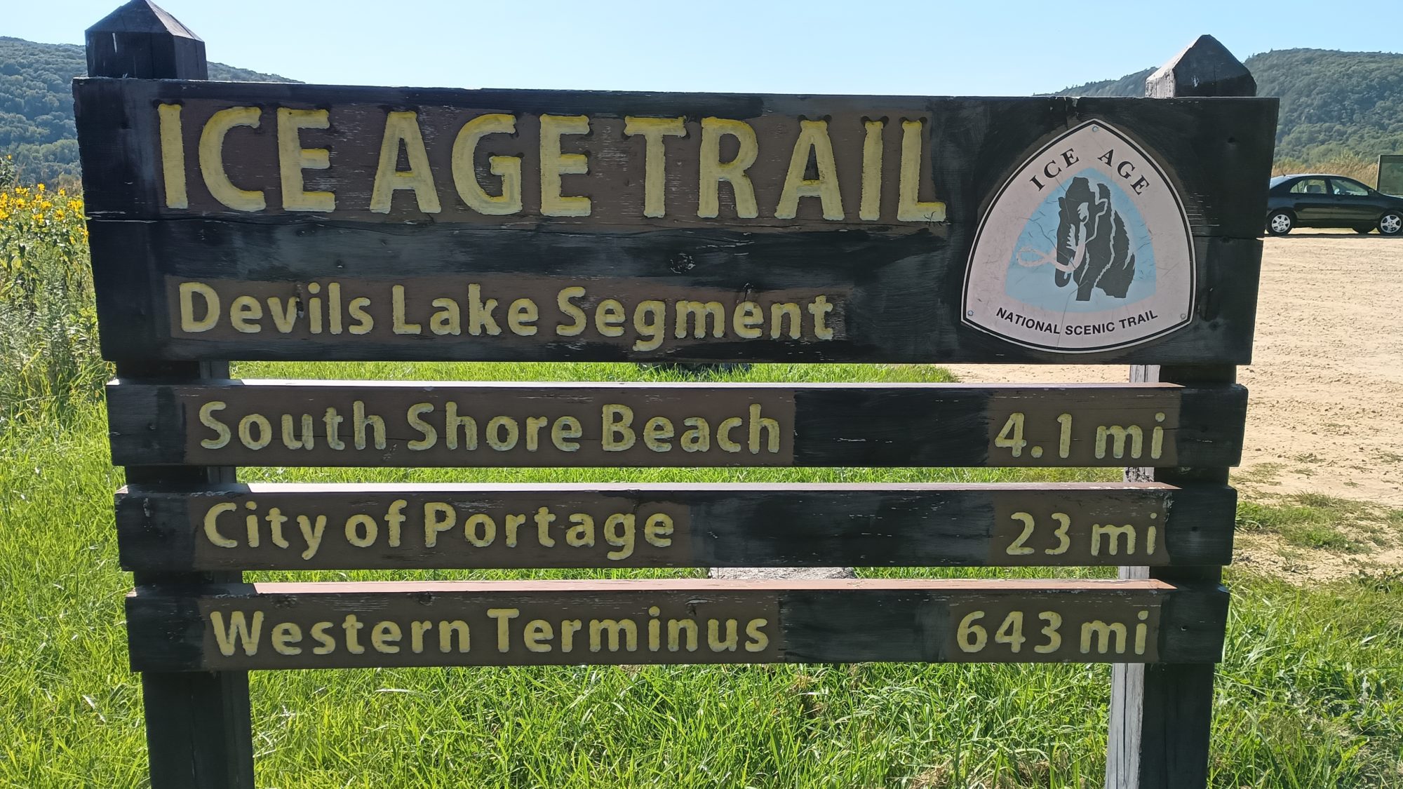
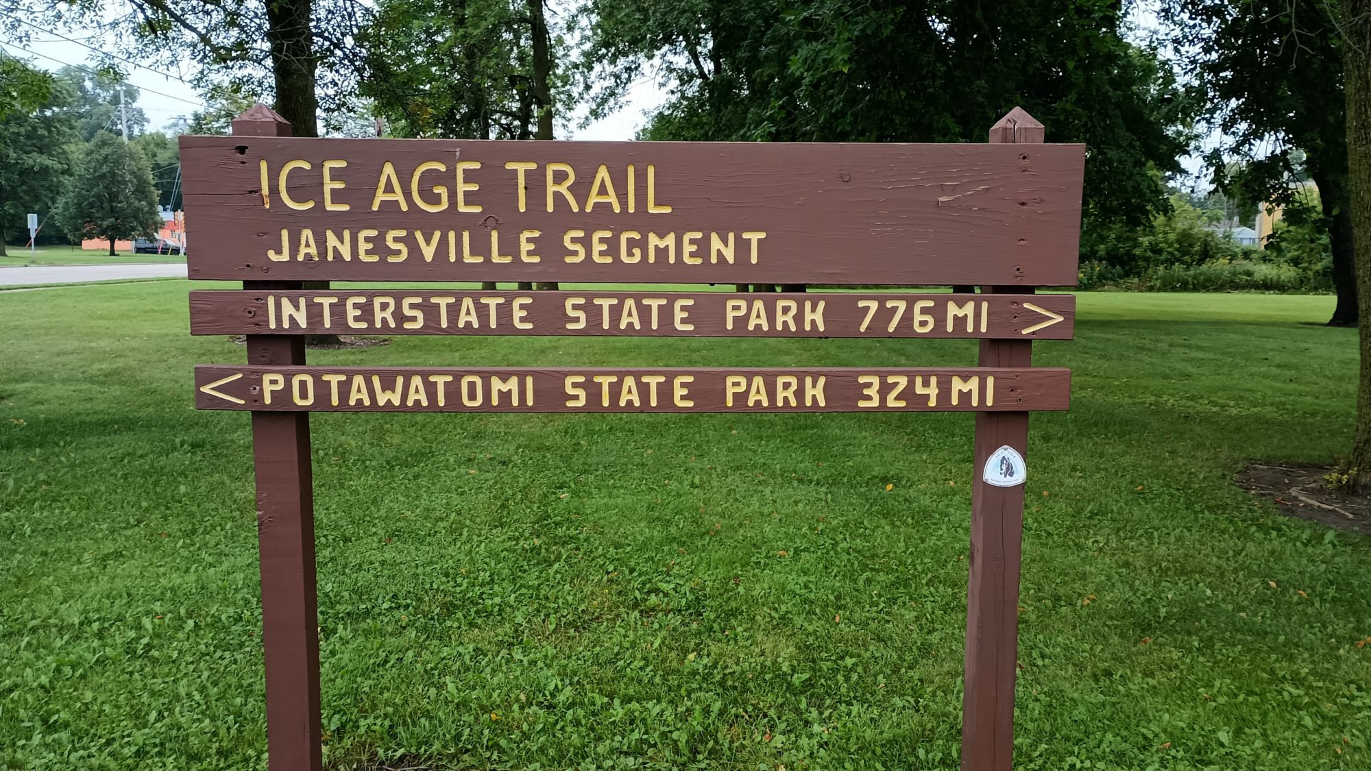
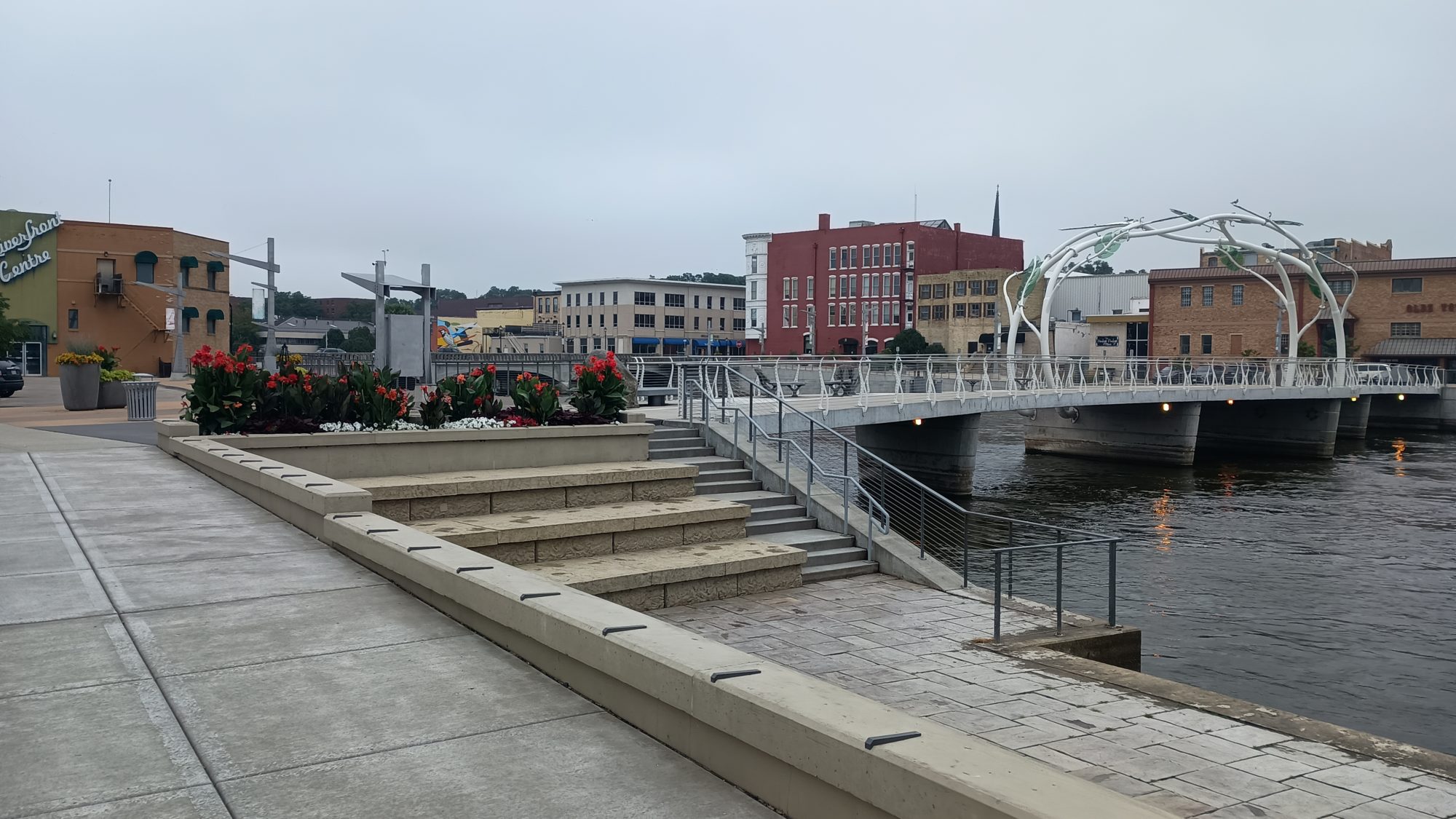
As the trail winds through town, I come across a sign that tells me how far it is to each terminus. I have come 324 MI and have 776 left to go. I am also at the most southern point in Wisconsin that I will ever be on this trail. From this point on I will be heading north while still drifting Westward.
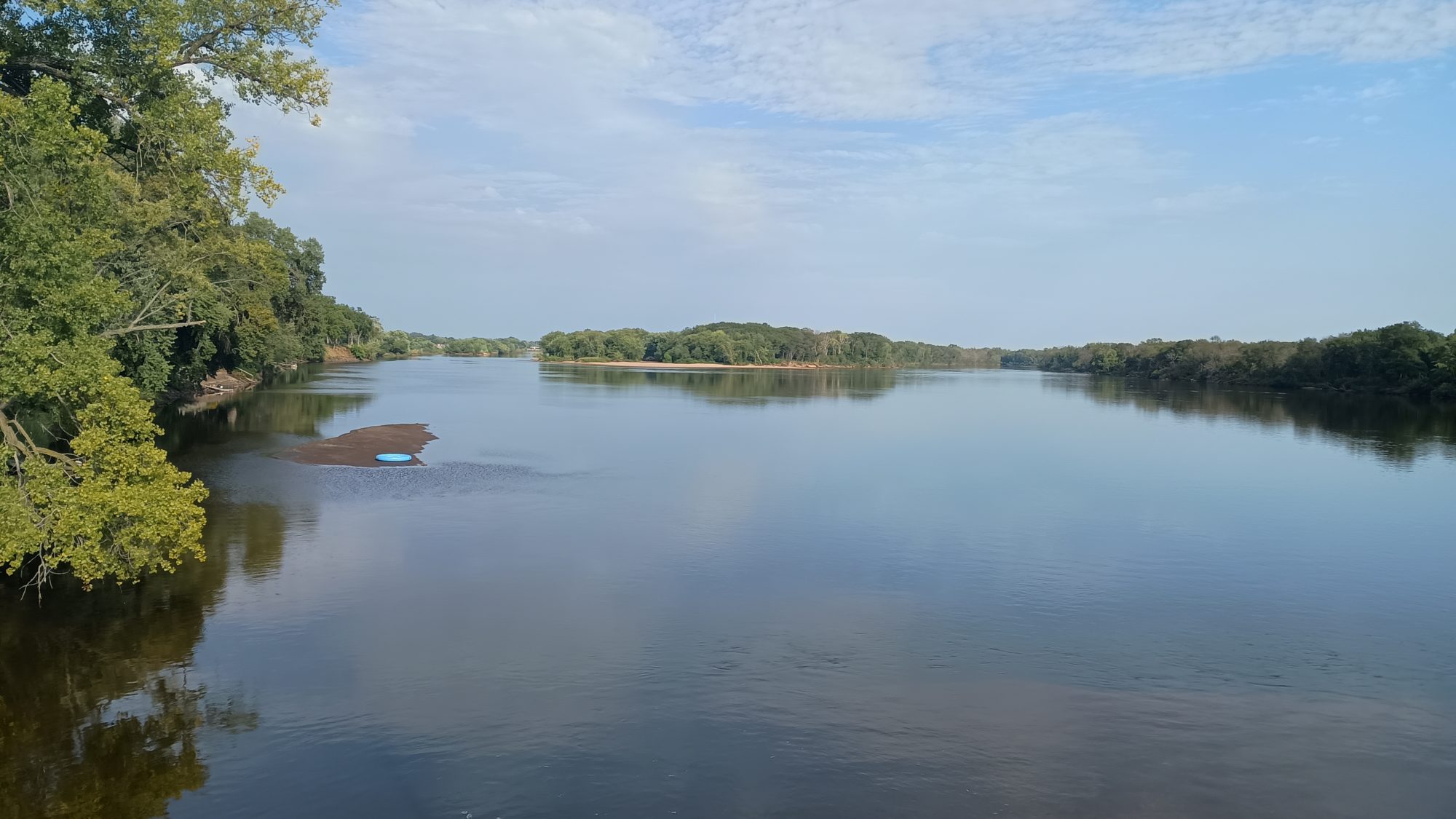
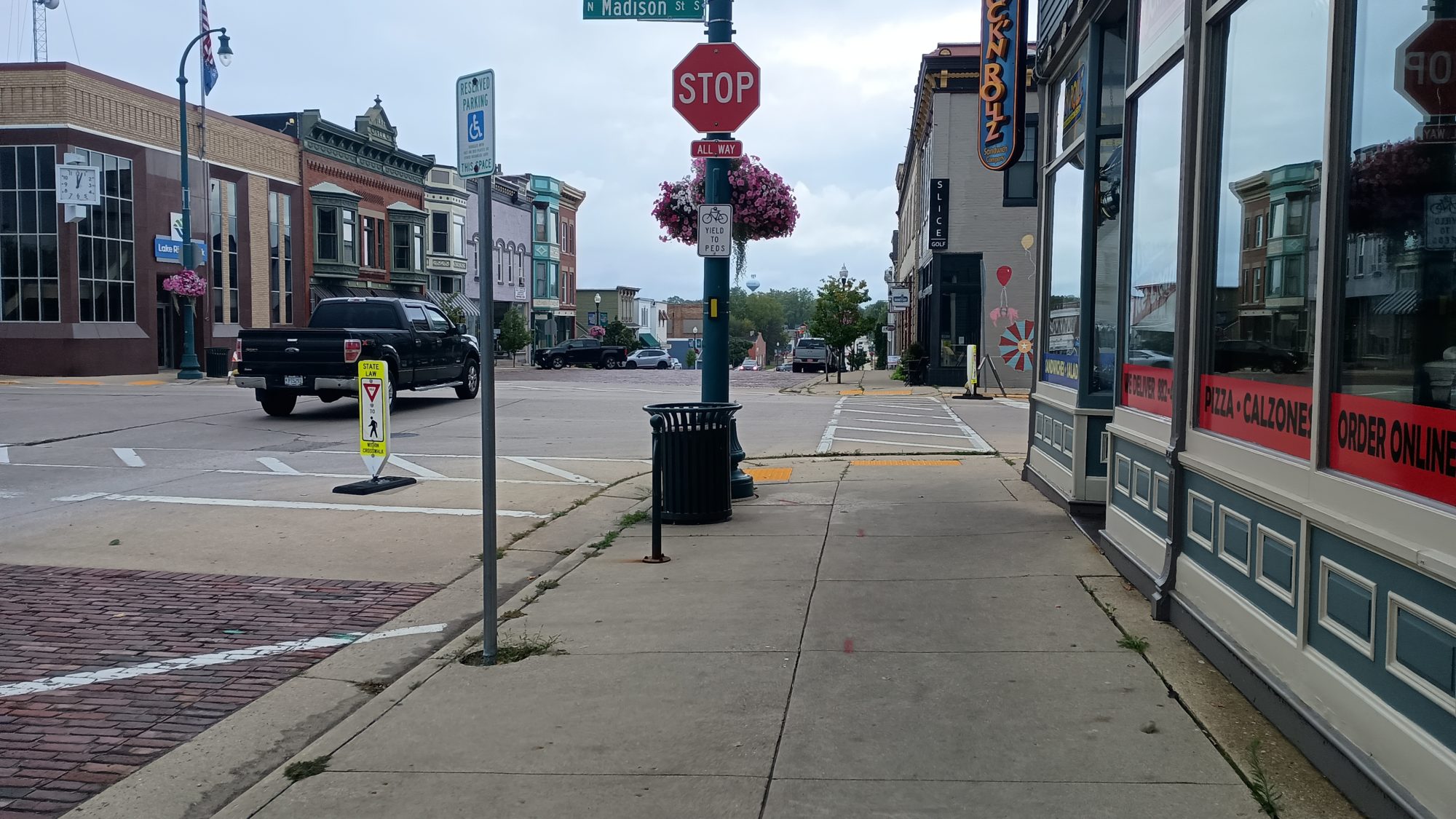
The downtown area is nice to walk in. The trail is along the Rock River and there are little shops and plazas everywhere. It seems like most of the shops are on the other side of the river.
Something just dawned on me this morning. I think so far the trail has routed me at right adjacent to about six or seven elementary schools, middle schools, or high schools. Isn’t there some laws for registered sex offenders that they can’t be within a certain distance of a school? If that is true then how would a registered sex offender be able to hike one of these trails without going off route? And what would happen if they accidentally got too close and someone found out? Creepy, I know, but I don’t ever think I’ve seen this many schools on a hike before.
Just before leaving town there is a restaurant just a few blocks off the trail. It is only 10:30 in the morning but they opened at 10:00. I sit there for about 5 minutes contemplating should I or should I not. I have plenty of food with me in fact probably too much. But it’s hard to resist a fresh sandwich. So I decided to go ahead and track up the hill and check out the restaurant which is actually a bar. I wanted an Italian beef but they are out of roast beef so a Ruben it is.
By the time I get back on the trail the clouds have cleared up. So it is not only muggy, now it is also hot and muggy. I am also feeling a little overfull, so I think my choice to eat lunch so early was a mistake.
The last section before leaving town is a park with a boat launch and lots of recreation areas. The trail leaves a park up a steep staircase to take you to a stream that is stacked with many tiers of boulders that they call the devil’s staircase.
I wasn’t in the mood for this climb because I am full and all of the rocks are wet. Most of the rocks are dolomite and they are very slippery when they are wet. Even the dirt has mold growing on it and you slip all over the place.
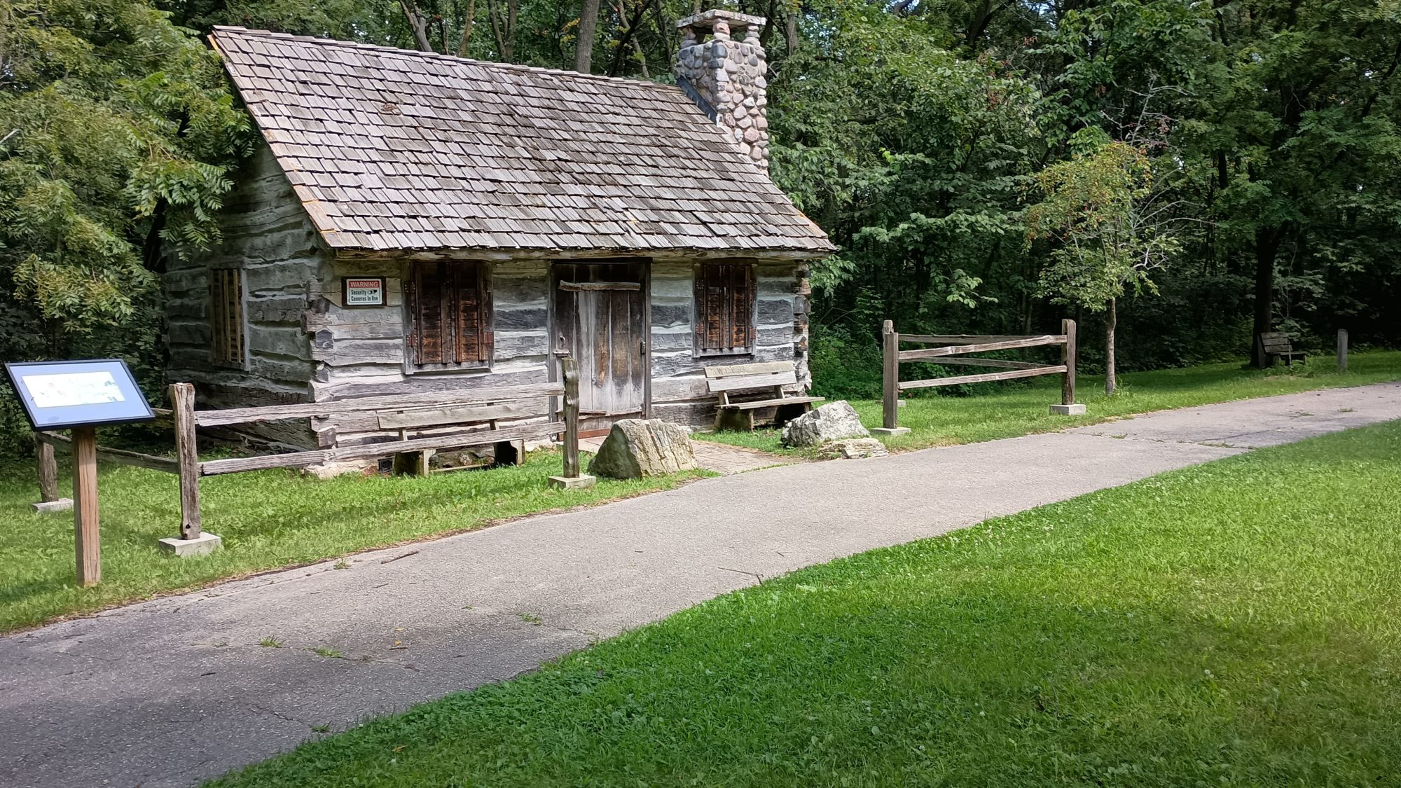
The trail exits that area and skirts around the edge of a golf course to go into another park area. This park has an 1840s pioneer cabin and there is also a building that has a fountain running continuously for drinking. I think I drink water there for about two solid minutes. And it is good and cold.
When I exit this park, it will be road walking all the way to the last park where I will be camping tonight. It’s probably 10 miles or so of road and that would put me at the park somewhere around 5:30 which is a good time to stop.
Most of the roads are very lightly traveled but they have pretty poor shoulders on them. I take a break when I find some shade at about 2:30 and make my coffee. But this time I just make it cold and don’t bother to heat it up. I am feeling pretty tired but within 15 minutes I have enough energy to keep trucking.
When I get to the next intersection and look at the map I see that it looks like there is a road that angles a little bit and could shave a half a mile off the route. This is one of the green sections so it is a connector and you’re able to make your own route if you want to.
I decided to go ahead and stick with the official route instead and soon regret it. One of the roads they have us on for a little over a mile has a tremendous amount of traffic and absolutely no shoulder. It is about 30 minutes of the most miserable road walking yet on this hike. It’s county road H if anyone cares.
The rest of the road walk go smoothly, but the last mile it begins to rain lightly. The good part is at least it is now much cooler and much breezier so my sweat begins to evaporate finally. I make it to the park just before 5:30 and head towards the hiker section that has a hand pump. Comments in the guidebook say that the hand pump is missing a handle, and indeed it is. It is about a quarter mile over to the equestrian side which has its own water pump, so I head that direction.
The equestrian side is much nicer. They have a covered pavilion with four picnic tables and their pump is electric. You just put your bag under the spout and turn the timer and it shoots out water at tremendous speed. The only bad part is that shoots out rusty water. Even after filtering it doesn’t taste very good. I arrived with about a half a liter, which is enough to cook with, but I will have to be drinking this water tomorrow during my hike.
Shortly after I arrive at the shelter it starts to rain, which I was expecting. The last forecast I was able to get said it would rain on and off till about 8:00 p.m. so I will basically do everything short of set up the tent under the pavilion and then set up my tent at the last minute. Luckily it is breezy so there are no mosquitoes even though there were some along the lake getting here.
A group of four girls arrive with horses as the rain intensifies. They are troopers. They keep gearing up and head out into the rain. If you love riding horses then I guess you love riding horses. Just like if you like hiking you like hiking whether it’s raining or not.
The cell service here is almost non-existent, so to wait out the several hours before dark I will have to entertain myself the old fashioned way – with a stick and a hoop. Not really. I have only listened to music one time on this trip. And for some reason I just don’t feel like listening to music now.
Emotion of the day, Regret
It’s amazing how the effects of one bad decision can last with you for so long. I do regret stopping to eat lunch so early. I missed out on the opportunity to lighten my pack and I made myself over full and uncomfortable for several hours of hiking. At least it’s a lowercase regret and not an upper case regret. The sandwich was still very good.
The bad news for tomorrow is I will pass by places both at lunch time and dinner time so I will have this dilemma two times tomorrow. Stay tuned to see if I I’m able to learn from my mistakes or not.

Recent Comments