Category: Appalachian Trail 2020

Day 29 mile 460.5 Bears and dogs

Yesterday must have been the opening day for bear hunting season because today was filled with people wearing orange, toting around dogs, and carrying guns.

I woke up nice and early at 6:15 and was able to get ready and on the trail before 7:00. It felt great to get out early and well before the sunrise. Last night was not cold at all and I got a little warm at times so getting ready was pretty easy.

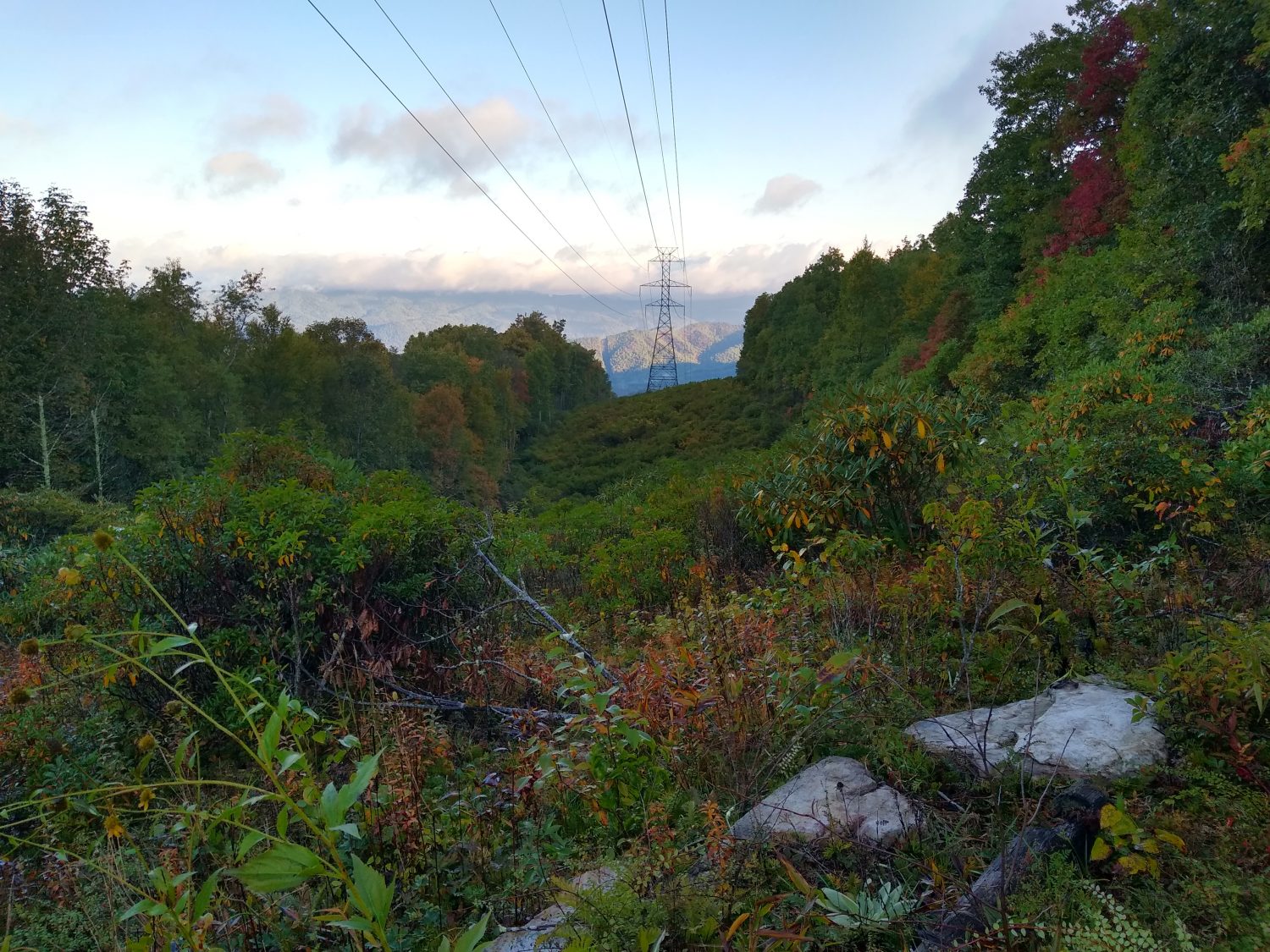
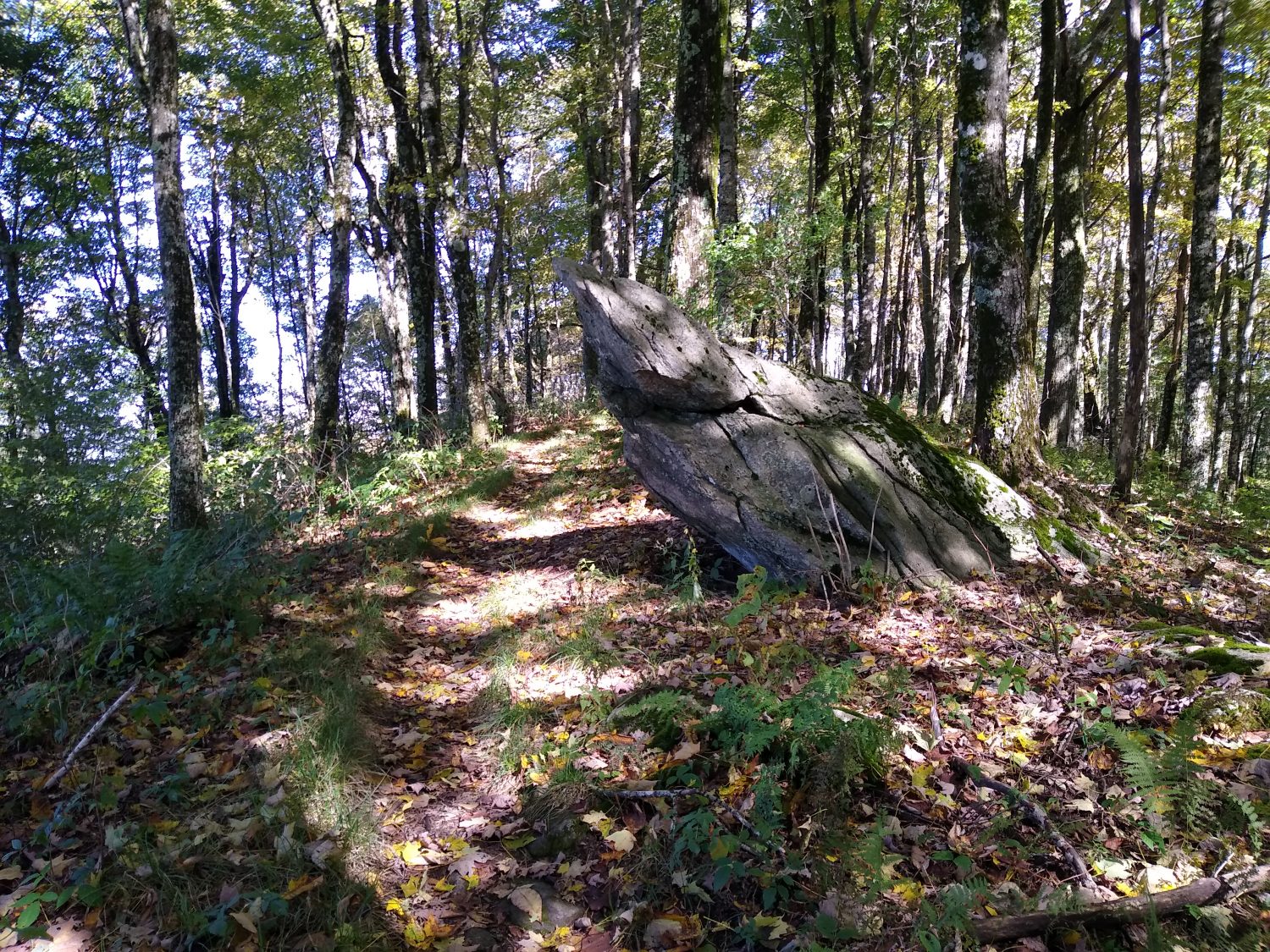
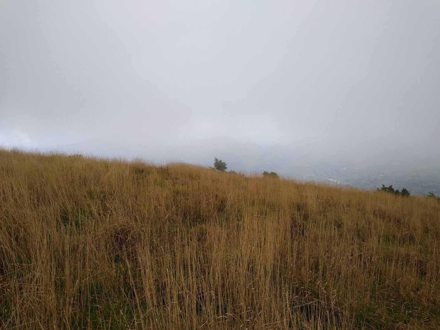
The first hour of hiking was quite a bit of up and down along the ridgeline and I got tired pretty early. I ate and drink a little bit and that gave me a little more energy. I knew water was going to be scarce today so I needed to plan where I would stop to collect it.

After about 2 hours I came across two guys in a camp site with two hunting dogs running around. The dogs were really skinny and one of the guys was feeding them as I got there. I went down to the water source and got some water straight out of the spring that was coming out of a rock. Since I could actually see the water coming out of the ground I didn’t bother treating it.

20 minutes after leaving that campsite the two dogs there came running behind me. They were really friendly and pretty neat dogs. They would come and go for the next hour as I was hiking.

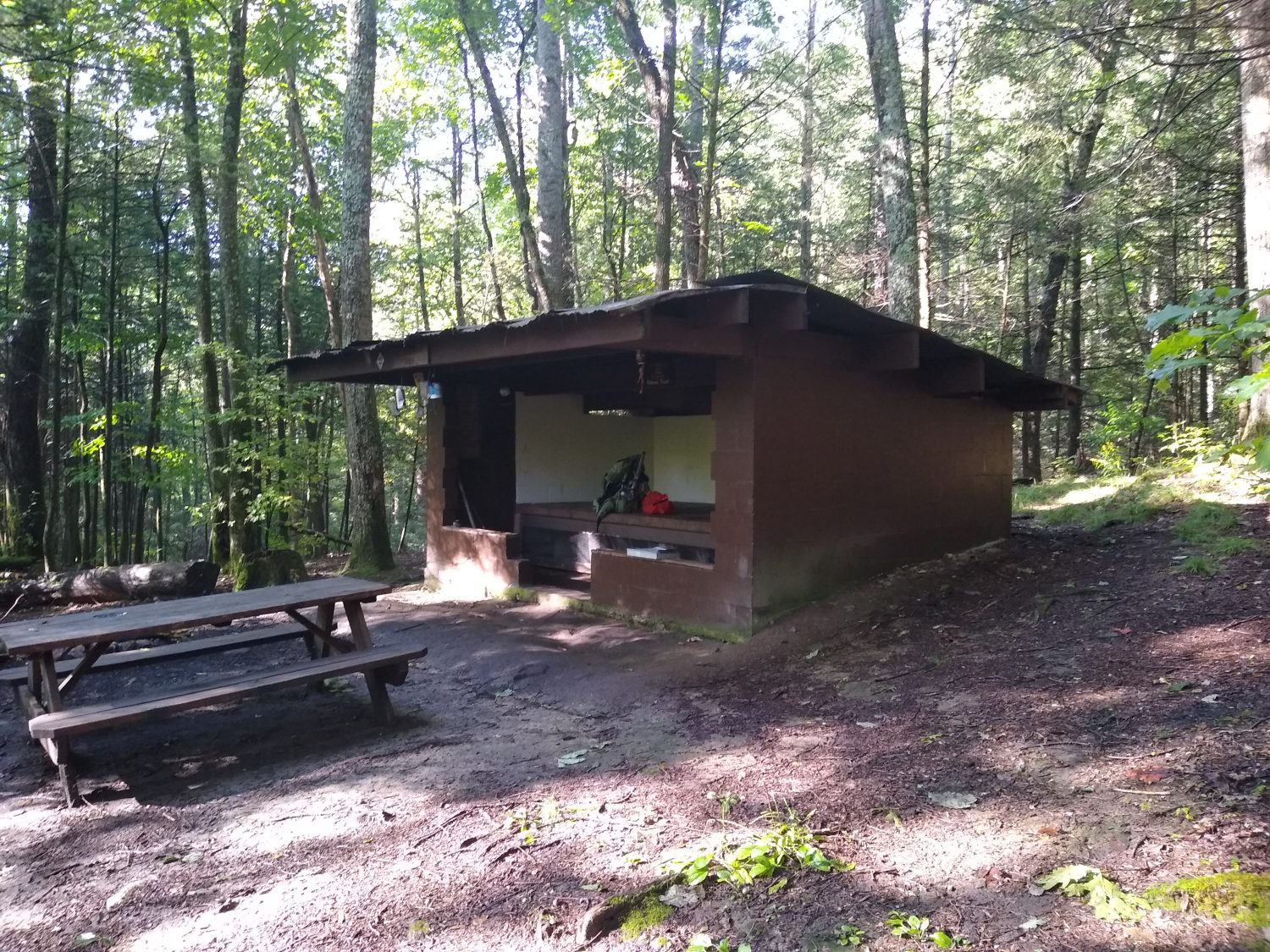
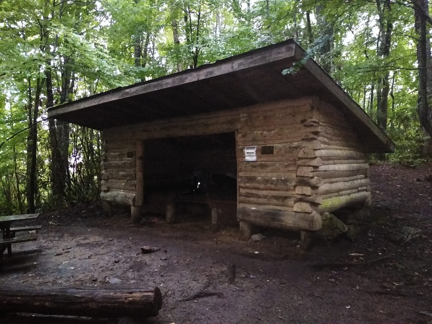
I stopped for lunch at one of the shelters and had the last piece of pizza which was horrible. Note to self: never buy Little Caesars pizza. Cheese, salami, and triscuits fixed the bad pizza.

Shortly after lunch the trail crossed Tennessee 92. The parking lot was full of trucks with dog crates in the back and dozens of hunters running around in orange. I stopped to have another quick snack and make some Gatorade and in the 5 minutes I was sitting there 3 hunters walked up the trail the same direction I was going. I decided it was best if I change from the long sleeve gray shirt I was wearing to the short sleeve orange shirt.

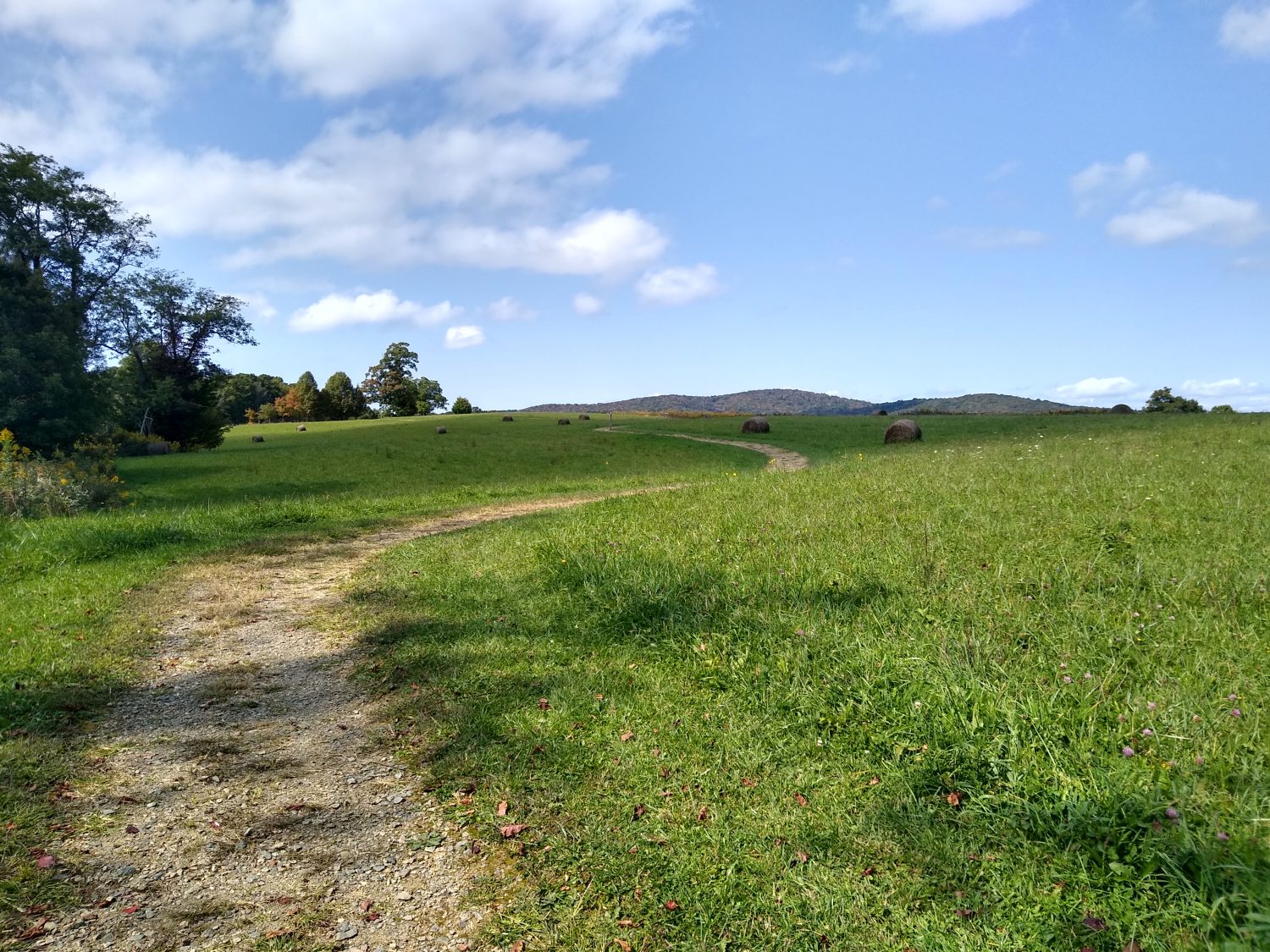
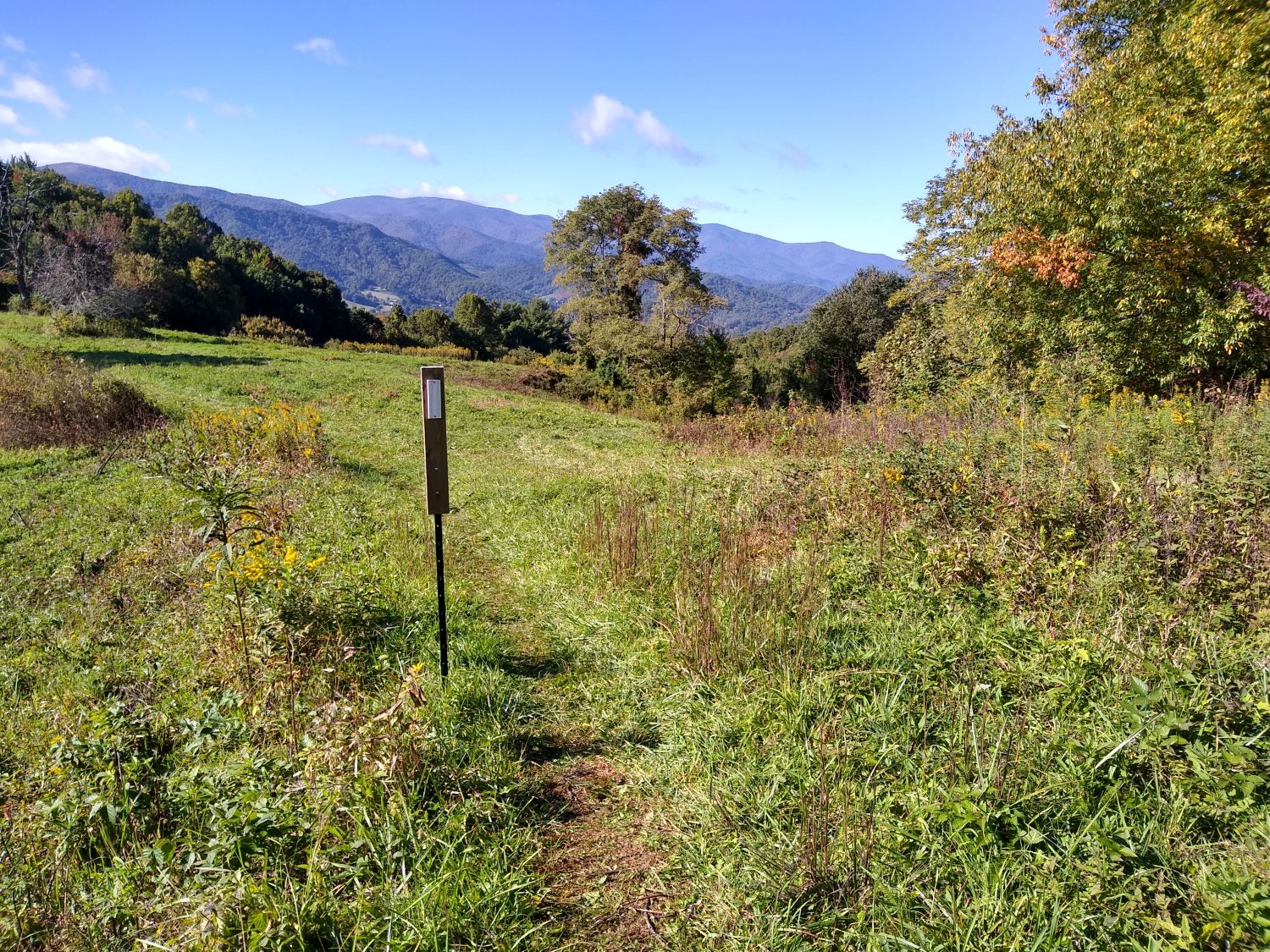
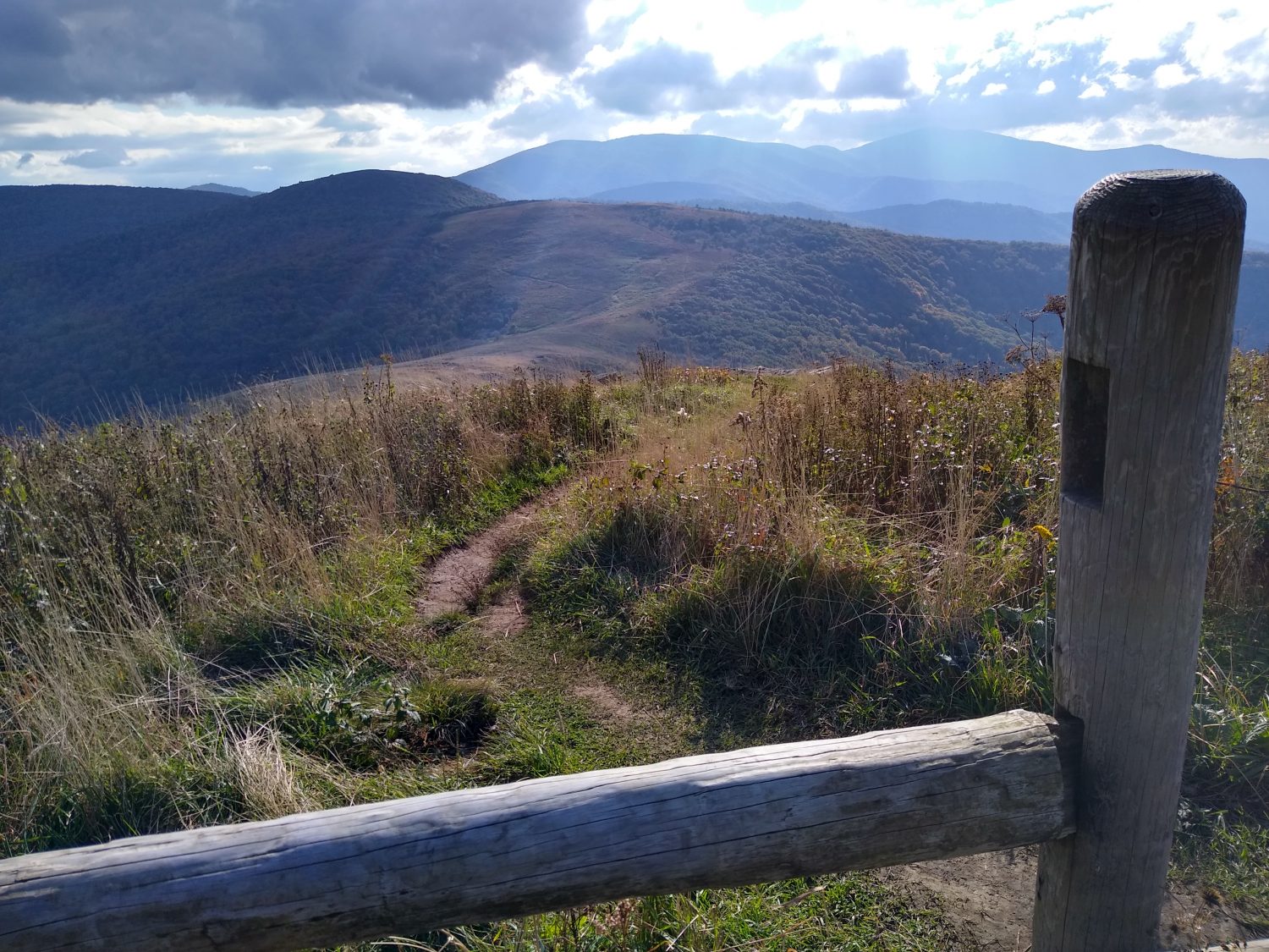
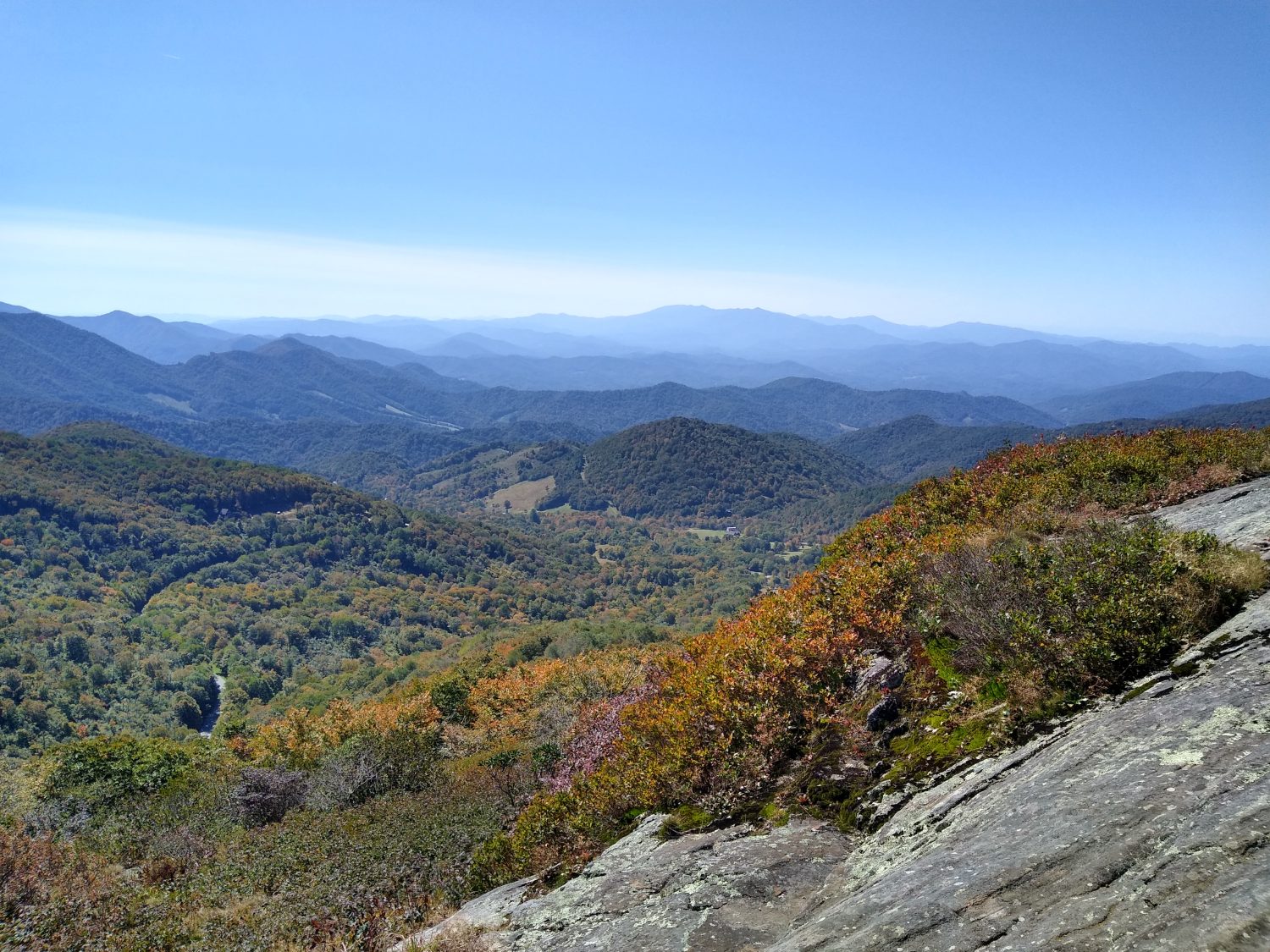
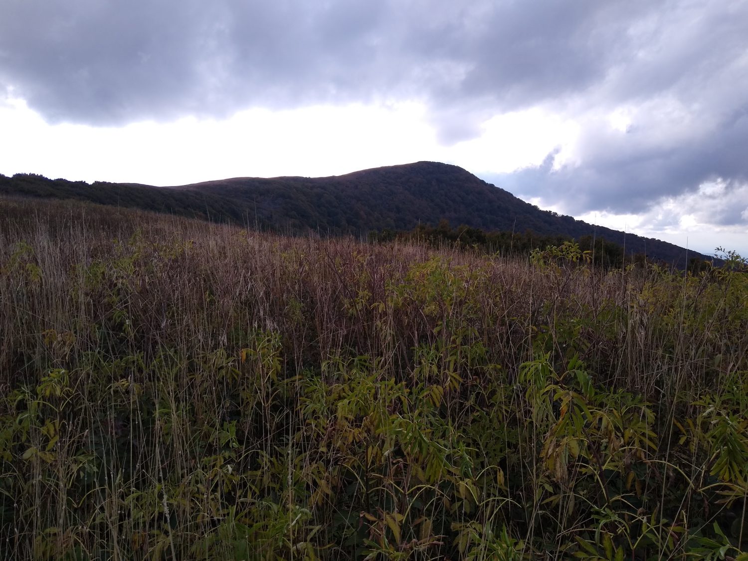
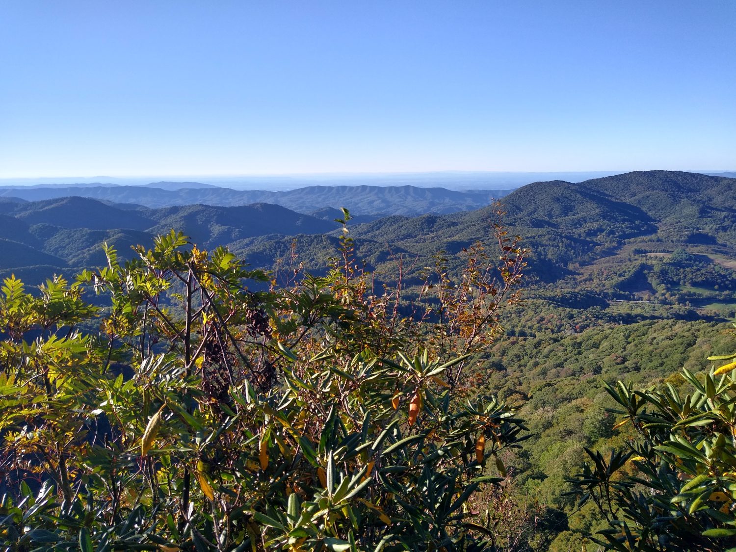
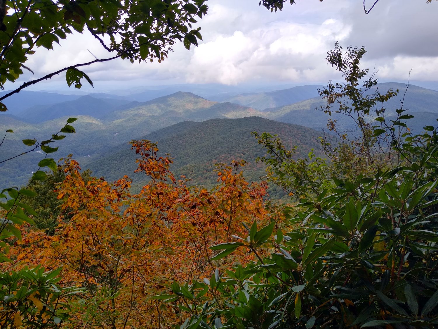
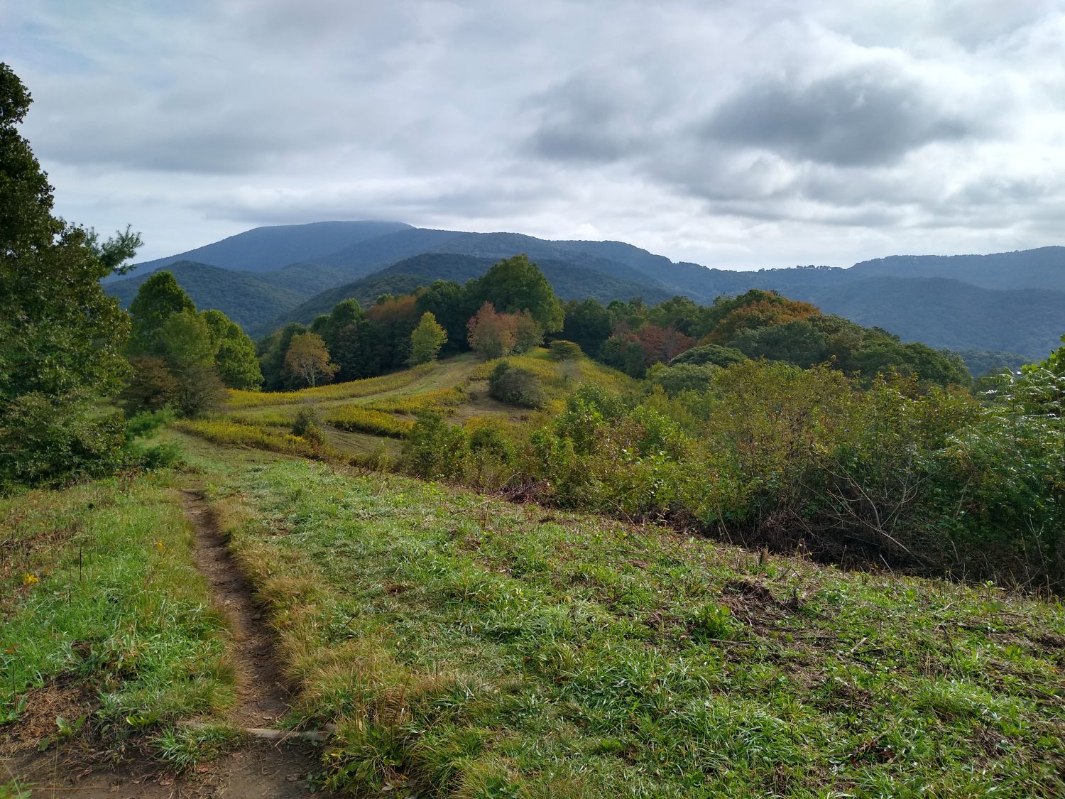
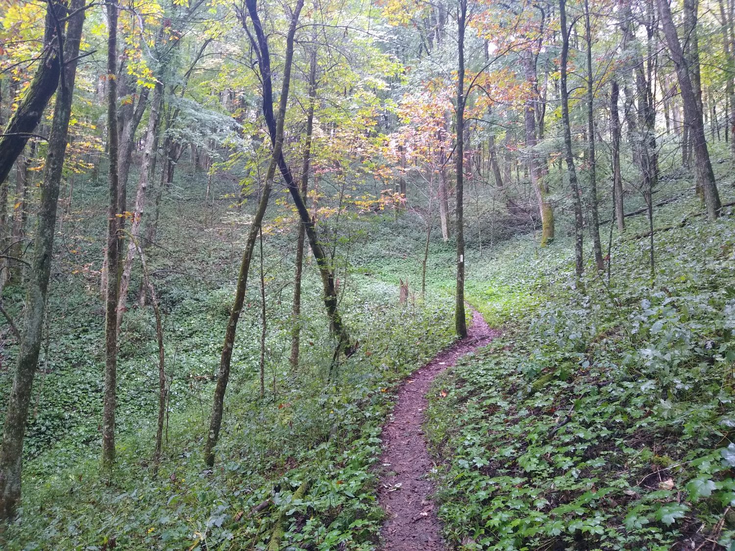
From here the trail ran across several pastures. It was probably over a mile worth and really very pleasant hiking and great scenery. After the pastures ended the trail continued to be very moderate for most of the rest of the day. The climbs now are a moderate grade and don’t slow you down too much which is nice for a change.

I kept running into one of the two hikers I saw in the morning that were feeding the dogs. We crossed paths more than five times during the day. He is also out to hike till the end of October but he only started at the beginning of the month. I am assuming he probably started near Carver’s Gap. He went past the shelter I stopped at tonight so I doubt I will see him again unless I run across him in Damascus.

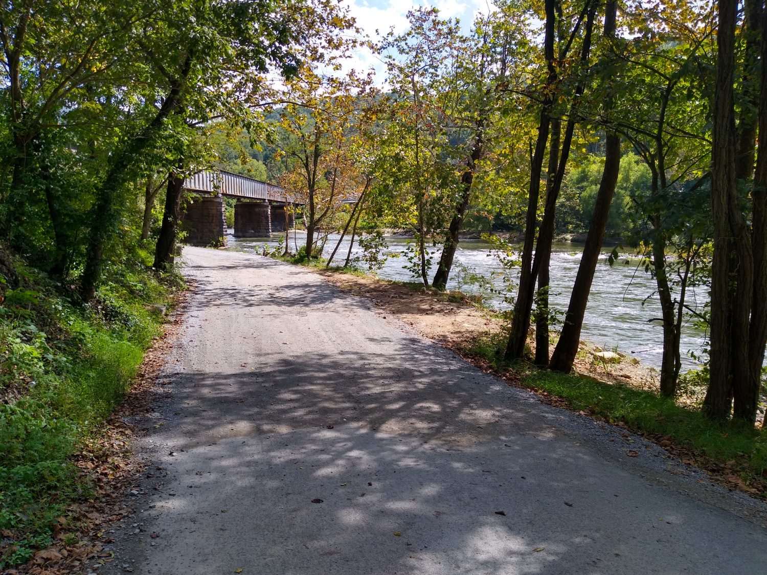
Since many of the hostels are closed I went ahead and called one of them to reserve a room for tomorrow night. I am only 10 miles from town and I’m pretty sure I can get there before lunch. If I get there early enough I might just drop my pack by the hostel and then run and rent a bike to ride down the Virginia Creeper Trail. That would be a nice change of pace to be able to ride a bike for a while instead of walk.

Today was my first 25-mile day of the trip. I don’t need every day to be 25 mi but I do need many of them to be close to be able to hit my end point goal of getting past the Shenandoah’s. The terrain should be a little bit easier than North Carolina. As long as I get up early I should be able to do the mileage I want to do. My only concern is the days are getting shorter very quickly. But I’ll worry about that on Tuesday as Monday in Damascus is all I’m focused on right now.

Day 28 mile 435.5 Waterfalls and pointless climbs

I guess this marks the end of 4 weeks and I was hoping to be in Virginia by now but at least I’m close. Some of the hiking was easy today and some of it was difficult but Laurel Falls in the middle of it made up for any of the difficulty.

I overslept this morning and didn’t get up till after 7:10. But since it was already light it was easier to get ready and I was still off by 7:45. I heard the other hiker Izzy pass me on the trail about halfway through getting ready to leave. I would not see him all day long until I stopped by Boots Off Hostel and he was already there cooking a pizza.

The night was pretty cold last night and I was wearing extra layers to sleep in so I was okay but my nose was pretty cold most of the night. I kept shifting onto my side and when I do that my knees and feet slide off the pad and get a little cold so I couldn’t sleep like that for too long.

The hike in the morning was relatively easy. There weren’t any steep grades either up or down. I got to the Laurel Falls Campground sometime around 10:00 and stopped to have a snack. It was one and a half miles to the falls and the trailhead was pretty crowded with lots of families. The first half mile was super wide, super flat, and super nice. The second half mile was pretty much like a typical trail – ups and downs and twisting around switchbacks. The last half mile was a terror of rock steps and really steep inclines and declines. I was really surprised how difficult the trail was. It was about as difficult as some of the really hairy trails in the White Mountains. But there were families and kids at the falls so I guess they like that kind of stuff.

I didn’t remember the falls from 1989 but I must have seen them. They were quite impressive and I would like to come back again someday. The AT continued along down the river for at least a mile. 

The old trail in 1989 kept following the river into the town of Hampton and then there was a 2 mi road walk to the lake. The new trail turned away from the river and went straight up a mountain. And by mountain I mean serious mountain. It was 3 miles to the top and over 1800 ft of climbing. At the top was an area called Pond Flats. So there must be a pond or at least it must be flat, right? Neither is the case, as there is only a mediocre campsite at the top. And then the trail immediately descends 1,800 ft for another 3 miles. 6 miles and 3,600 ft of elevation change doesn’t sound like a good exchange for a 2 mile trail along a river plus a 2 mile road walk.

The plus to the new route is that it ends up near Boots Off Hostel. It was too early for me to stop there and I already knew that they were full and only had space for camping but I went ahead and stopped by to see about getting some more food. I got there just as a Good Samaritan had dropped off a pizza and dipping sticks for the hikers and myself and Izzy were the only hikers around at the time but Izzy had already started cooking two pizzas for himself so the owner and I were the only ones eating the pizza. I got some drinks a few walking snacks, a pint of ice cream, and a fresh pear that was quite delicious.

I was there about an hour relaxing and eating and talking with Izzy. His friend arrived just before I was ready to leave. His friend and he are going to finish hiking to Damascus and that’s the end of their journey. But since I am moving ahead and they are camping there tonight I am not likely to see them again.

I headed back out across the highway to the lake where there is a public beach. The lake is pretty much as I remember it from 1989 but the roadblock approached the lake from a different angle. This new trail has you backtracking quite a bit around the lake to be able to get to the other side.

The trail has filtered views of the lake for several miles before turning towards the dam. The dam is an earthen dam just made of rocks and dirt. I didn’t realize until about a half a mile after the dam that this was a hydroelectric dam. What I thought were just overflow spillways were actually collections spillways for the generation plant below. But the generation plant is over a half a mile away. That seems like a long way to pipe a boatload of water and judging by the transmission lines it doesn’t generate a tremendous amount of electricity.

After the damn the trail follows the service road for the dam which is normally closed to cars and then heads up to the ridgeline on the north side of the lake. The hike up to the ridgeline had way more switchbacks than I was expecting and way more climbing than I was expecting too. I probably made it a few miles along the ridgeline before 7:00 arrived and it was time to look for a campsite. There is a shelter 2 mi away but it will be dark by the time I get there and I don’t care to hike in the dark.

So here I sit 35 miles away from Damascus. I am hoping to get into town before the post office closes on Monday so I am going to try to get an early start tomorrow to make as many miles as I can. Even if I only do 20 that would leave 15 and that should be doable before the post office closes but I’m going to try to do a little more than 20 just to shave a little time off of Monday’s hike.

Day 27 mile 414.7 A perfect weather day

Hardly a cloud in the sky, plentiful sunshine, and cool breezes all day long. And the weather wasn’t the only thing that was great today. The terrain was milder than it has been so far in the trip.

I slept pretty well last night in the bunkhouse except for the mattress that I was on had wires poking my body in all sorts of weird places. I had arranged to get a ride to the bakery in town at 8:00 when they opened but I was awake long before then. By 7:30 I was fully packed and ready to go. It was a later start than I would have liked but the bakery was well worth it. I got a bagel sandwich with home fries and then two pastries to take out for the hike.

It turns out that the couple that was running the hostel and shuttling me into town are both from Florida. He is from Tallahassee and she is from Gainesville. What a small world. They both just finished thru-hiking the Appalachian Trail less than a week ago and have only been working at the hostel for 2 days.

I got a quick ride to the trailhead and was off at 9:00. There were three other hikers that got there just before I did and started up the trail just a few minutes before me. For the next hour I could hear them talking on switchbacks either above me or on the next ridge. I didn’t actually pass them until about 5 mi into the hike when they stopped to take a food break. They were eating fresh apples. I ran into them again later and found out they also had carrots and all sorts of heavy vegetables with them. They are heading to Damascus which is about a 75 mile trip for them.

Most of the terrain today was pretty mild including the hike up from highway 19E. There were still all sorts of meadows to get good views from and a few rocky areas where you could see the next ridge. Water was abundant as I probably passed 20 water sources today.

For lunch I had a tuna wrap with potato chips and a Dr Pepper I had packed out from the hostel. The tuna was hot buffalo flavor and I could hardly eat it. I think I’m going to have to stick to the plane tuna packed in oil because the flavors are just so intense that they’re not very pleasing to eat.

There were a lot of hikers on the trail again today. I probably saw more than 20 people. When I stopped at the last shelter to get water before moving on to find a campsite I ran across a hiker I had met two days ago and also stayed at the hostel with last night. He is only going 12 miles to meet another person at a hostel so I will probably move ahead of him and never see him again. I haven’t seen the same hiker more than one or two days this whole trip which is a little unusual.

The weather was so cool I never had to stop to get water all day until the very end at 6:15. I filled up with 2 liters at the last shelter so I would have plenty of water to make camp. I think I only carried 1 liter plus the Dr Pepper out from the hostel.

I think I made roughly 20 miles for the day which is pretty good considering I started 2 hours later than normal. The easier terrain lets me hike a little faster. I haven’t checked the maps but I should be about 55 miles from Damascus. I think I should have enough food so I doubt I will try to stop off in Hampton, Tennessee. I think there is a gas station near where the trail crosses the highway at Lake Watauga so if I do need a few more walking snacks I should be able to top off there without going all the way into town.

I am camped pretty high on a mountain which is not ideal for cold weather but it was a great place to stop. I had an incredible red sunset that would have been nice had there been fewer trees to get a better view of it. I set the camera to take a time lapse video while I set up camp and cooked dinner. I am sleeping in one more layer than normal because I’m expecting it to get pretty cold tonight. But at least the wind is not nearly as strong as it was two nights ago. I’m hoping for a good night’s sleep so I can get up early and knock out some miles tomorrow.

Day 26 mile 395.3 A day of incredible views

Incredible is the only way to describe today.  I remember North Carolina having lots of balds and I think I found them all today.  Superb weather topped it all off.

Last night was cold.  Where I had camped on a saddle was quite windy all night.  It took me a while to get things situated in the hammock to block the wind and the cold spots, but after a few restless hours I was warm and slept well in the breezy conditions.

I woke up at 6:30 and saw some hiker headlamps headed towards me so I waited a few minutes for them to pass, but they never passed.  Then I realized that I was looking at the setting moon through the trees.  I was sleeping in my hiking clothes so I was able to get on trail shortly after 7:00.

It was breezy and cool again, so I was wearing my long sleeve shirt. I had my buff and gloves too, but at times I was still cold.  I was going up to Roan High Knob Shelter, the highest shelter on the AT at over 6200 feet.  At the higher elevations, it was breezier and definitely colder.

The hike up went quickly.  I stopped at the Cloudland Hotel site for a snack and to check email.  The hike down to Carvers Gap went quickly too, and had many more water sources than were documented.

On the other side of the gap begins the hike of balds.  I remembered Round Bald and Jane Bald from our hike ten years ago, but there was a side trail to a third bald that I decided to take.  It was over a half mile each way and steeper and more difficult than I expected.  This was the highest one and the views were definitely better.

The next stop was Clyde Smith Shelter for a quick snack, then past the Overmountain Shelter.  Karen and I camped there with Loretta on our trip.  It’s a neat old barn converted into a shelter, but was condemned last year, so I did not bother to take the side trail to see it.

From there the trail climbed up Little Hump Mountain for spectacular views.  But going up was in the sun and I actually got hot.  I considered switching to the short sleeve but didn’t want to take the time.  I’m glad I didn’t because ten minutes later I was cold again as the elevation rose and the breeze picked up.  The views here were even better than the other balds and I could see the red barn of the Overmountain Shelter.

Next up was Big Hump Mountain, higher yet.  This one took a while to climb and had me higher yet.  And the views were better yet, too.  And the cool breeze was chilliest of all.  I didn’t stay long but the next mile plus was still above treeline so the views continued.

As I checked the map for a place to camp, I realized I was close enough to highway 19E to make it before dark.  There are two hostels there so I decided to call one to see if they were open and had room.  They were and did, so game on.  Time to push another 5 miles before dark.

I remember this section well from 1989 and especially the Apple Orchard Shelter.  The shelter is gone now but it is still a camp site.  Back then we camped there, then walked the half mile to the highway to the restaurant which is no longer there.  That is where I ordered two complete dinners and ate them both, then had pie.  Hiker hunger was in full force and is starting to build a little now.

I made it to the road a little earlier than I expected but still had to use the headlamp for the last fifteen minutes.  7:15 is about the latest I can hike without the headlamp.

The hostel shuttled me in from the trail, I got a shower, then dinner and a beer at the pub.  I will get a ride into town in the morning for breakfast then should be able to get on trail by 9. Now to plan the segment into Damascus.

Day 25 mile 373.8 Heading northward again

We had everything packed in the truck the night before so we were able to get up early, grab a quick breakfast, and be off for the trail by 7:00. Everything went smoothly and I was able to begin hiking by about 7:45. The morning was very cold and at the elevations everything was in the clouds and damp and dripping. But the forecast today was nothing but sun.

From Indian Grave Gap it’s a slow steady climb up to Beauty Spot. The air was very cold but I was only wearing a short sleeve t-shirt. Within the first hour I had to put my gloves on to keep my hands warm. The vegetation up to beauty spot wasn’t too wet but my feet did get a little bit damp.

By the time I got to the top of Beauty Spot I could tell that the sun was out but the mountain was still in the clouds. After only 5 minutes walking across the meadow my feet were totally wet. I did manage to get a little bit of a view towards Erwin but in most directions it was totally clouded.

The new pack was working out well. It felt very heavy going up the climbs to Beauty Spot and the pack is much stiffer than my other packs but it fit comfortably and has lots of adjustments. Within the first hour I had it pretty much dialed it the way I wanted it. I would loose the shoulder straps a little bit on long up hills to move the pack away from my back to help with ventilation and on the level and down hills I would cinch it a little tighter to bring it a little closer to my body.

I passed three shelters today but I only stopped at the second one to eat lunch. Another thing I passed today was hikers. I saw more hikers today than I think I’ve seen any day on the trail except maybe the very first one at Springer Mountain. I could tell that I hit a pocket of south bounders. I only talked to a few of them and two that I talked to were finishing a flip flop back to Franklin when they got forced off the trail back in March. I imagine this year the south bounders are twice as numerous as normal years just because of COVID shutting the trail down in March.

I also had another run in with a dog that was not leashed. It was a German Shepherd that ran right up towards me barking the entire time and with its hair standing up. The owner was trying to get it under control but most dogs don’t listen to their owners that well. It had a service dog vest on but this was no service dog unless it was a drug dog. The place where this dog was was the exact place I’d identified on the map as a good place to camp for the evening but after the encounter I had no choice but to move on a little further.

Luckily less than half a mile away it was another pretty good spot just off the trail that had good trees for hammocking but it’s on a small saddle that’s a little bit windier than I would like for tonight. Nevertheless here I am camped. I cooked a big pot of Pad Thai and doctored it up with some extra tomato powder and Sriracha sauce. It was pretty good and hit the spot.  I was also glad to get rid of one of the heavier items in my food bag.

I am just under 100 mi from Damascus so I should be able to make it by Monday. Tomorrow I have a big climb and there are a few balds to cross so I’m glad the forecast is for sunshine. Maybe I will finally get some good views tomorrow.

Day 24 Mile 352.6 Another zero day for resupply and chores

Today was a great day to not hike.  It started raining at sunrise and has been raining all day.  I have too many things to take care of to be able to hike for more than half a day anyway, so better to just take the whole day off and take my time to get everything done.

First up was to try a quick repair to the pockets of the Quest to add elastic cord where the old cord has completely failed.  Twenty minutes later, I had repaired one side, but it was only marginally better.  These pockets are just too low and too far gone.  Time to buck up and get a new pack.

So off we set to Hot Springs, after stopping by the Post Office in Burnsville where Karen had the dehydrated dinners sent last week.  We picked them up and scooted off to Hot Springs in the rain.  It was raining pretty heavily when we got there, but we got a parking spot right in front of the outfitter.  I wanted to check their food section again since I did have some food resupply to do later on, and picked up some more Nuun with caffeine and a tiny bottle of Sriracha.  Fire makes anything taste better.  They had the exact pack I was wanting – a ULA Circuit in the exact size I needed (and others) and had a hipbelt in the right size I needed.  Bingo bango bongo – I’m set.  This pack has all the features I want except for a top lid, but I’ve been doing without one for three weeks now and can continue to do so for another month.

None of the restaurants in town were open yet, it was so early, and we weren’t really hungry, so we headed into Asheville to a BBQ place I have been told I need to try – Buxtons.  We got there and it was take-out only so we ordered and picked up our order and headed back home after stopping by the grocery store to finish the food resupply I needed for the next 4 days plus topping off the next two boxes to mail.

We got home and ate our BBQ.  It was good, but not great – definitely did not live up to the hype nor was it worth the price.  We still like Luella’s better.  Their collard greens were to die for, though.

So now all the food boxes are packed, the food bag for the next section stuffed, and all the other equipment swapped out into the new pack.  Other changes I am making are to add a fleece top and base layer bottoms, and swap out one of the short sleeve tees for a long sleeve one.  I also decided to switch from the alcohol stove to the isobutane one and trade a little weight for convenience.  With the dehydrated dinners you need to make sure your water is at a roiling boil or sometimes the beans or noodles won’t rehydrate fully and remain crunchy.  Crunchy beans suck.  Crunchy noodles aren’t much better.

So the gear is packed; the truck is packed.  Karen will drop me off at Indian Grave Gap for one last goodbye in the morning, then she and the dog are back off to Florida for a few weeks, until it is time to repeat the process to come get me in Virginia.

Day 23 Mile 352.6 Another day of Slackpacking

There is a huge weather front coming in, so this is the last good day for hiking for a while.  I decided to take advantage of a good weather day and a light pack to knock out a 20 mile section before the rain hits.

We got up at 6am and left the house by 7 to arrive at Spivey Gap at 7:30.  It was very wet and drizzly but not too cool, so it was a good morning to start a gentle climb out of the gap.  This was the ending point for Karen and me in the early ’90s when we tried to go from Erwin to Hot Springs over Thanksgiving week.  It was way too cold, the daylight too short, and snow overnight doomed the trip to end at this spot.  My uncle and aunt picked us up at this spot in six inches of snow back then.  Today it was just wet and cool.

It was sunny by 9:30 but still cool and the sun never came out more than 15 minutes at a time.  Early in the day there was not a cloud in the sky but by 10 it was partly cloudy and remained that way the rest of the day.  I came to No Business Knob Shelter shortly after 10.  I was hoping this would be my lunch stop, but I got here too soon, so I just had a quick cookie break.  The shelter was just as I remembered it, but painted a darker brown than in the ’90s.  This was the first AT shelter Karen ever stayed in when it snowed on us.

The trail into Erwin is along a very steep cliff and there are a few good viewpoints on the way down.  I timed it so I could hit one just after noon to stop to have lunch.  The sun was peeking in and out and the trees had grown up into some of the view, so it was not that great.

At the bottom of the gap at the Nolichucky River is Uncle Johnny’s Hostel.  It was not there in the ’80s but has been there since the ’90s and it is a very popular stop.  I always stop in for ice cream, and did so this time as well.  They also had Shoe Goo which I wanted to pick up to repair the toe on my right shoe that was starting to delaminate.  It was the large tube, but since I was slackpacking I did not care much.  Just a quick 15 minute stop at Johnny’s this time and I was off again.

I had hiked this section this past June and while the trail goes up the cliff above the river for the next mile, I decided to road walk to the Nolichucky Expeditions Camp just a mile down the road. I think the road walk might have been the official trail in the ’80s but I could be mistaken about that. Anyway, I took it and was glad I did.  The walk went through the state park tubing site and was very serene along the river.  I need to come back here again some day.

Everyone complains about the long hike up from the river.  I thought it was nice and not too steep.  It was a bit rocky, but trails next to creeks tend to be like that.  There was only one quarter mile section near the top that started switchbacks in a drier and hotter section away from the creek.  It went by pretty quickly, but was definitely harder than the trail by the creek.

I came to the shelter over an hour earlier than I was expecting.  I did not have a signal, but sent a text to Karen to adjust the pickup time to be earlier and left the phone on to let the text go out whenever I climbed high enough to get a good signal.  The text went out in just a few minutes and the time was set – 5:30.  I was expecting to take until at least 6pm, possibly 7 or 8 because of all the climbing.  But that’s the difference good food and slackpacking make – you definitely make better time.

One of the tasks for today was to switch to the old pack that I used on the AT in 2013 and the PCT in 2016 (a GoLite Quest).  It was slightly larger, but a little more comfortable and did not have the same problems that I was having with the current pack (GoLite Jam50).  The main problem being the hip belt digging into my back.  The Quest was more comfortable, but after 4000 miles of use, the water bottle pockets were all stretched out.  The lower pockets was one of the features I missed, but they being so stretched out, the bottles kept falling out – the coffee bottle 3 times in the first hour of hiking before I stopped and just shoved it in the main pack section.  The Quest could not come with me on the rest of the trip.  Good to find this out on a one day trip, not the rest of the trip.

Since it is supposed to start raining at dark for the next day and a half, tomorrow will be a zero day to do chores, resupply, and drive back to Hot Springs and buy a new pack.  I almost bought one as I hiked through there last week, but skipped buying it because I knew Karen would be bringing my Quest.  Now I know I have no choice.  Off to Hot Springs tomorrow.

Day 22 Mile 333.1 Slackpacking

Yes, today I slackpacked.  Slackpacking is when you don’t carry a full pack.  Since I only intended to do about 14 miles today, I just carried food, water, jacket, toiletries, and the sleeping bag just to fill out the pack a bit.  And I was able to carry fresh food (and a soda) with me today.

Since I did not have too far to go today, we got a lazy start.  Breakfast of steak and eggs (fresh steak and fresh eggs) and some OJ we hit the trail at 9am after a quick stop at the convenience store for a Cheerwine soda and chips to go with the two sandwiches I made before we left.

The parking lot was still full at 9am.  There was a group of 4 men hikers and a group of two ladies setting off at the same time.  The weather was cloudy and cool, but not raining.

This is one of my regular routes, so I knew the terrain well – start out with a medium climb to a small bald, down across the gap to more climbing, and a few more ups and downs until the main climb up to big bald.  Intended to get to the top by a little after noon, and leave by 1 so I could make Spivey Gap by 4.  There were some sections that were steeper than I remembered, but it has been about 5 years since I had hiked this side of Sams Gap.  I hardly drank or ate anything on the climb up in anticipation of my feast on the peak.

I reached the top shortly after noon and it was cloudy and breezy, but not too cold.  The clouds were wisping in and out, and the sun would peek its head out for a minute at a time, so I did get some views, but not great ones.  There is a gravel road up to the top, and some of the high rollers from Wolf Laurel Ski Resort drove up to the top.  It takes the wind out of your sails to know they put no effort whatsoever to get to the top to see the view.

I ate my lunch while the camera took time lapse footage of the clouds – I thought it might come out interesting with all the overhead and low level fog today.  Lunch was great – it’s hard to beat a fresh sandwich while hiking.  I packed up and left right at 1 as planned and made my way to the next bald.  On that bald, they had set some bird traps to catch and tag birds before releasing them again.  They had workers manning the traps.  I had never seen that before.

I kept on motoring and near the end of the day I hit a spot I remembered, but remembered in a different place – High Rocks.  Since the clouds were close again, and I had already set a pickup time, I skipped the short side trail to the top of the rocks this time – I’ll be back again soon.

On the last few miles back to Spivey Gap, I could see fresh trail maintenance had been done on the water bars and drainage ditches.  The soil was still soft so I know it was done after the recent rains.  The Carolina Mountain Club does frequent maintenance on these trails.  Since I hike them so often, I see their changes (always improvements) over time.  They have been putting in more water bars and steps to control erosion.

I made it down just before 4 and Karen was already there.  I guess I forgot to tell her that the parking area for the trail was actually a quarter mile before the official gap.  She had passed it and had to turn around to come back to the trailhead.  As I was walking down the trail towards the road, I could actually hear her go past, then come back to the parking area.  Good timing again.

So after another shower (two in two days) and a quick trip into town to have dinner at the brewery, it’s more reconfiguring of the gear and planning tomorrow’s slackpack and the following day’s departure.  We are waiting on a package to arrive in town Tuesday morning that I will need for the future days supplies.

Day 21 mile 319.7 Time for a break

…from hiking, from rain, from mice.

Last night was one of the worst nights trying to sleep on the trail. The mice that came to visit me while I was cooking dinner never went away. All night long they were carrying acorns from outside and stashing them in various places in the shelter for the winter. But two of their activities had me beyond my wits end. Apparently mice are not good at carrying acorns as they kept dropping them all night long, one about every 10 or 15 minutes. The other was in the dark they assumed that my fingers were also acorns and would come and try to grab them from me while I was trying to sleep. If you want to know how to be wide awake in a nanosecond try having a mouse grab your finger. After the third time I’d had enough and couldn’t take it anymore. I figured out a way to rig my hammock inside the shelter so that I could sleep in it still on the floor but having a barrier between me and the mice. It worked well but their falling nuts all night long still kept me awake.

The rain did finally stop just before sunrise but with the lack of sleep and the deep hollow that the shelter was in made me get a 30 minute delayed start in the morning. I didn’t start hiking till about 7:45. I wanted to get out earlier because today Karen was coming to pick me up at Sam’s Gap just 12 miles ahead.

Yes, you read that right. Karen has driven up to North Carolina to meet me for a few days while I’m in the stretch near our place in Burnsville. It looks like I will be able to make Sam’s Gap just a few hours after lunch so that will give us some time to visit.

While it wasn’t actually raining during the day the ground was still wet and saturated and the vegetation was covered with dew. Since I knew I would have laundry soon I decided to put on a dry pair of socks instead of the wet pair I’ve been wearing the last 2 days. It made a big difference too. My feet were warm and comfortable for pretty much the whole day and even though they got a little damp they stayed mostly dry.

There are two big climbs from where I was to get to Sam’s Gap and I wasn’t sure I would have enough energy to make them in good enough time since I got almost no sleep the night before. But the climbs were not as bad as I thought and I was able to make good time most of the day.

The original estimate for arriving at Sam’s Gap was 2:00 p.m. and I was able to make it at 2:15. Not bad for starting 30 minutes late and not having any sleep.

I had hiked this section 2 years before and yet everything looked a little bit different this time. While most areas of the trail were overgrown since COVID kept many of the volunteers away for much of the summer, this stretch seemed relatively weed-free. Two years ago I remember it being overrun with stinging nettles. I also noticed a lot more steps had been installed on the trail. I am guessing most of these improvements were actually done last year.

After making Sam’s Gap at 2:15 Karen rolled up just a few minutes after I arrived. She had brought a roast beef sandwich and a bottle of Gatorade which I devoured pretty quickly. A quick drive to the house, a few beers and a steak later, and I’m ready for bed. And this time I’m expecting to sleep like a log, not like an acorn.

Day 20 mile 308.5 Another day of rain

Woke up early and got off at 7:15. The other two hikers were probably only 15 minutes behind me but they were going the other direction to the Hot Springs. As expected it rained all night long and just about the time I got ready to take off it let up a little bit but it was still raining.

And that remains the theme of the entire day.  It rained on and off throughout the day. My feet stayed wet for most of it but there were two shelters where I stopped to take breaks and I took my socks off for about 10 minutes just to let my feet dry out a little bit. But as soon as you put wet socks back on they’re instantly wet again.

Two sections of trail were on high exposed ridges with bad weather bypasses since the entire mountain was in thick clouds.  I took the ridgeline in this section about 2 years ago, so I remember the views. And they were good views. But seeing as everything was completely socked in the clouds, there were no views to be had so why bother slipping on the rocks. The bypass routes stayed about 50 to 100 ft lower elevation and basically just parallel the ridge line.

I got to Flint Mountain Shelter at 6:45. A little earlier than I expected so that was nice. The terrain today has been relatively easy and not too many rocks to slow me down.  Within 10 minutes of arriving at the shelter it started to rain pretty steadily. I was considering going further as there was a road only 2 miles ahead, but I’m glad I stopped. I was able to cook dinner and eat in the dry shelter. And now I’m listening to it raining pretty heavily all night long.