Category: Uncategorized

PCT mm 1242.3 – Just a day in the woods

image

I got out by 6:00 and had 14 knocked out by noon, but I can’t say that anything special happened today.  They talk about the California blues setting in after the Sierras and I guess this is why, but I can’t say that I’m blue yet.  There are climbs, there are descents, there are a few rocks, but there’s a whole lot of trees and moderately graded trails.  This would be considered a good day on the AT.

There were a few lakes throughout the morning hiking and streams throughout the afternoon hiking.  I stopped for lunch at the peak of a mountain that was pretty rocky and bare, but I found a twisted pine tree that could shade me while I rolled out my mat and cooked black bean soup while lounging.  I tried to take a nap but this is not the desert.

There was a mild breeze some of the time, but it was pretty still most of the day.  And it was pretty hot at times.  It’s not desert hot, but the weather report says it’s getting upwards of 90 in town and it felt between 85 and 90 at times.  The overall elevation is getting lower, so I do expect it to get hot pretty soon.  I’m hoping Oregon will cool things off.

Water is starting to get scarce, too.  There are usually sources five to ten miles apart and only one or two have been dry.  Many of the sources are off trail a quarter mile or more, so I need to start paying attention to where I plan to get it and how much to carry.  I have only been carrying two liters most of the time, but I might have to start carrying three.  I’ll have to see if I can find some Gatorade powder in town, too.  I’m about out and I have a feeling I will be needing it more and more over the next two or three weeks.

I had to hike until 7:15 to get water from a creek.  I was hoping there would be camping sites there, but it was quite steep and rocky.  I did not want to go much further because the trail was about to start a big five mile descent on steep terrain.  I was able to find a descent spot within a quarter of a mile.  It’s a good spot except has lots of mosquitoes and zero wind.  It’s probably going to be a hot night.  Eating with the bugs was a nuisance, but I’m in my tent now where they cannot get to me.  Pesky little buggers.

PCT mm 1214.2 – The pack is lighter

image

I left town a little later than I like to leave, but it was worthwhile waiting for the post office.  I was able to send me a few things home that I have not used in 1000 miles that weighed maybe half a pound and send my broken pole, umbrella, two days of food and a few other food items.  Those weighed about five to six pounds.  I had the lack loaded with four days of food and two liters of water and it felt like it weighed the same as when I came into town with one day of food and no water.

I was able to sleep pretty well last night with a dozen or so hikers close by.  Everyone was quiet and well behaved and probably tired.  There was a street light that kept going on and off and the slope I was on made me need to shift around a few times, but with the restaurant not opening until 7:30 I got to sleep in.

I was dressed and at the door of the restaurant at 7:35 and it was already half full.  I ordered the hiker special, 3 eggs, 3 pancakes, 3 slices of bacon, 3 sausage links, hash browns, and coffee.  I ate every morsel and could have eaten more.  I went back and packed and fiddled around the store a bit waiting for 10:00 to arrive.  Tick tock.

I was at the post office e at 10:05 and it was full, too.  I think I am seeing a pattern here.  Hikers all want to eat and mail things.  Ten minutes of making a box that would fit the umbrella and addressing my two packages took ten mi utes and I was outta there.  One drink and ice cream sandwich from the store and I was finally hitting the road.  I didn’t even get two blocks down the road before a truck pulled over and took me to the trailhead.  I finished my ice cream and was on the trail by 10:30.

The locals kept telling us the steep switchbacks and exposed trail would have us baking all day.  That couldn’t be further from the truth.  Nearly all the switchbacks were in thick woods and the trail wasn’t exposed until it got to the top.  It did climb some more in the sun, but there was a fantastic breeze.  It was not hot, and it was not steep.  What it was, however, was rocky and overgrown.  You had to plow your way through bushes in several sections.  Six miles later and it’s back to the normal ridge walk with rocks, then back into the woods.  Rinse and repeat.

Just after getting past most of the exposed hiking, I could see alot of smoke.  Great, another forest fire.  And it looked like it was right at the end of town or perhaps a mile out of town.  Within an hour, there were half a dozen tankers buzzing around the canyon putting it out.  They were reply fast on that one.

I hiked until right about 8 PM, wanting to get as much distance as I could from town.  I saw a few hikers throughout the day, only one went past me, so the others must have camped a little short of me.  We are buzzing around 6000-7000 feet right now, but I know we need to go to 3000 or so either tomorrow or the next day.  I hope it’s not hot desert terrain or I will regret sending my umbrella forward to Ashland, Oregon.  Perhaps siestas will be making a comeback, but I hope not.

PCT mm 1195.4 – Resupply in Sierra City

image

The day went ad planned, but the post office closed at two and I have some things I need to mail out, so I’m spending the night behind the Methodist Church until 10 am tomorrow and then heading out of town.  The weather got a little warm in the afternoon, but I was able to get into town and get my resupply box and have a nice early dinner before the country store closed.

The wind on my little private ridge last night behaved but I still had troubles staying asleep.  I didn’t use the tarp last night but I’m not sure if that had any effect or not.  I might try sleeping on my stomach more to see if that helps because when I finally did that early in the morning, I slept for over an hour straight.

I managed to get out at 5:30 and after the fifteen minute warm-up of the feet, I was making a good pace on the trail.  It was a little rocky, but it was the typical ridge and woods walk of the last few days.  I passed several hikers who had not gotten up yet and leapfrogged with two of them most of the morning.

There were two medium climbs for the day, and when I peaked the second one, it was about 11:00 and my stomach was growling so I stopped and had first lunch.  I didn’t want to dilly dally too much so I ate quickly and was off again in thirty minutes.  When I got to the bottom of the mountain, the other two hikers had stopped for lunch.  I chatted briefly and moved on.

I had done 14 miles by noon, so I was on a good pace to get there between 2 and 3 PM.  The only problem with that plan is that the last six miles into town got quite rocky and steep downhill.  It was hard to go fast with all the rocks.  I started seeing day hikers as I got closer to the road.  I finally made it to the road just before 3.

I rested a bit on a rock and drank some water because the sun had come out on those last six miles and I was quite hot and thirsty.  One of the other hikers came by as I was changing into a clean shirt to hitch and we got a ride within ten minutes.  It’s only a mile and a half, but riding beats walking on a road.

The country store was about what I expected.  A mish mash of hiker goods and some meats and produce.  I went straight to the deli to order a burger and a milkshake and then went to look for my resupply package.  They have all the boxes stacked in the back and you just go find your own package.  It took at least twenty minutes to find it.  I bought a peach and paid for my burger while I waited for it to be ready.  The online comments for this place talk about how expensive it is and how it takes an hour to get a burger.  Well, it’s no joke.  One grapefruit costs $3 and the burger really did take an hour to be ready.  Management is not this place’s strong suit.  Once it was ready, it was good, but not worth an hour wait.

There used to be a hotel across the street, but it is closed now, so all the hikers hang out over there.  About a dozen hikers were there at any one time, so the conversation was always lively.  I still had to sort out my resupply so I did that on the store side of the street.  I have a few items I need to ship home and I packed five days of food in my box but only need three so I will be shipping two days of the food plus my broken pole to Ashland Oregon where I need to buy five days of food and hit the REI to get my poles replaced.  But I will have to wait until 10 am tomorrow to do that, so here I am overnight in Sierra City.

I bough a beer from the store and hung out at the closed hotel for a few hours and chatted with the other hikers.  Most of these guys started in mid April, so I’m officially in the bubble now.  I saw Perch for about an hour when I first got into town, but he headed out since his resupply was done.  Other than him, this is a whole new batch of hikers to me.

With so few businesses in town, one thing I’m missing is a shower and laundry.  I was really hoping to get both.  They have public restrooms down the hill from the church and one bathroom had a shower head in it so I was at least able to wash my feet and legs.  The next two resupply stops do not have shower or laundry either, so this is going to be a rough stretch.  I just hope it does not get too hot, or I might have to improvise with some back country laundry.

The lady who gave us a ride into town owns the only restaurant in town open for breakfast so I intend to hit that early (they open at 7:30) then pack up and wait for the post office to open and head back to the trail as soon as that chore is done.  It’s a long hot four mile climb out of town and I want to get it over with as soon as possible.  It’s also eight miles to water, so I’ll have to carry plenty with me.

PCT mm 1175.4 – Donner pass and Truckee

image

I was able to get up early today and get out at 5:30 and make good miles all day so now I am exactly 20 miles from Sierra City, where I have a resupply package waiting.  The store closes at 6 PM so I need to get an early start tomorrow so I can reach the store before they close.

The night up on the ridge in the trees was a little breezy and I woke up alot through the night but I was warm and toasty with the down jacket on.  I was able to eat and pack up in just thirty minutes which helped for the 5:30 start.  The moon was out all night and almost full, so it was hard to tell what time it was throughout the night.

My heels were stiff and sore for the first fifteen minutes of hiking, which is normal.  The trail was a little rocky, so it made it that much slower.  There was another ski area that we skirted under as the trail made its way towards Donner pass.  Around the ski area, the trail was nice and wooded.  On the slopes themselves, it always seems to get rocky with big rocks.  I guess with enough snow you have no clue what’s underneath.

The last mile to Donner pass was very rocky and had lots of switchbacks.  I remember many years ago taking the California Zephyr from Denver to Oakland and it went right through Truckee and the road at Donner pass goes into Truckee.  I was excited to be able to cross the tracks I once rode.  I could hear a train in the distance, but I could never see it.

When I got down to the road, there was a parking area packed with cars of day hikers.  I had seen ten or so on the way down, but this was more cars than for ten people.  They must be on other trails.  Lots of people running on the trails here, too.  There was another PCT hiker there trying to hitch into Soda Springs which is the other direction than Truckee.  I tried talking to him, but he was Japanese and did not speak much English.  I saw him on trail thirty minutes later, so I guess he gave up on going into town.  Some day I’d like to go into Truckee and check it out.

While I was down on the road, I got so hungry, I felt like eating my arm off.  OK, so that’s bad Donner pass humor.  But seriously, compared to the other passed I have seen in the last few weeks, Donner pass seemed like it would be a piece of cake to navigate.  There’s a huge lake nearby and it’s not that steep or high.  I’ll have to review the history of the Donner party to see what other contributing factors led to their demise.  Homework for after the trip.

As I ascended out of the pass, I saw a car on a pullout of the road with a whole pile of gear on the ground.  It took me a while to figure out it was climbing gear.  I looked above me and the rocks there did indeed look like good climbing.  I also noticed there were no railroad tracks in sight.  How could I have missed them?  I looked at the map and it showed them clearly and showed them on the south side of the road.  I had already crossed them, but I never saw them.  Then it dawned on me.  The train passes Donner pass in a tunnel.  I probably walked 200 ft above them and never knew it.  As I looked across the pass, I noticed the track and saw the snow sheds that I remember in the area.  And sure enough, the track disappeared into the mountain I just hiked over.  I was a little disappointed that I didn’t get to walk across them.

The next excitement of the day was crossing under I-80 and being able to go to a rest area.  Rest areas mean bathrooms and vending machines and vending machines mean Coca Cola.  It took about an hour to get there, but once I got there I discovered they did not have any vending machines.  Super bummer, I could have used a Coke.  Oh well, I got to eat lunch on a picnic table for probably only the second or third time of the trip.

The trail after that was alot like the last few days.  Deep woods, climb to a ridge walk, then back to woods and repeat.  There were two exceptions to this pattern, however.  There was one meadow and an actual hut, Peter Grubb hut.  It had a main room, a small room to the side, and a loft above.  It was maintained by the Sierra club and would have been a neat place to stay, but it was only about 2 PM.  It had a solar panel and provisions for lighting and cell phone charging.  It also had the most interesting outhouse.  It was two stories and you did your business on the second floor.  It had a ramp up to the door.  I guess when there are varying snow levels a ramp makes the most sense.  It received frequent use.

I planned on hiking until about 8pm to eat up as much distance to town as possible to make tomorrow easier.  I found a decent campsite right at 8 and it turns out to be exactly 20.0 miles from town, so that is my goal… Get out as early as possible tomorrow and see if I can hit town between 3 and 4 PM.  It should be possibly if I can get out before 6 am and the trail remains much like it has been for the last few days.  I can taste the hamburgers and smell the showers and laundry from here.
PCT mm 1146.6 – Ski slopes

image

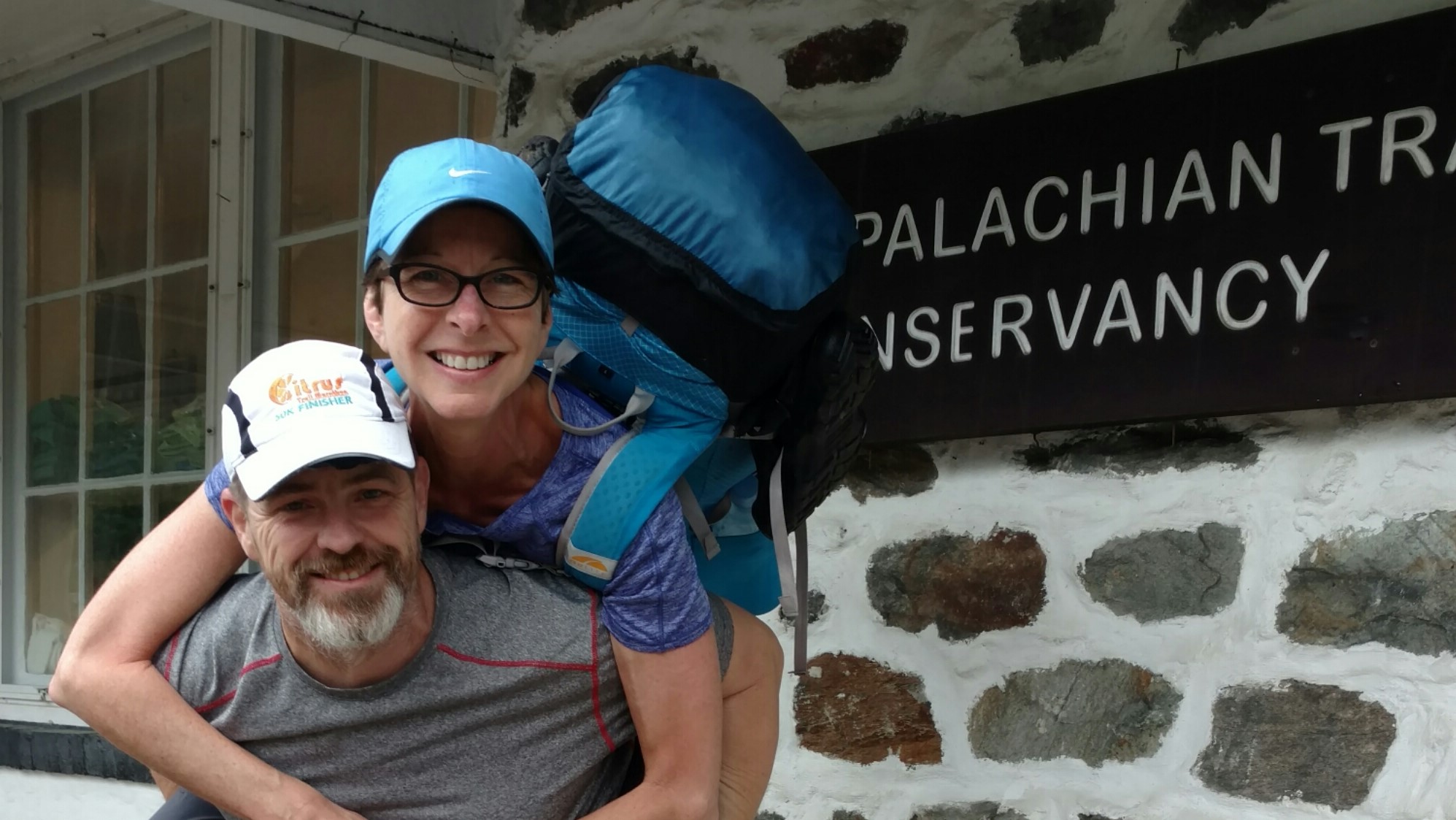
Today was a fun day.  There were plenty of climbs with switchbacks and not too many rocks and views galore.  I am on the Tahoe rim trail now and it’s routed more like the Appalachian Trail right now where they are taking us along the ridges instead of keeping us in the valleys and bringing us up just to jump to a different canyon.

I got a reasonable start this morning at 6:10 and the trail stayed in the woods a while.  It seemed to go up and down pretty gently going along the sides of the peaks.  There were snow patches here and there and lots of views of other canyons and lake Tahoe in the distance.  I’m passing the North end of the lake now.

I happened to check cell service since I could see the lake and I did get a bit of a signal, so I stopped and tried to get data in and out.  It was a bit spotty but I was able to get mail but not post blogs.  I moved along and the trail seemed to stay at the top of the ridges instead of staying in the valley.

A short while later, I could smell smoke and could see that I was approaching what could be a campsite.  Five minutes later it indeed was a campsite, but no campers.  I looked around at all the fire rings and saw one smoking.  I approached it and saw that the fire was still burning the pine straw layer beneath the fire ring rocks.  Some jackwagon left their fire burning.  I was pissed.  Every camper in California is required to watch a video to get a fire permit.  But someone doesn’t seem to care.  After seeing the massive fire destruction in southern California, I would hate to see a fire start in this area.  It’s so windy, it would be easy for a fire to get out of control.  There is massive amount of fuel in the forest.  So many pine needles, cones, and dead trees.  I had to use all the water I was carrying to put it out and had six miles to the next water.  I was pissed for over an hour.

As I approached the first ski resort of the day, I could see what looked like cell towers on top of the high ridge.  Oh boy cell service.  I got better signal than from Tahoe and was able to call Karen and post one blog entry, but not the other.  I’ve never been so close to a tower and not had great signal and data.  I spent at least 45 minutes just talking and getting data in and out.  There are alot of pictures that need backing up and that seems to eat up most of the bandwidth.

The trail went down into a deep and heavily wooded canyon before climbing to the other side.  I was still getting good data there, so I left the phone out of airplane mode for an hour to let pictures back up.

I spent so much time during the day stopping to fiddle with the phone that I realized I was a bit short on mileage for the day.  Checking the maps, it looked like I was not far from another ten mile ridge walk.  I would either have to camp on the near side and call it a short day or push on possibly after 10 pm to hit the next official campsite.  Being a high ridge, campsites are harder to find and would be very windy.  It seemed like the close campsite would have to be the target.

I pushed on and anticipated getting to the campsite at about 7pm.  I filled up on water at the closest stream.  There is 12 miles to the next water, so I loaded up with 3 liters to have 2 for the ridge walk tomorrow and 1 to camp with.  The pack always feels so heavy when loading up 3 liters.  And to think that I loaded 11 in the desert.

What I did not realize is that right after the stream, the next ridge walk actually began.  Yikes, will this campsite be on the ridge?  A mile later and yes, indeed, the campsite is on the ridge in small patch of trees.  And it’s occupied by four campers already.  OK, ridge walk it is.  I pass them by and see that the far end has another tentsite.  Score!  There are enough trees to help block the wind, but it will buffet the tent pretty badly, so I decide to cowboy camp instead of use the tent.

I set up and cook dinner.  I finally have both powdered milk and butter, so I can’t wait to make some potatoes – loaded baked.  The butter and milk do make a difference.  They taste pretty darn good.  I secure everything and hop in the sleeping bag.  I’m wearing my fleece and down just to make sure I don’t get cold tonight.  As I’m typing this, my hands are cold, so the gloves are probably going on soon. 

Tomorrow is Donner pass.  I hope I don’t get hungry and have to eat another hiker.  That would be terrible.  What is also terrible is that I noticed that Truckee also has an Enterprise and is fairly close to Reno.  An REI stop might happen.  I’ll play it by ear.  I wasn’t planning on going into Truckee at all.  I have plenty of food and don’t need any more delays.

PCT mm 1123.3 – lakes galore

image

Today was definitely a lake day.  I must have passed a dozen or more.  Some of the trail was rocky, but much of it pleasurable and there was one legitimate pass to cross early in the day.  I saw perhaps twenty other hikers and met two new thru hikers and ran into another one I have not seen in two weeks.

I woke up alot in the middle of the night probably because the wind was howling all night long.  I left the tarp off the tent so it wouldn’t flap around and wore my hat to bed to keep warm in the strong wind.  I ate my breakfast in bed and managed to get rolling at about 6:15.

The wind continued all morning and much of it I was borderline cold.  I didn’t bother to put on a jacket or gloves and was fine, but in the shade I was a bit cold with the strong wind.  All morning we went from lake to lake and all of the lakes larger than about 100 acres had whitecaps and waves on them.  Not a good day for fishing.

There was a big long climb up a rocky mountain that ended up being quite a high pass that was big and open and would have been a good place to hang for a while had it not been so windy.  Several times walking up to the pass the wind would actually blow me uphill or a few times clear off the trail into the bushes.  The backside was not nearly as windy but did have several snow banks to deal with.

I met two new thru hikers, Just Will and 050, who started in April and are just now realizing they need to pick up the pace to be able to finish.  They are about my age and my pace, but I think they start late and stop early.  We crossed paths about a dozen times throughout the day and chatted a few times.

During second lunch break, I saw a hiker pass by who looked familiar.  He looked like Fancy Pants.  He’s the only hiker I know wearing a rash guard as a shirt.  He had already passed by the time I made the connection.  About an hour later as I was catching up to the other two, he came right up behind me and behold, it was Fancy Pants.  I had not seen him since Kennedy Meadows.  He left the day I arrived and from the registers I could tell he was staying exactly one day ahead of me through the entire Sierras.  He took two days off in Tahoe and that’s how we synced up again.  I’ll probably see him off and on for the next few days until he gets ahead of me again.

I was hoping the easy afternoon terrain would let me get a bit farther than 25 miles today so I can chip away a little mileage off the last day into Sierra city, but the morning rocks took their toll.  I was out of juice at 7 PM so it was time to stop at a nice campsite not far from a stream.  I had been looking forward to Pad Thai for dinner.  It’s hard to find in some grocery stores, but the one in Tahoe finally had it.  I put a Justin’s peanut butter in it and ate a hot and spicy tuna packet while it was sitting.  It was a perfect dinner and will lighten the pack because it’s pretty heavy but worth it.  We’ll see if I can get an early start tomorrow and knock out 27 or 28 miles to inch northward.

PCT mm 895.4 – Full belly

image

Have I mentioned that there is a large lake in every meadow in the Sierra?


The crowd around the fire last night stayed up til 11 so I listened to music for an hour to drown them out and then in the morning again when I woke up at five because the store and restaurant didn’t open until 7 am.  I got up at 6:30 and started packing and was able to get 90% packed by the time the restaurant opened.  I had breakfast with another hiker from Portland who did Oregon and Washington last year and is just doing California this year.  The breakfast burrito at VVR is top notch.  At the time I was thinking that I was going to order two breakfasts but just one burrito did the trick.

I was able to close out my tab and buy a few last minute food items and finish packing before the 8 am ferry was ready to roll.  We set out across the lake at 8:30 and I was back on the PCT right at 9.  And of course the trail would begin climbing immediately.

Most of the day was uneventful.  Only one pass for the day, very little snow, the usual number of streams.  The burrito held me well all morning so I did not break for lunch until 2.  I loaded up on water and made some lemonade.  The only excitement of the day was while crossing a stream on a log that was wet, my foot slipped in the water and then the other foot of course.  I cracked one of my poles while trying to keep from face planting in the stream.  It’s still usable but will no longer collapse.  I don’t know if the warranty will cover this kind of damage, but I’ll find out at the next REI opportunity.  I know Leki covers damage like this.

The terrain is a bit rocky and steep as we head towards Red Meadows so finding a campsite is not as easy as other places.  I stopped a half mile before my intended destination because I found a nice soft flat spot without too many mosquitoes.  A bird in the hand, you know.

I am now 11 miles away from Red Meadows, where they have a small store and restaurant and have a bus that goes to Mammoth Lakes every 20 minutes.  This is where I hope to finally get cell service.  I should be able to get to town well before lunch if I leave early in the morning.  There are two hostels and laundry, but I’m not sure about the restaurant situation.  They have a full size grocery store and a movie theater.  Now that I’ve slowed down a little bit with the VVR side trip, I don’t feel the need to take a full zero in Mammoth, but we’ll see.  After all, they have a brewery, too.