
A cool morning a cool breeze and a cool deli make for a perfect departure of the Seminole Indian Reservation
Leaving town
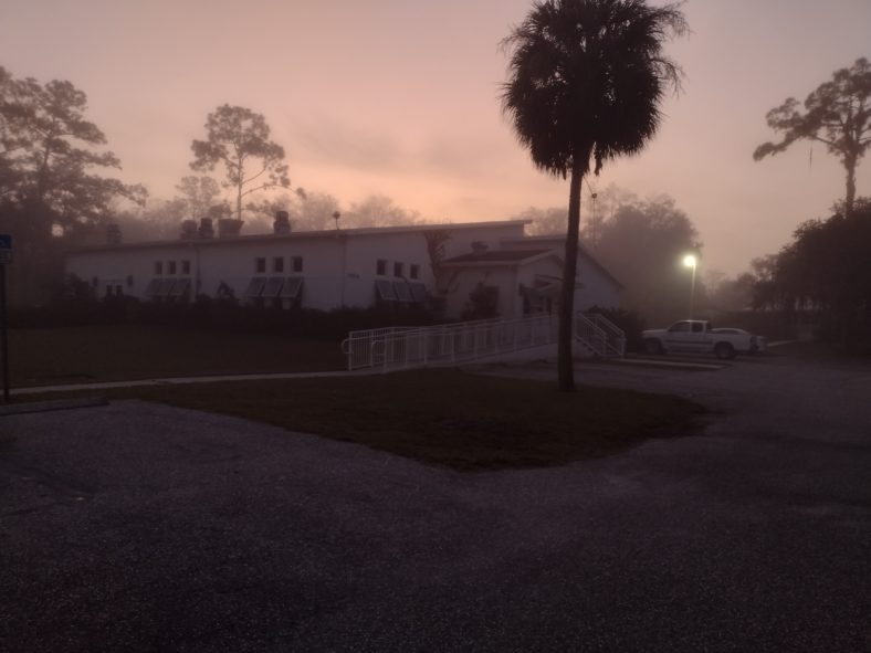
The convenience store and deli that I’m planning to resupply at opens at 6:00 a.m. That’s still a little too dark for me but I get up at 6:00 a.m. and I’m leaving the church at 6:45 just before the sun rises.
The morning is cool but it is still very misty. It’s not really fog, it’s just how Florida is in the mornings. I walk through the east part of town and get to see the reservation schools, hospitals, and other buildings. They are building new buildings everywhere.
I can also see driveways with all sorts of crazy black marks and trash in them which explains where the fireworks I heard last night came from. New Year’s Eve was the day before not last night.
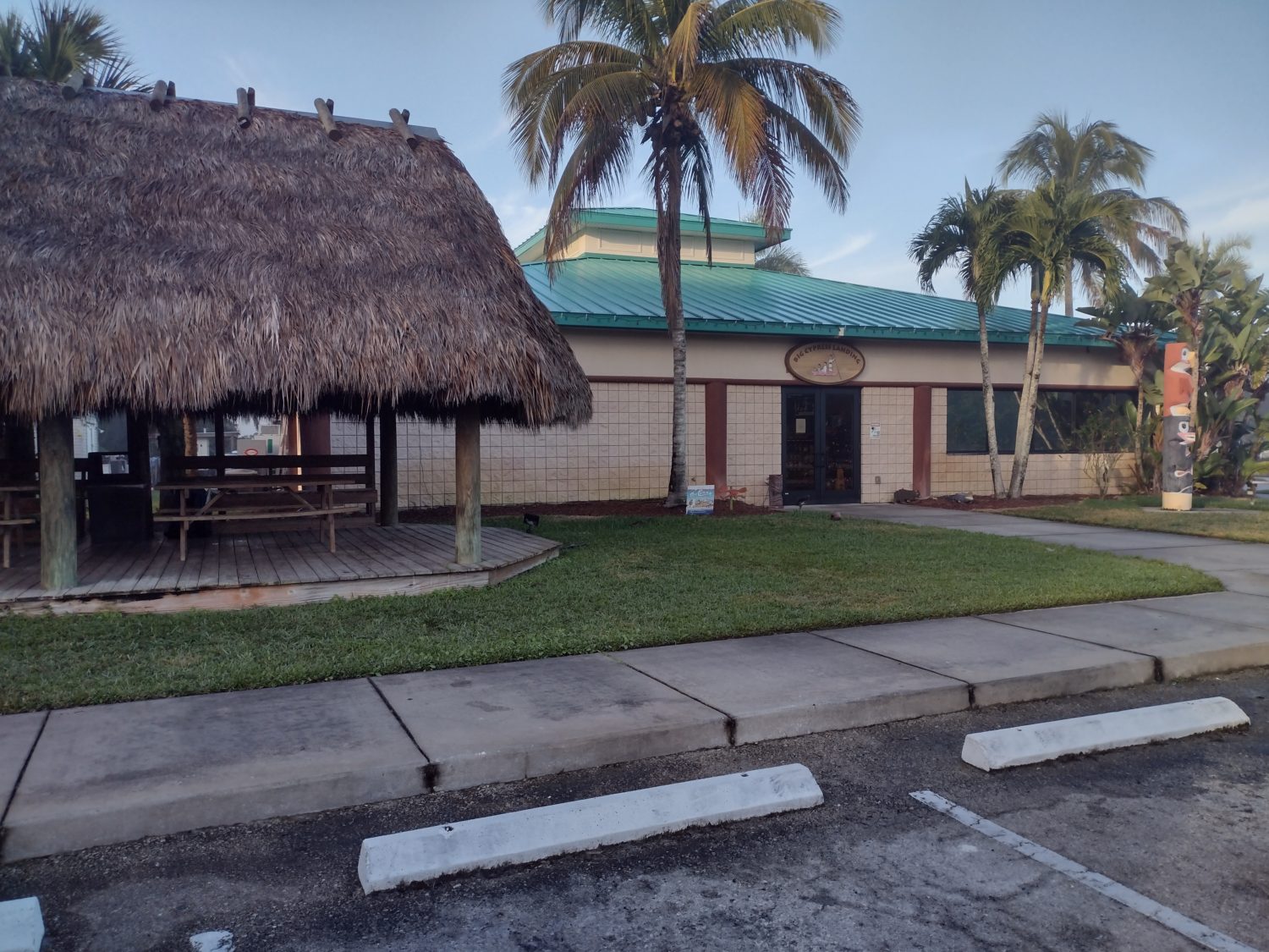
It doesn’t take very long before I finally hit the convenience store that I am wanting to stop at. As I find a chickee outside to take my pack off one of the tribal police pulls up to where I am unloading my pack.
She is interested in the Florida Trail and wants to get into backpacking herself. So I direct her to the Florida Trail Association because she is looking for a group to get started with and not to start out on her own. I let her know that she can probably find a group trip through the Everglades which would be an excellent trip. I hope she looks into it.
When I get inside the store it looks just like the pictures in the app. A large convenience store selection with a deli in the back. I head straight for the deli and check out the menu of breakfast items. A breakfast bowl with eggs, potatoes, ham, onions, and peppers and a side of Cuban toast please.
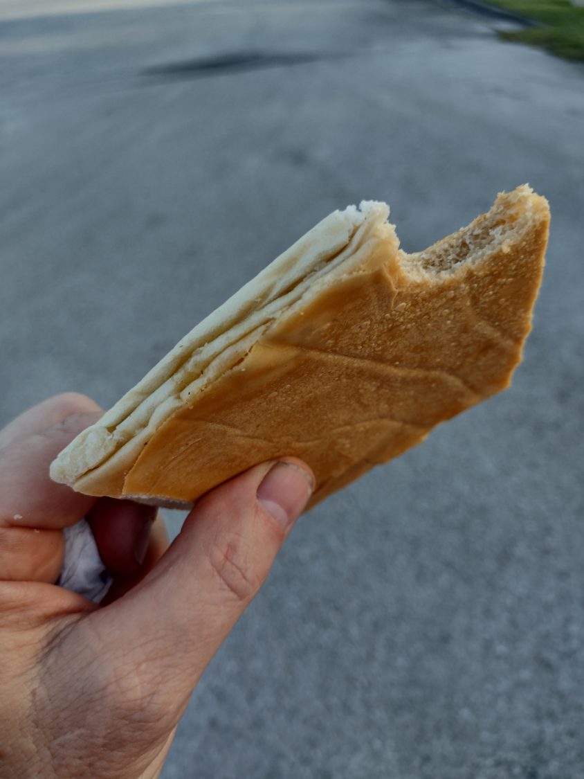
I do my resupply shopping while it is cooking and pick up about two and a half days worth of food. The breakfast bowl is good but the Cuban bread with butter and smashed on a hot press is even better.
Exit Stage Right
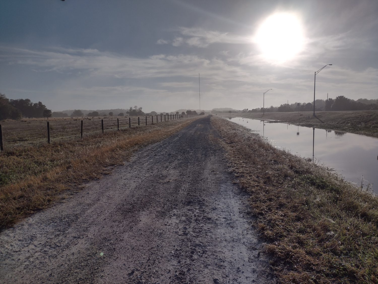
The road out of town starts on a sidewalk but very quickly turns to a dirt road on the other side of the canal leaving town. This is much better hiking than either being in the road or right next to it.
On the other side of the road from the canal are cow pastures and some of the cows are curious as to the big silver object I have circling my head. For this part of the trip I will definitely need the umbrella a lot.
They have the same breeds of cows we have up around Gainesville. I can identify Brangus, Brahma mixed bred, and I can tell there’s even some Charlais blood in there with all the curly hair cuts. The ones with Brahma blood in them are easy to identify because of all the neck skin they have.
By 9:30 it is already getting a bit warm but under the umbrella and the strong breeze I’m not very hot. Without the breeze today I know I would be miserable. The temperature is only supposed to be 85 but 85 under the full sun down here might as well be a hundred.
Don’t Panic
After about five miles of walking out of town on the road next to the canal, the road comes to a sudden intersection where I can no longer be paralleling the main road. I don’t see any blazes at first, so I panic thinking that I should have moved out to the road off of the dirt road at one of the crossings back behind me.
But I check the app and it says this is where I am supposed to turn 90° to the north. And after looking around very quickly I do spot the blazes telling me to turn north here. Crisis averted.
At this point I know I am getting near the end of the reservation. It should be within the next two miles.I spot the water structure that is supposed to be right near the gate. But as I cross it I keep looking for a gate but can’t find one. The trail just keeps on going.
After about a quarter of a mile I stopped and checked the app. Sure enough I am a quarter mile outside the reservation already. There was no gate. I guess there was just a sign.
The Long Canal Walk Begins
Even though the last eight miles out of the reservation were along canals, to me this seems like the beginning of the canal walks. I guess just because it’s outside the reservation.
It is now 45 and a half miles to Clewiston. I have only eight and a half miles to go to the campsite I have reserved from the Southwest Florida Water Management District for tonight. It’s not even noon yet to do no way that’s where I’m camping tonight.
Along the canal there is absolutely no shade from tree cover. But there are water control structures about every mile. Since the Sun is to the south in January, the entire and north side of each structure has a large amount of shade.
I pull off behind the second one I see to have first lunch. First lunch is basically just a bag of potato chips and some beef jerky. But I begin cold soaking some ramen noodles for second lunch when I get to the campsite sometime between 2:00 and 3:00.
Aerial Photography
Now that I am no longer in the National Preserve nor on the Indian Reservation, I can legally use my drone. And walking along the canal gives a nice linear backdrop for some of the maneuvers that it can do.
I stop and get out the drone and power everything up. Now I have to put on my backpacking gear so that it looks like I’m just hiking along.
After sending the drone about 150 ft away from me, I begin a sweep about 40 feet over my head. Because I am using my umbrella you can’t see my head and I can look down at the controller while it flies overhead recording me. That’s one of the hardest things to do is to control the drone while walking and not looking like you are controlling a drone.
I take five or six shots of various maneuvers, some of them performed manually and some of them using the automatic modes. The whole recording session takes less than 10 minutes and when I land the drone I am delighted to see I have only used about 25% of the power. I want to save power to be able to take similar shots at sunset later today.
Station 5/6 Campsite
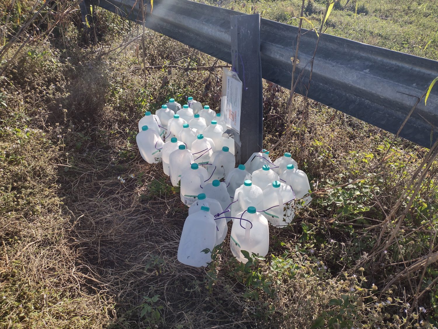
The comments on the app all mentioned the sulfur smell and taste of the water at the pitcher pump where the campsite is. When I get there that’s one of the first things I do because I am nearly out of water at this point.
I begin pumping the well and feeling the water with my hand to see how cold it is. After four or five pumps the water gets pretty cold. This is a good sign.
I smell my hand and it is indeed sulfury but not too bad. These folks have never had true Florida sulfur water. They are in for a real treat.
I pump them out three liters and let it begin filtering. The next order of business is taking off my shoes to let my feet air out.
Then it’s time to eat my cold soaked noodles. Ramen noodles taste pretty good cold soaked if you use only half of the spice packet. A few other snacks are devoured and I pull out a protein bar to eat while I’m hiking on the next stretch.
I dump a Propel packet into my drinking bottle to mask the taste and it does a very good job of hiding the sulfur. I drink nearly two liters there just to make sure I am well hydrated before I leave. I am filled up with three liters even though two miles up the road is a water cache. My plan is to down another liter and then replenish with the liter from the cache.
By the time I leave the campsite it is a little after 3:30. I know there is no way I can make the 16 plus miles to the campsite I have reserved for tomorrow night. There are no other official campsites between this one and that one. In fact these are the only two campsites officially designated by the South West Florida Water Management District for this 40-ish mile stretch of canal.
So I guess the plan for tonight is to stealth camp somewhere between the two campsites. Two miles after the previous campsite and right at the water cache, I meet two local fisherman and chat with them for about ten minutes. They let me know there is another hiker about 30 minutes ahead of me.
Where to Camp
There are supposedly some old farm buildings about 10 miles ahead. They are not any sort of official campsite but people are commenting that they have stopped there. I am assuming there aren’t any no trespassing signs, but you never know.
But even at 10 miles away that is still pretty far for me to go today. I know at least an hour if not 90 minutes of today will be hiking under moonlight. The moon is 3/4 full and already 45° up into the sky so it is pretty ideal for night hiking without a headlamp.
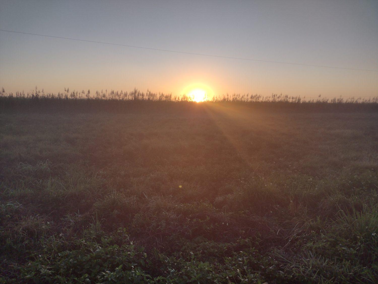
I just head northward and will see what might come up that looks interesting. After about an hour of hiking the sun is finally set and the sky is a very beautiful red and orange color.
I decide to stop again and take another drone session. I do the similar sequence as before but try and get the sunset in most of the shots. After this session the drone is down to 50% power. This lets me know that with one battery I can probably get three sessions safely before having to recharge it.
I have two more batteries and a charging station but it weighs a half a pound and I decided to leave it at home. Now I see that that was probably a sound decision.
I put the drone away and begin hiking with renewed energy. It is getting dark pretty quickly, but the moon is nice and bright and the trail is easy to see and follow.
On the right side of the trail is the main road. But unlike the middle of the day this part of the road has lots of traffic because there are working farms all around. So camping on the right side is out.
On the left side is the canal. Most of the bank is very sloped but in most places there’s a 20-foot ledge at the bottom that is flat before it goes to the water. I am not sure 20 ft is enough space between me and a pool of alligators.
Just as the last ten minutes of Twilight are burning away, I spotted section on the left of the canal that is much wider than normal. It is maybe 80 ft wide. I think I will camp here tonight.
For the last 20 minutes the mosquitoes were buzzing around my head. But since I was walking briskly and there was a good breeze they were not actually able to bite me.
But as I head down to the water to set the tent up, they find me within seconds. I put my bug net on but it is a race between me and the mosquitoes to see how fast I can put the tent up. The answer is about 4 minutes.
Avoiding the Blood Suckers
Instead of my usual take everything out of the pack and throw it in the tent routine, this time I just throw the whole pack into the tent and then rub myself down thoroughly and jump in as quickly as I can. If you don’t brush off before you get in you can carry 20 or 30 mosquitoes in the tent with you.
Once inside, I unpack only enough to begin eating my empanada that I packed out from the deli. It is cold and completely saturated with grease. It would have been much better warmed but it is good enough cold. I am careful to not spill any crumbs and police the area I am eating over afterwards. I do spot a few that need the human vacuum treatment. I am not too worried about critters tonight.
I don’t think the alligators will attack me to get my cinnamon buns. But I will let you know in the morning. Or maybe I won’t. But if I don’t, then you have your answer anyway.
It is well past dark and I can’t see anything other than the moon, but I can still hear all sorts of creatures. Most of them I assume our birds and they have really strange calls at night. I know they are not alligators or frogs.
The other thing I realize while I lay here is that there’s not a cloud in the sky. The 360 degree camera has a starlapse mode so I decide this is about the best night to try it out. I set it up at the foot of my tent pointing north. I will probably let it record for about 4 hours. I hope the results turn out well with such a bright moon. It will be okay if it uses the entire battery because I probably won’t use that camera too much between here and Clewiston.
Emotion of the Day
I think I will choose disappointment for today’s emotion. But it’s just a lowercase disappointment not an upper case one.
Not having a gate or a giant sign at the exit of the reservation was a little disappointing. The one at the other end was a giant 8-foot high fence and a big heavy gate with really big signs.
I do remember seeing a reservation sign about the size of a speed limit sign. But it looked just like the 100 others I have seen over the last two days. I guess I was just expecting something different.
Having only two official campsites in this area long stretch is also disappointing. It forces you to either have really long days or really short days. I don’t like short days unless they are town days when I’m doing chores.I am also disappointed that even though I got up earlier than any other day this trip that I was still only able to do 24 miles. It is still early in the trip and the days are still short so I don’t want to push things too hard. But Clewiston is still 31 miles away and there’s no way I can make that tomorrow. I had planned for two and a half days and two and a half days it shall be.
Those are all minorly disappointing things. I will take disappointment over a catastrophe any day. That alone is something to be grateful for.
Addendum
I just heard an alligator eat something that didn’t want to be eaten. Is it too late to choose fear?
Recent Comments