Month: June 2016

PCT mm 418.5 – Road walk and poodle dog

image

Another undercast day in southern California.

I got up bright and early to make some tracks today and to be sure I was done with the road walking when it was still early and cool.  Since I was high on mount Wilson, I had a great sunset as well as a nifty sunrise.  The breeze died down in the middle of the night so I was alot warmer than when it was blowing while I was cooking and eating the night before.

All because of a toad

It was only a few miles before I hit the trail closure because of a rare toad in the area.  12 miles of trail are closed and substituted with a 7 mile road walk.  The road walk itself was quite nice.  In the two hours or so I was walking it, I probably saw only five cars.

A peaceful road walk with very little traffic.

The scenery was nice and the grade pretty tame.  A campground was five miles into the walk so I detoured to get water.  It took a while to find and I don’t think I was really using the official source, but it was water and I needed it.

Walking tall… On a road.

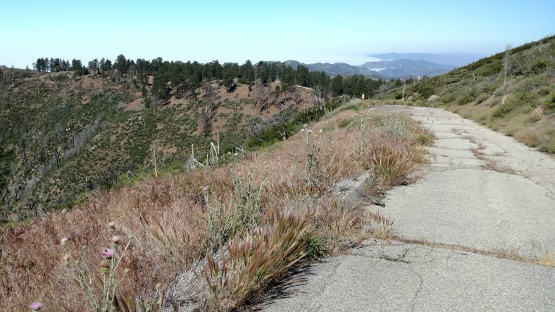
I was back in the woods long before lunch and stumbled on two other hikers who were both section hikers.  The trail here was an old abandoned road.  You could see chunks of asphalt here and there.  The trail was smooth and the grade quite mild again.

When we came to the private campground that sometimes has water, the owner was there and had filtered water for us and even cooked us hotdogs.  It’s always nice to eat something you don’t have to cook yourself.  He was there for the week with his son and a few other people doing maintenance on the structures.  We chatted a while and then set off again.

Another milestone – 400 miles done.

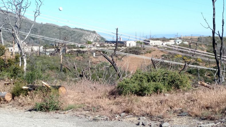
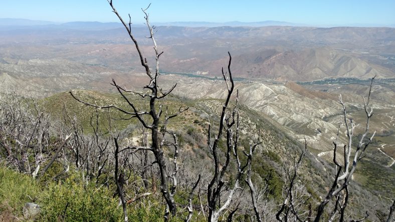
The afternoon was warm, but not hot and I took a short 30 min break to eat at 12:30 then again for an hour in the shade to nap at 3:00.  The area for at least ten miles around here had been burned and one of the nasty things that grows back after a burn is called poodle dog bush.  Weird name, weird bush.  It was all over the place and frequently right on the trail.

Poodle Dog bush is special because it has a toxin similar to poison ivy and oak that causes severe rashes if you touch it.

I am still wearing the long sleeves and long shirt to combat this possibility.  I am also carrying cortisone just in case.  There is also a lot of poison oak around here.  The one odd thing about poodle dog is that it is very fragrant.  It smells like skunked Canadian beer, and I like that smell.

The mild mannered poodle dog bush.

I ended the day a little early because I needed water to cook with and the only water for quite a while is at a forest service fire station.  They have a pit toilet, water, and a picnic table.  A perfect place to make a huge pot of spaghetti and chocolate pudding.  It’s 18 miles to the next water and there is another road walk specifically for poodle dog section that is really bad.  I think it’s about 8 or 10 miles of road walk.  If nothing else, it should make the day go by more quickly.
A typical southern California view on the Pacific Crest Trail.

PCT mm 446.7 – More road walks

image

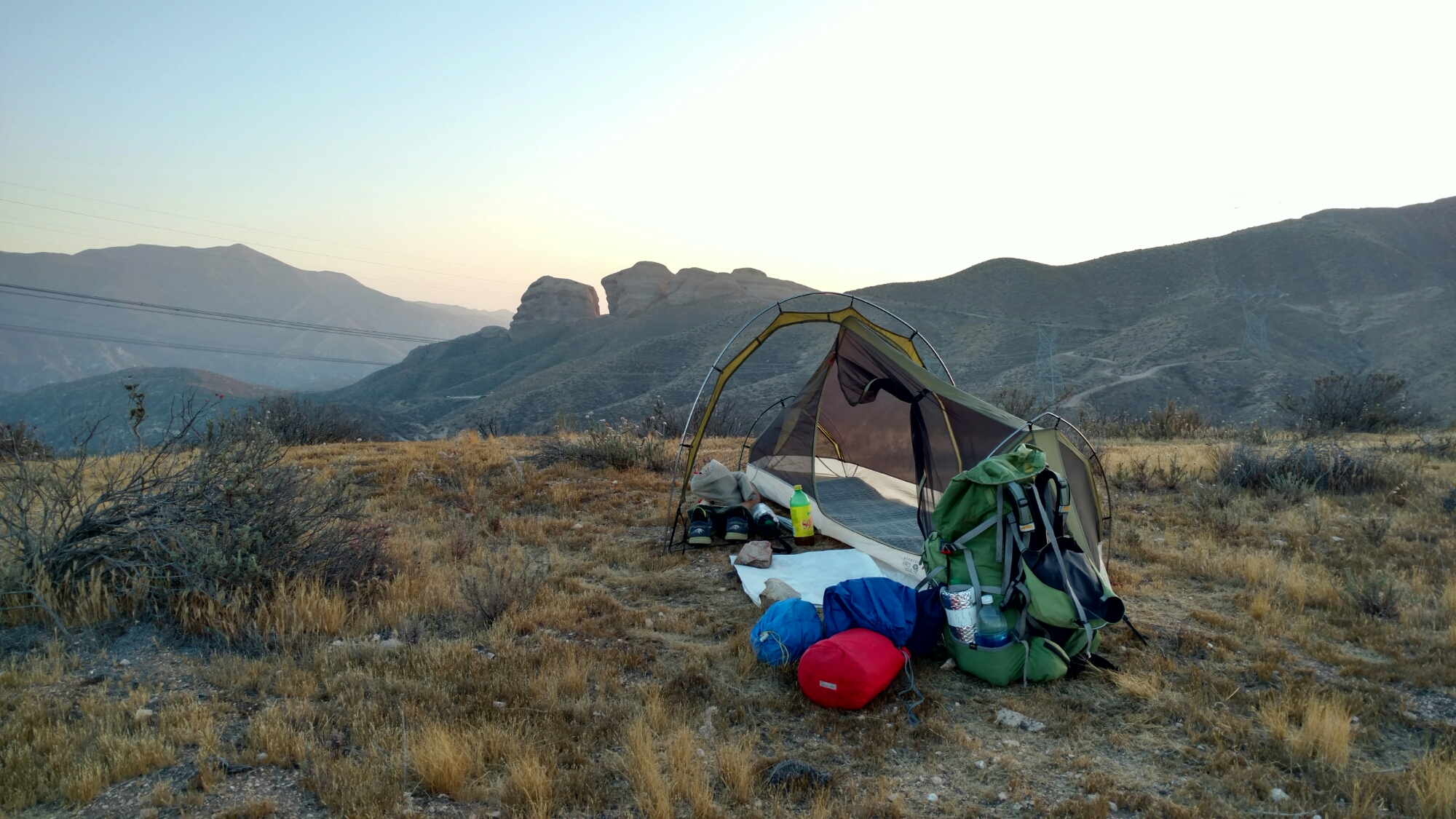
Setting up camp on a ridge line with a fantastic sunset.

Camping at the forest service fire station kept me up all night for some reason.  I had a good spot, it was not too windy, it was not noisy, but I just kept waking up all night long.  I got a late start at 5:30 but went back for more water and to cook some black bean soup I should have eaten days ago.  It was not too good.  Whenever plentiful water is available, I try to cook.

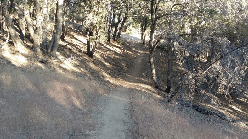
Early morning through a grove of oaks.

It was only a few miles from the fire station that the poodle dog bush bypass began.  It followed the road parallel to the trail for six or seven miles.  There was poodle dog all over the road even.  There were at least two back country campgrounds that were basically now deserted because of the road closure.  [Post hike:  This area was cleared of Poodle Dog bush and this section of trail reopened in 2017.]

This is now an abandoned road with abandoned back country campgrounds.

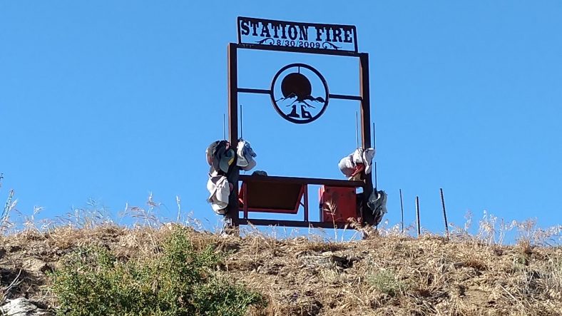
Even the old station with its burned out buildings was very eerie.  I’m not sure how many people lost their lives in that fire, but it was enough to erect a monument to them.

The monument to the 2009 station fire that was the worst in Angeles county.

The abandoned station with its burned out buildings.

What was once a low forest is nothing but scrub now.

The trail after the road walk still had some poodle bush, but just the normal amount.  I hit the ranger station 17 miles from the fire station at about 1 PM or so.  There were three other hikers I had not met yet already there, and one more showed up shortly afterwards.  The caretaker there (another abandoned campground) was supplying bottled water.  I cooked a big lunch and rested my feet for a few hours.  I’m starting to use the flip flops as much as I can now to let my feet rest and dry out.

I headed out at three to set off for anywhere past the KOA campground eight miles ahead.  I was able to find a nice high spot overlooking some interesting rocks and get there before 7:30 and had plenty of time to make camp, clean a bit, and cook a big dinner.

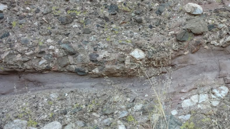
These rocks are made up of sediment and other rocks.

I have only about eight miles to the next town, Agua Dulce, where I will probably take a nearo to take care of chores that need to get done. I would normally be there by 8 or 9 am, but six miles from here are the Velasquez rocks, where several Star Trek episodes were filmed.  I have an idea I will hanging around there quite a bit taking pictures.

PCT mm 387.8 – The big climb out of town

image

Whispy clouds in the next valley.

I purposely slept in late so I could catch breakfast at the coffee shop and wait to here from Aaron to see if he found my shades or not.  If he found them, I would stick around until he got in, otherwise I’d head out.  I chatted with my host a few minutes then headed to town for vittles.  It was a five block walk to The Grind.  Town was mostly dead, there were only two others in the shop and no other shops were open.

I ordered an oatmeal and bagel along with my coffee.  All three were great.  I realized after I ate that I was still hungry.  I should not have skipped dinner.  I ordered a breakfast sandwich and honey bun as well.  They were also good, but I saved half the sandwich to pack out for lunch.

The Grind had many photo albums of hikers they had taken pictures of over the years.  I thumbed through them while waiting and saw some interesting faces.  I was hoping to see a hiker that I had met on the AT, but no such luck.  I noticed one guy in a red vest showed up in multiple year albums, sometimes solo, sometimes with another hiker.  He was a red headed white guy with dreadlocks – he stood out.  [Post hike: I DID end up meeting this guy later at Kennedy Meadows – and mentioned seeing him in the photo albums.]

I headed back and packed up and went back to the hardware store to hitch.   I tried to make eye contact with every driver that passed by to increase my odds of getting one to stop.

Most of the cars passing by were Sunday-going-to-church-I’m-too-dressed-up-to-pick-up-vagrants drivers with their families, so I was worried it might be a hard hitch out of town.

This one also took 30-45 minutes and the guy who picked me up also turned around to come get me.  He also wanted to talk about the trail.

Ponderosa pines leading up to Mt Baden Powell – named after the founder of the Boy Scouts.

The trail out from town was more of the same as yesterday – ponderosa pines.  About five miles in we hit the approach to mount Baden Powel, named after the founder of The Boy Scouts.  My host had told me there were 40 switchbacks during our chat this morning, so I started counting them right from the trail head.  Part way up another hiker said there were 42.  I was determined to see who was right.  I counted the segments all the way to the peak and came up with 41, so I think my host was right – there are 40 switchbacks up that bugger.

Still a long way from Canada.

The trail was crowded, too.  There were perhaps 40 cars in the parking area.  I passed at least 50 people on the way up, and was passed by no one.  I’m starting to get my legs.  I also got a text from Aaron while on top – he could not find my sunglasses, booo.

The view from Mt Baden Powell.

The view up at the top was nice, but not spectacular.  I had heard there are great views of Los Angeles, but the entire coastline was undercast, so all I saw were the tops of clouds and the mountains 5-10 miles away..

Sunset from Mt Wilson.

About a half an hour after getting up there, Peter from Poland showed up.  He is now officially Peter pan.  We hiked most of the afternoon together and are both camped on Mt Wilson, but on different sides.  It is very cold and windy up here.  I was cold while making dinner but the bag is keeping me toasty.  We shall see how cold I am in the morning, though.

PCT mm 369.3 – Wrightwood

Cajon pass is now blanketed in fog.

6-11-2016

In the morning I waffled back and forth on whether to backtrack 7 miles to try to look for my glasses or not.  In the end I decided it was wisest to not try to do that and to rely on Aaron and Stiff to look for them as they came up behind me.  After all, I did have a backup pair and I can use my regular glasses most of the time unless it’s really bright out.

I played leapfrog with Tule most of the morning and we were both surprised to find another water cache not on the water report that was well stocked.

Using the Guthook app that shows way more campsites than the official data book and has up to date postings on statuses as well as pictures.  It has been the most reliable thing to use so far.  It’s the best $25 I have spent on the entire trip.

The terrain at the beginning to f the morning was more desert but the last five miles turned to ponderosa pines again and it was a nice hike into town.  I did not seem to have much energy most of the morning and I think it’s because all of the extra running back looking for my glasses from the night before and not getting enough to eat.  I ate a full dinner but I guess I needed more.

It took at least 30 or 40 minutes to get a hitch into town.  Another hiker I had passed that morning showed up and we hitched together.  Turns out he is also from Florida and also hiked the Appalachian Trail in 2008.  Small world.  His name is Achilles.  The guy who picked us up was interested in doing the PCT some day so he picked our brains all the way into town.  He had actually passed us, then turned around to come back to get us.  And he wasn’t even going all the way to wrightwood.

Once in town I went straight for the hardware store to pick up my resupply packages.  That a small section of the store dedicated to PCT hikers and had a two page flier with trail angels names and numbers.  I took a photo and headed straight to lunch.  Tule texted me where he was eating and Achilles and I joined him.  After lunch (burger, fries, salad, and a beer) we started calling trail angels to see who had room.  I found one on my second call and she had room for two.  Tule already had one so Achilles and I took it.  She had a pop-up camper for us to use.  It was perfect.

Achilles showered and went to town, while I did laundry and repacked from the supply boxes.  One of the things I had Karen send me was a book on PCT planning that didn’t arrive until the day after I left.  She said it was big and wouldn’t fit so I had her take out a days worth of food to fit it in.  She was right, it was big… And heavy.  Being Saturday, I couldn’t mail it back or anything so I started reading it.  It has some useful info and I took photos of about a dozen key pages.  I still have not finished planning all of Oregon and Washington so it will still come in useful.  The other thing I wanted it for was town maps.  I looked through all the towns I have already been through and came to the decision that the Guthooks app is just as good, so I did not photograph any of those pages.

By the time I had my shower and laundry was done it was close to 9 and I wasn’t hungry, so I did not go out to dinner, I just ate a few cookies and went to bed.  It felt really good to be clean and in clean clothes.  I slept well and didn’t even use earplugs.

PCT mm 353.9 – It’s all about McDonalds

Where the abandoned Route 66 crosses through Cajon pass, nirvana awaits.

6-10-2016

I slept in a bit then headed out about 6 and visited with everyone as I passed them.  Everyone was focused on McDonalds.  I was trying to get there after 10:30 but it was just too hard to go slow.  And I tried.  I dilly-dallied and checked out all the views and scaled down a steep slope to retrieve a mylar balloon (second of the trip).  Much of the terrain was extremely steep and extremely crumbly rock.  I was surprised how close they took us to the edge.  I would not be wanting to ride a horse.

Robin gets close to the edge – it’s a few hundred feet down.

We did end up getting to McDonalds at 10:00 so I broke down and ordered a parfait and an orange juice and a coke.  That held me over for 30 minutes until lunch started.  I found an outlet to charge devices and got the phone and battery pack pretty full.  Then lunch was a double quarter pounder with fries and a shake.  We were there until 1 and I must have had eight cokes in that time.  I have never had that much coke before but they just kept going down smoothly.

Ice cream for dessert in the desert.

Both arriving and leaving McDonald’s we could get a great view of Canon pass.  The interstate is split and two double mainline freight tracks go straight up it.  All the trains had for or five engines on the front and some in the middle or rear.  From my campsite I can see the interstate and it’s steady stream of traffic to and from Barstow CA.

The climb out of town is 27 miles without water and 5000 ft of climb.  Cloud cover cooler things off a bit, but it was still a hot climb out.  I took a short break at about 5 miles out and think I left my sunglasses there.  I did not notice it until I was about 10 miles past, and actually dumped my pack and ran about 4 miles back to a second spot where Robin and I stopped later.  As silly as it sounds, running without a pack felt good.

I am camped somewhere in the middle of that backtracking and contemplating running farther down in the am to where I think I left them.  Another hiker (Tule) came by as I was about to settle down for the night and texted to two other hikers who have not come up yet.  I don’t know if I should cross my fingers and rely on them, or suck it up and run an extra 14 miles.  And did I mention I’m on limited water…  It’s going to be a long night thinking about it.

The really funny thing is that I found a pair of sunglasses as I started backtracking to look for my prescription glasses that I left at a rest stop earlier in the day.  The trail provides exactly what you need exactly when you need it.

The sunglasses I found are not prescription.  I’m not totally hosed, but I wear mine ten hours a day and have grown quite accustomed to having them.  I’ll keep asking around if anyone has run across them.  I am just very fortunate to not have to continue through the desert without sunglasses.  The desert reflects a lot of light and are pretty much required equipment for me.

Cajon pass is a constant stream of cars all night long. This is the main route into the Los Angeles valley. They sleep less than New York, apparently.

PCT mm 333.8 – Swimming finally!

What looks like a large dam is actually for flood control Yeah, it floods here. Seriously.

6-09-2016

I got up early and was on trail by 5 am because I had about 18 miles to go to the picnic area with water, shade, and swimming.  I passed the other crew I was with yesterday at about 5:20 and they were all still sleeping.  Late risers 😉

The rest of the canyon was pretty uneventful.  There was old rock work dated from 1927 along most of it and it was still in decent shape except for the graffiti.  Apparently deep creek has a history of flash flooding because they built an entire flood control dam to control it.  The spillway itself was at least 50 ft high.  That also explains the enormously high bridges that had built across the river over the previous 15 or so miles.

The morning started out cool, but got hot pretty quickly.  Every day the forecast says the max temp will be only 87 but then at the end of the day they report that it got to 100.

I took an early lunch break around 10 when I found some good shade trees and made a peanut butter, honey, and chili cheese Frito wrap.  I’m already sick of peanut butter and honey, but the fritos add that extra oomph that make it palatable.

There must be a large quantity of water somewhere around here.

I got to the first picnic area which had pit toilets and shaded picnic tables but no water.  It was very tempting to stop there since it was already one, but the lake water was greenish and I wanted a better spot two miles further, so I pushed on.  I got to the main picnic area about two and hit the toilets first.  Flushing toilets and running water, ahhhhh.  It’s the simple things.

Water at last! And lots of it.

I set up under the main pavilion which was vacant and tanked up on water and prepared to cook some soup when in rolled Robin.  He had the same idea as me… Go for the good picnic area.  We are some lunch, rested a bit, then went swimming for about 5 minutes.

The water had lots of plant life in it so it was not super pleasant, but boy did it feel good.

We dried, dressed, and both headed out around 5.  We were only 13 miles from I-15 which has a McDonalds and we both want to hit it for lunch.  I only ventured out 5 miles and camped and Robin went about 8.  He will probably dilly dally a bit before heading out tomorrow, and I will too, since I don’t want to get there before they serve lunch.  I’m not a fan of McD breakfast.  8 miles away and I can already smell the big Mac.

My typical camp setup in the desert – tent body to keep critters out but let the breeze in. Kitchen off to the side and laundromat everywhere.


PCT mm 310.0 – Water everywhere

A group of hikers taking a lunch break.

6-08-2016

[Post hike:  The hiker on the far left is Stiff – I don’t know how far he made it, but I knew where he worked in Asheville, NC and told him I would visit him.  Karen and I did so the November after the hike.  It was great seeing him.  Sitting up is Aaron, who is from Seattle and made it through Oregon before having to go back home.  In the Red is Tule, who I left in Wrightwood and he leapfrogged me when I had to leave the trail in Portland for the wedding.  We kept in touch until the end, when he finished a few days before me and we missed each other by only a few hours in Mazama, WA.  I met the three of them in Warner Springs and they were there when I was christened as Dirty Gil.  Tule is the reason the name stuck.  Robin is on the right – I chased him from Wrightwood to the Sierra, where I lost track of him as he probably assumed a trail name after that.  I was within two hours of catching him at Hiker Heaven and a day away at Kennedy Meadows.  I have no idea if he finished or not and have no contact info for him.]

Most of the day today we have been walking a canyon along the same river.  Much of the time we have been high above it, but several times we went right down to it.  And when one spot opened up to a sandy beach, it was too much to resist.  I think I got there about 11 am and others kept filing in.

I left at 3, trying to get to the next interesting spot, hot springs, by 6 PM.  I didn’t get there til 7 and it was quite crowded.  The canyon provides very few places for camping, so it was either go a short day or a long one, and I chose long.

Where we stopped for lunch, it was too shallow to swim, but I did go splash around.

Several miles later I did find a good swimming spot, but could not afford the time to do so.  The same with hot springs.  There’s an actual hot springs that spills into a rock hot tub then into the river.  There were at least fifty people there all camping out, even though camping is not allowed.  It is also clothing optional, but none of the bathers opted for clothing.  Again, no time to go swimming.  Also, no time for pictures.

This stream goes on for miles and miles. There is water, but it is very far down and very hard to get to.

The rest of the day was hiking along the river and crossing back and forth several times.  The park service has installed several high and sturdy bridges across the canyon.  Makes for good views, that’s for sure.


One of the many bridges across the canyons.

We pushed on another few miles and I stopped to camp on an old abandoned trail and the others went on another mile looking for a better place.

PCT mm 285.6 – A turnaround day

This section of trail leaving Big Bear looks a lot like Pennsylvania.

6-07-2016

A turnaround day, indeed.  We got a very late start, waiting for a shuttle that never happened, then going to the outfitter to buy things they didn’t have, then a late breakfast.  This is one of the reasons it’s easier to hike solo, your least common denominator is just you, not two other people.  We were with another hiker that we had met earlier, and it was apparent that he was in no rush to leave town.

Breakfast finished, we went across the street and waited for the bus that would take us to the other side of town closer to the trail, but then we would have to hitch the last 4 miles to the trail.  The road is narrow and not recommended to walk.

We only had our thumbs out ten minutes before we got a ride to the trail head and finally set off at 12:30.  Late, indeed.

As we were exiting town, the beautiful ponderosa pines gave way to more beach like scrubby trees.  There were small amounts of shade on the trail and it was not terribly hot.  Each mile we hiked improved the situation.  We were climbing the ridge behind Big Bear Lake and the ponderosa pines returned.

Excellent views of Big Bear Lake as the trail climbed and the trees got taller and provided ample shade.

The bulk of the hiking was in pine trees and fairly cool.  I stopped at a small stream that was not flowing, but had pools to gather water.  It was cool and tasty.  I cooked a lunch and set off again at five after the one hour break.  I wanted to head to the next official camp area just before the next water source.  It was an area that had been burned, so all the ponderosa were just sticks.  Darkness started to fall so I switched on the headlamp and kept walking.  I was only a mile or two away.  I could see two headlights camping as I approached the valley floor.  When I got to the campsite I realized the other hikers were camping at the next spring a half mile away.  I decided to camp at the designated spot because it had wood chips all over the place which looked comfy.

This once was a beautiful forest, but now it is black twigs and will be this way for decades.

I quickly set up the tent and set out about eating then made some quick repairs to my shoes.  As we were leaving the hostel this morning, I found a whole tube of shoe goo in the hiker box.  I did not have time to fix them then, but fixed three of the major holes after I ate.  If the weather and shade hold tomorrow, I might actually be able to hike all day long.  But if it gets hot again, it means lots of night hiking is in store.

PCT mm 266.1 – Road walk and bus day


Hot but breezy walking in the canyons.

6-06-2016

The fire closure North of I-10. Made for an interesting day today.  I camped 17 miles from the interstate to have a shot to make all the bus stops.  I awoke at 3:45 and was off at 4:20.  I ran across Robin at about 5 am just after he left his camp about two miles further.  We leapfrogged each other most of the morning.  We both had the same plan, so it’s not odd that we ended up at the same place at the same time.

Even though the trail was almost all downhill, it was harder than we expected with rocks and eroding slopes and it took a long time to get to the valley floor.  And it was hot… Blistering hot.  But very breezy.  I was not able to use my umbrella most of the day because it was too windy.  The entire valley is a giant wind farm.

Another major milestone completed!

Up high in the canyons it is at least breezy. Down on the desert floor, it is soft sand and hot air for miles. I have to hike across that before lunch.

Just as the trail leaves the mountains and enters the desert floor, there is a water spigot provided by the city of Palm Desert water supply.  There’s not much shade, but a quick reapplication of sunscreen and a quick fill of the water bottles and it’s time to head across the desert floor.  We have about three or four miles to I-10, then a 5 mile road walk along a service road to the casino to catch a bus.  There is a famous trail angel hostel, Ziggy and the Bear, that we will miss.  But that doesn’t matter, as we have heard that Ziggy and the Bear closed just a few days ago.  Sigh.

Looking back at the mountains which are the water source for the town of Palm Desert, CA.

A quick shade stop at the I-10 service road before the road walk to the casino.

Only a few cars passed by during the entire road walk since I-10 is just 100 ft to our right the whole time. No one travels this road.

We hit the road walk at about 12:30 and walked over 7 miles into a stiff 40 mph wind until 3:15 when we finally made it to the Indian casino.  We were able to catch the #2 bus to the Walmart at 3:45, but when we got there, our connecting bus was leaving.  We missed it, and it was the last bus of the day heading to the bus terminal.  We were able to grab a quick lunch and get an Uber ride to the connecting terminal and get there 10 minutes before the last bus to Big Bear pulled out.  The ride out reminded me of the bus ride to Campo with its twisty road so I started having flashbacks of the bus breaking down on us.  But we arrived safely and got dropped off one block from the hostel and got checked in quickly.

The hostel owner informed us that the fire closure we just walked and bused around was not closed and has never been closed.  I find that hard to believe, but who knows.

There are three independent sources on the internet, including the forest service saying that it is closed, so better safe than sorry.  [Post hike: I never found a trustworthy answer until my very last day approaching Canada, where one of the hikers I was with told me first hand that he had walked straight through the trail to Big Bear about two weeks before I got there and there was no closure.]

We did not have time for anything other than resupply, as it was nearly 8 PM already and one of the guests had a car and was driving to the grocery so we quickly did that first after a quick stop at the sporting goods store for fuel.  By the time we got back from the grocery it was just past 9 and we had a very hard time finding a restaurant still open, but we finally found one.  It was now after 10 and after showers, we did not get to sleep until 11.

[Post hike:  You will notice the huge 70 mile difference in the trail mileage markers.  The bus from I-10 to Big Bear cut out probably 50 miles of the trail.  This section, the short 3-4 miles outside of Idyllwild, and about a half mile near Hiker Town a few hundred miles further are the only sections to break my continuous hike.  It doesn’t feel good to miss a section.  I don’t mind alternates, as most of the time they were more fun than the official trail.  But I was hoping for a completely unbroken hike to Canada.  It’s frustrating when these fires were five years ago and the trail is still closed and we were not even sure if the trail was truly closed or not.  Fire is a massively destructive force on this part of the country.  The other two sections did not sting because they were so small, but this was a large chunk of trail that I missed and it still leaves a small hole in my heart over a year later.]

We are sleeping in late so we can arrange for a ride to the trailhead around 8 or 9.  It’s 8 miles to the trail from where we are, so I’d rather not start the day with another long road walk.

PCT mm 193.6 – Trees galore

The San Jacinto mountains jump up to 9,000 ft with great views and cool weather.

6-05-2016

I was still tired when I awoke in the morning at 5 but my feet felt a million times better.  I ate the breakfast I bought at the market the night before and took one last shower for a while.  I was out the door at 6:30.

One of the alternate routes around the fire closure left town right in front of the inn.  I took the roads they indicated for just over a mile then took a 2.5 mile trail that led to a parking area and another 2.5 mile trail to the actual PCT.  This parking area was full and swarming with people.  It also had a ranger at the trail head… who wanted to see my permit… which i did not get a chance to print yet.  I tried to show her the PDF, but there was no cell service, so we couldn’t read it from the email.  Then I checked downloads and voila, there it was.  But unfortunately I had only downloaded the cover letter and not the permit itself.  Grrrrr.  She was about to make me go back to town to print or download it when at the last minute I guess she felt sorry for me since it was obvious that I had one, I just couldn’t show it to her.  So instead she made me attend her impromptu leave no trace course right then and there.  Five minutes later I was headed up the mountain… With 50 other hikers… And another 50 coming down.

Honest to goodness trees on honest to goodness rock strewn trails.

These roots could give the AT in Maine a run for their money.

It was quite crowded up there but after about five miles I guess we passed the interesting stuff and the crowd died down.  I had flashbacks of Yosemite and the crowded trails.  The trail was steep, but the breeze was cool.  This was a textbook high mountain trail. and I could feel the effects of the higher altitude.  It did not help that I now had a fully resupplied pack from town.

I probably saw only ten other people the rest of the day.  One person I did see again was Robin, from Switzerland.

We hiked together a little and stopped for lunch and to fill up on water at the last source for the next 20 miles.  I loaded up 5 liters and drank as much as I could before setting out.  I wanted to make about another ten miles so I could be within striking distance of I-10 tomorrow.

I caught up with Robin by lunch time and we hiked the rest of the day together.

The best part of the day it that it was not hot.  I did not even use the umbrella once all day.  There were tons of huge ponderosa pines, too.  We topped out at about 9000 ft and I could tell the air was thinner.  Most of the morning and afternoon was climbing and it felt like I had no juice all day long.  In the late afternoon is was nearly all downhill and fairly easy.  The trees have given way to desert again, but there are still a few trees for shade.

Hikers have placed pine cones in these interesting erosion pockets in this large boulder. It looks like a Christmas display or something.

A wind farm far off into the distance.

Being this high up there was an abundance of cool breezes and plenty of shade to go along with the great views.

We have another fire closure coming up and thus is a big one.  I think we will miss close to sixty miles or trail just because there are no alternative trails in the area.  We will end up having to take buses to get to Big Bear Lake as best we can.  It’s too far to road walk.

I am hoping to make the 17 miles to I-10 in one shot in the morning to avoid the heat.  It’s then a 5 mile road walk to catch the first bus from the Morongo Casino.  I hope I can finish this all before the buses quit running, otherwise it we will be scrambling to find a hotel in Sacramento.  I better get an early pre-dawn start to make sure I have enough time.