Page 12 of 32

Day 0 Flying to Miami

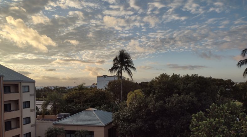
Sometimes the hardest part of a hike is getting there. This travel day went much smoother than most. On time flights, good weather and Uber save the day.

Packing and Preparing

I have been working on the gear list for several weeks now. In fact I have had more time to prepare for this hike than most hikes. But there have been many points of indecision such as which stove to take.

I prefer using the isobutane stove because it is fast and convenient but there is a shortage of being able to purchase the canisters in Miami. The alcohol stove burns ethanol or methanol which is easy to find at gas stations Walmart and many other stores.

The day before I left, I checked Dick’s sporting goods and Walmart to see what the availability was in Gainesville. Walmart had both heet and denatured alcohol and Dick’s sporting goods still had some isobutane cylinders.

I spent the morning before the flight testing both methanol and ethanol in the alcohol stove. The methanol had a definite odor to it and being toxic I decided I will probably never use that in the future. Both fuels took about 4 minutes to boil a cup of water.

The isobutane stove takes just over a minute to boil the same amount of water. Decision made – isobutane it is, even if it is going to be harder to find them on the trail.

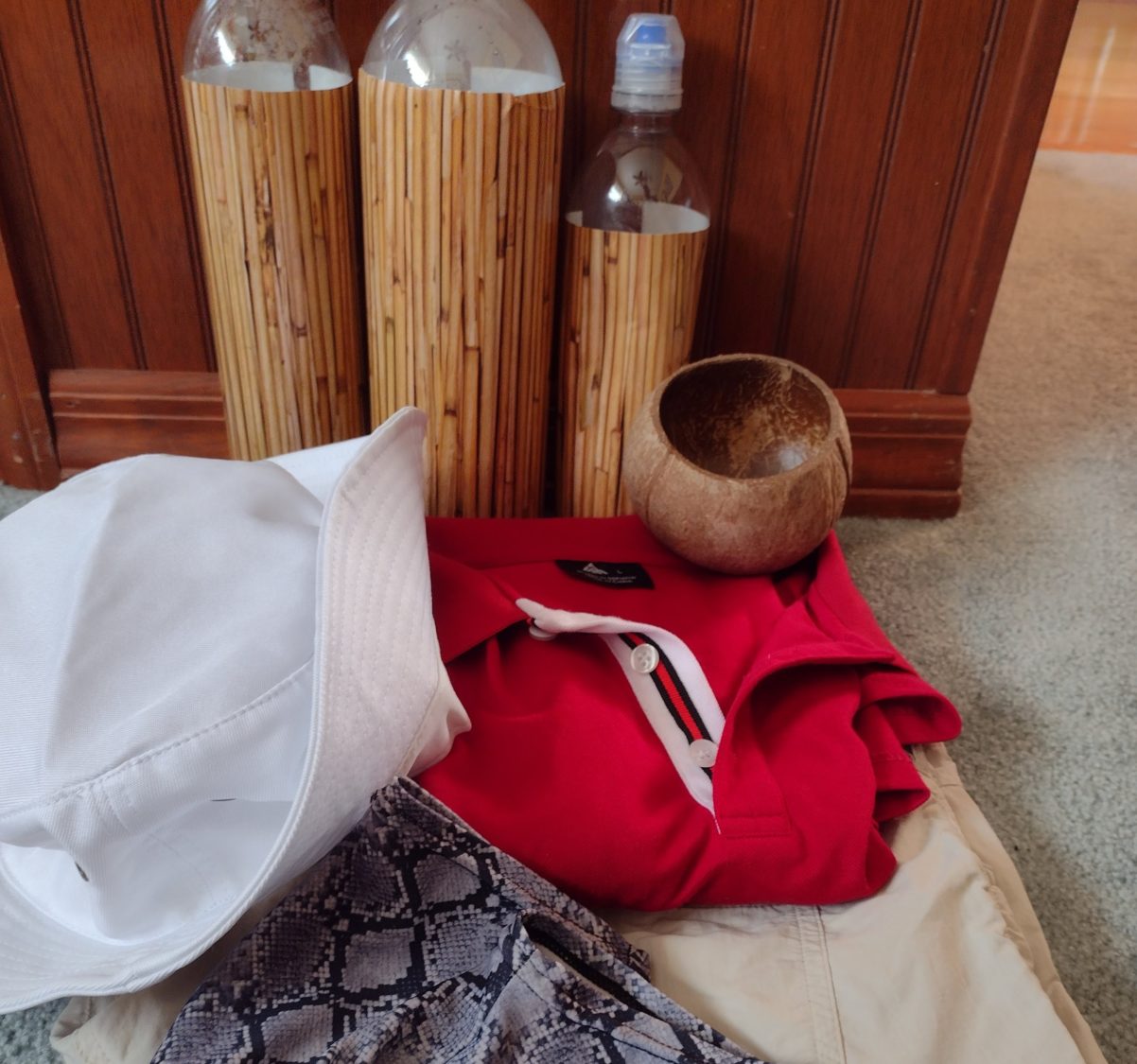
I still also had not decided which camera gear to take. The drone weighs two and a half pounds with three batteries but takes awesome video. The 360° camera is only a half a pound and the video quality is not great but the pictures that it takes are clearly unique. The pocket osmo also takes excellent video and is probably what I will be using most of the trip. In the end it all matters how heavy the pack is as to how many cameras I bring.

So when I finally packed everything up with 5 days of food but no cameras and no water it ended up weighing 22 lb. That was lower than I was expecting so I have decided to bring all three cameras since I should be able to keep the total weight under 30 lb even with water.

Travel Day

Having a late flight at 7:30 p.m. instead of a.m. means that I have plenty of time to do chores. And one of those chores is getting my haircut for the last time for the next 2 months.

Karen used the same stylist many years ago, so she went with me to my appointment. It was like a small family reunion. But we were very early so we ran out for a quick beer before arriving.

After the haircut, we went to the local food court. They have a satellite location of one of our favorite pizza shops so it was a great decision. I have a feeling that Karen will be going there without me quite a bit.

We also got to the airport early. Early is beginning to become a theme for this trip which is perfectly fine for me. TSA even opened up the screening line early for me. And that’s a good thing because they wanted to open my pack and inspect a few things which took time.

Did you know that you can’t take peanut butter on an airplane? I know that now. They were super nice about it and even offered to let me go leave it in my car if I had a car in the parking lot. No car, not for a while. I had to sacrifice a new jar of Trader Joe’s peanut butter to the landfill gods.

The Flight

I had just read an article that morning about Southwest airlines canceling nearly all their flights. I was hoping that American airlines was not in a similar situation. The flight was on time and maybe even a little early. When there are only 30 people on the plane, and you are the only plane leaving the airport, nice things like that can happen when the weather is good.

The flight was perfect. Fifty minutes to Miami. But the Miami airport is so big that it took 25 minutes just to get to ground transportation.

I got on the shuttle bus to the Courtyard and even asked the driver if this was going to the Courtyard on the northwest corner of the airport and he said yes. After getting to the Courtyard I realized it was the one on the Southeast corner of the airport instead. Uber time

Once I finally got to the correct hotel, the check in went very quickly. I had shipped three last minute Amazon packages to the hotel and they were delivered earlier today, so I inquired about them. They said they would go get them and then ring my room when they had them. No phone calls.

Thinking about the packages and a travel day on an airplane, means that the brain is going 100 mph. I arrived at the hotel at 11:00 p.m. and waited for the packages until 12:00 but could not get to sleep until about 1:00 a.m.

Emotion of the Day

It is hard to pick a single word to describe the emotions of the day. But releif has to be the strongest one.

I have been preparing for this hike for approximately two months. To not have made a decision on either stove or cameras until the day of the flight is very unusual for me.

But with such an easy travel day, a lighter than expected pack, and less worry about purchasing fuel in Miami, means that there are no more decisions. Other than tracking down my packages, finding a place to eat breakfast, and getting an isobutane cylinder for the stove, there is nothing left to do except hike.

A New Adventure on the Florida Trail

I have been blessed with another opportunity for hiking, this time much closer to home on the Florida Trail. Join me as I hike from the everglades to just short of the Alabama border in the west panhandle of Florida.

This will be an 1100 mile journey, and I have a mere eight weeks to complete it. Florida, being flat, is normally not a problem to do this kind of daily mileage. But most hiking is done in the Summer or shoulder seasons where there is plenty of daylight. This hike will be in January and February where I will have several hours less daylight than I am accustomed to.

Although I love night hiking, I am not a fan of finding a campsite in the dark, so I do not plan on doing much hiking after sunset. I am not averse to night hiking in the morning, so I will probably get up before sunrise to begin the day. There is nothing better than be hiking for 20 or 30 minutes before the sun even makes its presence known. I want to be the first one to see sunrise, even at the expense of clearing every spider web with my face. Take one for the team.

I am unsure how many hikers I will see on this trip. I will be leaving a week before the official kick-off weekend, where a dozen or more FTA trail angels will shuttle hikers to Big Cypress from both coasts and have some informational seminars on what to expect and Leave no Trace (LNT) principles.

If I see one, or see a hundred, it makes no difference to me. In previous section hikes during the hiking season, I have tended to see only one thru hiker a day at most. many other hikers have already started from both ends. So I know I should at least see plenty of south-bounders for at least the first half of the trip as they finish their hikes.

I have section hiked maybe a quarter of the trial over the years. I have been an FTA member on and off since 1990. The only areas I have never ventured to are the southern 300 miles in the sugar cane fields and swamps of Big Cypress, and the center section of the panhandle near Eglin AFB. I am looking forward to new experiences.

One thing that will be different about this hike, is that I have decided to hike in “costume.” The trail name that I acquired on the AT in 2016 was Gilligan, from the 60’s TV show Gilligan’s Island. later that same year, it was transformed into Dirty Gil, as the desert of California is very dusty and a white shirt and cream pants get dirty very quickly. I have white pants and shite shorts, a red long sleeve shirt and a short sleeve one, and a white bucket hat. I have also shaved clean for the first time in 30+ years. Perhaps I should dye my hair brown, too? I am also bringing an orange hat and orange shirt, because I will still be in active hunting areas for the first few weeks. We shall see how long the coconut lasts… it’s heavy.

I have changed out much of my gear, too. I am going with a Gossamer Gear pack that is lighter than I am used to. I will be using my 40 degree down bag, but switching up the insulation layer to a super thin 1/8″ foam pad more for prickly protection, and a torso length inflatable pad. I have a back issue that requires me to elevate my lumbar when sleeping on the ground, and the torso length pad eliminates the need for that and actually improves my sleep significantly. The combo is lighter than my normal Z-lite or Ridge-rest setup. But the biggest change is I will not be using my hammock this year, I have opted for a Zpacks solo plex. It’s just soooo darned light and still has great rain and bug protection. I have only spent a few nights in it so far, but think I am going to love it.

I have selected five locations to mail myself packages of harder-to-find items, but will be buying most of my food along the trail. I prefer to buy locally as the palette changes over a period of weeks on the trail and you get sensitized to the flavors of some of your food items. I doubt I will ever be able to put a Clif bar in my mouth ever again. Tuna packed in oil? Still love it and will have a dozen in each box. Once I discovered (by accident) to eat it cold and not hot, I just cannot get enough tuna fish even to this day. I probably have enough mercury in my body by now to make a thermometer.

I am upping the camera game on this trip, too. I will be bringing the DJI Pocket Osmo again. It takes great video. But I am also considering bringing a drone. I know I cannot use it in the national lands, but there are hundreds and hundreds of miles of the trail where they are permitted. I have a tiny 450g drone that takes great video, but I am unsure if I want to lug the weight of the entire kit with batteries, controller, case, etc. It’s over 2 lbs, and that is a ton of weight for a hiker. I must make my final decision soon. I also have a 360 degree camera, but early tests show that the editing software on the phone is just too cumbersome to try to post anything on the trail. it is also nearly half a pound, so this one will stay on the gear shelf for this trip.

I will not bother with a complete gear list because up until the time I board the airplane, I probably will not know exactly what I want to take. On our 2016 Appalachian Trail hike, I had brought a small bluetooth keyboard to assist with blogging. But as we entered the train station in Washington DC, there was a USPS post office on the ground floor, and I mailed it back home before ever setting foot on the trail. I hope to not have any last minute moments like that any more.

Day 49 – Back to Civilization

Driving back home

Twelve miles does not seem very far, but it’s far when it’s cold. I had camped high up on a ridge and ridges mean wind, so it was a little chilly that night and especially in the morning when you have to put on cold and damp clothes. But the excitement of the final day of hiking motivated me.

Just beyond the break of rocks where I had camped was a nice outcropping with a great view of Waynesboro, VA. The sun was just coming up and making great patterns with the extensive cloud cover. Can you believe that I did not snap any pictures? My brain must have been frozen. I spent nearly a half an hour taking in the views before heading towards my last destination – Rockfish Gap, and the entrance to Shenandoah National Park. Karen was set to meet me at 3PM, so I better get going.

The morning was uneventful, and the weather held out just fine. I was lucky on this entire trip to not have much rain. It could have been colder, too, but it could also have been hot and miserable. My only regret for the timing of this hike was that in the fall, the days were too short to make enough miles to get all the way to Harper’s Ferry, WV in the allotted time. First world problems.

I made good time with a light pack devoid of food or heavy water. I ended up getting to the Rockfish Gap parking area an hour early, so I sent a text to Karen letting her know I was at the pickup point. I dug out some less-dirty clothes to wear, and started digging through my food bag to find something to munch on to pass the time.

One thing that surprised me as I car-watched, was that there were way more cars than I was expecting. Like four times as many more. Being in a break-out-of-COVID-lockdown-mood, apparently all of Virginia had decided to head to Shenandoah NP. There was an unending stream of cars at every interchange, all waiting ridiculous lengths of time to merge into traffic. Karen might be late.

But as luck would have it, Karen arrived right on time. I could see her approach from the intersecting road, and loop all the way around me to get to the parking lot. Our eyes met as she looked for traffic, and I could tell that she was as glad to see me as I was to see her.

I quick hello, hug, and kiss, and it was time to load up and take off. I think she hd enough of driving for the day, and it felt weird for me to get into a car and start driving. After spending nearly two months going 2 MPH, a leisurely 55 MPH seems like light speed. It takes a while to get used to it.

The rest of the day was uneventful – check in at the hotel, take a shower, then find a place to eat. Apparently life in civilization is just like life on the trail. We found a nice outdoor pizza joint and had a pizza and a bottle of wine. Hmm, again like trail life.

I wish I could say that I learned some great revelation about life or myself on this trip, but the only thing that I can say that I have reaffirmed, is that I really love hiking. The Appalachian Trail might be a bit harsh or cruel at times, but the beauty never abates. I think I will try to keep doing this for as long as my body allows and opportunity provides.

(Editor’s note – this was published over two years after the hike ended just to put proper closure to the trip.)

Day 48 mile 852.5 Only 12 more miles to go

This trip is quickly coming to an end and the reality of that really only hit today. My targeted finish is Rockfish Gap which is the last road before Shenandoah National Park starts. I got an early start today just to make sure I could knock off as many miles as possible today and not leave them for tomorrow. Where I am camped now I have only 11.8 miles to go and I will try and get there between 1:00 and 2:00 tomorrow afternoon because the forecast says it’s supposed to start raining. It would be awesome to be able to get off the trail before it rains.

I had set the alarm for 6:30 but I was awake at 6:15 so I went ahead and started packing. There were several other people camping so I tried to be as quiet as possible. I packed up, ate my breakfast, and was on the trail by 7:00. It was just starting to get late but I still needed my headlamp to see the rocks.

From the Priest Shelter I had to finish climbing to the top of priest Mountain. It was only about a third of a mile and went quickly and when I got to the top there really wasn’t much up there other than trees. But about 20 or 30 minutes later the trail came out to a nice ledge where I got great views from an angle I hadn’t seen before. I stopped and ate a quick snack. I would need my energy because this was a 4,000 ft descent down to the Tye River.

The hike down took longer than I thought. I passed many people coming up and several with dogs that weren’t on leashes. I don’t want to be anywhere near them when some of these unfriendly dogs meet each other for the first time.

When I got down to the Tye River, it was shallower than I remembered from 10 years ago. Maybe the time of year has an effect on the depth of the river because then it was summertime and probably raining more. And then of course the trail climbs again.

2 miles from the river is a junction where the AT splits off from the Mau-Har Trail. The AT climbs around a series of ridges with rocky ledges and good views of the valley.  The Mau-Har Trail goes the other direction and goes up a steep chasm where a cascading river flows. The AT is longer but easier and since I took that route last time and I was looking to save a little time today I decided to take the Mau-Har Trail this time.

The trails started off pretty normal for about a half a mile and then turned to really steep switchbacks. At the top of the knoll where the switchbacks were taking me it then descended into a ravine. In the ravine was the cascading stream. In the stream bed was a hodgepodge of very large boulders and there were waterfalls everywhere with a deep pools beneath them. The trail next to the stream was very rocky and very steep. People who do this section as a loop with the Appalachian Trail usually go the opposite directions since this is so steep they would rather go downhill. In this case I think it is better to go uphill. Even though it’s harder you get to be looking up the cascades rather than looking down them which is a far better view.

After nearly a mile following the stream it turns directions and starts following a much smaller stream that is one of the feeders to this amazing stream. After about a half a mile that it turns to switchbacks again and continues to climb to the shelter where the trail meets again with the Appalachian Trail. I stopped at this shelter and had a snack and talked to a pair of couples who were just finishing the loop.

At this point Northward the trail was pretty tame and unremarkable. It came down to Reed’s Gap where there’s another parking area that was overflowing with cars. It had a nice rock wall and a pretty meadow to walk through to continue the trail. Pretty soon I was zigzagging back and forth across the Blue Ridge Parkway again. Only this time the trail was getting really rocky and very technical and was slowing me down a bit.

After a few miles of this rocky trail it came out to a ledge called Cedar Cliffs. It’s called that because their cedar trees all over these cliffs and these are the first cedar trees I think I’ve seen on the entire trail so far. I picked and crushed one of the berries just to smell it and it smelled really good. That’s one of the things I’ve gotten in habit of doing is pulling leaves off some of the pine and fir trees and smelling them as I walk. The Douglas firs smell the best by far.

The last few miles of the day were pretty rocky again and had quite a lot of climbing. I was trying to hike till at least 6:00 but I couldn’t go too late because where the trail was taking me was very rocky and probably had small trees but for not good for camping. From the map it look like there was a dip in the ridge where there might be good camping spots. About a half a mile from that area was another set of ridges where two guys were hanging out waiting for the sunset which was about 30 minutes away. Part of me wanted to sit there and watch the sunset with them but the other part wanted to go find a camping spot get set up and cook dinner.

Dinner tonight was a special dinner. Most trips I try to have freeze dried lasagna the first and the last night of the trip. And in this case I have been saving a Mountain House lasagna that I bought for the PCT in 2016 and have been carrying since Pearisburg.

When you cook freeze dried dinners they come in a Ziploc bag that is sealed at the top. You tear the top off and that reveals the Ziploc portion and then you remove the oxygen absorber pack. Even at the right amount of boiling water which in this case is 2 cups, stir it, pencil the Ziploc and let it sit for 10 minutes or more. Well preparing this one I noticed it was defective. The Ziploc portion had become detached from one side of the bag and was just hanging free. I used an extra quart size I had and put it upside down onto the dehydrated bag to keep the steam in and then put the pot cozy on top of that to keep the heat in. 

I finished setting up my hammock and then came back about 15 minutes later to eat the lasagna. It was still fine, there was nothing wrong with it, but it seemed like there was too much water in it. I still had dehydrated spinach and tomato powder so I put some of each in just to absorb some of the liquid and it improved the lasagna 100%. The extra tomato flavor really enhanced it. I enjoyed it so much I had my extra honey bun for dessert.

I had trouble hanging the bear bag as all the branches around here seemed rotten or are too high for me to throw the rope over. Since I am low on food everything will fit inside the odor proof sack that’s inside my bear bag so I’m just putting everything in the outer proof sack and hanging the bag from the end of my hammock. I have done this before in areas where bears are the problem but I’m only 10 miles away from Shenandoah where there’s tons of bears. So I have a bag of food which includes tuna fish about two feet from my head. What could possibly go wrong?

Day 47 mile 829.7 Great views today

Aside from getting a late start today it ended up being a really positive day. There were several meadows to cross, many ledges with views for 30 miles or more, and the trail was relatively tame.

I picked through the gas station confections I had bought the night before to try to drum up a breakfast. The Jimmy Dean chicken biscuit was about the worst I’ve ever had in my life. Imagine chicken bologna sliced 3/8 of an inch thick, breaded, and slapped on a crumbly biscuit. I had a hard time eating it. The pecan pie was even worse. I think I took two bites and threw the rest away. And the lemon things that look like they should have been good we’re so dry I ate two of them and threw the third one away. The chocolate milk and orange juice were excellent though.

I told the shuttle driver when he dropped me off that I would call him shortly after 7:00 so at 7:15 I tried calling him but his phone was off and it went to voicemail. I called back every 5 minutes till 7:30 and then tried to look up names of other shuttle drivers. I tried once more at 7:38 finally got a hold of him he would be here in 1 minute. 15 minutes later he was there. I think he has been shuttling hikers for nearly 40 years. Some of the stories he tells and some of the people he met are truly amazing. You could probably talk to him for a week and never hear the same story twice.

I finally got to the trailhead and was off at 8:15. This is where the proprietor of the Dutch house B&B was sitting on a picnic bench and took some of my extra gear so that I could select back the rest of the way to his hostel. Many of the places I hiked over were also very familiar from that same 2010 trip. The meadows and things that were still green still look the same but all the woods with the leaves either yellow or totally missing it on the ground look very very different from the lush green of summer.

The climb up from the highway was very steep and very long though. I think it was about 1800 ft of climbing in 2 mi. Once I was at the top the hiking got much easier though. About 3 hours into it I came across a meadow on top of Cole Mountain. It went on for about a half a mile and I remembered it from 2010. It’s one of those Sound of Music moments.

Every mile or so it seemed like another ledge appeared and the views from these ledges were very spectacular as opposed to most of the ledges further south which were still obstructed with trees they weren’t even really a view at all. The trail in this area seemed to hug the contours instead of just going over every bump in between where I was and where I needed to be. Water was a little scarce but I was expecting that and had plenty on hand. I ended up filling up only 1 liter throughout the day and then one more when I hit camp.

I passed two southbound thru hikers and ten or so day or weekend hikers. There were also at least a dozen people who have hiked up to the meadow on Coal Mountain. I don’t blame them; it’s a great place to hike and a great view and from where they parked it’s not a tough climb. I was surprised however to see as many people who had already set up camp being a Thursday and not a Friday. It was Friday kind of numbers.

From the beginning of the day my goal was always the Priest Shelter which was about 20 miles from the highway. Getting a late start didn’t help but the easy terrain did help. Throughout the day the forecast for when I would get there was bouncing between 6:30 and 7:00. So when I did get there at 6:38 I was pretty happy about that.

There was one hiker in the shelter and two more camped nearby. The hiker in the shelter had a fire going and was storing his food in the shelter so I decided I was going to camp out too. I set up the hammock, hung the bear rope, then dragged my food and stove over to picnic table at the shelter to cook. One of the other hikers who is camped out also came over to eat dinner.

The conversation was actually pretty good. The one hiker in the shelter was a south bounder; he started August 1st so he is making good time to be this far south now. The other hiker with sectioning a big chunk of the trail and has also done the John Muir Trail in the past so we had a lot of common things to talk about between the PCT and JMT.

One of the traditions at the Priest Shelter is for hikers to write their confessions in the trail register. I’ve been thinking all day about what I want to write in there but I got here so late I really didn’t have a chance to even read any of the entries much less write my own. Maybe I’ll just write it out in the blog instead.

I have 35 miles to go before my pickup point. There is a lot of climbing tomorrow so I am uncertain if I can do more than 20 miles. The area between 20 and 25 mi from here also does not look good for camping. So depending on how tomorrow goes I may have to adjust my pickup point. If I can’t make it the full distance it looks like Humpback Rocks Visitor Center right on the Blue Ridge Parkway is the next best place. Let’s see how tomorrow plays out.

Day 46 mile 809.1 Time for laundry

I have enough food to make Waynesboro except for missing one dinner which I can improvise with, but the climbs in the heat of the last few days have all of my clothes pretty filthy. Long distance hikers on the 80 smell pretty bad, but it’s horrible when you can’t stand smelling yourself. I was able to connect with a shuttle from the trailhead, so into Buena Vista I go.

I got up 30 minutes earlier than normal to get a head start to try to make Virginia 60 before it got dark. I packed up quickly and was on the trail by 6:30. The climb out from the shelter was pretty much as I expected. There was level enough terrain and good trees that I could have hammocked anywhere within the first 45 minutes from leaving the shelter, but beyond that point it was too steep and the trees too small really to make any kind of reasonable campsite. So I think the combination of stopping at the campsite and leaving early was the right choice for me.

It took a little over an hour to get to the top of the ridge and there actually was one decent campsite there for a tent and I probably could have made the hammock work. But if I had pushed on an extra half hour in the dark and camped there I would have missed the incredible sunrise that was happening just as I got there. So again I think I made the right choice by staying at the shelter.

Last night wasn’t cold at all; I was actually warm in the sleeping bag and was only half in it for most of the night. It was the first night in a week I didn’t have to wear my gloves either, in fact I didn’t even wear a hat. And even though there was a slightly cool breeze this morning the climb up had me totally soaking in sweat. I had already changed from the long sleeve to the short sleeve and they were both pretty wet at this point.

The ridge kept climbing to higher and higher peaks but the climbs were pretty quick and did get me sweaty each time I encountered one. The peak I arrived at around 11:00 a.m. used to have a fire tower on it. It also had a plaque telling the tale of a four-year-old that wandered away from the schoolyard in 1890 and ended up on this mountain top 7 miles away. It seemed like the perfect place to stop and have first lunch other than the eerie consequences for the small boy 130 years ago.

The morning climbing along the first ridge the trail started descending very gently. Most of the midday was really gentle trail in a mix of hardwoods and pines and actually seemed a little familiar. I came upon a suspension bridge that I remember vividly from 10 years ago that I camped under with two other hikers. The vivid part is that I got poison ivy. When I crossed the bridge I walked underneath it just to check out the vegetation around there to see if it was still poison ivy and I actually couldn’t find any.  So yay.

After the bridge the trail climbs around the edge of the Lynchburg reservoir and I remember that part vividly too. Past the reservoir the trail travels along Brown Mountain Creek. This creek was settled by free slaves after the civil war and they had signage telling little stories about the settlement. You could still see a lot of stone fences and a few remains of houses mostly being fireplaces. The signs talked about the crops they grew and how they got paid and how they made a living. This would be the last water for a while so I filled up both liter bottles and also my Coke bottle with two coffee packets in it to have ready for tomorrow or for use if I needed them later in the day.

At this point I was only 2 miles from Virginia 60 which leads into Buena Vista. It was about 4:15 so I should hit the highway within the hour. The trail climbs from the creek up to the highway which is kind of odd for trails going to a highway usually always go down. So it took a little longer than I thought but I was there shortly after 5:15 or so.

Since I had been climbing out of a ravine where the creek was I had assumed that I would not be able to get a cell signal since I had not had one for hours. I was surprised to find that I got three bars up at the highway. I was also surprised to see a business card for a shuttle driver in Buena Vista. I was dripping wet and stinky so I called the shuttle driver and arranged to be picked up in 20 minutes or so. I then called the only hotel in town to make sure they had rooms and they did so I was set. I mainly wanted to stay in the hotel because they have laundry. The only other place to stay in town is the campground which has showers but no laundry. There is a laundromat in town but it would require walking at least a mile from the campground so I was happy to be able to get a room in the hotel.

Since I had a while before the shuttle driver was to arrive I went ahead and cleaned up a little bit tried to wipe the sweat off my body with my handkerchief. I then changed into my sleeping shirt because I needed to keep my town shirt clean for after showering and doing my chores in town.

After over 30 minutes I was getting kind of nervous that maybe the shuttle driver wasn’t going to arrive. There was a decent amount of traffic going towards town and several pickup trucks so I probably could have hitched if I had to but I decided to just sit tight and be patient. After about 35 minutes the shuttle driver arrived and soon after starting down the mountain I realized why he was so late. It’s a 10 mile drive but he was only driving 30 miles an hour. Now I know what to expect.

I enjoyed talking with the shuttle driver on the way down. He’s been doing this for over 15 years and he had a lot of interesting stories to tell about both the trail, the forest service, service and the town.

After he dropped me off at the hotel I arranged to have a morning pick up return trip and then I checked in. The first order of business is showering. My feet had gotten the filthiest they’ve been on the trail in weeks. It has been 5 days on trail but that’s not unusual. Next order of business was checking my food supply to see what I needed to purchase. Since I would eat dinner here really the only thing I was lacking is a breakfast for tomorrow and two more breakfasts.

With my shopping list in hand I headed towards town to check out either the Chinese restaurant or the Italian restaurant. They both had similar ratings but since I haven’t eaten Chinese in a long time I decided to go there. It was okay but not outstanding. On the way back I stopped at both the Family Dollar and the Exxon picking through the selections they had for breakfast. I’ll eat the heavier things in the morning and pack out the lighter ones for the next 2 and a half days. I only have Thursday, Friday, and Saturday until 3:00 left to hike the last 55 miles to the trailhead in Waynesboro. I will have to hike a minimum of 20 to 22 mi for the next 2 days to make sure I have enough time to finish on Saturday before 3:00. That should be doable.

Day 45 mile 789.0 Rocks and rivers

Today I finally crossed the James River. But to get there there was a lot of climbing and there were a lot of rocks involved. I know it’s probably not more than the normal amount of rocks for the Appalachian Trail but my feet were sore today and they noticed every single one of them.

I got up about 6:20 and didn’t get on trail until a little after 7:00. I wanted to get out a little earlier than that to make up for the short day yesterday but it’s still in early enough start to need the headlight for 15 minutes. A couple that camped with me probably got out 15 or 20 minutes after I did.

As is the norm for most shelters, the morning started with a climb. I was close to the Blue Ridge Parkway all day but didn’t get near enough to see it very often and didn’t get down to any of their overlooks. The first major climb of the day was to get up to the top of Apple Orchard Mountain. I don’t know why they call it that because there are no apple trees, but there is an FAA tower at the top of it that looks like a giant golf ball that hums. There was someone camped out in a tent in the grass right near the tower when 30 ft away there was a great spot nestled in some trees away from the wind.

There were quite a few rocks all around the peak of Apple Orchard Mountain. They weren’t terrible and there were not miles of it but I’ve had a crack on my big toe on the right foot that’s been bleeding for a few days and each rock seemed to find the exact spot that the toe didn’t want to be touched. Not only that, there were little rocks hidden by the leaves that I kept stepping on, and when they’re very pointy they cause serious pain when you step on them with all your weight. That’s been the only problem I’ve had recently -making sure my feet stay healthy and not sore all the time.

Later in the morning I did come to an overlook that had a father and daughter talking to their wife/mom on the telephone. We chatted a bit about the trail and my experiences and he asked if I needed any food. I was tempted to say yes but I said no. But honestly a Coca-Cola would have been really good about then. Luckily this overlook was close enough to a parking area and the parking area did have a garbage can so I was able to get rid of some trash that I had been carrying. That’s one of the good parts about the Blue Ridge Parkway – there’s lots of garbage cans as well as lots of good views.

Thunderhead Mountain was the next one to climb and it had about the same amount of rocks near the top. If the entire mountain were all rocks it would be unbearable but luckily it’s usually only the top 100 or 200 ft. And for a 1500 ft climb that’s not too bad. But it does slow you down.

There were no opportunities to sneak off trail today to find some place to grab something to eat, but that’s okay, I’m coming up to the James River and if I need food badly enough I can just hit Glasgow. I had estimated that I should hit the river at about 5:30.

The climb up to the last ridge before the river was graded really well and followed the contours of the mountain. Once it started to descend it got a little bit steeper but it wasn’t too bad. I knew that the trail would descend down to the river pretty quickly but then follow the river for about a mile to get to the footbridge to cross it. Since the graded trail was pretty nice I actually got to the river just a little after 5:00. Walking along the river went pretty quickly but there were a few little rocky areas that slowed me down a little bit.

The footbridge is built on piers that look like it probably used to be a railroad bridge but this is a brand new bridge designed specifically for foot traffic only and it’s about a thousand feet long. I noticed they had signs on the bridge saying “no jumping” but I remember 10 years ago seeing video of bunch of people jumping off the bridge into the water. The water is dark enough you can’t really tell how deep it is so there’s no way I would jump off of it. It’s at least 20 ft above the water.

Crossing the road and beginning the ascent of the other side was pretty uneventful. There was a shelter not too far up the trail that I would hit probably before 6:00 and I would have to decide whether or not to stay there or try to push on a little further. I made better time than I expected and actually got there a little bit before 6:00. 

I looked at the map and from the shelter the trail climbed really steeply. Probably more steeply than anything I had encountered today. The ridgeline was over 2 mi away and would take probably an hour and a half to climb. That would put me well after dark getting to the top and judging by the contours it didn’t look like there would be any camping either on the way up or maybe possibly at the top. Some of these peaks lately have had rhododendron or mountain laurel on the top and those are horrible for hammock camping. 

I had gone a pretty good distance today and the next road leading into Buena Vista which is my next plan stop is 20 miles away. If I get up a little early I should be able to get to the road in good time. That will give me the option to either go into town if I can get a shuttle or a hitch or keep going a little bit further. There’s no official camping or shelter within 5 mi of the other side of the road but the contours look a lot more friendly than the mountain I’m currently on.

I’ve been taking a tally of the food that I have left and I think that I can make it all the way to Waynesboro on the food that I have with me but I will be down to the last bits of food if I push that far. If I have a good day tomorrow I will probably try to push forward. But if I’m struggling I may go ahead and go into town. Today was pretty hot and I am getting pretty stinky. Since I had extra time at the shelter I went ahead and took a sponge bath that was a little more in depth than the usual nightly routine. We’ll see how tomorrow goes.

Day 44 mile 767.2 A day of memories

Since it has only been 10 years since I’ve hiked the section there were a lot of things that looked very familiar to me. And a lot of coincidences that I didn’t realize until after they happened.

I got up at what I thought was an early time but ended up getting on trail just after 7:00. I had to use the headlamp for about 15 minutes even though the sun was not quite officially risen but was making the sky a beautiful orange color all around me. I was still near the parkway and the trees around the park were pretty thin so even though I didn’t get unobstructed views of the sunrise seeing it through the silhouette of the trees was still a neat experience.

It was close to an hour before the trail actually snaked back on to the parkway which surprised me since the night before it had been every 15 minutes. I never got a good unobstructed view of the sunrise but I did get some unobstructed views of the James River Valley below on the other side. The river produces enough moisture that the entire valley was under cast in fog. It was easy to tell where the river flowed to the valley just by looking at where the fog was. I will be crossing that river in a few days.

After the trail left the parkway it seemed to do a lot more climbing and descending. It seems I’m back in a stretch which is basically just hiking up and down mountains instead of following a road. I know I’m never far from it but I’m not exactly following the parkway anymore and I rarely actually see it.

I came across the shelter just after 10:30 in the morning so I decided to go ahead and stop and have first lunch Even though it was a little early it was important to have a shelter for this lunch because I planned to eat my salad. Fixing a salad on the trail requires a picnic table because you have to slip open the top and bottom of the bag and then slice open the seam and fold out the plastic to make a large place setting to mix and eat the salad. This was a kale salad with lemon vinaigrette and asiago cheese. It was easy to mix up without spilling any and it was quite delicious. I’m kind of sad that it’s the first salad on the trail and probably the last for a while.

After the trail left the shelter it went down to Jennings Creek. I remember the name but more importantly I remember that it has a great swimming hole. When I was here 10 years ago it was in June and it was a great place to swim. It October it’s not exactly the first thing I want to do.

There was a campground that had a sign at the intersection that listed all the food they had for sale and their telephone number for a ride from the trailhead to the campground. I looked at the comments on the Guthook app and they said that the shuttle wasn’t running but they would open the grill and cook great hamburgers and milkshakes. Even though I still had tons of food it’s really hard to pass up a cheeseburger and a milkshake. I contemplated doing the road walk and then walking past the campground to rejoin the AT a few miles further but it would mean missing the next shelter which I had planned to stop at to have my normal lunch.

I decided to just stick to the trail and do the next climb which was actually a lot harder than I was expecting. When I finally got to the shelter near 2:00 I was excited and happy that I had not taken the detour to get the cheeseburger. This was one of the most memorable shelters on the AT. It’s a two-story shelter but looks like it’s a three-story shelter because it has all these sub levels. It was built in 1992 and just has the most interesting design. I didn’t stay there in 2010 and I wouldn’t stay there this year either but I would love to come back just to sleep in that shelter.

I headed on and the rest of the day was more climbing and descending. I’m already missing the parkway. I was due to hit the next shelter out about 5:30 and then there was another shelter after that 5 mi further that I would love to be able to hit. But the climbs to the next shelter were tougher than I thought and I didn’t get to there until a little after six. There was a southbound couple that had just gotten there a few minutes earlier who were resting in the shelter and I needed water because I was almost out. By the time I got my water and got back to the shelter it was close to 6:15 and I only had another 30 minutes of good hiking light and there was no way I was making another 5 mi so I decided to stay at the shelter.

When I walked behind the shelter to check out the privy I recognized the campsites and then realized this was the shelter where back in 2010 a hiker named Sandstone had hiked out a salad kit and prepared it exactly as I had done at this very picnic table. In the 10 years since I had seen him do it I’ve never done it myself and I thought it was neat that the very day I do decide to do it was the same day I hit the shelter where I learned how to do it. Spooky.

I prepared dinner and had a nice chat with a couple who was southbounding. We talked a lot about the AT and also the PCT.  They decided to pitch their tent and I decided to stay in the shelter so now I’m curled up in my sleeping bag on a hard floor. It’s starting to get pretty chilly but I have extra layers in case I get cold. Since I didn’t get as far as I wanted to today I’m hoping to get out early tomorrow and have a good day. Maybe the climbs will mellow out again.

Day 43 mile 747.4 Hello Blue Ridge Parkway

Now is where the interesting part of Virginia begins. For the next few days the Appalachian Trail will zigzag across the Blue Ridge Parkway. I have already crossed it three times and come to five overlooks but I have many more in the days to come.

I slept in this morning till 7:00 and ate breakfast at the hotel. I checked Uber to see if I could get a ride to the grocery store and got a driver to accept within seconds. I was in Kroger for over 30 minutes trying to find all the things I needed for the next 4 days. And as usually happens there were some impulse buys to eat at the hotel, in this case chicken wings and sushi.

I got back to the hotel shortly after 9:00 got everything packed up and was able to head out on trail by 10:00 a.m. The packing of the food was no easy chore. I made sure I was not hungry when I went to the grocery store but I still bought too much food. I have hard boiled eggs to eat every morning along with apple pastries. I packed out a small package of fake crab meat to have with my Thai peanut noodles, a deli sandwich to have either today or tomorrow, and a fresh salad bag mix. All that is in addition to the four days of food I intended to buy in the first place. So I guess I really bought 5 days worth of food.

The trail out of town was actually pretty nice considering it was between an interstate and a highway. It was noisy but pretty. It started out through a grove of black locust, wondered by some houses and then went over a few meadows, and then finally headed into the woods. The first shelter was about 6 mi out of town and I hit that about 12:30 so I stopped to have lunch. Oh yeah, lunch was a chicken biscuit I bought at the gas station on the way to the trail.

Between drinking all the caffeine over the last 2 days, or maybe a little dehydration, or maybe the beer I had with dinner last night, something was giving me a headache that lasted almost all day. I took two aspirin at the hotel before I left but I knew that wasn’t going to do anything if this was from caffeine withdrawals. If you play with fire you’re bound to get burned. I’ll have to go easy on the caffeine for a while and by go easy I mean drink only half of the coke I also bought at the gas station on the way to the trail.

After the shelter the trail kept going up and down as it went over small ridges sneaking its way over towards the Blue Ridge Parkway. It was probably 3:30 or 4:00 by the time I hit the first crossing of the Blue Ridge. For the next few days I will hear cars almost constantly as they drive down the Blue Ridge Parkway and I will either see the road or cross the road about every 20 to 30 minutes. It sounds annoying but it’s actually fun because they do actually clear the trees down the slopes from the road to ensure that the motorists have good views. They don’t normally do that for hikers but we get the benefit of having lots of great views. The bad part about that is that the trail usually goes right through these clear-cut areas so it’s a jumble of dead trees and little saplings biding their time before they too get chopped down. But if you’re not looking at the ground the view is wonderful.

From the map I had identified a little area where the trail snuck away from the road a few tenths of a mile out on a piece of the ridge. When I got there it was still about 6:00 p.m. and it was too early to stop so I kept hiking onward. Just before 6:45 I found another little area that look like it might be far enough away from the road so I walked out on that little bridge and it stayed pretty flat for a while and found a good place to pitch the hammock and also to hang the bear bag.

I made camp and started cooking my Thai peanut dish. I ate the crab meat while the noodles cooled. After eating I had a dessert of a fried apple pie. It’s basically an apple turnover. Oh yeah, that’s one more thing I bought at the gas station on the way to the trail. It was really heavy but it made an awesome dessert. I could hear deer snorting around me as I was eating and by the time I was ready to get in the hammock I could see their eyes just a hundred feet from my campsite. Let’s hope they don’t have any bigger furrier friends. I have a lot of food in my bear bag.

Day 42 mile 730.3 The rest of the Virginia Triple Crown

The Dragon’s Tooth, McAfee Knob, and Tinker Cliffs are known as the Virginia Triple Crown. The Tooth was yesterday, and the Knob and the Cliffs awaited me today. Unfortunately it also awaited hundreds of day hikers.

I wanted to get up extra early to make sure I had a jump on the day and that I could make Daleville before dark. But it was really cold last night and all I could muster was 6:00 a.m. wake up. I also fell for the headlights coming up the trail trick again. I thought I spotted a hiker climbing up the switchbacks to the top of the ridge where I was camped. But they seemed far enough away that I wasn’t going to wait for them this time. About the time I was getting my shoes on I realized it was headlights from cars in the valley below and not hikers.  Oops.

I don’t know exactly what the temperature was but it was definitely in the 30s and probably the coldest night yet. I wore my leggings and fleece on top of my long sleeve shirt to start the day. I didn’t get rolling till right at 7:00 a.m. but I still needed my headlamp for about 15 minutes.

About 15 minutes after putting my headlamp away I came across a campfire burning right in the middle of the trail high up top the ridge amongst some rocks. The fire was burning pretty well but I couldn’t find anybody around. I called out looking for the campers but nobody responded. I’ve been realized that someone had abandoned this campfire still blazing. Jackasses. There was trash all around so I threw the trash in the main part of the fire which looked pretty secure and pushed the burning pieces together. Anything that was not burning I moved out of the way and anything that was barely burning I pulled out and tried to knock the embers off. I had less than a half a liter of water and had several miles to go to get any so I couldn’t afford to try to put it out with my water. I would have needed two or three liters to put this thing dead out anyway. I did the best I could and moved on.

By this time I was getting warm so I took my fleece off. With my gloves on I was actually pretty good temperature wise. The ridge that I was walking now was very narrow and very rocky so I’m very fortunate to have stopped where I did to camp. If I had gone any further I would have had to go at least three more miles to find a place to be able to camp. And I’m glad I didn’t night hike until 11:00 p.m.

By the time I got down to the parking area for McAfee Knob I was amazed to see that the lot was completely full, actually over full with some cars blocking in other cars. There was another parking lot down the road and people were walking single file up from that lot as well. Today was going to be a busy day on McAfee Knob.

The knob itself is 4 mi from the parking area. The trail was thick with hikers and it took right at 2 hours or maybe just a little less to get up to the knob. I passed probably 50 or 60 people on the way up. I also passed probably 20 dogs, some of them barking hysterically and fighting. When I got up to the knob there were about a hundred people there. Early on the hike from the parking lot I met a guy coming down who said he camped up there and that at sunrise nearly 300 people were crowded on the rocks. 100 is definitely better than 300 but it’s still a lot of people. People were lining up to take pictures on this famous rock. It is the most photographed location on the Appalachian Trail.

On the way up there was a group of hikers that was taking a group selfie and after they had taken it I jumped in and said take one more so they did. The same group was on top of the knob now and one of them was donning a dinosaur suit and was inflating it. Oh yes, I must get a picture with the dinosaur and I did.

Once the AT passed the knob the trail got much much quieter. But I was surprised to see that I was still having people pass in the opposite direction every two or three minutes. These people must be doing the Triple Crown and must have just come from Tinker Cliffs where I was headed.

I finally made it to Tinker Cliffs about 1:45. Perfect timing for third lunch. Yes I said third lunch. While eating on the rocks I met a hiker that was doing the Triple Crown and she explained the route to me. They use a different ridge and can actually make a circle and loop together all three of the landmarks. Another hiker approached that I had passed earlier was also hiking northward. He was finishing his last section to finish the AT and was going to the Maryland-Pennsylvania border. He was only planning on going 10 mi for the day. I didn’t have the heart to tell him I was planning 20 plus.

From Tinker Cliffs it’s right at 10 miles into town and leaving at 2:00 would make it right at 7:00 when I should get to town. This is right at the limit of how late I wanted to hike. I headed on and the trail, once it dropped off the ridge, got much easier. It was graded well and not too rocky and didn’t go up and down too much. In the middle of this stretch I’m at another southbounder and we chatted a while. He mentioned that the ridge just before Daleville was pretty rocky. This was not good news because it could potentially push me past seven.

I made sure to drink and snack enough and had another coffee to make sure I kept my energy up. About 4 mi from Daleville it did get quite rocky and I slowed down quite a bit. But luckily with the easy trail I had gained about 30 minutes, so with this slow down I should still be able to get there by 7:00. As luck would have it I did end up getting to town at 6:45. Yay me.

I also did another experiment throughout the day with my heart rate monitor. Early in the day on high effort climb I did record high 130s for a heart rate. This is exactly what I would expect. But after lunch I was only recording 120s. And by 6:00 p.m. again 102 was about the highest I recorded even though I felt like I was hiking just as hard and I was definitely breathing just as hard. I guess I’m just flat out tired and when you’re tired you can only go so fast. The data doesn’t lie.

Highway 220 was very busy and it took me several minutes to be able to cross. My hotel was only a couple buildings down from the trail. It’s the same one I stayed at 10 years ago. When I got there it was way nicer than I remembered. They have definitely upgraded since then. It’s a Super 8 by Wyndham.

I got checked in and showered quickly because now it was approaching 8:00 and I needed to get dinner. Instead of trying a half a mile to the barbecue joint I ate at the Mexican restaurant right out in front of the hotel. I ate there 10 years ago as well and it was delicious this time as well as the last time.

Back at the hotel I started laundry. While the laundry was going I started planning out the next resupply for the next week. I don’t want to carry 7 days worth of food but the options in the middle are not great. Buena Vista is the best option at about 4 days but it’s 10 miles off trail and will require hitchhiking, finding a cab company, trying Uber or Lyft, or hoping I can find the number of a shuttle. I have not had good luck with Uber this trip and I doubt hitchhiking will work during COVID, and I don’t think there are any taxis in Buena Vista. So I think I’m down to shuttle drivers. I will pack for 4 days of food and pray that I can get the Buena Vista easily. There is a Food Lion there.

Speaking of Food Lion, that is one thing I was not able to do tonight. It was well after 10:00 before my laundry finished and even though the grocery is open till 11:00 I just don’t feel like walking around in the cold and dark a half a mile down the road to go grocery shopping. Grocery shopping will have to wait until tomorrow.