
I hiked extra hours and extra miles today for two basic reasons. Reason number one: to try to get a sunset at Dragon’s Tooth. Reason number two: to be able to get into Daleville tomorrow instead of Sunday early in the day and waste half a day. I started out the day hiking in the dark at 6:45 and finished the day hiking in the dark at 9:45.
I got up extra early because I wanted to make sure that today I could get more than halfway to it. It was fairly warm last night and I didn’t get in the bag until the middle of the night. But as usual somewhere between 4:00 and 5:00 it got pretty chilly. I woke up shortly after 6:00 and was on the trail just after 6:45. It was still dark until about 7:15 so I had to use the headlamp for about 30 minutes as I made the big climb up to the next ridge.
This ridge was interesting because it had big rock cairns on top. And we’re not talking three or four, we’re talking 20 at least. And these aren’t the little “guide your way” style either; these were large. The smallest were about 5 ft across; the largest at least 8 ft across and 5 ft tall. Looking at the comments in Guthook someone said they had seen these before as apple storage. I didn’t see any apple trees and most of these were just solid piles of rocks. The ones that were formed well enough to look like they could actually be a storage system of some sort was totally filled with miscellaneous rocks on the inside. They put the pretty rocks on the outside and just filled the middle with trash. I don’t think these were used for apple storage; I think this was just a farmer clearing his field of annoying rocks.
I did my usual first lunch at 11:00 at a shelter picnic bench. If you mix mayonnaise and tuna and sriracha sauce and put it on a wrap it makes a pretty good lunch. The hot sauce gives it that extra touch that makes you feel like you’re not eating hiking food.
I was making good time in the middle of the day to get to Trout Creek. This is a special place to me because this is essentially where Don and I didn’t actually quit the trail but this is the last actual trail miles we hiked. It was 4th of July weekend and we were running low on food so we got a ride from here into town to pick up our resupply boxes and it’s when we hit the trail from Daleville that we actually decided to quit. If we hadn’t quit there and kept going we would have missed about 35 miles of some of the most spectacular sections of the trail. This is where the Dragons Tooth, McAfee Knob, and the Tinker Cliffs are. McAfee Knob is the most photographed place on the entire Appalachian Trail so to say you hiked it and not have a picture of McAfee Knob would just be odd.
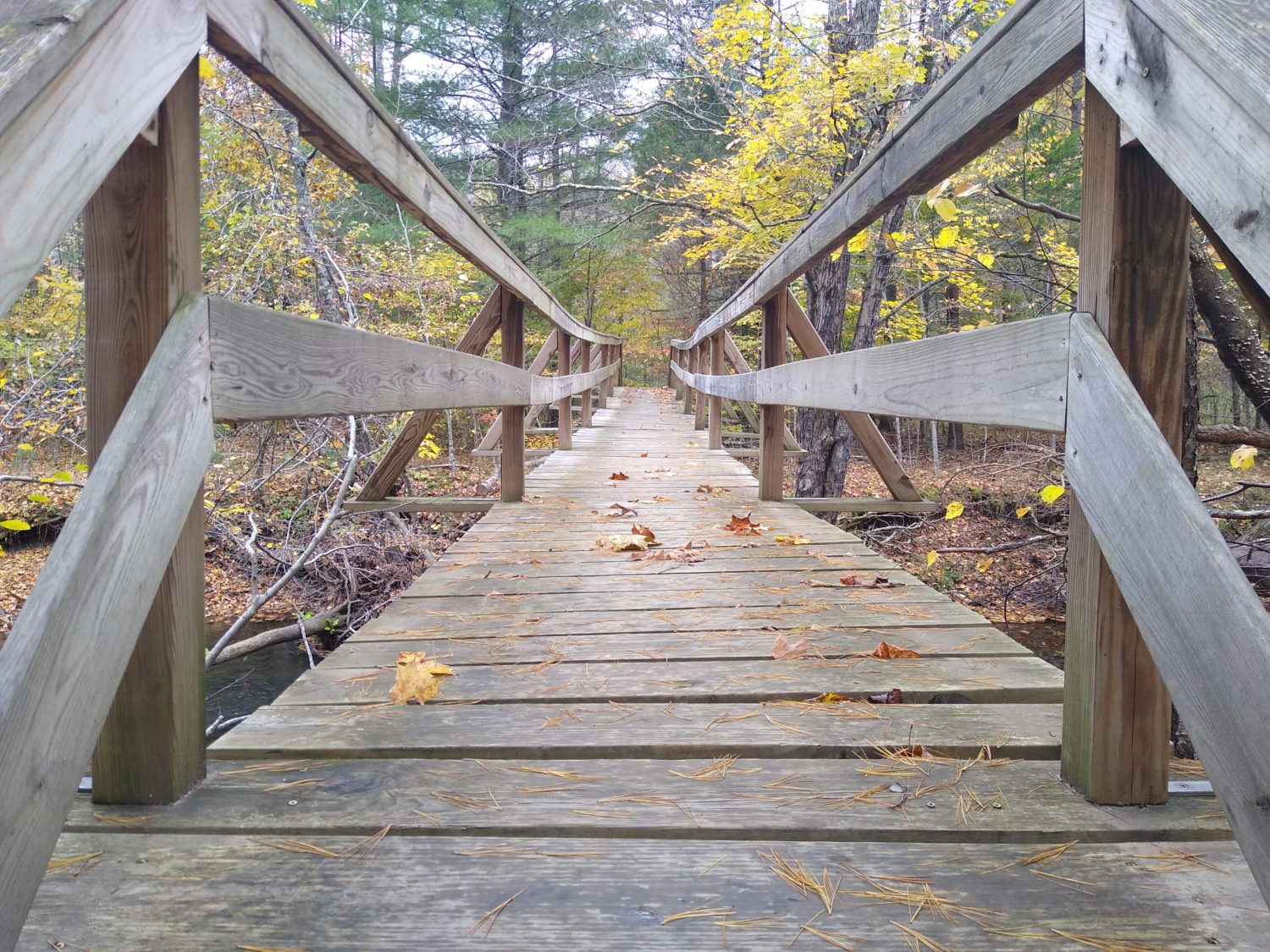
So that is why Trout Creek is so special to me and I had planned to do a lot of video recording there. But as soon as I walked up to the road someone got out of their car and came over and asked if I wanted a beer. They were doing “trail magic” but they were actually interfering with my special moment. I had planned on stopping and eating a second lunch here so I did that while this person asked me a bunch of questions. I finished my lunch quickly, made and drank a coffee, thanked the person for the conversation, and headed across the bridge. The other disappointing part is this bridge has been sagging the same way for 30 years but just this spring they replaced all the boards so it’s no longer sagging. How dare they fix up my special place. I noticed the trailer that Kelly lived in is still there. Kelly made his breakfast in the morning and is the one who took us into town to pick up our packages. If that person had not been hanging around there I would have investigated a little. I could tell someone was living there but I have no idea if it was the same person.
So I walked across the bridge and started up the other side and did a few video recordings there but it just wasn’t the same as being right there at the bridge. Oh well. Dragon’s Tooth awaits and with the distance and pace that I’m expecting I should get there between 6:00 and 6:30. That should be perfect for catching a sunset.
The first half of the hike up to the ridge was pretty much like I remembered it: just a steady climb. But when I got up to the ridge and started the Question Mark Bend around towards Dragon’s Tooth I had not remembered how rocky it was up here. There was a ton of up and down scrambling across rocks zigzagging back and forth across the ridge. If not for the fresh coffee at the river I would have been dragging ass. But the coffee and jelly beans had me fueled and I was going about as fast as could be expected.
On one of the climbs up on the ridgeline that was a steady, long, uphill climb, I switched my watch to heart rate mode to see how high it was getting. During the first week of the hike on a climb like this it was in the high 130s, almost 140. But I was amazed to look down and see 102. I can’t imagine my fitness is that much improved that my heart is working much less to do the same amount of work. I also doubt that caffeine would have an effect of lowering my heart rate. If anything you would think caffeine would make it even higher. But I was going full steam and still my heart only got up to 102. I might do more experiments in the future when I haven’t had caffeine.
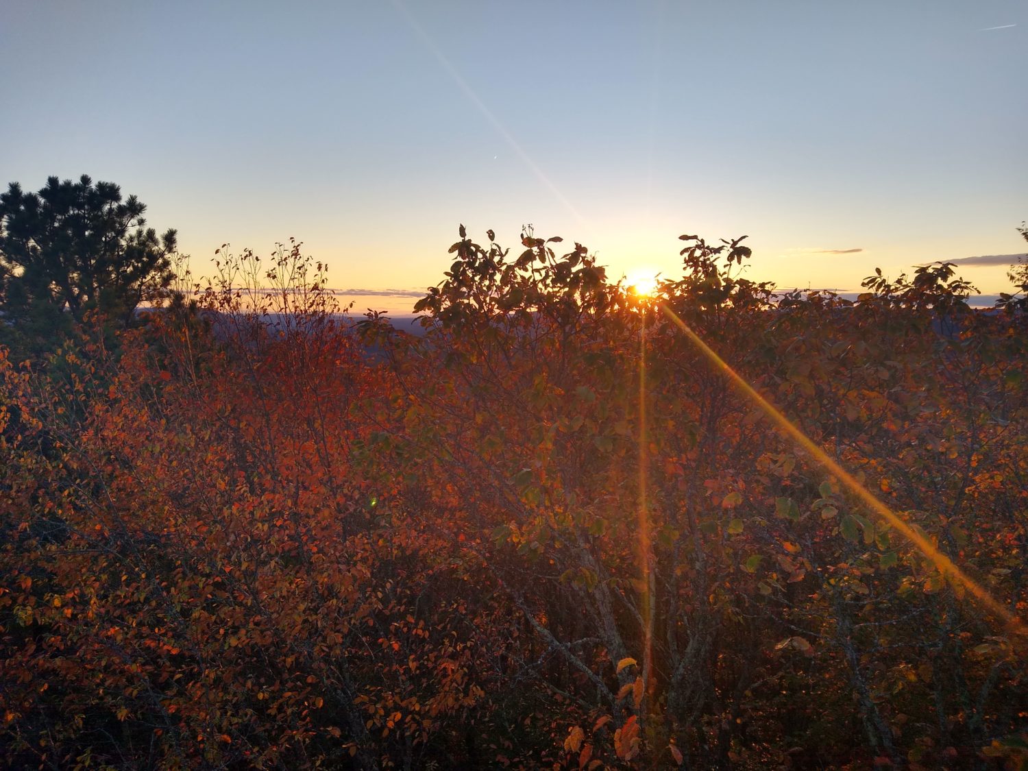
I got to Dragon’s Tooth at 6:25 and had forgotten that it was a side trail away from the Appalachian Trail. It looked just like I remembered it. There was already a guy at the tippy top taking pictures of the sunset with a nice camera. Unfortunately to the west it was heavily wooded so you really did have to get almost to the very top to get an actual shot of the sun. I climbed up there too; it was a very scary climb. The sun was going down in some clouds which made the sun have a setting effect even though it was almost a whole diameter above the horizon. That’s perfect because I don’t want to wait too late as the climb down on the north side is the one I remember being really treacherous. I don’t want to have to do that in the dark.
I climbed down and started the hike down at around 6:45, or maybe a little earlier. I got a quarter mile down before I had to pull out the headlamp since this was the shadow side of the mountain. The hike down was actually worse than I remembered. I only remember it being about a quarter mile of really scary stuff but this went on for over a mile. At the two campsites closest to the Dragon’s Tooth there were people camping there with big fires. I did not intend on stopping there since I wanted to cover as much mileage towards Daleville as I could today to make it easier to get there tomorrow since I knew I would have the headlamp out and be night hiking I might as well really be night hiking and try and cover some miles.
I picked a spot about 4 mi from Dragon’s Tooth that would be a good place to reach to trim some distance off. It was a stream so chances are there would be plenty of camping near it. It was also in the middle of two meadows. When I got there I noticed that there really wasn’t very much flat ground to camp on and none that seemed to have trees good for hammocks so I decided to keep going past the second pasture and go up the next ridge until I found something flat enough and clear enough with good trees that I could pitch the hammock. It turns out that I had to go almost to the top to find an area suitable.
It’s pretty cold tonight. It’s already in the 40s and supposed to get down to 36. That’s about the limit of the sleeping bag that I have so I will wear extra layers tonight to make sure I stay warm. If it gets too cold I’ll have to wear my rain gear as well. Luckily the wind has died down a little bit so maybe it won’t be so cold. I made sure I ate a really good dinner to make sure I have enough energy both for sleeping tonight and to hike tomorrow as I still have 23 or 24 miles to go to Daleville. That’s still a long day. I will try and get out early again tomorrow so that maybe I can get to Daleville before it gets dark.
Recent Comments