Month: February 2023

Day 36 Leaving the Suwannee

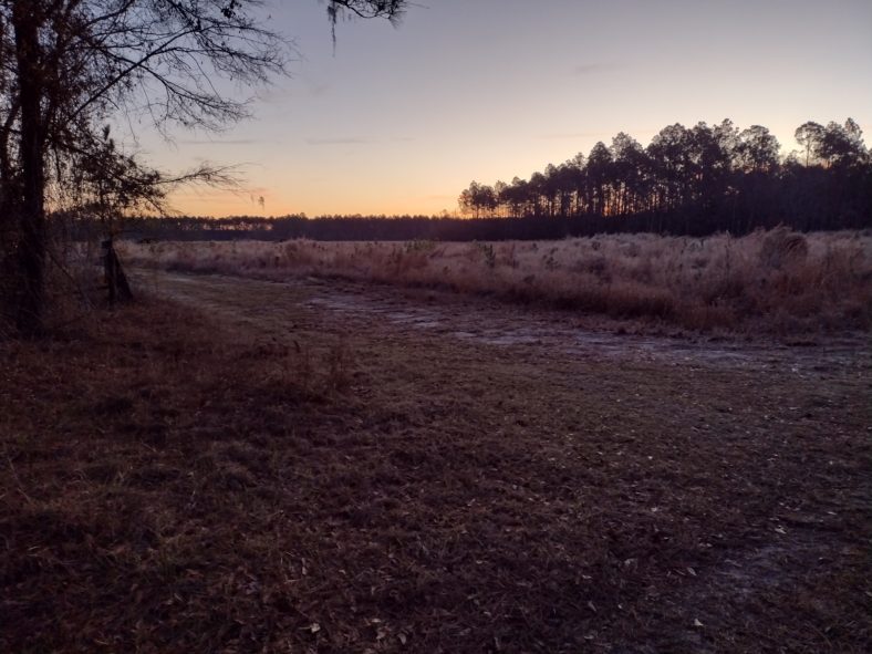
Leaving the Suwannee is a bit unceremonious. You duck away from the river on forest roads, then duck back to it one last time before embarking on a 48.8-mile road walk. There is a stop near an I-10 exit to Marianna, but other than that there is nothing on this road walk except six churches. but the road walk will wait.

Another Early Start

Food is the first order of the day, and making it to the Midway Baptist Church as early as possible is the second order of business. This is the church where Karen will be picking me up today to spend a day off back in Gainesville.

The air mattress seems to be getting worse each day, so I will be eager to get home to switch out air mattresses. Because it is so uncomfortable, I have no problem getting moving early. I am rousting by 5:30 and moving by 6:30. The goal is to make the food store that is 3 miles away by 8:30.

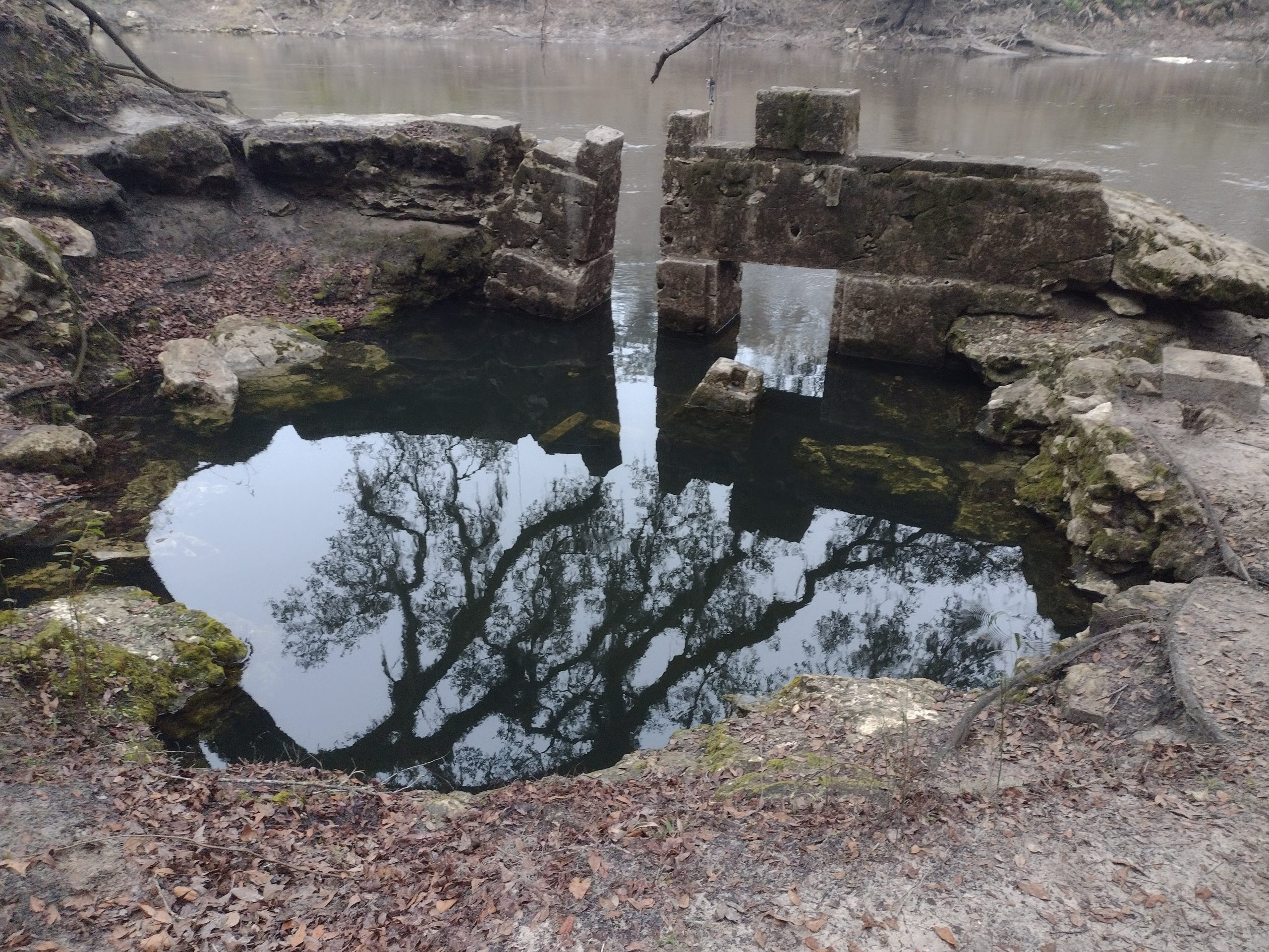
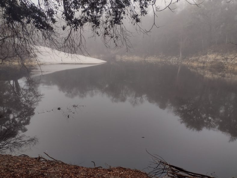
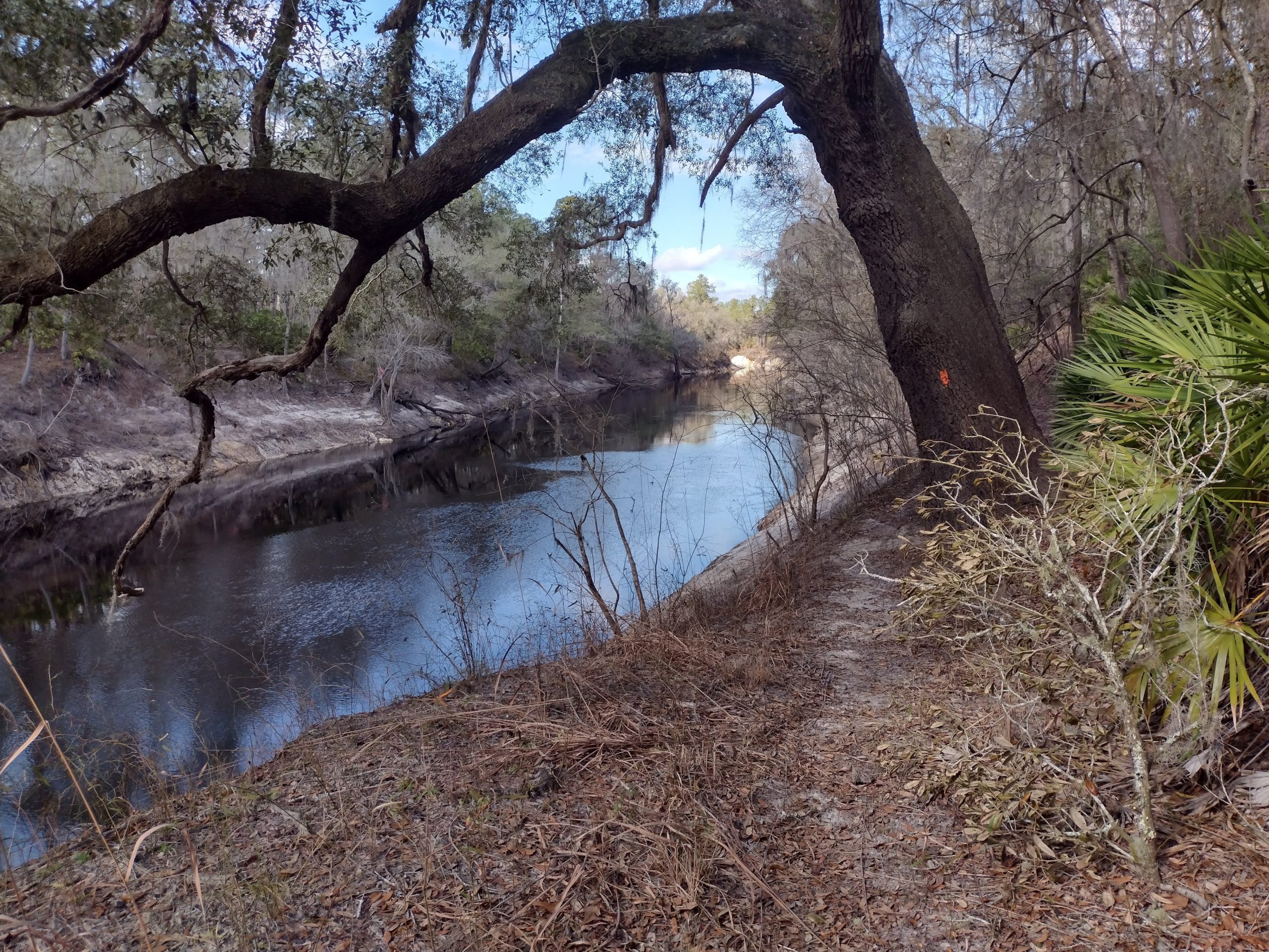
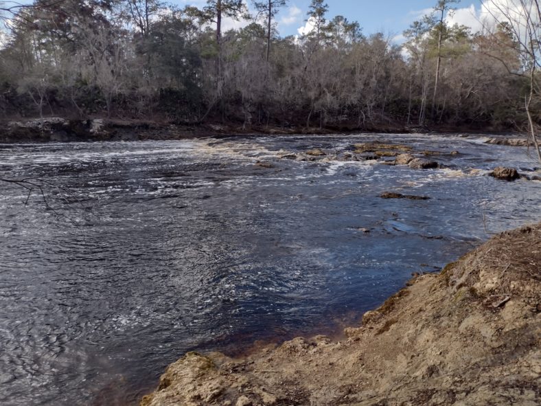
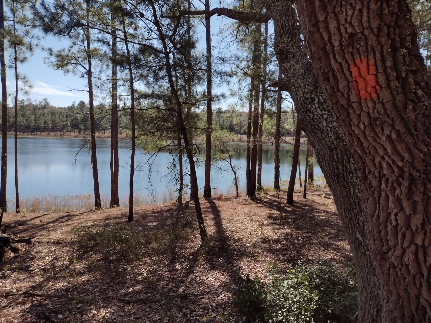
But there are a few things between here and there. There is a boxed spring that I want to visit that outflows into the river. If the river is low, the spring is fresh. If the river is high, the spring is inundated with river water. It takes me perhaps 45 minutes to get there, and the river is a little high – perhaps eight inches above the outflow, but the spring looks pretty clear to me. Maybe the discharge is strong enough to keep out most of the tannic river water.

The boxed spring has some inindation from the river when I pass by it. I woudl love to see it when the river level is lower.

Where the spring is, there is an information kiosk that mentions the Jay Veer store I will visit. It says the store does not open until 8 am. That sounds ridiculous. What convenience store opens that late? That’s not convenient.

I get to the store by 7:30 and they are indeed open for business. In fact, when I first enter the store, they are putting out fresh fried chicken! Mmmm. I will take two thighs to go, please. But I order the two-egg breakfast to satisfy my morning’s hunger since I did not eat much for breakfast yet.

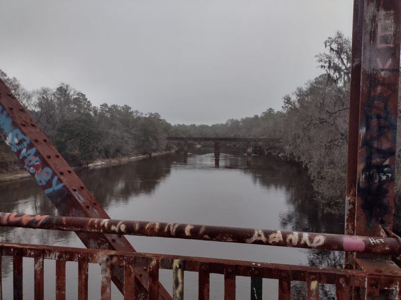
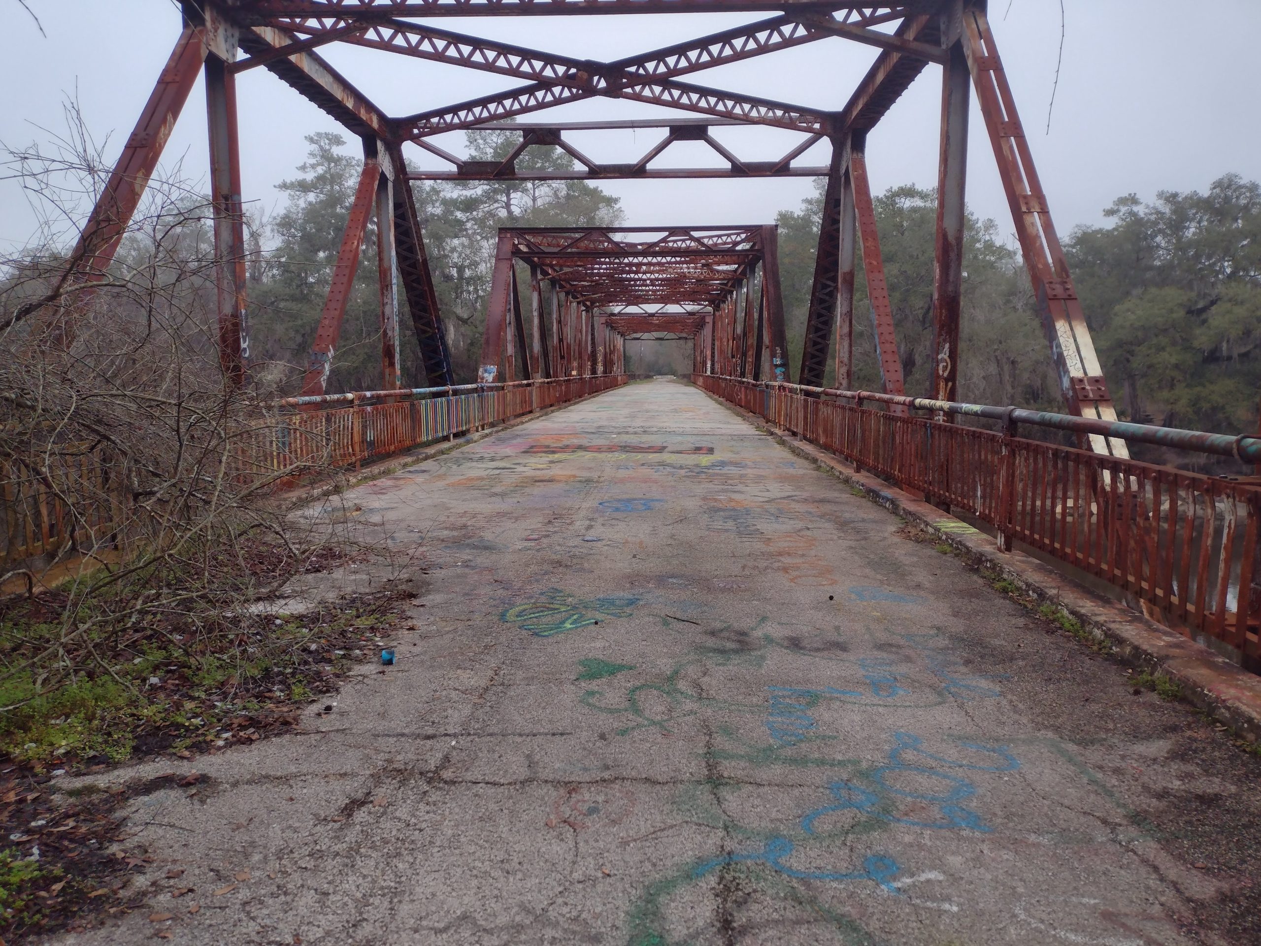
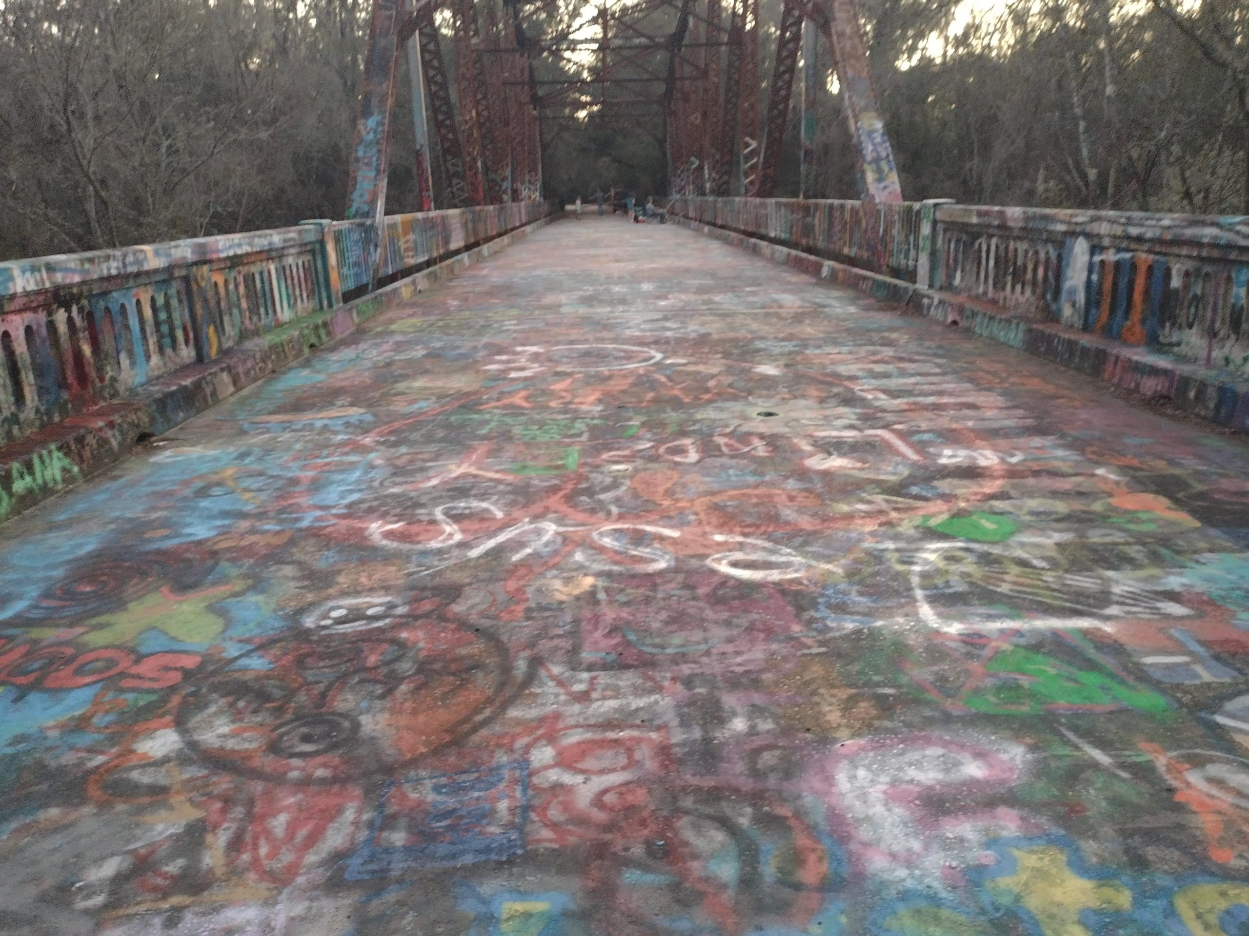
Breakfast is done, chicken is wrapped, and an ice cream cone as a walking snack. Life is good. Now it is time to hit the third obstacle of the day – the Ted Bundy bridge. There is supposedly some graffiti from Ted Bundy, the serial killer from the 70s on the bridge. There is a description in the guide as to where to find it, but the bridge is so weathered, that I think any graffiti from the 70s is long obscured. I never find it.

The bridge commonly known as Ted Bundy bridge becasue there was supposedly graffiti from him from 1976 on one end of the bridge that I could never find.

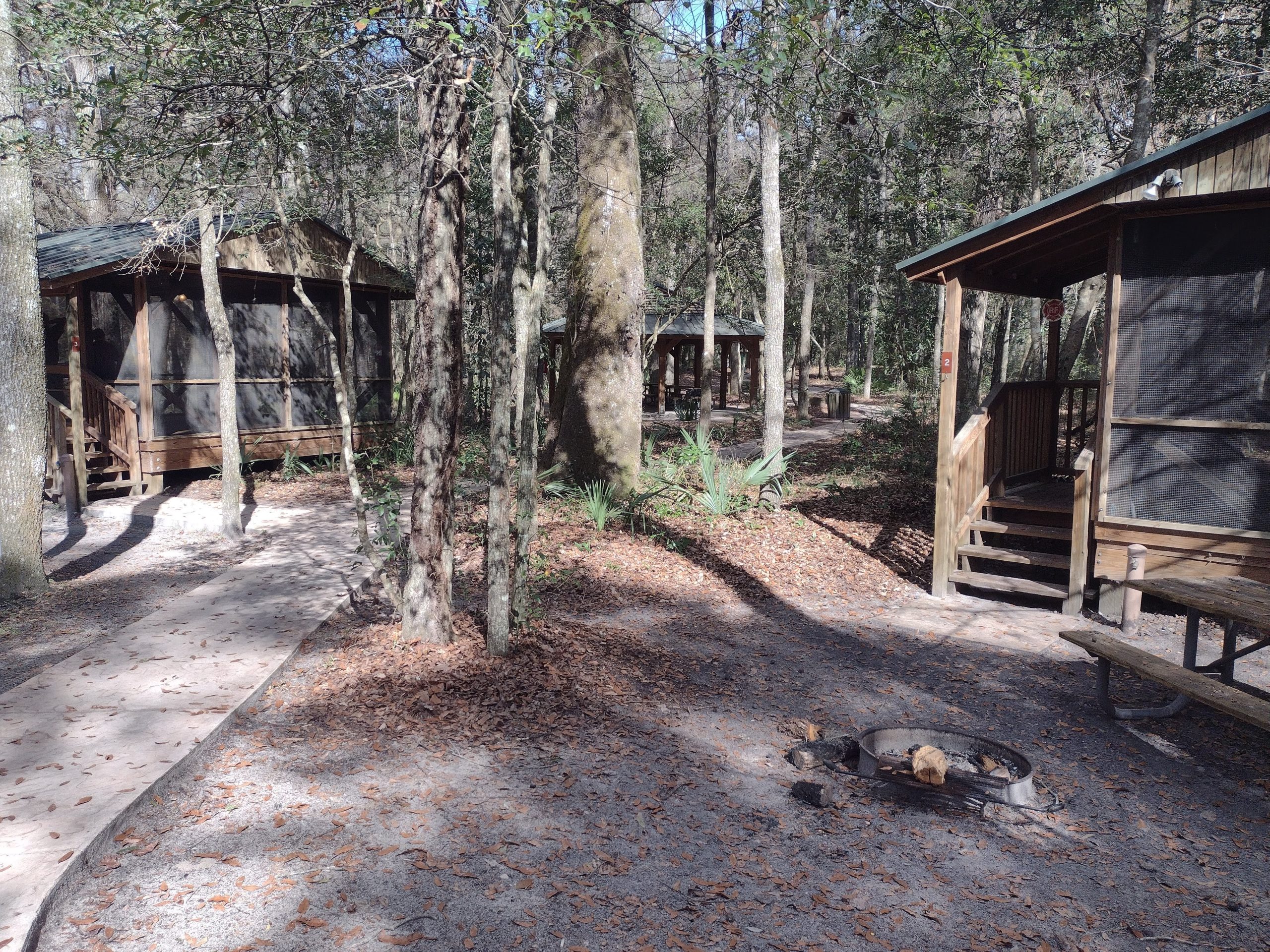
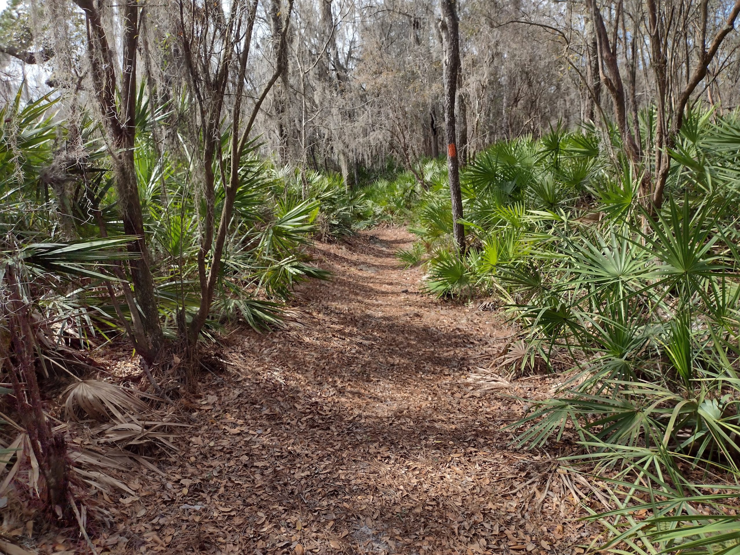
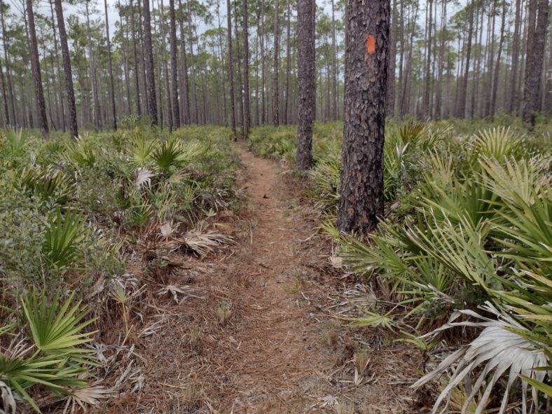
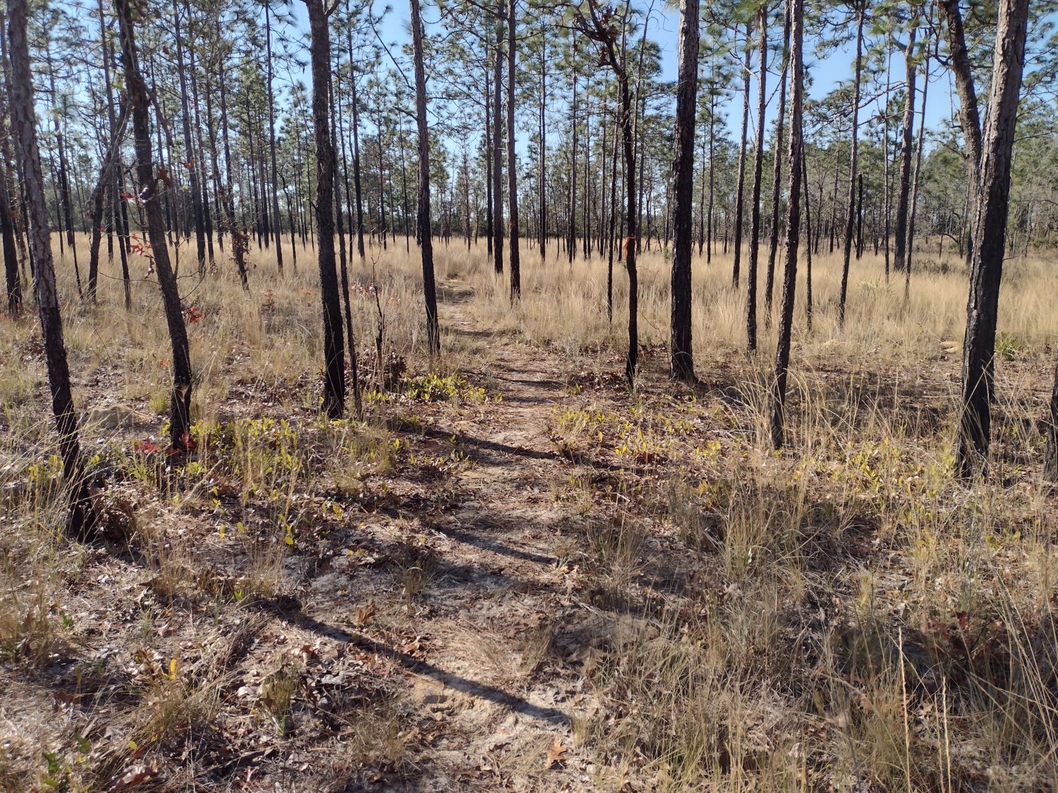
Now it is time to get hoofing to the destination for the day. The trail continues to bounce around the Suwannee river all morning. At one campsite that has a picnic table along the river, I stop to eat chicken thigh #1.
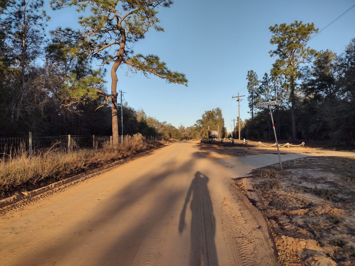
More Road Walking

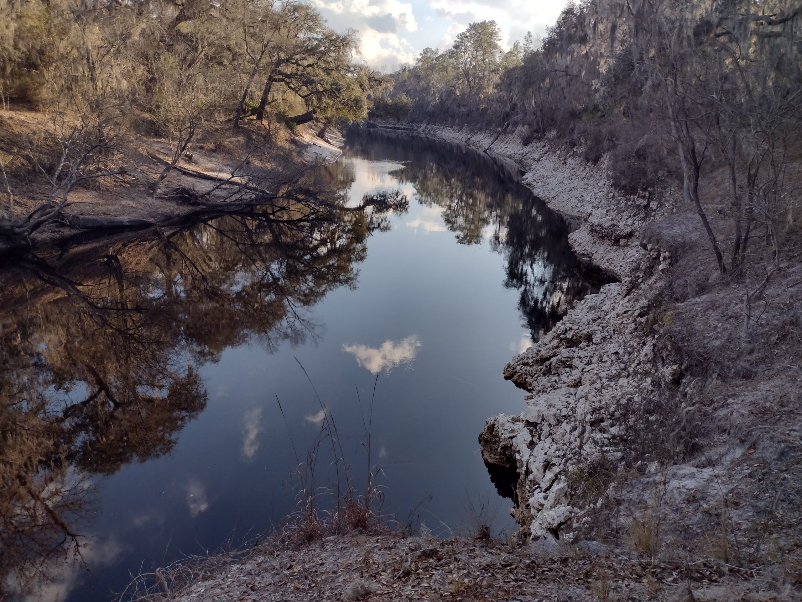
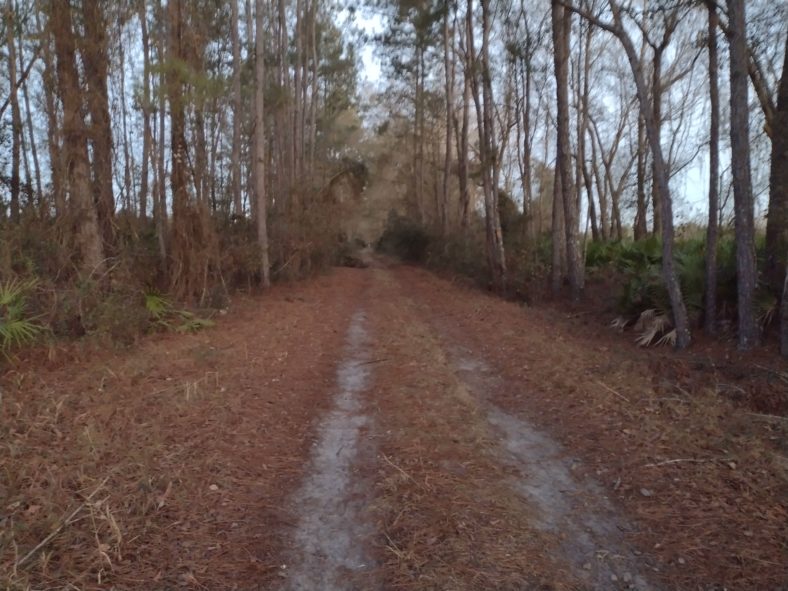
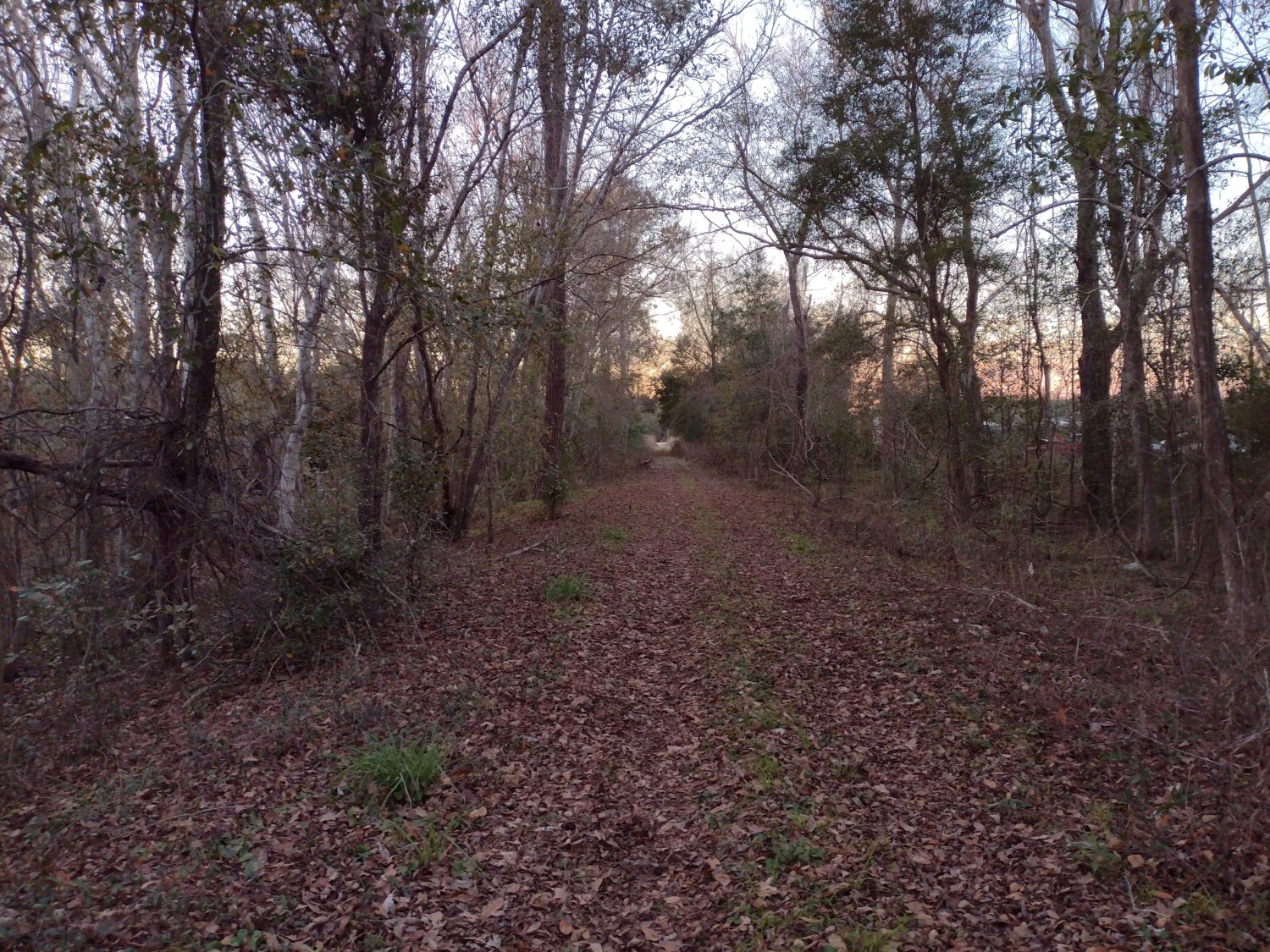
By noonish, the trail has moved onto a lightly used forest road. It ducks back towards the river for a brief stint, but after just a few miles, it is back on the same road again, but this time for good. I have seen the last of the Suwannee River for the trip.

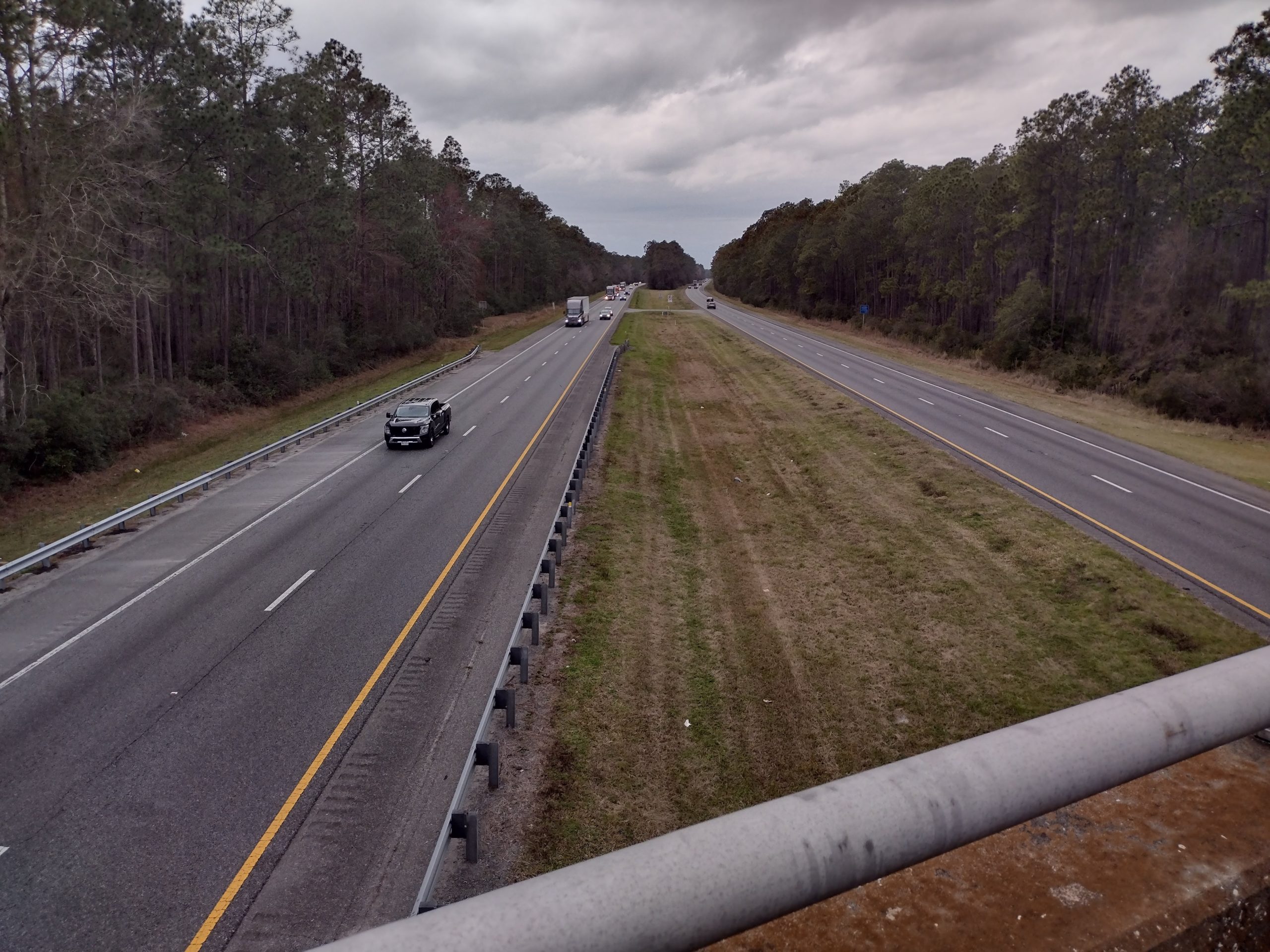
I shoudl also mention that I crossed I-10 again. The frist time was south to north in the Osceola National Forest. This time is it north to south. I know I will cross it again in Crestview, and I know I will get very, very close ten miles into this road walk. It get’s me to wondering, just how many times will I end up crossing under or over I-10 on this hike?

The second crossing of Interstate 10 on this trip. How many will there be on the entire trip?

Just before beginning the road walk, I stop in the shade for chicken thigh #2. Yum. I still have plenty of water to make the rest of the day, as long as the temperatures stay down. And there is a cool breeze, so the temperatures indeed stay comfortable. There is some shade, but I use the umbrella for most of the afternoon.

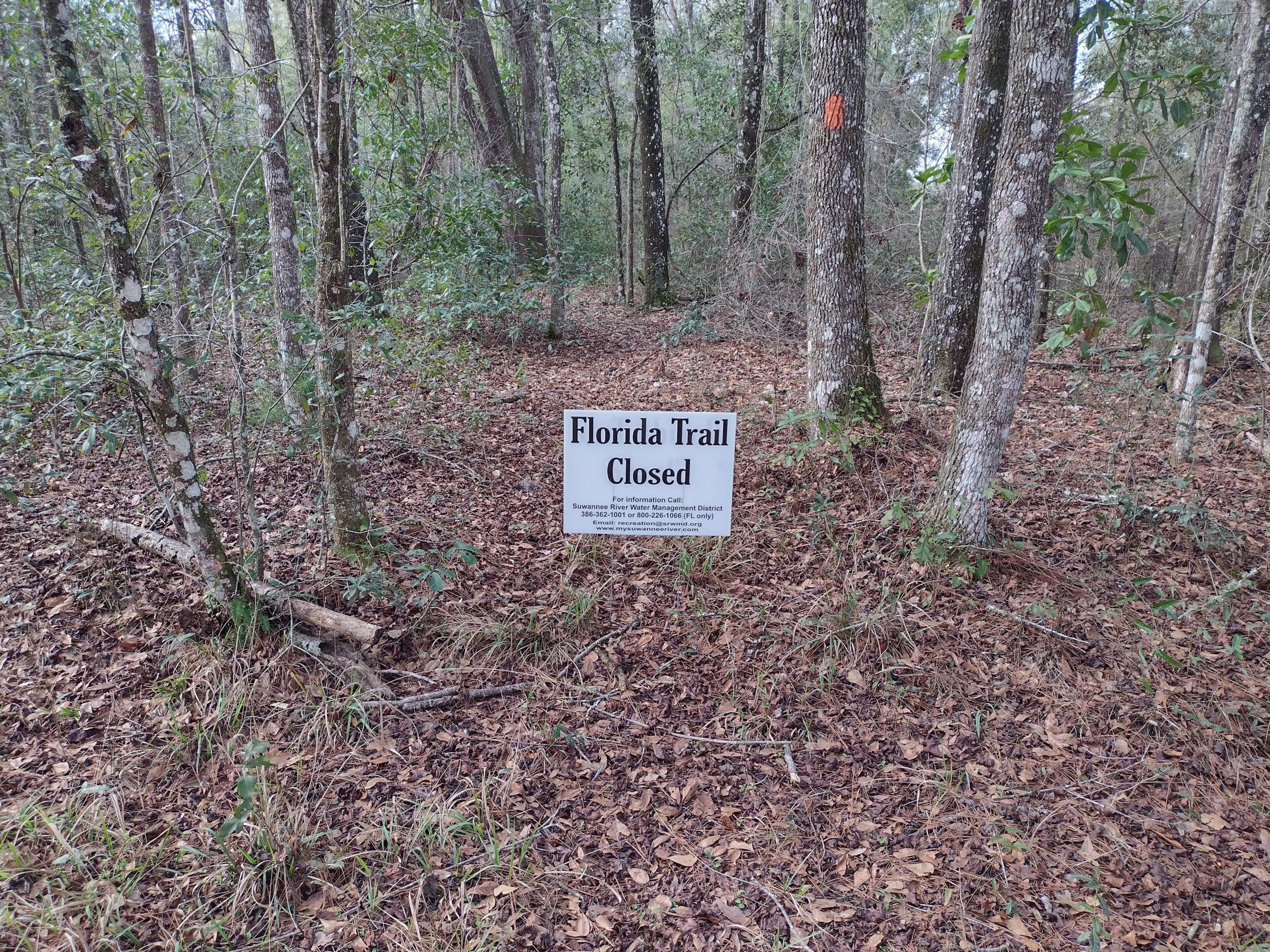
About halfway through this dirt road walk, a local trail maintainer stops by and chats for a while. He mentions that the bay is closed, and I did not think to ask at the time, but I hope he is not referring to Bradwell bay because that is one of the main attractions of the trail. It is still several days away, so I guess I will find out soon enough.

He gives me options for the road walk that don’t seem any shorter or easier, so I will stick to the marked route. The devil you know (or have guidebook for) is usually better than the devil you don’t know.

Peanut farming with pivot irrigation along the road walk.

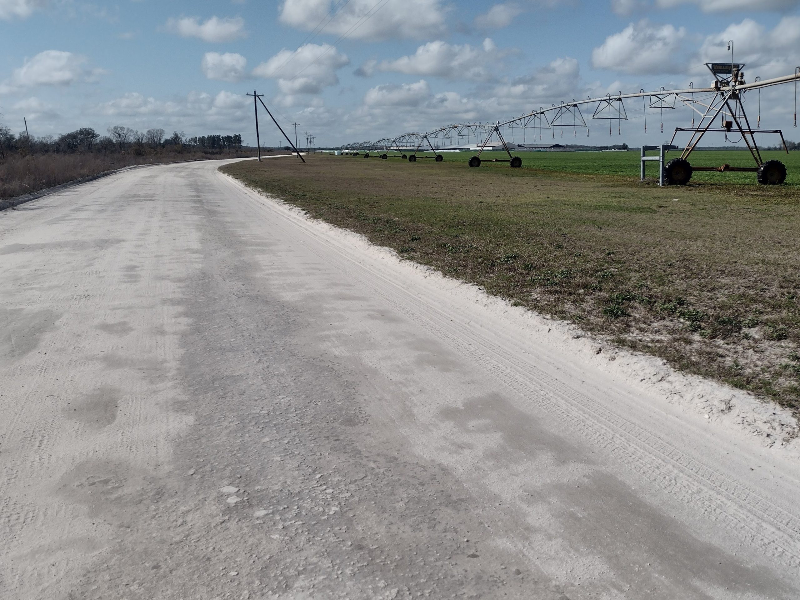
The dirt road ends into a county road, CR 53. This road has a fair amount of traffic, but I can spend 90% of the time walking on the roadway, so I’m not too upset.

By this time, Karen has already left Gainesville. I have only four miles to go, and she has nearly two hours. I will win. But she encounters an accident on the interstate on the way up, so she is delayed. I should get to the church a half hour before she will.

The next destination after the church is the campground at the I-10 interchange where CR 53 comes up to it. It is three miles away and would take me an extra hour to get to. I am better off staying at the church and waiting for her. Being able to sneak more miles in today is enticing because it means I can start later on Saturday. But only being able to get halfway there is not enticing enough.

When I arrive at the church road, there is an abandoned old-time gas station. There aren’t any No Trespassing signs, so I decide to just plop down here on the concrete in the shade. The church is several tenths down the side road. There’s no point in walking extra miles that don’t get me any closer to Pensacola.

Right on time, Karen arrives, and a quick wash later, I have clean clothes and we are on our way home. With a pit stop in Alachua to hit my favorite pizza shop. The only problem is the shop has closed its doors. But luckily, my second favorite pizza shop in Alachua is just across the street. Pizza will be consumed.

Emotion of the Day

I think it has to be relief.

While I still have about 40 miles of road walking ahead of me, I am not worried about that today. What matters is that I have clean clothes, a shower, a comfy bed, a beautiful wife, and a home to go to.

I am relieved to know that I can get more tent stakes, a new air mattress, and replace other broken or missing items. A trip to REI will be in the cards tomorrow.

The day was not stressful, the road walks were manageable, and the temperatures were comfortable. It was not a bad day of hiking at all, but just a little boring.

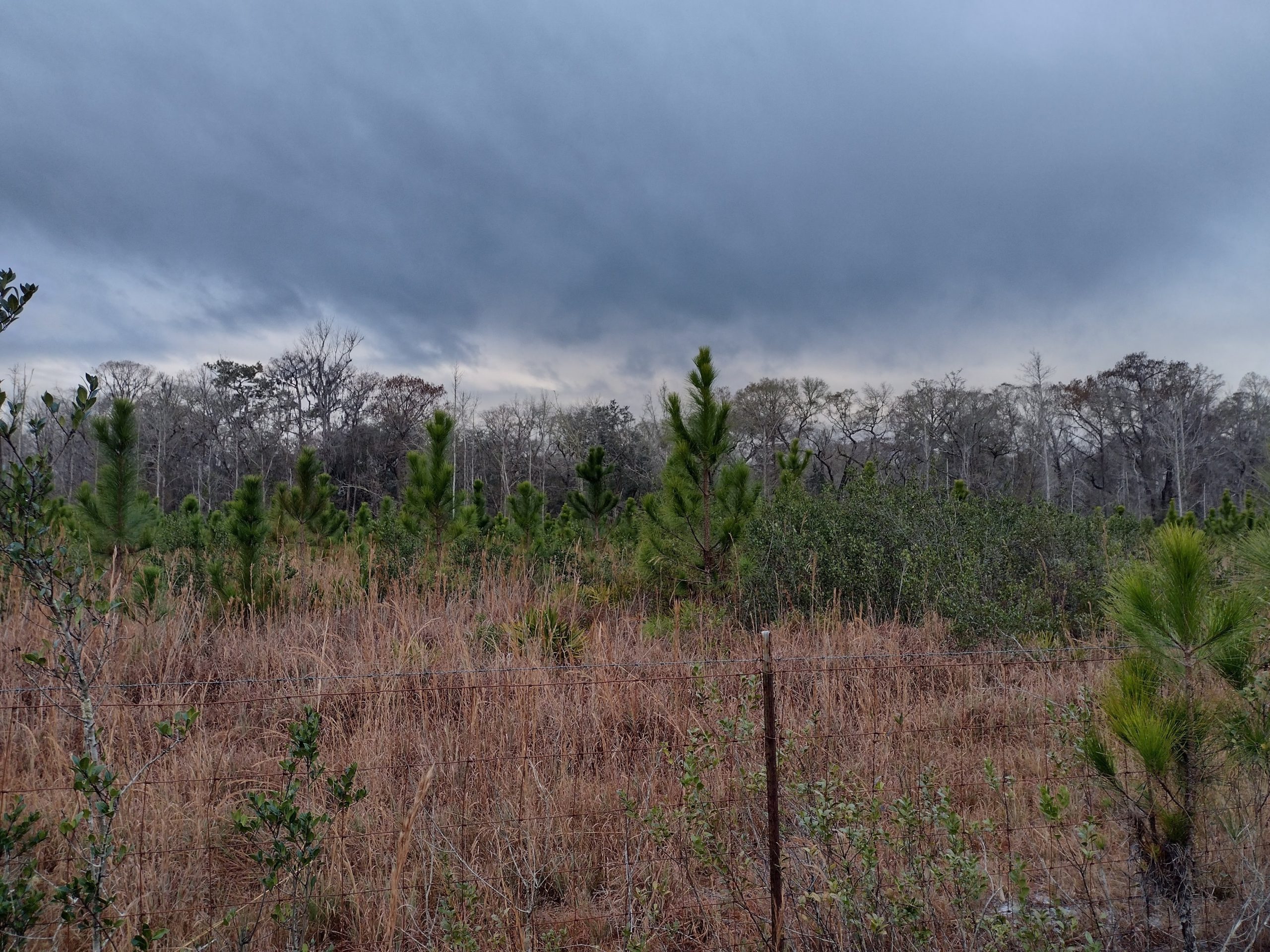
I am also greatly relieved that I will not be walking through the rains that are starting to build. It will rain all night tonight and most of the day tomorrow. That does not sound like fun rod walking conditions.

So I am relieved that I am able to skip a bad weather day and get all the creature comforts of home for a day instead. Maybe I can also catch up on my blogging.

Day 35 A Shower at Last

I think it was Forrest Gump that said something like the happiest day in a kid’s life was the day he got a new pair of shoes. Well, the best day in a hiker’s life is the day he got a shower.

Early Start

I have to try to go as far as I can manage today to chip away at the mileage for tomorrow. But there are two obstacles between me and wherever I will camp tonight. And that is two parks that have showers.

I have lost track of the days since I last had a shower in Palatka, but it has been many. The number of days since the last laundry is even larger. The last shower and laundry day was at the 88 store in Ocala. That was hundreds of miles ago.

I managed to get rolling by 6:45 in the morning which is good enough. It was dark enough that I needed to use the headlight for at least 15 minutes. It is much darker in the morning when it is foggy and it’s definitely foggy today.

I am camped between the old 129 bridge and the new 129 bridge. The first obstacle is getting past the new 129 bridge.

The trail is difficult to follow as it goes on and off some dirt roads near the bridge. I end up taking off in the wrong direction. Instead of going towards the water side of the bridge to go under it, I start heading towards the ramp side that would take me over it.

And not only that but I also have a creek to cross. It is about 8 ft wide where the trail crosses it. There’s no way I’m taking my shoes off this early in the morning. I start hunting for alternate crossings upriver because I thought I remembered reading about an area upstream.

About 50 yards upstream there are a few rocks but not enough to make it all the way across. So I keep looking. About 100 yards upstream I see the crossing with many many rocks. This one looks doable.

A massive three foot Florida waterfall.

Normally I don’t shy away from rock hopping across streams. But in this case, it is still dark and I am having to hold my flashlight. If I lose my balance I am likely to drop the flashlight and that would not be a good thing. I guess I better not screw up.

The crossing goes nice and easy. The trick to any kind of crossing is to keep moving and actually try and go as fast as possible. But you have to be able to anticipate a rock or a log that’s going to move and change your trajectory. But your balance is so much better when you’re moving than when you’re standing still that it’s worth the risk to go faster.

After the stream and the bridge across the highway are out of the way, it’s easy hiking in the woods along the river. The entire morning should be walking pretty close to the river.

Holton Creek Paddler Camp

My first destination is the paddler’s camp that I should be heading some time after 11:00. The state has set up these small campgrounds spaced out along the Suwanee River. They have several buildings that are basically just screened-in walls with wooden floors for sleeping in. I think the cost is only $6.50 a night.

But what I am interested in are the showers. They have free hot showers for the paddlers and hikers. When I get there one of the park volunteers is just finished cleaning them and let me know that only two of them have hot water and two of them only had cold water. That is good to know.

The screened-in rooms at the paddler’s camp.

I pick one of the hot showers and immediately scrub days worth of funk off of myself. I always carry a small bottle of shampoo for just such occasions when you are taking a shower in a campground. 

Shampoo can work as a body wash and laundry soap, too. So I also take the time to wash a pair of underwear and a shirt to use for tomorrow. I will wear the pair I washed in the Suwanee River yesterday after the shower.

I noticed as I put them on that they also smell slightly like algae just like the water I collected from the same location. Let me tell you the smell of algae is way better than what I smelled like 20 minutes ago.

I grab one of the picnic tables and begin eating lunch. For some reason, I am very hungry today.

There is a new camp host just setting up for a 3-month shift at this campsite. They are a couple from North Carolina and they will be living in their small travel trailer for the next 3 months. Where do I sign up for this job?

Once lunch is done, it’s time to head out. The trail is pretty much the same here as before. The trail is high on the bluffs and going up and down each ravine is actually quite challenging. But the view makes up for the extra effort.

The Alapaha River

Only a few miles past the paddler’s camp there is a trail closure and reroute notice. There is no information about the reroute other than signs posted on the ground to go this way or to go that way.

Trail closed ahead becasue this whole section was clear cut from logging.

Halfway through the reroute, it is obvious this section was closed because it was logged recently and the trail has been completely obliterated.

It ends up being a road walk on forest roads in the same general direction and length as the original trail. The only difference is there are no trees so it is a hot walk.

I know that more road walks are going to get more frequent and longer coming up, so every place that I can get water I go ahead and fill up to the full capacity. I filled up completely at the paddler’s camp and will fill up again at the next park, Gibson park.

I get to the park at about 2:30. This is a perfect time to use the restroom, fill up more water, and drink my afternoon coffee. They also have a shower, but they charge for it and it is locked. I am glad I showered at the paddler’s camp.

This stuff is a quick one and I keep going on. The trail from the park is a short road walk across another river. This time it is the Alapaha River. It is a black water river just like this 20 but about half the width. The current is much faster than the Suwannee, too.

I remember this section well from when I hiked this six years or so ago. I know that the trail will be going by lots of homes and on and off back roads to get around private property.

After five or six miles around this new river the river eventually merges with the Suwannee. So now I am hiking along the Suwanee River again.

Gibson park charges for their showers.

Where to Camp

I would love to be able to make the Jay Veer convenience store that is just on the other side of Ted Bundy bridge. But it is still many miles away and it would be after dark by the time I got there. There is an RV park next door that allows camping for $10.

But in my food bag, I have plenty of dinners. What I am short of is breakfasts. In fact, I am out of breakfasts.

Maybe a better plan is to just try and get within an hour of the store and head there for breakfast. I am sure they are open at 6:00 or 7:00 in the morning. They have a grill that serves hot food. People rave over the fried chicken but I’m sure their breakfast is good as well.

There is a campsite just a mile and a half from the store and this would be a perfect place to stop. But as I get closer to my destination I realize it be after 6:30 by the time I get there and it will be dark.

There is a short road walk just before that campsite, so I need to either stop a little early or push and try and make it all the way. I can hear traffic from the road so I know how far I can go before I run out of woods. If I can find a good spot before I hit the road, I will go ahead and stop.

As luck would have it, I did find a really good spot probably 4/10 of a mile away from the road. It has lots of oak trees which will protect me from the dew tonight. This campsite is even better than last night’s.

I can hear a few mosquitoes, so I set the tent up quickly and begin cooking my meal. I will make sure it is a good one tonight because I am very hungry again. I select an Alpine Aire brand. It is a three-cheese alfredo and looks pretty good.

Once the meal is cooked and sitting for the required 10 to 15 minutes, I finish setting up everything inside the tent. I even take the time to take a little bath. I don’t want that wonderful shower to go to waste.

I finally crawl into the tent and begin eating my meal. It is wonderful. It could use a little more sauce, but it tastes far superior to the brand that I don’t like. Maybe I should have added some butter to it to bulk up the sauce.

It is a warm evening again and I doubt I will get inside the sleeping bag until well after midnight. I will get up and try and be out hiking by 6:30 or 6:45 again. I have two small sausages to eat for breakfast and that’s about it. It will be a long three miles to the store but I am sure that the breakfast that awaits me will make it a trip worth making.

From where I am camping now it is 22 miles to the Baptist Church where Karen will pick me up tomorrow. An early start will be required to make it on time. And I Will not be able to spend too much time at the convenience store.

This bridge was a bit janky, but held up to the test.

Most of tomorrow will be road walking so I should make good time. I will load up on as much water as I can carry because I know it will be long stretches without water and it is probably going to be hot tomorrow.

Emotion of the Day

I think I will choose Bliss.

You just have no idea how good that shower felt. Even though the clothes I put on afterward were not actually washed, they were at least fresh.

I felt like a whole new person after that shower. Shower and laundry would have been even better but I only have one more day until all the showers and all the laundry my heart desires.

And even though I am a mile or so short of where I wanted to end up tonight I am still within a striking distance of where I want to be tomorrow. And that is a good feeling.

Day 34 The Suwannee River

Most of my day revolves around sunlight and food. Keep it simple Sam.

White Springs

The primary job in town tomorrow is to reach the post office when they open at 8:00 a.m. The one restaurant in town opens at 5:00 a.m. so that’s no problem. I am about an hour away, so if I leave at 6:30 I can eat breakfast at 7:30 and pick up my package at 8:00.

The campsite I picked out ended up being a good one. Oak leaves shielded most of the tent from the morning dew, so it was barely damp when I packed it up. I wasn’t able to get out at 6:30, but I was out at 6:45. This will have to be good enough.

It was dark enough that I needed to use my lamp when I was in the trees. But once I was out on the road, I didn’t need it anymore.

It is harder to follow blazes in the dark because orange on brown doesn’t show up well without a light on it. I got lost under the bridges, so I wasn’t sure how to get up to the road. I would have done better just to take the access road all the way to the highway instead of following the trail in the dark.

The bridge across the river was not very long and it was extremely wide. It had ample space for pedestrians to safely cross with the traffic.

No problems for pedestrians in White Springs, FL.

On the other side of the river, the trail snaked along the river some more before popping up into town from the south.

I was going to grab some cheese sticks at Dollar General, but they don’t open until 8:00. So I just headed straight for the restaurant to eat breakfast. I was able to charge my phone and battery some while I was eating.

There is a laundromat in town, but I don’t feel like waiting two hours to do laundry. There is a convenience store, so I stopped to get some coffee and a few food items I know are not in my box at the post office.

I finally get to the post office just a few minutes after 8:00. I quickly get my box and go to the lobby area and continue charging my phone and battery bank while I unpack my box.

The box was packed with supplies to get me another 200 miles. But I am only going to be going 70 or 75 miles so there are way more of certain supplies than I am going to need.

The pack was much heavier when I put it on and headed out of town. When I was already 2 miles away, it dawned on me that I was sitting at a post office and could have easily mailed a lot of the things I didn’t need back home. This is why I need to write things down. I could have dropped at least 4 lbs right there at the post office.

Hiking Along the Suwannee

The trail exits town through the Steven Foster Center. The park is a ghost town in the morning, but that is just fine for a solo hiker.

It’s only been a few years since I hiked this section so everything looks pretty familiar.

If it’s not a river, then it’s palmettos.

Once the trail gets out of the park, you are mostly walking on the bluffs above the Suwannee River. Because the trail is on the bluffs, there is a lot of up and down in the trail. And when it goes up and down it is usually steep. I am not going to be able to do as many miles today as usual because of the extra elevation.

The elevation doesn’t slow you down because it’s a long climb that tires you out. It slows you down because it’s so steep it’s actually hard to climb or descend. Some places are so steep I’m surprised it hasn’t washed away years ago.

The trail doesn’t always stay within sight of the river, though. There are private residences in certain sections along the river. 

Most of the time the trail will route away from the river to go around the residences. But in other sections, they actually go between the residences’ backyards and the River itself. One resident even put a water spigot right at the fence line for hikers to fill up from. Thank you, resident.

If it’s a river, then it’s big river.

There were a few sections that I had forgotten about but remembered once I got there. One of them was a really high bluff that was far higher than the bluff on the other side of the river. It seemed like we were actually looking down on the treetops on the opposite shore.

There were also mountain bike trails and horse trails intermingled with the hiking trail. And in some sections, the mountain bike trail and the hiking trail were the same trail.

The Suwannee is a nice river to walk along.

Hot Weather

The forecast was that it was supposed to stay in the ’70s today. But the morning stayed foggy for so long that I started out pretty wet and damp. By noon it was quite warm and I was sweating pretty decently.

I am wearing a fresh set of clothes today in hopes that I can find a place to do a quick wash in the river where I can find a rocky section that I can scrub my clothes on. I find one at about 11:00 a.m. so I stop to wash out some things and filter some water at the same time.

I would later regret filtering water at this location. I didn’t taste it when I collected it, but when I started drinking it afterward it tasted like green algae. Definitely not a refreshing drink.

When I stopped for lunch, I made a chicken salad wrap and ate some chips. Since I have so much food there’s no point in trying to ration anything. If I have it and I want it, I should eat it.

What I really need is either some powdered Gatorade or better water. I know there is a stream that flows into the river coming up, so I decide I will wait until then and just get all new water.

Streams leading into the river are better sources of water than the Suwannee itself.

It wasn’t until 2:00 when I found a stream that had what looked like really good water. I dumped what I had left of the algae water and filtered an entirely fresh set.

I also used this time to drink the rest of the Starbucks double shot I packed out from town. It’s amazing how effective coffee is with hiking. It’s like a three or four hour energy pill.

Where to Camp

I really would like to get a shower today. I have a few options available. There is a side trail to a convenience store across the river at the spot I should be at around 5:00. It is 5 miles from here to the town of Live Oak where there are several hotels. Or across the street is the Spirit of the Suwannee Park which has cabin rentals.

The plan is to walk to the convenience store and then see if I can get Uber service into Live Oak. If I can get an Uber ride, then hotel time it is.

The Bridge to the convenience store is full of graffiti.

If I can’t get an Uber ride, then I will call the Spirit of the Suwannee to see if they have any cabins. The worst case is they do have a campground with showers available.

As I expected, I cannot get an Uber into town even after trying twice. I am not going to road walk five miles and I’m not going to hitch five miles away without knowing I can get back easily.

So I decided to call the park across the street. It is not even 6:00 p.m. yet and the phone just goes to hold music for over 20 minutes. I hang up and call again and the same thing. I’m not even sure they are open.

So with both of those plans failing, I have no choice but to hike back out to the trail and just camp somewhere. I find a decent place between the old 129 bridge and the new 129 bridge. I’m only a quarter mile away from the new bridge so it will be a little noisy for most of the night.

After looking at the maps again, there will be a few options for showers tomorrow. I will be passing a paddler camp that has shower facilities that I can probably use. There is also another convenience store with an RV Park, and a county park.

 I know the county park has showers and the RV park should, too. It will be a very long day to make it that far so I’m going to have to get up early again just to have a fighting chance.

Emotion of the Day

Even though as I write this I am tired from the ups and downs of the trail, it is not the emotion that is sticking with me.

What is sticking with me is disappointment.

Disappointment with not being able to get into Live Oak to a hotel where I could shower and do laundry to be comfortable for the next two days.

Disappointment with staring directly at a facility that rents cabins but won’t answer their phone. I could have just walked over there and taken my chances but that would have used all of the remaining daylight I had left to find a campsite.

I think there was also a little disappointment with the trail itself. I didn’t remember as much of the trail being away from the river as their actually was today. Not that that’s a deal breaker, it is just more boring walking through the woods with nothing but palmettos to look at.

But also disappointment of not thinking to mail back extra items that I won’t need for the next three days. I had a golden opportunity to shed four pounds on the spot. But it is disappointing that it took me 2 miles of hiking to even think of the idea.

There’s also some disappointment with the water. Here I am next to a river that I can bathe in but it’s too cold and there are warning signs all over the place to not swim in it because of alligators. I can rinse my clothes out and beat them on a rock, but that’s not the same as a washing machine. And that is disappointing.

All in all, it was still a good day. But it’s disappointing that it wasn’t a great day when it easily could have been. We will try again tomorrow to have a great day.

Day 33 Big Shoals

I am now on a new map section. And I will spend the next 3 days walking along the Suwannee River. This should be a fun few days as long as it does not get too hot.

Slow Start

It was another warm night last night but I knew not to layer up this time. I didn’t even get into the sleeping bag until nearly midnight.

Even though I woke up early and was camping 70 yards away from Chuckles, I did not get as early a start as I would have liked. I didn’t want to make a bunch of noise and wake him up too early.

I started packing at 7:00 and was heading out at 7:30. Chuckles was up and making coffee. Neither one of us is planning on going into town today but I am not sure if I will see him at all during the day.

It’s a State Park, am I trespassing or not?

The ground is damp with dew. And the area is a bit swampy and has quite a bit of sphagnum moss. My feet get a little wet, but nothing bad. There are bridges over the worst sections.

One thing that is annoying this morning is that there is more coyote crap than I have ever seen on a trail before. It’s not an uncommon sight, but these jokers are crapping every 10th of a mile right in the middle of the trail.

I tried to avoid all their gifts but eventually, find one that is hidden in the grass. I am accompanied by the smell of fresh dog crap for the next 20 minutes.

I am low on water, so I stop at the next campsite which is an equestrian camp with a flush toilet and running water. I might as well make use of both. I fill up my two main bottles but do not put water in my coffee bottle which will come to hunt me later.

Leaving Osceola National Forest

Nearly the entire forest is exactly the same. It is pine trees and palmettos and occasionally swamp and cypress. The trail is frequently on double-track roads but is also a single-track dedicated trail much of the time. The only thing to break the boredom is kicking pine cones.

I finally exit the forest at about 11:30. I decided to take a small break and eat a little bit because I have many miles of road walking ahead of me. I go ahead and mix some Gatorade in my drinking bottle and have just a splash in my main bottle. I hope this will be enough for the whole walk.

More Road Walking

The first mile-plus is a small paved road that is not too bad. There is a short section on the highway to get up to a different dirt road. This dirt road goes on for many miles.

It eventually turns down a small paved road which is a country road without much traffic. I think it was about a mile and a half long and I don’t even remember any cars passing on the entire length.

By now it is getting pretty hot and I am very thirsty. I am nearly out of Gatorade and I need to make sure that I can make coffee between two and three in the afternoon.

The road walk finally ends and turns into a trail that has a decent amount of shade. I have about 2 miles until the Suwannee River and the first availability of water, but it is already nearly 3:00.

There is a section of thick pines with a heavy layer of pine needles on the trail. There is a large amount of shade and a cool breeze so I decide to just pop down on the pine needs and rest. I have now finished all of my Gatorade and have only the tiny splash of water to make coffee with.

There is not even an ounce of water, but I go ahead and make coffee with it. The entire amount takes only two sips to complete and it is very strong. But oddly it is not any stronger than real espresso, so it is actually quite pleasant to drink.

After 10 minutes of laying in the pine needles in the breeze, the caffeine begins to hit my brain and I start to get some energy. I have only one mile to the river and all the water I can drink.

On the way to the river, I meet another hiker. We stand in chat for at least 15 minutes. But I am distracted because I only have water on my mind.

May I Have a Cup of Water, Please?

It is a quick ten minutes to the river. And the first point you come to the river is a canoe launch, so there is easy access to the Suwannee River.

At Big Shoals and the Suwannee River at last.

I immediately fill my water bladder and begin filtering some water. Once two or three oz are filtered I switch bottles and drink the two or three oz. I do this three or four times until I feel I have drank enough water for now.

The next order of business is to take off my shoes and socks and go wading in the water. I grabbed my bandana and soak various parts of my body. I start with the head and the neck and cold water feels great. Next the arms and the legs. Last is the feet.

I was originally planning on going swimming, but the water is really cold. I think it would be quite painful to try and swim in this. But washing myself with a bandana is very refreshing.

I fill up both of my bottles and dry my feet off to put my shoes back on. Just this twenty minutes up by the river has made me feel like a new person. With the recent consumption of coffee, I should be good to go for three more hours. The campsite I’m planning to stop at is about an hour and a half away.

Walking Along the Suwannee

The area where we enter the Suwannee is called Big Shoals. It is called this because there are some substantial rapids in the river here. I have been here before, but on the other side of the river.

The river varies from bluffs that are 40 ft above the water to white sandy beaches right at the water. It is a bigger version of the Little Big Econ State Park.

There is a wide variety of vegetation on the bluffs. It is a mix of pine, palmettos, scrub oak, cypress, and all sorts of small bushes. They seem to be all just growing together in one big giant mess.

This tree started growing when there was far more dirt on the riverbank than there is now.

When I finally get to the area I was planning on camping at, I can see that it has road access and is very heavily visited with lots of trash. I don’t think I will be camping here.

I keep moving along the river but the palmettos ruin any chance of having a nice campsite. Every time I think I see a clearing away from the trail I find out that it is actually a mountain bike trail. I doubt there will be any mountain bikers overnight but I still don’t want to camp in the middle of a trail.

I finally find a large flat area near Little Shoals. It is nearly 6:00, so I need to stop soon because the tent is still wet. I have less than 30 minutes of daylight left and I also don’t want to get too close to town since the post office won’t open until 8:00 in the morning. This site checks all the boxes, so I stop.

I still have plenty of water, but I have an entire river next to me if I need more. But of the few miles I have hiked along the Suwannee already, it is evident that the best water is going to be the small streams that flow into it. Most of these streams look quite clear.

The Niagara falls of Florida.

Pick one Emotion

I think I would pick thirst today.

I was only actually thirsty for about an hour today. But it was quite hot and when you are getting thirsty, it is a very unpleasant experience.

It is a strong enough feeling that it overpowers all of the boredom of the morning walk out of the National Forest.

It also dulls the excitement of reaching the Suwannee River at last.

If you have ever been truly thirsty, you should remember what a strong feeling it is. Since dehydration is one of the quickest ways to die, I guess the body has been wired very strongly to pay attention to this trigger.

I was never in any danger, but I really, really wanted to make coffee. I would have rather had it in the normal 8 oz quantity, rather than the 1 oz triple shot variety.

But I got my coffee and I got my water, so all is well. 

The next three days of hiking along the Suwannee should be fantastic. Is fantastic an emotion? Find out tomorrow.

Day 32 Osceola National Forest

Last night was the opposite of the night before. Instead of freezing cold, it was smoking hot.

Early Start

I expected last night to be cold, so I layered up when I went to bed. But as the night went on it never got cooler. I was stripping off layers all through the night.

I am going to be meeting Brook and Alyssa today at the Olustee trailhead. I also want to get as close to White Springs as I can. So today is a good day to start early.

I wake up at 4:30, but I’m not ready to start quite that early. I listen to music until 5:30 and then I begin my routine. I am able to get out at 6:45, but because the sky is overcast, I need to use my headlamp.

It rained lightly several times during the evening. And it is raining on and off while I’m listening to music and getting ready. But lucky for me, the rain has pretty much stopped by the time I get outside the tent to pack it up.

Not the best weather, but at least I’m not sweating.

I have been practicing packing the pack fully except for the tent and my rain jacket for situations exactly like this. Once the pack is ready, it should only take 5 minutes to take the tent down and get it packed up.

The morning wasn’t hot, but I definitely wouldn’t call it cold either. It was comfortable hiking weather other than the humidity. And it continued to sprinkle on and off for the first few hours. It never rained hard enough to get out the rain gear.

Most of the morning was hiking on forest roads. The GPS tracks and blazes seemed to indicate there was an actual trail just off the roadway. But every time I looked for an actual trail, it never materialized. So after a while, I just kept on the roads and stopped even looking for a trail.

Osceola National Forest

At some point in the morning, one of the roads I crossed signaled the entry into the Osceola National Forest. The forest didn’t look any different, only the color of the road signs was different. It is nothing but pines and palmettos here with the occasional swamp filled with cypress.

The plan to meet Brook and Alyssa was for them to park at the Olustee battlefield. I would be hiking East toward the battlefield so they would start out hiking West.

It worked out perfectly and we met about half a mile from the parking area. We went back to the parking area and ate lunch at a picnic table. They brought me some oranges and other goodies.

After lunch, we walked North together continuing on the trail. They got to see some of the swampier areas and walk some of the boardwalks. We said our goodbyes and they turned around to go back to their truck to head home.

The rest of the afternoon was more pines and palmettos. That literally is all that is out here unless it is a swamp. I never realized that the Osceola National Forest and the Okefenokee swamp actually meet borders at the Florida-Georgia line. The Osceola National Forest is just the continuation of the Okefenokee swamp in Florida.

Wading Through Water

Since the palmettos were very dense, I did not have high hopes for finding a random campsite. There is an official shelter and campsite that I should reach at about 5:30. This will be my destination for the day.

About 2 miles before I get there, I come to a pretty long water crossing. I have been lucky all day in that I have been able to walk around all of the water I encountered so far. But this is far more water than I’ve encountered today.

Since my feet are filthy and have not been washed in a few days, I decided it is best to just take my shoes off and walk through the water. I am also out of drinking water and instead of taking a half-mile detour to a nearby campground, I decided that the swamp here is an excellent source of water.

Wading through the water to clean my feet.

To my surprise, when I am halfway through the water I noticed that there is a bridge in the middle of it. But the water is so deep that the bridge is completely submerged under water. I guess it’s a high-water year here.

While my water is filtering, I sit down to dry and clean my feet and put my shoes back on. I go ahead and fill up with two and a half liters just in case it is hot in the morning.

Official Campsite

It takes about an hour to get to the campsite and shelter. When I get there I am happy to see that Chuckles has just recently gotten there and already set up his gear.

It looks like there are mosquitoes in this area, and with a malfunctioning air mattress, I decided it was best to camp in my tent instead of staying in the shelter. I go ahead and set up my tent and then bring my food and stove back to the shelter to cook dinner with Chuckles.

Interstate 10 crossing number one.

We have a nice chat for about an hour before everything is done and the Sun is gone.

Back in the tent, I can tell that it is going to be another night of humidity and heat. Joy. Surprisingly, there are almost no mosquitoes. This is surprising since there’s a nearly stagnant Creek right next to the shelter.

Emotion of the Day

The emotion for today should deal with seeing Brook and Allyssa, or reuniting with Chuckles. Or maybe with a rainy evening or a rainy morning. But it doesn’t.

All I seem to be fixated on today is the fact that the blazes and the map indicate there should be a trail along the side of the roads. And the blazing was just bizarre beyond belief.

Assuming that the trail actually was the forest road, the blazing was sometimes 30 ft off of the road on the border marker trees.

And when the road made a turn to the left or the right, there would be double blazes on trees several hundred yards before the turn. Normally the double blazes are right at the turn. When you are traveling at 3 mph you don’t need a lot of advance notice. I am not driving in a car.

It was actually very confusing. There were no intersecting roads or other trails, like you were going to get lost anyway.

It was not like yesterday evening when I was actually getting angry and frustrated. I was just in shock and disbelief at some of the blazes I was seeing.

So I guess the emotion for today is disbelief. Or maybe confusion. I’m not sure which word captures it best.

Day 31 Lake Butler

Last night was the coldest night of the trip so far. I know this because my water bottles were frozen about the top eight inch of water. After 4:00 a.m. it was miserable trying to sleep.

Sleeping

The site I selected last night was in a grassy area of planted pines. The grass was in clumps and very uneven. Luckily my butt was in a hole and my shoulders were on a clump as well as my knees so it made a natural cradle to sleep in.

At about 12:30, I was visited by some coyotes. I could tell they were walking down the tracks and could smell me. They barked for about a half an hour. I was just thankful it wasn’t hunters with dogs looking for hogs.

I began my morning routine at 5:00 since I had been shivering for an hour, and was eager to get up. I had to break the surface layer of ice in the water bottles to be able to take my morning pill. I didn’t listen to music, since I wanted to stay alert.

Despite the early start, I still didn’t get out until 7:00 when it was already light enough to hike. I was hoping to get out a little earlier today. But the cold weather was not cooperating.

Once I got moving, I warmed up quickly. But I was bundled up in several layers including my puffy jacket. I was eager to shed this jacket because it would easily tear on the thorns along the trail. I only wore it for about 30 minutes.

The frost on the ground was very thick and lasted for nearly 2 hours in the shade. So I know it was well below 30 degrees even though the forecast said that Lake Butler was 35° last night.

The Trail to Lake Butler

The trail continued as an unpaved roadway of top the old rail bed. After a few miles, it stopped becoming a road and was just a footpath. Because the grass was still frozen, my feet didn’t get wet from morning dew.

About halfway to Lake Butler there is a reroute out to highway 100 for about 2 miles, and then back. The detour out and back is an additional 2 miles. I can see the trail goes over a river, so I’m assuming there is no serviceable bridge and that’s why we have to walk along the road.

I consider taking my chances of continuing on the trail and dealing with whatever water I encounter. But there are several reasons I decided not to try it.

The first was that about 3 mi before the reroute, there was another river that had a bridge This one was only 20 yards from the road so it was easy to run out to the road and cross on the highway bridge and then run back to the trail. This Creek was wide enough that you definitely wouldn’t want to walk across it but you could if you had to.

If this first one is not rerouted, then the second one must be even bigger than this.

Reason number two is that if there is no traffic for that 2 mi section, then the trail will be even more overgrown than it currently is. After seeing what happened at the other end of the trail towards Palatka and the woods becoming so thick that it was impassible, I decided this was a credible reason to not try it.

And the third reason is because the waterway that we were crossing is called the New River. The New River sounds big. If it was called Possum Creek, then I probably would have dismissed it.

The roads leading from the trail to county Road 100 were not heavily trafficked. I was able to walk on the pavement 90% of the time.

The highway bridge over the New River was very, very long and had almost no shoulder whatsoever. It was not a pleasant crossing. The River itself at this point was about 20 yards wide, so it definitely would have been a wading situation.

Lake Butler

Coming into town, the trail became paved. It skirts from the south end of town to the west end of town. But I was interested in the Mexican restaurant on Main Street. So I took a detour just before City Hall to go grab lunch. It was nothing to write home about. Or blog about.

The next stop in town was the IGA supermarket. I only need two breakfasts, two lunches, and some walking snacks. I was also wanting some more instant coffee, but they did not have any that were suitable. I was also able to charge up my phone and battery bank for about 30 minutes while I repacked my food bag.

The Trail out of Town

The trail turned to grass again right after the IGA supermarket. And within a few blocks it went from a grassy field to a forested track again. Only this time the forest was too thick to negotiate easily.

I could see from the GPS tracks that it looks like they started out with a road walk and then headed over to the railroad bed. So I walked along the road for about a quarter of a mile and then ducked in to the railroad track.

But the track even here was covered in trees growing up in the middle and downed trees and lots of vines. Another look at the GPS tracks showed that they were actually on the west side of the tracks and not on the tracks themselves.

When I went further away from the road, I could see that there was a mowed path between the property and the right of way. Okay so this will do just fine.

Within about a mile and a half, the trail on the side of the tracks basically disappeared. So I tried walking on the tracks for a while but it was just too crazy and too many vines and obstacles to negotiate. So I went back out to the road again.

The same pattern would repeat itself three or four times over the next few miles. I would see that the GPS tracks show that I should be on the other side of the railroad bed and not along the road. So I would go over there and find a small path but most of the time it was on private property and not the right away.

I eventually gave up on trying to find or follow any trails whatsoever. It was just easier to walk along the shoulder of the road for the 8-mile walk out of town. They shouldn’t even bother calling this section a trail.

Away from Town at Last

After the 8-mile road and jungle walk is done, the trail turns directly north. I will now be making my way to Olustee and the Osceola National Forest.

From the map it looks like we’re going to be doing road walking again, but when I get there I see that there is a trail that just closely parallels the road. This will do just fine.

It is exactly 5:00, so I would like to hike for another hour before finding a place to camp. There are pine trees all around and it looks like it will be easy to find a place. The only problem is the ground is also a little bit swampy, so it might be hard to find a dry place.

I met another hiker who is looking for a place in the pines shortly after I enter the woods. He is doing a section hike to get ready for doing the Continental Divide trail in a few months. I let him know about Chuckles and him just finishing the CDT a few months ago. The other hiker has not seen Chuckles, so I can only assume that he is behind me and probably staying in Lake Butler tonight.

Pick one Emotion

The morning went very well. It was very cool and relatively easy hiking, except for the state road 100 road walk around the river. So I’d like to pick something up beat.

But the afternoon s*** show of not being able to find a walkable trail really put a damper on what would have been a great day.

So I guess I need to pick exasperated.

The railroad out of town could make a perfect trail. All they would need to do is just cut down the trees and vines that are growing in the middle of it. The path is already set and there is an excellent foundation for an actual trail.

But the fact that the GPS tracks are going off of the right of the way and into private property is just insane. If they don’t want to clear the trail, or for some reason are not allowed to because the Florida Department of Transportation actually owns the land, then they should just make this section a road walk and not a nightmare of barbed wire and vines.

As a blogger, you know it was a bad day when you only took two pictures all day and only one is worth posting.

Day 30 Gold Head Branch State Park

Gold Head State Park has always been one of my favorite spots. The Ravine Trail is awesome. I also have memories for my childhood being there and catching my first fish out of their pond.

Late Start

Since I am in no rush to get to the park headquarters, I get started quite a bit later than usual at 8:00. It was 35° last night, so a little extra time bundled up in the bag is just fine by me.

I really like the camping spot that I found last night. I felt safe and secure nestled away in the pine trees and behind palmetto bushes. I could barely see the lights of the cars on the road as they passed by.

The last dirt road into the park.

Gold Head Branch State Park

The entryway into the park is unceremonious. You enter at the maintenance buildings area and begin hiking a trail towards the first lake. There was a nice bathroom facility and I could see the canoes lined up along the beach for rental.

The trail inside the park was longer than I thought. I was expecting to maybe 3 miles tops to the headquarters. But I think it ended up being closer to 4 miles.

Sparse pines entering the park.

I did not take the side trail down to the ravine, but I did take the loblolly pine alternate trail. I’m not sure it was any different than the regular trail, but I know I have hiked the regular trail many times before.

When I got to the park office, they had a fire going. It was still pretty cold and not even 10:00 yet, so the fire felt good. I paid my $2 day use fee and filled up one of my water bottles.

The trail out of the park was as unceremonious as the trail into the park. It looked like it was mostly blackjack oak scrub.

The exit of the park leads across the highway to Camp Blanding. Sometimes that trail is closed for maneuvers, but today it was open. The alternate around it along the bike trail is only 2 miles, but the Camp Blanding trail is 8 miles. I hope the extra 6 miles are worth it.

Camp Blanding is open today.

Camp Blanding

You have to fill out a registration card when you enter the park and keep a stub with you. Locals are all goo goo for the Camp Blanding section, and complain loudly when it is closed. I never really knew why until I started hiking through.

The trail is on roads for just a little bit and dedicated trail for most of it. It passes by three very large lakes. The trail stays pretty far away from the first one. You can get a good view of it but there is a row of trees in the way.

Three big lakes in Camp Blanding.

As you hit each new lake they become smaller and smaller, but you get better and better views of them.

There were several picnic benches along the way spaced out every two or three miles. The last one was at a former State Park called Magnolia Lake State Park. It was built during the period of segregation as a State Park for colored folks that were not allowed at Gold Head Branch State Park. The park was closed at some point and the land turned over to Camp Blanding in the seventies.

Reunited

As I exited Camp Blanding and turned in the stub of the form I filled out at the other end, I could see Chuckles was just passing me on the bike trail. He obviously decided to take the shortcut instead of going through Blanding.

I must say, I strongly considered the shortcut, too, but I’m glad I actually went through the Camp instead.

From this point it’s about five or six miles of road walking on back country or dirt roads. We hiked together for the next several hours on those road walks.

The roadwalks are taking us back to the Palatka Lake Butler bike trail. And just before we finally reache the trail, we come across another convenience store. We stopped to buy some snacks and rest a little.

Chuckles, like most through hikers, hikes a slightly faster ground speed than I do. I am just wanting to make it to at least Hampton before finding a place to camp along the side of the trail.

He went ahead and took off before me and I could see that he was slowly pulling away from me the entire time. By the time we hit Hampton, he was a full half mile ahead of me.

I never saw him again after the last turn into Hampton. He was talking about stopping at the convenience store in Hampton, but I was planning on just walking through.

More Hikers

While I was hiking with Chuckles, we met several south bounders. The first two we met early in the day while on the bike path. They were heading southward on the Eastern Continental Trail. That goes from Cape Gaspe in Canada, all the way to Key West

Later on while in the road walks to get back to the Lake Butler Palatka Trail, we met Sawgrass. She is another hiker that is blogging about the Florida Trail for TheTrek. She started in Pensacola shortly before I started from the Everglades, so I was able to read her first few posts.

While on the trail, I don’t really read much. I spend nearly every free moment writing either these blog posts or my own blog posts for TheTrek. I have a lot of catching up to do when I get home.

Time to Camp

Once you pass the town of Hampton, the trail goes from paved to grass. Now it feels like a special trail in the woods. They have already removed the rails and railroad ties so it is actually very pleasant hiking.

A grass version of a rail trail.

I know that I want to hike until about 6:00 p.m. so I start looking on the maps to see what the terrain is like where I will end up at that time. I can see several spots that are heavily wooded and they look like they will make good camping spots.

Ever since leaving Hampton, none of the woods along the trail have been posted as no trespassing. As long as this trend continues, I should be able to camp where I intend to stop.

As I near my destinations, I see that what I thought were woods from the satellite images are actually swamps. These do not make suitable camping spots.

I end up finding a field that has been recently planted with pine trees and is still open with grass instead of choked out with palmettos. There are no signs indicating no trespassing or posted so I wander off into the pines to try and find an open spot.

I find a good spot of far enough away from the roads but the grass is very lumpy so it takes a while to crush down the grass with my feet to make a space large enough for my tent.

And the very first tent stake I put in the ground pulls up and I lose it in the deep grass. I have lost more tent stakes on the Florida Trail than I have in my entire life combined. I am probably going to have to get more spares before this trip is over.

Despite searching the area for over 5 minutes all the way down to the dirt, I never find the stake. This pisses me off.

The highlight of the night is when I decide to cook another one of the brand of meals that I don’t like. I don’t like them because two of them have tasted horrible and they require me to cook in the pot instead of just pouring boiling water into the bag.

But this one is chicken risotto and says it only needs to cook for 1 minute. This seems like a good time as any to see if I can get it to rehydrate in the bag. To my delight it does rehydrate quite well and the meal itself is quite delicious.

So I should probably stop bashing this brand even though I will probably never buy any more ever again. At least I know there are two flavors I like. I just can’t remember what the first flavor was.

Emotion of the Day

Enthusiasm is the word I pick for today.

Even though I purposely got up late, the 2 mile road walk into the State Park was quite pleasant and I was in good spirits.

And even though the hike through the park wasn’t as exciting to me since I’ve been there many times before, I was also still in good spirits. I also had fun talking with the ladies in the Park office.

And even though I knew the route through Camp Blanding was 6 miles longer than it needed to be, I was very upbeat while I was hiking through it. It really was a nice Trail.

And then meeting up with Chuckles again and having several hours to talk with him was also very uplifting.

And then the last three or so hours of the day hiking solo again on the paved trail was also uplifting. Even though my left foot is not in 100% health, I am still able to hike quite well on it with very little stopping. Other than meal breaks, I didn’t really stop at all today.

I hiked 26 and a half miles today. If not for the lack of daylight, I could have gone many more. To know that I now have my hiker legs back is very uplifting.

The cool temperatures probably have a lot to do with my energy levels today. If it were 80 degrees, I doubt I would have made it past Hampton.

Tomorrow is supposed to be cool as well. Let’s hope tomorrow is as good as today was.